List of nature reserves in the district of Nürnberger Land
In Nuremberg County there are eight nature reserves . Together they cover an area of 1165.93 hectares. The oldest nature reserve in the district is the Schwarzach-Durchbruch nature reserve established in 1936 .
| Surname | image | Identifier
|
details | position | Area hectares |
date | |
|---|---|---|---|---|---|---|---|
|
Lichen and pine forests south of Leinburg |

|
NSG-00570.01 WDPA: 318401
|
Leinburg Unique natural area with sand dunes, lichen and pine forests characterized by drought. |
⊙ | 834.0803 | 1950 | |
|
Schwarzach breakthrough |

|
NSG-00300.01 WDPA: 165487
|
Schwarzenbruck Räthsandsteinschlucht with surf caves, abundance of mosses, alder - alluvial forests and on the slopes mixed forests of beech, pine and spruce trees. Area distribution: District of Nürnberger Land = 25.04ha District of Roth = 13.23 |
⊙ | 38.27 | 1936 | |
|
Schwarzenbrucker Moor |

|
NSG-00415.01 WDPA: 165504
|
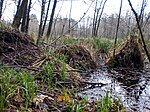
Schwarzenbruck One of the few moors in Middle Franconia. Silting complex of near-natural ponds with floating leaf and underwater vegetation. |
⊙ | 9.8906 | 1982 | |
|
Upper Molsberg Valley |

|
NSG-00227.01 WDPA: 164884
|
Happurg Natural canyon forests with spring slopes, grazed grasslands, juniper bushes, meadows, tall herbaceous vegetation and calcareous debris fields. |
⊙ | 17.4252 | 1984-12-04 | |
|
Rinntal near Alfeld |

|
NSG-00579.01 WDPA: 318994
|
Alfeld Typical Jura rock valley on the Alb plateau. |
⊙ | 32.8211 | 2000-09-08 | |
|
Schottental near Heldmannsberg |

|
NSG-00579.01 WDPA: 318994
|
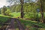
Pommelsbrunn valley floor with the typical character of a Hutanger . |
⊙ | 42.0441 | 1996-09-25 | |
|
Wetland and sandy grasslands near Speikern |
NSG-00242.01 WDPA: 163062
|
Ottensoos Varied habitat made up of dry sand and wet biotopes. |
⊙ | 10.4915 | 1996 | ||
|
Pegnitzau between Ranna and Michelfeld |

|
NSG-00548.01 WDPA: 318939
|
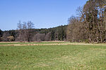
Neuhaus , Auerbach , Pegnitz valley meadows. Area distribution: District of Nürnberger Land = 99.34ha District Amberg-Sulzbach = 79.83ha District Bayreuth = 19.24ha |
⊙ | 198.71 | 1998 | |
| Legend for nature reserve | |||||||
Individual evidence
- ↑ Green list of nature reserves in Middle Franconia. (PDF; 87 kB) Bavarian State Office for the Environment, December 31, 2014, accessed on May 23, 2016 .
See also
- List of landscape protection areas in the district of Nürnberger Land
- List of FFH areas in the district of Nürnberger Land
- List of protected landscape components in the district of Nürnberger Land
- List of natural monuments in the district of Nürnberger Land
- List of geotopes in the district of Nürnberger Land
- List of nature reserves in the city of Nuremberg
- List of landscape protection areas in the city of Nuremberg
- List of protected landscape components in Nuremberg
- List of natural monuments in Nuremberg
- List of FFH areas in the city of Nuremberg
- List of geotopes in Nuremberg
Web links
Commons : Nature reserves in the district of Nürnberger Land - collection of images, videos and audio files