List of geotopes in the district of Nürnberger Land
This list contains the geotopes of the Middle Franconian district of Nürnberger Land in Bavaria . The list contains the official names and numbers of the Bavarian State Office for the Environment (LfU) as well as their geographical location. This list is incomplete. Around 3,400 geotopes (as of March 2020) are recorded in the Bavarian geotope register. The LfU does not consider some geotopes suitable for publication on the Internet. For example, some objects are not safely accessible or may only be entered to a limited extent for other reasons.
| Surname | image | Geotope ID | Municipality / location | Geological unit of space | description | Area m² extension m |
geology | Digestion type | value | Protection status | comment |
|---|---|---|---|---|---|---|---|---|---|---|---|
| Maximiliansgrotte E from Krottensee (show cave) |
 |
371H001 |
Neuhaus an der Pegnitz position |
Northern Franconian Alb | In the Franconian dolomite there is a widely branched floor system of corridors, chambers and halls. There are various sinter formations. Guided tours have been held here for the public since 1852. | 10400 130 × 80 |
Type: Karst shaft & horizontal cave Type: Dolomite stone |
cave | significant | Natural monument, FFH area, nature park | |
| Road cut below the town hall in Burgthann |
 |
574A002 |
Burgthann position |
Southwest Albrand region | Sandstones with a thickness of 4 m are exposed. The lower half is assigned to the Rhaetian transition layers, the hanging wall consists of ariet sandstone (Lias alpha 3). | 375 75 × 5 |
Type: Layer sequence Type: Sandstone |
embankment | significant | no protected area | |
| Former clay pit E from Reichenschwand |
 |
574A003 |
Reichenschwand position |
Northern Albrand region | The clay pit opens up 8 m of Amaltheenton. Clay iron lumps up to a size of a few decimeters are particularly abundant. | 14400 120 × 120 |
Type: Rock, Animal Fossils Type: Mudstone |
Clay pit / clay pit / marl pit | precious | Natural park | |
| Former quarry N von Vorra | 574A006 |
Forward position |
Northern Franconian Alb | In the old quarry you can see the transition from factory limestone to sponge stump as well as clay-filled karst crevices. | 30000 250 × 120 |
Type: Rock type, karst chimney, karst crevice Type: Limestone |
Quarry | significant | Landscape protection area, nature park | ||
| Former quarry NE of Schupf | 574A007 |
Happurg position |
Middle Franconian Alb | It is the only quarry in the district in which the fossil-rich Malm Gamma stratum facies is accessible. The break is used by sport shooters as a shooting range. | 7000 100 × 70 |
Type: Rock, Animal Fossils Type: Limestone |
Quarry | significant | Landscape protection area, FFH area | ||
| Quarry NE of Happurg |
 |
574A009 |
Happurg position |
Middle Franconian Alb | In this quarry, only the short east and north walls are accessible, as the remaining part is used by a rifle club. | 4000 100 × 40 |
Type: Rock Type: Limestone |
Quarry | inferior | Landscape protection area, FFH area | |
| Former quarry NW of Hartmannshof |
 |
574A010 |
Pommelsbrunn position |
Northern Franconian Alb | In the disused western part of the huge Hartmannshof quarry, there is a Malm standard profile. Resumption of mining is planned in the eastern part of the quarry. | 22500 300 × 75 |
Type: Standard / Reference Profile Type: Limestone |
Quarry | especially valuable | Natural park | |
| Former NNW quarry in Oberndorf | 574A011 |
Simmelsdorf position |
Northern Franconian Alb | The quarry is at risk from unauthorized backfilling. | 15000 300 × 50 |
Type: Rock Type: Limestone |
Quarry | significant | Landscape protection area, nature park | ||
| Embankment on the Ludwig-Danube-Main Canal E from Dörlbach |
 |
574A012 |
Burgthann position |
Southwest Albrand region | The canal embankments, especially at the canal bridge, give an insight into the sequence of layers of the Lower (Lias) to the Middle Jura (Dogger) from the Amaltheenton Formation to the Opalinus Clay Formation. At the time of the canal construction (1840–1841), this was the first major outcrop in these rocks in Franconia. Since then, it has been a classic reference profile. Many fossil finds have been made here, e. B. the 1.6 m long skull of the ichthyosaur Temnodontosaurus, which was found during the construction of the canal. After landslides in 2005 and 2008, the embankment was extensively renovated in 2010–2012. The fresh findings gave rise to a new scientific investigation. The embankment is on the Nuremberg - Kelheim cycle path, which runs along the canal here. | 15000 500 × 30 |
Type: standard / reference profile, animal fossils, layer sequence, sediment structures Type: clay marlstone |
embankment | especially valuable | Landscape protection area | |
| Former quarry SW of Regelsmühle | 574A013 |
Alfeld position |
Middle Franconian Alb | In the abandoned quarry, 2 reef pillars are exposed in the stratified limestone of the Lower Malm. The break has already been partially filled. | 12500 250 × 50 |
Type: sedimentary structures, rock type: limestone |
Quarry | precious | Landscape protection area | ||
| Former quarry in the SW of Oberrieden |
 |
574A014 |
Altdorf near Nuremberg position |
Middle Franconian Alb | The walls of the quarry have partly collapsed here, which makes access to the outcrops much easier. | 1500 50 × 30 |
Type: Rock Type: Limestone |
Quarry | inferior | Landscape protection area | |
| Sand pits and dunes SW of Weißenbrunn |
 |
574A016 |
Winkelhaid position |
Southwest Albrand region | The area west of Weißenbrunn is characterized by large deposits of Quaternary flying sands, some of which are underlain by terrace sands. The sands form elongated, mainly north-south running dunes. The landscape shows the typical vegetation of drift sand areas with sparse pine forests and blueberry and heather bushes. In the past, the sands were mined in many pits, today the area is designated as a nature reserve and partly as a water protection area. In the north and south there are two abandoned, very large sand pits. These pits, which are up to 40 meters deep, still have some free sand areas, but the internal sediment structures of the dunes and the underlay of the drift sand with terrace sand (with small pebbles) are no longer recognizable. The scenic area is accessible by several paths. A signposted cycle path leads past in the west (with a view of the southern sand pit), in the south and east the Franconian Dune Path leads through. | 1200000 1500 × 800 |
Type: rock type, dune type: sand |
Gravel pit / sand pit | precious | Nature reserve, bird sanctuary, water reserve | |
| Outcrop in the Steingraben W of Engelthal |
 |
574A017 |
Engelthal position |
Southwest Albrand region | The limestone banks of the Lias Epsilon are exposed above the Amaltheenton. | 1 2 × 0 |
Type: stream / river course, type of layers : limestone |
Impact slope / river bed / stream profile | precious | Landscape protection area | |
| Former ESE quarry in Weißenbrunn |
 |
574A018 |
Leinburg position |
Middle Franconian Alb | In the abandoned quarry in the Kesselgrub corridor there is one of the few still generally accessible outcrops of sponge limestone from the Oxford strata in the southern part of the district. Due to decay, vegetation and partial backfilling, only a seven by three meter part of the outcrop wall of an upper excavation cable is preserved. In the area of the top, the formation of fragments caused by the weather can be seen. The outcrop is on a supraregional hiking trail (Frankenweg). | 2500 50 × 50 |
Type: Rock Type: Limestone |
Quarry | significant | Landscape protection area | |
| Felsenkeller S von Altdorf (Löwengrube near Prackenfels) |
 |
574G001 |
Altdorf near Nuremberg position |
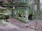
Southwest Albrand region | Originally an overgrown quarry, from which the sandstone for the university buildings in Altdorf was broken in the 16th century, the place was rediscovered by students 100 years later and prepared for happy festivities. At the beginning of the 19th century, the University of Altdorf closed and Altdorf citizens built a beer cellar and a bowling alley as a gallery. The large rock cellar offers good outcrops in the Rhaetian sandstone, especially with charred woods. | 400 20 × 20 |
Type: Rock Cellar, Rock Type , Vegetable Fossils Type: Sandstone |
Rock cellar | precious | Landscape protection area | |
| Rhätschlucht Teufelskirche SE von Weinhof |
 |
574G002 |
Altdorf near Nuremberg position |
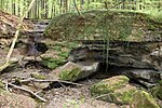
Southwest Albrand region | The Teufelskirche is a Rhätsandstein gorge with a waterfall at the beginning of the gorge. The fall originated from the contact of the coarse-grained, weather-resistant arietes sandstones with the softer Rhätolias sandstones and clay horizons. Already in the years 1525, 1600 and 1720 mining on coal and silver (in pebbles) was attempted. Urlichs (1966) reported 6 m long charred tree trunks. | 35000 350 × 100 |
Type: Tunnels, Plant Fossils, Layer Sequence, Gorge, Minerals Type: Sandstone, Lignite |
Tunnel / gallery / shaft | especially valuable | Natural monument, landscape protection area, FFH area | |
| Former Heidenloch N silver sand mining from Weißenbrunn |
 |
574G003 |
Leinburg position |
Southwest Albrand region | In earlier centuries, the so-called silver sand (light-colored areas in the Dogger sandstone) was popular for scrubbing wooden floors and tables. The Heidenloch is the largest known mining site for this material. Access to the underground passages is blocked by a grille after the ceiling has been demolished (Fig. 4). The Heidenloch is bat winter quarters. | 450 30 × 15 |
Type: Stud Type: Sandstone |
Tunnel / gallery / shaft | precious | Landscape protection area | |
| Mine field at Moritzberg ENE von Diepersdorf |
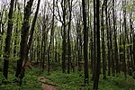 |
574G004 |
Röthenbach on the Pegnitz position |
Southwest Albrand region | The Moritzberg is a witness mountain separated from the Alb. From its base to the summit, the sequence of layers from the upper Keuper to the lower Malm is open. The summit is formed by a remnant of the Franconian Alb plateau, which has been heavily ransacked by quarries (gravel, scouring lime) and excavation pits (probably floor ore). | 20000 200 × 100 |
Type: Pinge / nfeld, Inselberg / Zeugenberg, type of layer sequence : Limestone |
Ping | precious | Landscape protection area | |
| Rock apartment in Thalheim (E 80) | 574G005 |
Happurg position |
Middle Franconian Alb | About four meters above the state road, between two residential buildings, there is a no longer used rock cellar carved into the Doggerstein. The property is under protection as a monument (monument no. D-5-74-128-60). | 10 5 × 2 |
Type: rock cellar Type: sandstone |
Rock cellar | significant | Monument protection | ||
| Devil's Cave SW of Altdorf |
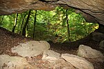 |
574H001 |
Altdorf near Nuremberg position |
Southwest Albrand region | The cave (consisting of a single large room) was artificially expanded by extracting parlor sand and a thin coal seam. The regulation of fossil woods on the cave ceiling was examined by Ulrichs (1966). | 750 25 × 30 |
Type: eruption / weathering cave, plant fossils, sedimentary structures, tunnels, rock type: sandstone, lignite |
cave | precious | Landscape protection area | |
| Distlergrotte ENE by Finstermühle |
 |
574H003 |
Neuhaus an der Pegnitz position |
Northern Franconian Alb | From the entrance hall, two 90 m long corridor systems lead downwards. One corridor reaches a groundwater lake, another ends at a sandstone filling. In the winter months the entrance is closed to protect bats. | 450 90 × 5 |
Type: Karst horizontal cave, rock wall / slope Type: Dolomite stone |
cave | significant | Natural monument, landscape protection area, nature park | |
| Cave system The wind hole SSW of Kauerheim |
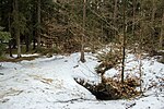 |
574H005 |
Alfeld position |
Middle Franconian Alb | The length of the cave is approx. 2000 m, the depth approx. 52 m. In the wind hole there is a stone structure called the table. A documentation about this cave is currently being worked on. | 40000 1000 × 40 |
Type: Karst Shaft & Horizontal Cave Type: Limestone, Marlstone |
cave | precious | Natural monument, landscape protection area, FFH area | |
| Geißloch E from Krottensee |
 |
574H010 |
Neuhaus an der Pegnitz position |
Northern Franconian Alb | The shaft cave has a total length of 25 m and a maximum depth of 7 m. | 125 25 × 5 |
Type: Karst shaft & horizontal cave Type: Dolomite stone |
cave | significant | Landscape protection area, nature park | |
| Geißlochhöhle NNE by Münzinghof |
 |
574H011 |
Velden position |
Northern Franconian Alb | The shaft cave has a total length of 25 m and a maximum depth of 7 m. | 725 145 × 5 |
Type: Karst horizontal cave Type: Dolomite stone |
cave | significant | Soil monument, landscape protection area, FFH area | |
| Andreaskirche N of Rupprechtstegen |
 |
574H012 |
Velden position |
Northern Franconian Alb | The spacious rock hall has three entrances. | 220 11 × 20 |
Type: Karst horizontal cave Type: Dolomite stone |
cave | significant | Natural monument, landscape protection area, nature park | |
| Large Rohenloch (D18) NE of Viehhofen |
 |
574H013 |
Velden position |
Northern Franconian Alb | In the cave you can see ceiling and wall plungers, pressure pipe and leaching forms. A Pleistocene fauna and prehistoric finds have been excavated. | 335 67 × 5 |
Type: Karst horizontal cave Type: Dolomite stone |
cave | significant | Soil monument, landscape protection area, nature park | |
| Wind hole (A5) SSE from Großmeinfeld |
 |
574H015 |
Hartenstein position |
Northern Franconian Alb | A shaft 28 m deep and 10–12 m in diameter follows the 8 m deep collapse doline. This is often visited by cave tourists. | 150 15 × 10 |
Type: karst shaft cave, sinkhole Type: dolomite stone |
cave | precious | Landscape protection area, FFH area, nature park | |
| Appenloch (Michelhöhle, Friedrichshöhle) D150 SSW from Münzinghof |
 |
574H016 |
Velden position |
Northern Franconian Alb | The short horizontal cave in the folded limestone and dolomites of the middle Malm impresses with its imposing (15 m wide, 3 m high) entrance hall. Finds of large Pleistocene fauna were also made there. | 300 20 × 15 |
Type: Karst horizontal cave Type: Dolomite stone, limestone |
Slope crack / rock wall | significant | Soil monument, landscape protection area, nature park | |
| Kühloch (A67) NW of Hartenstein | 574H017 |
Hartenstein position |
Northern Franconian Alb | 25 m long passage cave with finds of Pleistocene fauna as well as prehistoric finds from the Neolithic and La Tène periods. | 38 25 × 2 |
Type: Karst horizontal cave Type: Dolomite stone |
Slope crack / rock wall | significant | Soil monument, landscape protection area, FFH area | ||
| Sophienquelle S from Grünsberg |
 |
574Q001 |
Altdorf near Nuremberg position |
Southwest Albrand region | The staircase around the Sophienquelle was built in 1720. The Sophienquelle is a typical example of a shift spring. It rises on the border between Feuerletten-Rhätolias, its discharge is approx. 4 l / s. | 100 10 × 10 |
Type: Layer Source Type: Sandstone, Mudstone |
Slope crack / rock wall | precious | Landscape protection area, FFH area | |
| Sprosselbrunnen SW from Schönberg |
 |
574Q002 |
Run at the Pegnitz position |
Southwest Albrand region | The Sprosselbrunnen (or Spratzelbrunnen) is a spring pouring up to several liters per second, which rises from adjacent sandstone just below the layer of the Rhätolia. In the coarse-grained sandstone, numerous round tubular holes with a diameter of 5 - 30 cm have been weathered over an area of about 2 × 2 m, some of which are water-flowing. | 5 5 × 1 |
Type: layer source, layer level, rock type: sandstone, claystone |
Slope crack / rock wall | precious | Landscape protection area | |
| Siebenquellental SW of Thalheim | 574Q003 |
Happurg position |
Middle Franconian Alb | In the Siebenquellental southwest of Thalheim there are numerous springs on the stratum boundary from the Malm to the underlying clayey Dogger. The source outlets are natural and scenic. There are even small natural outcrops of marl limestone from Malm Alpha. | 50 10 × 5 |
Type: film source type: Bricks, Kalkmergelstein |
other information | precious | Landscape protection area | ||
| Schwarzachschlucht SW from Schwarzenbruck |
 |
574R001 |
Schwarzenbruck position |
Sandstone Keuper Region | The Schwarzach Gorge offers the hiker typical outcrops of the Middle Burgsandstein. Scouring, erosion caves, rocky slopes and honeycomb-like weathering forms are striking. On the northern bank of the gorge, a hiking trail leads from Gsteinach over the Gustav-Adolfs-Höhle and Karlshöhle to the west. | 400000 2000 × 200 |
Type: Tafoni / honeycomb weathering, type of rock, bank / surf cave Type: sandstone |
Impact slope / river bed / stream profile | especially valuable | Nature reserve, FFH area, bird sanctuary | Bavaria's most beautiful geotopes No. 22 |
| Röthenbachklamm NW of Röthenbach |
 |
574R002 |
Winkelhaid position |
Southwest Albrand region | The Röthenbach Gorge (also popularly known as the Rumpelbach Gorge) is a Rhätsandstein gorge that is accessible to those looking for relaxation through hiking trails and resting places. At the entrance to the gorge designated as ND stands an old, half-decayed oak with a trunk circumference of 6.30 m. | 30000 300 × 100 |
Type: Canyon Type: Sandstone |
Impact slope / river bed / stream profile | significant | Natural monument, bird sanctuary | |
| NNE gorge from Sendelbach | 574R003 |
Ottensoo's position |
Southwest Albrand region | The Rhätschlucht gorge offers outcrops in the Rhaet-Lias transition layers, which are, however, partially covered by debris deposits. | 23000 460 × 50 |
Type: Canyon Type: Sandstone |
Impact slope / river bed / stream profile | significant | Landscape protection area | ||
| Wolfsschlucht NE from Wallersberg |
 |
574R004 |
Schwarzenbruck position |
Southwest Albrand region | A waterfall in the west forms the best end to the deep, small Rhätsandstein Gorge. | 12500 250 × 50 |
Type: Canyon Type: Sandstone |
Impact slope / river bed / stream profile | significant | Natural monument, landscape protection area, FFH area | |
| Bowl stone N by Fischbach |
 |
574R005 |
Laufamholzer Forst position |
Sandstone Keuper Region | The conspicuously weathered rock knoll made of middle castle sandstone is comparable to granite knolls weathered like wool sack. With the Celts these rocks had a cultic meaning. | 100 10 × 10 |
Type: Ridge Type: Sandstone |
Slope crack / rock wall | significant | Ground monument, bird sanctuary | |
| Castle sandstone cliffs in Rummelsberg |
 |
574R006 |
Schwarzenbruck position |
Southwest Albrand region | The hilltop gives an insight into the composition and structure of the Upper Burgsandstone. | 100 10 × 10 |
Type: Ridge Type: Sandstone |
Rock slope / cliff | significant | no protected area | |
| Hohler Fels SE from Happurg |
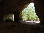 |
574R007 |
Happurg position |
Middle Franconian Alb | Stone Age cave finds were made on the Hohlen Fels. On the cliffs above the Malm Gamma, thick limestone of the Malm Delta (with marl slab) is exposed. Above the cave there is thick-banked dolomite with chert stones. | 14000 200 × 70 |
Type: rock wall / slope, karst horizontal cave Type: dolomite stone, limestone |
Slope crack / rock wall | precious | Soil monument, landscape protection area, FFH area | |
| Riffelfelsen E by Alfalter | 574R008 |
Forward position |
Northern Franconian Alb | The reef rock, divided by several vertical fissures, is often visited by climbers. | 2500 50 × 50 |
Type: Rock Tower / Needle Type: Limestone |
Slope crack / rock wall | significant | Natural monument, landscape protection area, FFH area | ||
| God's finger on Langenstein NW of Vorra |
 |
574R009 |
Forward position |
Northern Franconian Alb | The rugged rock tower, split in the upper part, is difficult to find on a wooded hilltop. It consists of very porous dolomite. | 25 5 × 5 |
Type: Rock tower / needle Type: Dolomite stone |
Slope crack / rock wall | significant | Natural monument, landscape protection area, nature park | |
| Sounding waterfall NNE from Haimendorf |
 |
574R011 |
Röthenbach on the Pegnitz position |
Southwest Albrand region | The Rhaetian transition layers are outstandingly open at the Klingenden Wasserfall. The hard sandstones form a layer on the edge of which the waterfall lies. | 75 15 × 5 |
Type: waterfall, layer sequence, layer level Type: sandstone, claystone |
Impact slope / river bed / stream profile | precious | no protected area | |
| Bastei at Zankelstein E from Pommelsbrunn |
 |
574R012 |
Pommelsbrunn position |
Northern Franconian Alb | On the south and south-east side of the Zankelstein, three rock towers protrude from the forest, which serve as popular observation rocks. | 400 20 × 20 |
Type: Group of rocks Type: Dolomite stone |
Slope crack / rock wall | significant | Natural monument, landscape protection area, FFH area | |
| Spurzelgrub rock group NW of Hofstetten |
 |
574R013 |
Pommelsbrunn position |
Middle Franconian Alb | Rock group in the massive Franconian dolomite with a spacious half cave. The partly massive, partly thick-banked dolomite traces a reef dome. | 70 7 × 10 |
Type: rock group, karst horizontal cave Type: dolomite stone |
Slope crack / rock wall | significant | Natural monument, ground monument, landscape protection area | |
| Düsselbacher Wand SE from Düsselbach |
 |
574R014 |
Forward position |
Northern Franconian Alb | The rock face is on the left slope of the Pegnitz. | 1500 50 × 30 |
Type: Rock Wall / Slope Type: Limestone |
Slope crack / rock wall | significant | Natural monument, ground monument, landscape protection area | |
| Enzendorfer Felsen E from Enzendorf | 574R018 |
Hartenstein position |
Northern Franconian Alb | Two high rocks protrude from the wooded area. The rock faces are popular with climbers. | 400 20 × 20 |
Type: Rock Wall / Slope Type: Limestone |
Slope crack / rock wall | significant | Natural monument, landscape protection area, FFH area | ||
| Jump stone (sole stone) NE of Fischbrunn | 574R020 |
Pommelsbrunn position |
Northern Franconian Alb | The reef dolomite protrudes from the Jura slope. | 100 10 × 10 |
Type: Rock tower / needle Type: Limestone, dolomite stone |
Slope crack / rock wall | significant | Natural monument, landscape protection area, nature park | ||
| Huberfelsen near Alfeld |
 |
574R021 |
Alfeld position |
Middle Franconian Alb | The group of three rocks dominates the landscape of Alfeld. | 1800 60 × 30 |
Type: Felsburg Type: Dolomite stone |
Slope crack / rock wall | significant | Natural monument | |
| Ponor Bachloch in Großengsee | 574R022 |
Simmelsdorf position |
Northern Franconian Alb | The ponor was used to drain the village. A corridor leading down to WNW connects to the three m deep Ponor shaft. | 4 2 × 2 |
Type: Ponor, karst horizontal cave Type: Dolomite stone |
cave | significant | Natural park | ||
| Felsburg Teufelskanzel WSW von Mittelburg |
 |
574R023 |
Happurg position |
Middle Franconian Alb | The chunky cliff has the shape of a pulpit. | 150 15 × 10 |
Type: Felsburg Type: Dolomite stone |
Slope crack / rock wall | significant | Natural monument, landscape protection area, FFH area | |
| Stream with limestone terrace W from Kainsbach |
 |
574R024 |
Happurg position |
Middle Franconian Alb | Small stream lined with tufa, which has formed mossy sintered terraces on a slope. | 16 4 × 4 |
Type: sintered terraces, streams / rivers Type: limestone, tufa |
no information | precious | Landscape protection area | |
| Stone channel W from Schrotsdorf |
 |
574R026 |
Offenhausen position |
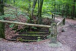
Southwest Albrand region | On the northeast slope of the Buchenberg, a small stone channel has formed below a spring, directly on a supraregional hiking trail (Frankenweg). Their formation is based on abiogenic (pressure relief, temperature increase, carbon dioxide release to the ambient air) and biogenic (algae and moss get their carbon dioxide needs from the water, not from the atmosphere) precipitation of tufa. The feeding source rises in the border area of Dogger and Malm. The channel was damaged several times by vandalism. To protect them, a wooden walkway with a railing was made, and an information board explains the mechanism behind it. In addition to the original stone channel, which has fallen dry due to the damage, a new one is already being built. | 30 30 × 1 |
Type: Stone gutter Type: Tufa limestone |
other information | significant | Landscape protection area | |
| Stone channel SW from Raschbach |
 |
574R027 |
Altdorf near Nuremberg position |
Middle Franconian Alb | Approx. 500 m SW of Raschbach, one of the very rare stone channels has formed at one of the numerous sources of the stream of the same name. The ornate tone separates the groundwater bodies of Dogger and Malm and represents an important source horizon. The source is popularly known as the aster or Easter fountain. The formation of the stone channel is based on two factors. Abiogenic causes of the precipitation of tufa are pressure relief, temperature increase and the release of carbon dioxide in the area close to the source. Algae and moss do not meet their carbon dioxide requirements from the ambient air, but from the calcareous water (biogenic factors). After a few tens of meters, the lime content of the water has decreased so much that the separation of tufa comes to a standstill. Obviously, the water flow was interrupted at least temporarily, so that only a small part of the water flows over the stone channel, while a new watercourse has formed to the left of it, in which the precipitation of tufa is already starting. The stone channel is a protected part of the landscape and is under special protection. | 20 20 x 1 |
Type: Stone gutter Type: Tufa limestone |
no information | significant | Landscape component, landscape protection area |
See also
- List of nature reserves in the district of Nürnberger Land
- List of landscape protection areas in the district of Nürnberger Land
- List of FFH areas in the district of Nürnberger Land
- List of protected landscape components in the district of Nürnberger Land
- List of natural monuments in the district of Nürnberger Land
- List of nature reserves in the city of Nuremberg
- List of landscape protection areas in the city of Nuremberg
- List of protected landscape components in Nuremberg
- List of natural monuments in Nuremberg
- List of FFH areas in the city of Nuremberg
Individual evidence
- ↑ Data source: Bavarian State Office for the Environment, www.lfu.bayern.de, Geotoprecherche (accessed on September 16, 2017)
Web links
Commons : Geotopes in the district of Nürnberger Land - collection of images, videos and audio files