| No.
|
Surname
|
image
|
Geotope ID
|
Geotope type
|
Administrative district
|
district
|
Municipality / location
|
comment
|
|
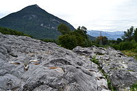
01
|
Large stake near Viechtach
|

|
276R002
|
Härtling, rock wall / slope, rock tower / needle, fault, rock type
|
Lower Bavaria
|
Regen district
|
Viechtach
position
|
|
|
02
|
Glacier cut near Fischbach
|
|
187R004
|
Glacier cut, round humps, glacier mill, Kolk
|
Upper Bavaria
|
Rosenheim district
|
Flintsbach am Inn
position
|
|
|
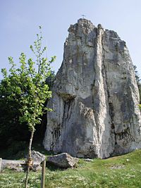
03
|
Burgstein near Dollnstein
|
|
176R006
|
Rock tower / needle, rock castle
|
Upper Bavaria
|
District of Eichstätt
|
Dollnstein
position
|
|
|
04
|
Falkenberg Castle Hill
|

|
377R012
|
Rock castle
|
Upper Palatinate
|
Tirschenreuth district
|
Falkenberg
position
|
|
|
05
|
Broken diabase on Galgenberg
|

|
475A003
|
Shift sequence, pillows
|
Upper Franconia
|
Hof district
|
Schwarzenbach am Wald
position
|
|
|
06
|
Former quarry in the Pingarten porphyry
|
|
376A007
|
Type locality, minerals, disorder
|
Upper Palatinate
|
Schwandorf district
|
Bodenwoehr
position
|
|
|
07
|
Basalt quarry on the stump of linden
|

|
672R003
|
Basalt columns, volcanic vent, type of rock
|
Lower Franconia
|
Bad Kissingen district
|
Schondra
position
|
|
|
08
|
Lechfall and Klamm near Füssen
|

|
777R016
|
Gorge, waterfall, stream / river course
|
Swabia
|
District of Ostallgäu
|
Feet
position
|
|
|
09
|
Aumühle quarry
|
|
779A013
|
Standard / reference profile, ejection material (impact)
|
Swabia
|
Donau-Ries district
|
Hainsfarth
position
|
|
|
10
|
Gypsum break Endsee
|

|
571A007
|
Type of rock, tunnels, carts / fields, folds / troughs / saddles
|
Middle Franconia
|
Ansbach district
|
Steinsfeld
position
|
|
|
11
|
Sandstone cliffs Nuremberg Imperial Castle
|

|
564A002
|
Type locality
|
Middle Franconia
|
Nuremberg
|
Nuremberg
position
|
|
|
12
|
Frickenhauser lake
|

|
673R001
|
Sinkhole, type of rock
|
Lower Franconia
|
District of Rhön-Grabfeld
|
Mellrichstadt
position
|
|
|
13
|
Weltenburger narrow
|

|
273R005
|
Breakthrough valley, rock wall / slope, karst horizontal cave
|
Lower Bavaria
|
District of Kelheim
|
Kelheim
position
|
|
|
14th
|
Horwagen marble quarry
|
|
475A009
|
Layer sequence, type locality, type of rock
|
Upper Franconia
|
Hof district
|
Bad Steben
position
|
|
|
15th
|
Boulder Dengelstein
|

|
780R018
|
Boulder
|
Swabia
|
District of Oberallgäu
|
Through
position
|
|
|
16
|
Partnach Gorge
|
|
180R002
|
Gorge, sequence of layers, rock fall
|
Upper Bavaria
|
Garmisch-Partenkirchen district
|
Garmisch-Partenkirchen
position
|
|
|
17th
|
Silberberg Bodenmais
|

|
276G002
|
Studs, minerals
|
Lower Bavaria
|
Regen district
|
Bodenmais
position
|
|
|
18th
|
Baierbrunn climbing garden
|

|
184A001
|
Standard / reference profile, fossil soil, layer sequence, geological organ
|
Upper Bavaria
|
District of Munich
|
Baierbrunn
position
|
|
|
19th
|
Growing rock from Usterling
|

|
279R004
|
Stone channel, layer source
|
Lower Bavaria
|
Dingolfing-Landau district
|
Landau on the Isar
position
|
|
|
20th
|
Basalt cone High park stone
|
|
374R004
|
Basalt columns, volcanic vent, type of rock
|
Upper Palatinate
|
Neustadt an der Waldnaab district
|
Park stone
position
|
|
|
21st
|
Oertels broken roof slate
|

|
476A030
|
Rock type
|
Upper Franconia
|
District of Kronach
|
Ludwigsstadt
position
|
|
|
22nd
|
Schwarzach Gorge
|
|
574R001
|
Tafoni / honeycomb weathering, type of rock, bank / surf cave
|
Middle Franconia
|
District of Nürnberger Land
|
Schwarzenbruck
position
|
|
|
23
|
Wilhelmine copper mine
|
|
671G001
|
stollen
|
Lower Franconia
|
Aschaffenburg district
|
Summer bald
position
|
|
|
24
|
Scheidegger waterfalls
|

|
776R007
|
Waterfall, sequence of layers
|
Swabia
|
District of Lindau (Lake Constance)
|
Scheidegg
position
|
|
|
25th
|
Stone Agnes
|
|
172R012
|
Rock tower / needle
|
Upper Bavaria
|
District of Berchtesgadener Land
|
Bischofswiesen
position
|
|
|
26th
|
Buchberger Leite on the Bavarian stake
|
|
272R003
|
Canyon, fault, shift sequence
|
Lower Bavaria
|
Freyung-Grafenau district
|
Hohenau
position
|
|
|
27
|
Luisenburg rock labyrinth
|
|
479R014
|
Block flow, wool sack formation
|
Upper Franconia
|
District of Wunsiedel in the Fichtel Mountains
|
Wunsiedel
position
|
|
|
28
|
Hesselberg
|

|
571A001
|
Layer sequence, animal fossils
|
Middle Franconia
|
Ansbach district
|
Gerolfingen
position
|
|
|
29
|
Felsburg Tüchersfeld
|

|
472R156
|
Umlauf- / breakthrough mountain, rock castle
|
Upper Franconia
|
Bayreuth district
|
Pottenstein
position
|
|
|
30th
|
Wengenhausen impact rocks
|

|
779A012
|
Layer sequence, gravel (impact), ejection material (impact), inner wall (impact)
|
Swabia
|
Donau-Ries district
|
Marktoffingen
position
|
|
|
31
|
Breitachklamm
|
|
780R017
|
Gorge, waterfall, scour, shift sequence, disturbance
|
Swabia
|
District of Oberallgäu
|
Oberstdorf
position
|
|
|
32
|
Sea of blocks on the Lusen
|
|
272R016
|
Block sea
|
Lower Bavaria
|
Freyung-Grafenau district
|
Neuschönau
position
|
|
|
33
|
Ice crumbling landscape Osterseen
|

|
190R035
|
Kames, Toteisloch, Os, terrace, fen, source of folds
|
Upper Bavaria
|
Weilheim-Schongau district
|
Iffeldorf
position
|
|
|
34
|
Karlsgraben
|
|
577G003
|
Ditch, canal
|
Middle Franconia
|
Weissenburg-Gunzenhausen district
|
Treuchtlingen
position
|
|
|
35
|
Kalbenstein shell limestone profile
|
|
677A009
|
Sequence of layers, rock wall / slope, rock fall, karst horizontal cave, impact slope
|
Lower Franconia
|
Main-Spessart district
|
Karlstadt
position
|
|
|
36
|
Kreuzberg in Pleystein
|
|
374A015
|
Minerals, hard rock, type of rock
|
Upper Palatinate
|
Neustadt an der Waldnaab district
|
Pleysteine
position
|
|
|
37
|
Dead ice hole wolf pit
|

|
179R001
|
Dead ice hole
|
Upper Bavaria
|
Fürstenfeldbruck district
|
Grafrath
position
|
|
|
38
|
Open caves
|
|
779H001
|
Karst horizontal cave
|
Swabia
|
Donau-Ries district
|
Nördlingen
position
|
|
|
39
|
Eclogite on the Weißenstein
|
|
475A029
|
Type of rock, cliff
|
Upper Franconia
|
Hof district
|
Stammbach
position
|
|
|
40
|
Gypsum karst spring Bottomless hole
|
|
571Q002
|
Constriction source
|
Middle Franconia
|
Ansbach district
|
Diebach
position
|
|
|
41
|
Stone woman at Walberla
|

|
474R036
|
Rock tower / needle
|
Upper Franconia
|
Forchheim district
|
Kirchehrenbach
position
|
|
|
42
|
Steinwies boulder
|

|
187R020
|
Boulder
|
Upper Bavaria
|
Rosenheim district
|
Bad Feilnbach
position
|
|
|
43
|
Devil's Kitchen Obergünzburg
|

|
777R001
|
Landslide, rock wall / slope, sequence of layers
|
Swabia
|
District of Ostallgäu
|
Obergünzburg
position
|
|
|
44
|
Rotenhan castle ruins
|
|
674G001
|
Machined rock
|
Lower Franconia
|
Haßberge district
|
Boars
position
|
|
|
45
|
Bodenmühlwand
|

|
462A001
|
Sequence of layers, discordance, animal fossils
|
Upper Franconia
|
Bayreuth
|
Bayreuth
position
|
|
|
46
|
Ramsau magic forest
|
|
172R009
|
Landslide
|
Upper Bavaria
|
District of Berchtesgadener Land
|
Ramsau near Berchtesgaden
position
|
|
|
47
|
Black moor
|

|
673R008
|
High moor, low moor
|
Lower Franconia
|
District of Rhön-Grabfeld
|
Hausen
position
|
|
|
48
|
Molasse profile Eistobel
|

|
776R001
|
Gorge, standard / reference profile, fold / trough / saddle, scour, waterfall
|
Swabia
|
District of Lindau (Lake Constance)
|
Maierhöfen
position
|
|
|
49
|
Big perforated stone
|

|
472R086
|
Rock tower / needle, karst halfway / natural bridge
|
Upper Franconia
|
Bayreuth district
|
Veldensteiner Forst
position
|
|
|
50
|
Serpentinite-Härtling at Föhrenbühl
|
|
377R008
|
Härtling, metamorphic structure, contact
|
Upper Palatinate
|
Tirschenreuth district
|
Erbendorf
position
|
|
|
51
|
Malmschichten on the Arzberg
|

|
176A017
|
Shift sequence
|
Upper Bavaria
|
District of Eichstätt
|
Beilngrie's
position
|
|
|
52
|
Mill quarry Hinterhör
|

|
187G001
|
Quarry / pit
|
Upper Bavaria
|
Rosenheim district
|
Re-firing
position
|
|
|
53
|
Blockstrom Kaser Steinstuben
|
|
277R001
|
Block stream
|
Lower Bavaria
|
Rottal-Inn district
|
Triftern
position
|
|
|
54
|
Three Brothers Rock
|

|
479R020
|
Rock tower / needle, wool sack formation
|
Upper Franconia
|
District of Wunsiedel in the Fichtel Mountains
|
Meierhöfer page
position
|
|
|
55
|
Coal seam on the Bühlach
|
|
190A012
|
Minerals, type of rock, animal fossils, sequence of layers
|
Upper Bavaria
|
Weilheim-Schongau district
|
Peiting
position
|
|
|
56
|
Protection rock Pentling
|
|
375R032
|
Rock wall / slope, type locality, sequence of layers, discordance
|
Upper Palatinate
|
Regensburg district
|
Pentling
position
|
|
|
57
|
Shift levels on the Schwanberg
|

|
675A001
|
Layer sequence, sediment structures
|
Lower Franconia
|
Kitzingen district
|
Iphofen
position
|
|
|
58
|
Granite on the three armchair
|
|
272R024
|
Rock castle, wool sack formation, type of rock
|
Lower Bavaria
|
Freyung-Grafenau district
|
Neureichenau
position
|
|
|
59
|
Mica schist on the Osser
|

|
372R010
|
Crag, hard rock, type of rock
|
Upper Palatinate
|
Cham district
|
Lohberg
position
|
|
|
60
|
Wellheim dry valley
|
|
176R001
|
Dry valley, Umlauf- / breakthrough mountain, rock tower / needle
|
Upper Bavaria
|
District of Eichstätt
|
Wellheim
position
|
|
|
61
|
Riesenburg cave ruins
|

|
474R064
|
Rock wall / slope, karst shaft & horizontal cave, sinkhole
|
Upper Franconia
|
Forchheim district
|
Wiesenttal
position
|
|
|
62
|
Twelve Apostles Rock
|

|
577R008
|
Rock group, rock tower / needle, rock castle, sediment structures
|
Middle Franconia
|
Weissenburg-Gunzenhausen district
|
Solnhofen
position
|
|
|
63
|
Riesseekalke Hainsfarth
|

|
779A015
|
Standard / reference profile, animal fossils, crater rim (impact)
|
Swabia
|
Donau-Ries district
|
Hainsfarth
position
|
|
|
64
|
Steinachklamm
|
|
477R003
|
Klamm
|
Upper Franconia
|
District of Kulmbach
|
Presseck
position
|
|
|
65
|
Kaolin pits near Hirschau and Schnaittenbach
|

|
371A022
|
Kaolinization, type of rock
|
Upper Palatinate
|
Amberg-Sulzbach district
|
Hirschau
position
|
|
|
66
|
Aubenham tertiary world
|
|
183A003
|
Standard / Reference Profile, Plant Fossils, Animal Fossils
|
Upper Bavaria
|
District of Mühldorf am Inn
|
Oberbergkirchen
position
|
|
|
67
|
Stockheim coal
|

|
476G003
|
Tunnels, sequence of layers, plant fossils
|
Upper Franconia
|
District of Kronach
|
Stockheim
position
|
|
|
68
|
Humpback meadows near Mittenwald
|

|
180R013
|
Humpback meadow
|
Upper Bavaria
|
Garmisch-Partenkirchen district
|
Mittenwald
position
|
|
|
69
|
Doggerfelswand Niederhofen
|

|
373A030
|
Sediment structures, type of rock, rock cellars
|
Upper Palatinate
|
District of Neumarkt in the Upper Palatinate
|
Pilsach
position
|
|
|
70
|
Flysch in the Röthenbachtal
|

|
777A017
|
Layer sequence, type of rock, standard / reference profile
|
Swabia
|
District of Ostallgäu
|
Halbch
position
|
|
|
71
|
Solnhofen limestone fossil site
|

|
577A008
|
Type locality, animal fossils
|
Middle Franconia
|
Weissenburg-Gunzenhausen district
|
Langenaltheim
position
|
|
|
72
|
Volkacher Mainschleife
|
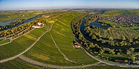
|
675R004
|
Stream / river course, impact slope, circulation / breakthrough mountain
|
Lower Franconia
|
Kitzingen district
|
Volkach
position
|
|
|
73
|
Schlossberg Flossenbürg
|

|
374A009
|
Type locality, wool sack formation, hardness, rocky hilltop
|
Upper Palatinate
|
Neustadt an der Waldnaab district
|
Flossenbürg
position
|
|
|
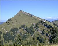
74
|
Law profile Staffelberg
|

|
478R029
|
Inselberg / Zeugenberg
|
Upper Franconia
|
Lichtenfels district
|
Relay stone
position
|
|
|
75
|
Chalk transgression Obertrübenbach
|
|
372A059
|
Discordance, layer sequence, standard / reference profile, animal fossils
|
Upper Palatinate
|
Cham district
|
Roding
position
|
|
|
76
|
Ammergau whetstone quarries
|

|
180G004
|
Quarry / pit, type locality
|
Upper Bavaria
|
Garmisch-Partenkirchen district
|
Unterammergau
position
|
|
|
77
|
Nagelfluh on the Hochgrat
|
|
780R029
|
Härtling, shift sequence, carts / fields
|
Swabia
|
District of Oberallgäu
|
Oberstaufen
position
|
|
|
78
|
Sand dune Seeholz Abensberg
|
|
273R011
|
Dune field
|
Lower Bavaria
|
District of Kelheim
|
Abensberg
position
|
|
|
79
|
Ruhpolding marble
|

|
189A021
|
Shift sequence
|
Upper Bavaria
|
District of Traunstein
|
Ruhpolding
position
|
|
|
80
|
Gneiss on the high rock
|

|
376R002
|
Crag, type of rock, boulder stream
|
Upper Palatinate
|
Schwandorf district
|
Stadlern
position
|
|
|
81
|
Röslauschlucht Gsteinigt
|

|
479R027
|
Canyon, rock type, metamorphic structure, tunnels
|
Upper Franconia
|
District of Wunsiedel in the Fichtel Mountains
|
Arzberg
position
|
|
|
82
|
Geological organs rugged
|

|
171R001
|
Geological organ, fossil soil, quarry / pit
|
Upper Bavaria
|
Altötting district
|
Untereukirchen
position
|
|
|
83
|
Lime quarry Kleinochsenfurt
|
|
679A012
|
Rock type, layer sequence, sediment structures, gorge
|
Lower Franconia
|
Würzburg district
|
Ochsenfurt
position
|
|
|
84
|
Volcanic crater mountain stone
|

|
672A017
|
Contact, igneous structure, basalt columns, type of rock
|
Lower Franconia
|
Bad Kissingen district
|
Wildspot
position
|
|
|
85
|
Main meadows near Ziegelanger
|
|
674A016
|
Vegetable fossils, breakthrough valley
|
Lower Franconia
|
Haßberge district
|
Zeil am Main
Position
|
|
|
86
|
Hoechberg sandstone quarry
|

|
679A007
|
Rock type, layer sequence, plant fossils, animal fossils, sedimentary structures
|
Lower Franconia
|
Würzburg district
|
Höchberg
position
|
|
|
87
|
Sulzheimer gypsum hill
|

|
678R005
|
Subrosion landscape, sinkhole, sinkhole, layer level
|
Lower Franconia
|
Schweinfurt district
|
Sulzheim
position
|
|
|
88
|
Helvetikum near Burgberg
|
|
780A001
|
Standard / reference profile, fold / trough / saddle
|
Swabia
|
District of Oberallgäu
|
Burgberg in the Allgäu
position
|
|
|
89
|
Granite center in Hauzenberg
|

|
275A039
|
Rock type, quarry / pit
|
Lower Bavaria
|
District of Passau
|
Hauzenberg
position
|
|
|
90
|
Seltenbach Gorge near Klingenberg am Main
|

|
676R003
|
Rock type, layer sequence, sediment structures
|
Lower Franconia
|
Miltenberg district
|
Klingenberg am Main
position
|
|
|
91
|
Soil formation on the Heusterzbühl
|
|
377A035
|
Soil profile, kaolinization, sequence of layers
|
Upper Palatinate
|
Tirschenreuth district
|
Leonberg
position
|
|
|
92
|
Marble quarry Unterwappenöst
|

|
377A003
|
Rock type, sequence of layers
|
Upper Palatinate
|
Tirschenreuth district
|
Kulmain
position
|
|
|
93
|
Isar valley wild river landscape
|
|
173R005
|
Alluvial fans
|
Upper Bavaria
|
Bad Tölz-Wolfratshausen district
|
Lenggrie's
position
|
|
|
94
|
Mistelgau fossil pit
|
|
472A016
|
Layer sequence, animal fossils, standard / reference profile
|
Upper Franconia
|
Bayreuth district
|
Mistelgau
position
|
|
|
95
|
Historic quarries in Wernsbach
|
|
576A001
|
Rock type, quarry / pit, tunnel
|
Middle Franconia
|
District of Roth
|
Georgensgmünd
position
|
|
|
96
|
Bogenberg
|

|
278R005
|
Impact slope, type of rock, disturbance
|
Lower Bavaria
|
District of Straubing-Bogen
|
Bow
position
|
|
|
97
|
Shale coal on the Uhlenberg
|

|
772A007
|
Plant fossils, fossil soil, sequence of layers
|
Swabia
|
District of Augsburg
|
Spelled shards
position
|
|
|
98
|
Dinosaur tracks in your village
|
|
672A018
|
Trace fossils, sequence of layers, type of rock
|
Lower Franconia
|
Bad Kissingen district
|
Your village
position
|
|
|
99
|
Wackersdorfer brown coal
|
|
376A031
|
Layer sequence, type of rock
|
Upper Palatinate
|
Schwandorf district
|
Wackersdorf
position
|
|
|
100
|
Watzmann east face with ice chapel
|

|
172R025
|
Glacier / Firnfeld
|
Upper Bavaria
|
District of Berchtesgadener Land
|
Schönau am Königssee
position
|
|


.JPG)


.JPG)


.jpg)


.jpg)


.jpg)


_3.jpg)


