List of geotopes in Regensburg
This list contains the geotopes of the Upper Palatinate city of Regensburg in Bavaria . The list contains the official names and numbers of the Bavarian State Office for the Environment (LfU) as well as their geographical location. This list may not be complete. Around 3,400 geotopes (as of March 2020) are recorded in the Bavarian geotope register. The LfU does not consider some geotopes suitable for publication on the Internet. For example, some objects are not safely accessible or may only be entered to a limited extent for other reasons.
| Surname | image | Geotope ID | Municipality / location | Geological unit of space | description | Area m² / extension m | geology | Digestion type | value | Protection status | comment |
|---|---|---|---|---|---|---|---|---|---|---|---|
| Former quarry SW of Kager |
 |
362A001 |
Regensburg position |
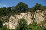
Middle Franconian Alb | Reference profile of the Netzstall subformation of the Torleite formation on the Middle Franconian Alb. Medium to thick banked, yellowish gray to bright white limestones with very well developed, even layer boundaries. The layer surfaces rub off chalky. The micritic limestones break in fragments. The occurrence shows very strong fissures. These layers were also known as Kager layers. These rocks were deposited in the central area of the stratified facies basin of Kager-Eberwies. A large part of the former quarry area is now occupied by the Regensburg animal shelter. | 4200 120 × 35 |
Type: standard / reference profile, rock type: limestone |
Quarry | precious | Landscape protection area | |
| Dogger outcrop NW of Tegernheim | 362A003 |
Regensburg position |
Regensburg Forest | Dogger iron sandstones are exposed on the western slope of the Tegernheimer Graben near the Keilberg fault. These are slightly flaky and sometimes noticeably red-colored and softened. | 100 20 × 5 |
Type: Rock Type: Sandstone |
Slope crack / rock wall | significant | Nature reserve, FFH area | ||
| Friedrich-Zeche opencast mine near Dech Betten |
 |
362G001 |
Regensburg position |
Southern Franconian Alb | The tertiary brown coal reached a thickness of 24 m here. The mining mainly relates to the clayey main intermediate compound, a mining permit for the Friedrich-Zeche is available until 2029. A nature trail for geology, landscape and raw material extraction with a viewing platform was set up at the edge of the opencast mine. | 62500 250 × 250 |
Type: Open-cast mining, layer sequence Type: Lignite, clay |
Clay pit / clay pit / marl pit | significant | Landscape component | |
| Cave at Keilstein NE of Schwabelweis |
 |
362H001 |
Regensburg position |
Dungau | The half-cave consists of two similar recessed indentations. The angular rock structures show an impressive change between white and completely black surfaces. | 15 3 × 5 |
Type: Karst halfway / natural bridge Type: Limestone |
Slope crack / rock wall | significant | Nature reserve, FFH area | |
| Rocky slopes on the south side of the Keilberg NE of Regensburg |
 |
362R001 |
Regensburg position |
Dungau | In the area of the Keilberg Fault, which separates the crystalline basement of the Vorderen Bavarian Forest from the overburden in the west, the entire Jura curves upward to the east like a flexure. The individual layers of the shift come to light on the southern slope of the Keilberg. The transition from steep to W dipping into flat white Jurassic limestones is easy to see. | 200000 1000 × 200 |
Type: rock group, layer sequence, flexure, karst horizontal cave Type: limestone |
Slope crack / rock wall | especially valuable | Nature reserve | |
| The big rock on the Keilberg NE of Schwabelweis |
 |
362R002 |
Regensburg position |
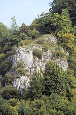
Dungau | The Malm Epsilon begins at the top of the rock with thin limestone. | 1000 50 × 20 |
Type: rock castle, type of layers : limestone |
Slope crack / rock wall | precious | Nature reserve, FFH area | |
| Rock group on the SW part of the Keilberg N of Schwabelweis |
 |
362R003 |
Regensburg position |
Dungau | The rock group opens up the mass limestone of the Malm Epsilon and Zeta. A dense series of pebble sponges can be seen at their feet. On the level between the two rock galleries there are thin limestone from the Malm Epsilon. | 1000 50 × 20 |
Type: rock group, layer sequence type: limestone |
Slope crack / rock wall | precious | Nature reserve, FFH area | |
| Large sinkhole Schauergrube W from Vorderkeilberg |
 |
362R004 |
Regensburg position |
Middle Franconian Alb | The completely overgrown sinkhole has an irregular, not round outer edge. | 800 40 × 20 |
Type: sinkhole Type: limestone |
no information | significant | Natural monument | |
| Rocky slope on the Winzerer Höhen near Niederwinzer |
 |
362R005 |
Regensburg position |
Middle Franconian Alb | The rocky slope made of massive Malmkalk was built into the base by a garage. The exposure is not publicly available. | 30 30 × 1 |
Type: Rock Wall / Slope Type: Limestone |
Slope crack / rock wall | significant | Natural monument | |
| Rocks on the Max-Schulze-Steig N of Sinzing | 362R006 |
Regensburg position |
Southern Franconian Alb | Numerous impressive rock towers over 20 m high characterize the Danube side in the area of the NSG Max-Schulze-Steig. There are also about 30 smaller caves there. The rocks consist of plump rock limestone from the White Jura. The high-altitude trail runs more or less on the surface of the Pre-Cretaceous land. To the east of the way there are some former quarries in the Regensburg green sandstone (Regensburg Formation, Upper Cretaceous) When prominent rocks in this area were to be blasted and dismantled at the beginning of the 20th century, the senior building officer Max Schultze bought the area with his own funds. In 1921 it was placed under nature protection. The entire Danube bank was then - with two exceptions (forest and vineyard) - unforested and grazed with sheep and cows. | 40 20 × 2 |
Type: rock wall / slope, sequence of layers, karst halfway / natural bridge Type: limestone, sandstone |
Slope crack / rock wall | significant | Nature reserve |
See also
- List of nature reserves in the Regensburg district
- List of landscape protection areas in the district of Regensburg
- List of FFH areas in the district of Regensburg
- List of nature reserves in the city of Regensburg
- List of landscape protection areas in the city of Regensburg
- List of FFH areas in the city of Regensburg
Individual evidence
- ↑ Data source: Bavarian State Office for the Environment, www.lfu.bayern.de, Geotoprecherche (accessed on September 16, 2017)
Web links
Commons : Geotopes in Regensburg - Collection of images, videos and audio files