List of geotopes in the Fürstenfeldbruck district
This list contains the geotopes of the Upper Bavarian district of Fürstenfeldbruck in Bavaria . The list contains the official names and numbers of the Bavarian State Office for the Environment (LfU) as well as their geographical location. This list may not be complete. Around 3,400 geotopes (as of March 2020) are recorded in the Bavarian geotope register. The LfU does not consider some geotopes suitable for publication on the Internet. For example, some objects are not safely accessible or may only be entered to a limited extent for other reasons.
| Surname | image | Geotope ID | Municipality / location | Geological unit of space | description | Area m² / extension m | geology | Digestion type | value | Protection status | comment |
|---|---|---|---|---|---|---|---|---|---|---|---|
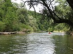
| Traces of gold washing on the Amper SW of Schöngeising | 179G001 |
Schöngeising position |
Paar-Isar region | Near the Amperschlucht gorge, in the floodplain below the Schlossberg, there are areas with restless morphology, drainage-free depressions and hills that are interpreted as traces of an early gold panning process. Whether it was actually the Celts who are said to have panned gold here cannot be proven archaeologically. Evidence of Bronze Age settlement can be found in abundance in the area. The property is under special protection as a ground monument (monument no. D-1-7833-0384). | 28500 190 × 150 |
Type: Soap Laundry Type: crushed stone, gravel |
Ping | precious | Soil monument, landscape protection area | ||
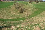
| Deadisloch Wolfsgrube E by Grafrath |
 |
179R001 |
Grafrath position |
Paar-Isar region | The dead ice hole with its steep, deep flanks is particularly well defined and preserved. It is considered a teaching example and is suitable as an excursion destination. | 18000 150 × 120 |
Type: Dead Ice Hole Type: Moraine |
no information | precious | Natural monument, landscape protection area | Bavaria's most beautiful geotopes No. 37 |
| Amperschlucht between Grafrath and Schöngeising |
 |
179R002 |
Grafrath position |
Paar-Isar region | The late worm-glacial run of the Ammersee is approx. 3 kilometers long. | 600000 3000 × 200 |
Type: Trumpet Valley Type: Gravel, Moraine |
no information | precious | Natural monument, landscape protection area, FFH area | |
| Dead ice kettle E from Wildenroth |
 |
179R003 |
Grafrath position |
Paar-Isar region | The dead ice hole that lies in the Würm moraine is completely silted up. | 1000 50 × 20 |
Type: Dead Ice Hole Type: Moraine |
no information | significant | Natural monument | |
| Haspelmoor SW from Haspelmoor |
 |
179R005 |
Althegnenberg position |
Paar-Isar region | A raised to transitional bog has been preserved in the cracked ice basin. There is accumulation of water in pitted areas. Here, too, there is a threat of increasing bush cover. | 3300000 2200 × 1500 |
Type: raised bog, low bog Type: moraine, peat |
no information | significant | Nature reserve, landscape protection area, FFH area | |
| Terminal moraine N of walls |
 |
179R006 |
Grafrath position |
Isar-Loisach young moraine region | The terminal moraine wall is assigned to the main edge of the Reichling-Schöffelding walls. | 6000000 4000 × 1500 |
Type: End (wall) moraine Type: Moraine |
no information | significant | Landscape protection area | |
| Glaciogenic landscape SE von Unteralting |
 |
179R007 |
Grafrath position |
Paar-Isar region | To the south-east of Wildenroth, three relief forms of glaciogenic origin can be studied next to each other: A low terrace of high-worm glacial gravel - it lies outside the terminal moraines of the Würm Cold Age - is limited in the northwest by the wall shape of a worm moraine (height approx. 30 m) and interrupted by a horseshoe-shaped dead ice hole ( In the deep valley) with a size of about 300 m × 200 m and a depth of 20 m. | 1500000 1500 × 1000 |
Type: Dead ice hole, terrace, end (wall) moraine Type: moraine |
no information | precious | Natural monument, landscape protection area |
See also
- List of nature reserves in the Fürstenfeldbruck district
- List of landscape protection areas in the Fürstenfeldbruck district
- List of FFH areas in the Fürstenfeldbruck district
Individual evidence
- ↑ Data source: Bavarian State Office for the Environment, www.lfu.bayern.de, Geotoprecherche (accessed on September 16, 2017)
Web links
Commons : Geotopes in the Fürstenfeldbruck district - collection of images, videos and audio files