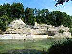
List of geotopes in Kempten (Allgäu)
This list of geotopes in Kempten (Allgäu) shows existing geotopes there. The list contains the official names and numbers of the Bavarian State Office for the Environment (LfU) as well as their geographical location. Around 3,400 geotopes (as of March 2020) are recorded in the Bavarian geotope register.
| Surname | image | Geotope ID | Municipality / location | Geological unit of space | description | Area m² / extension m | geology | Digestion type | value | Protection status | comment |
|---|---|---|---|---|---|---|---|---|---|---|---|
| Former Quarry S of fir trees |
 |
763A001 |
Kempten position |
Iller-Lech young moraine region | About 15 m thick fossil-rich sandstones, conglomerates and marls of the Upper Sea Molasse are exposed over the weathered Lower Freshwater Molasse. The layers dip steeply (60 ° N). | 6600 220 × 30 |
Type: layer sequence, animal fossils, sedimentary structures Type: sandstone, conglomerate, marl |
Quarry | precious | Natural monument | |
| Iller breakthrough W from Oberkottern |
 |
763A002 |
Kempten position |
Iller-Lech young moraine region | On the banks of the Iller and on the rock (covered by the dam) rock in the river, there are granite molasses. | 1800 100 × 18 |
Type: Rock type: Sandstone, marl, conglomerate |
Impact slope / river bed / stream profile | precious | Landscape protection area | |
| Impact slopes of the Iller N from Kempten |
 |
763A003 |
Kempten position |
Iller-Lech young moraine region | The Iller has created several impressively high and long impact slopes north of Kempten, on which a profile of the Upper Freshwater Molasse can be seen. Colorful marl stones are overlaid by a coarse conglomerate bed. From the parking lot on the Iller below Hirschdorf you can hike upstream and the walls can be viewed across the river. | 6000 600 × 10 |
Type: Impact slope, rock type: conglomerate, marl |
Impact slope / river bed / stream profile | precious | Landscape protection area | |
| Historic quarry on the Lenzfrieder mountain ridge |
 |
763G001 |
Kempten position |
Iller-Lech young moraine region | A steep rib of a 10–20 m thick fossil-bearing sandstone of the Upper Sea Molasse (OMM) runs over the Lenzfrieder ridge east of Kempten. The rubble-bearing sandstone is known as bryozoan sandstone. The hard, relatively weather-resistant and easily minable sandstone was broken to a large extent as a building block. Bryozoan sandstone was already used as a building block in the Roman Cambodonum. However, it cannot be proven whether this quarry was already in operation in Roman times. The vertical to overturned layer sequence owes its steep position to the movement of the marginal fault that passes a little further south and separates foreland molasses and fold molasses. The upright southern edge of the foreland molasse shows up on the Lenzfried ridge. The former quarry is a natural monument that aims to preserve the wealth of typical molasse fossils. Therefore no removal of fossils! | 400 80 × 5 |
Type: Quarry / Pit Type: Sandstone |
Slope crack / rock wall | significant | Natural monument | |
| Cut of the Roman road W from Rothkreuz | 763G002 |
Kempten position |
Iller-Lech young moraine region | To the west of Rothkreuz, a partially water-bearing cut in the terrain runs in an arch behind the edge of the forest. It is an old Roman road that is deepened here in sandstones, sandy marlstones and conglomerates of the Upper Sea Molasse at the transition to the Upper Freshwater Molasse. The profile is described in Scholz (1989). The cut of the old street is a ground monument (monument no. D-7-8227-0045). | 9000 450 × 20 |
Type: ravine, rock type: conglomerate, sandstone |
Pit / canal / ravine | significant | Ground monument | ||
| Drumlinfeld E from Kempten |
 |
763R001 |
Kempten position |
Iller-Lech young moraine region | The distinctive drumlin landscape shows some exemplary shaped drumlins. Drumlins are interpreted as erosion and accumulation forms of rubble-laden glaciers. | 9000000 3000 × 3000 |
Type: Drumlin- / G.moränenfeld Type: Moraine |
no information | significant | no protected area | |
| Gorge S of Mariaberg |
 |
763R002 |
Kempten position |
Iller-Lech young moraine region | A deep 600 m long gorge leads east from the hiking car park in Mariaberg. The Upper Freshwater Molasse is exposed several times on the walls, which are up to 100 m high. | 90000 600 × 150 |
Type: Canyon, Rock Type: Conglomerate |
Slope crack / rock wall | precious | no protected area |
See also
- List of natural monuments in Kempten (Allgäu)
- List of landscape protection areas in Kempten (Allgäu)
Individual evidence
- ↑ Data source: Bavarian State Office for the Environment, www.lfu.bayern.de, Geotoprecherche (accessed on September 16, 2017)
Web links
Commons : Geotopes in Kempten (Allgäu) - Collection of images, videos and audio files