List of geotopes in the Eichstätt district
This list contains the geotopes of the Upper Bavarian district of Eichstätt in Bavaria . The list contains the official names and numbers of the Bavarian State Office for the Environment (LfU) as well as their geographical location. This list may not be complete. Around 3,400 geotopes (as of March 2020) are recorded in the Bavarian geotope register. The LfU does not consider some geotopes suitable for publication on the Internet. For example, some objects are not safely accessible or may only be entered to a limited extent for other reasons.
| Surname | image | Geotope ID | Municipality / location | Geological unit of space | description | Area m² / extension m | geology | Digestion type | value | Protection status | comment |
|---|---|---|---|---|---|---|---|---|---|---|---|
| Former quarry NW of Adelschlag | 176A001 |
Adelschlag position |
Southern Franconian Alb | Best outcrop in the pebble limestone of the Malm Zeta 3, at the base there is a thick reef rubble bank. The outcrop is strongly overgrown and partly covered by garbage deposits. | 250 25 × 10 |
Type: Layer sequence Type: Limestone |
Quarry | precious | Natural monument, nature park | ||
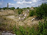
| Quarry S from the Schernfeld sports field |
 |
176A003 |
Schernfeld position |
Southern Franconian Alb | Here the Obereichstätter slate facies are exposed. In the upper area is the sharply separated hanging wall Krumme Lage. | 5000 100 × 50 |
Type: Layer sequence Type: Limestone |
Quarry | precious | Natural park | |
| Former Wasserzell quarry on Frauenberg near Eichstätt | 176A004 |
Eichstätt position |
Southern Franconian Alb | The former quarry opens up the lower slate (Malm Zeta 2A) and above it the separating Krumme Lage. There are only residual digestions left. | 20000 200 × 100 |
Type: Layer sequence Type: Limestone |
Quarry | significant | Landscape protection area, FFH area, bird sanctuary | ||
| Former quarry on the Steigweg near Obereichstätt | 176A006 |
Dollnstein position |
Southern Franconian Alb | The small quarry opened up the uppermost Malm Zeta 1 (marl slate with Dachhornstein layers), which is rarely opened. The remaining exposure area is only about 2 square meters. | 100 20 × 5 |
Type: Rock Type: Limestone |
Quarry | precious | Natural monument, landscape protection area, FFH area | ||
| Former quarries on Reisberg S von Böhmfeld | 176A007 |
Böhmfeld position |
Southern Franconian Alb | The quarries (Upper Bank Limes of Malm Zeta 3) are spread over 5 - 10 hectares. The Reisberg hiking trails are equipped with explanatory boards. | 1000000 1000 × 1000 |
Type: Rock Type: Limestone |
Quarry | precious | Natural monument, landscape protection area, nature park | ||
| Former Arnsberg gravel pit | 176A009 |
Kipfenberg position |
Southern Franconian Alb | In the Arnsberg gravel pit, the oldest Pleistocene of the Altmühl-Danube is exposed. There are both North Franconian (Urmain) and Alpine pebbles. | 200 20 × 10 |
Type: Rock Type: Gravel |
Gravel pit / sand pit | significant | Landscape protection area, nature park | ||
| Former sand pit W von Ensfeld | 176A011 |
Mörnsheim position |
Riesalb | In the sand pit near Ensfeld, colored clays, sands and boulders are exposed under pebble chalk. | 15000 100 × 150 |
Type: Layer sequence Type: sand, silica |
Gravel pit / sand pit | precious | Natural monument, landscape protection area, nature park | ||
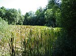
| Former quarry N of Gaimersheim |
 |
176A013 |
Gaimersheim position |
Southern Franconian Alb | Numerous tertiary fossils (vertebrate fauna) were found in the karst fillings of the Gaimersheim quarry. The area is covered by freshwater limestone. | 40000 200 × 200 |
Type: Animal Fossils, Rock Type: Clay, Dolomite Stone |
Quarry | precious | Natural park | |
| Former quarry SE from Schernfeld | 176A015 |
Schernfeld position |
Southern Franconian Alb | The Mörnsheim layers (Malm Zeta 3) are also exposed above the Solnhofen layers and the hanging Krummen Lage (Malm Zeta 2). The quarry is being used for garbage deposits. | 2500 50 × 50 |
Type: Layer sequence Type: Limestone |
Quarry | precious | Natural monument, landscape protection area, FFH area | ||
| Kalkschieferbruch E from Zandt |
 |
176A016 |
Denkendorf position |
Southern Franconian Alb | The Zandt slate quarry is the most important outcrop of the plate limestone of the Schamhaupten tub, with typical bank. In the northwest corner, clay-filled karst crevices and a discordance are exposed. | 50000 100 × 500 |
Type: Layer sequence, karst chimney, karst crevice, animal fossils Type: Limestone |
Quarry | especially valuable | Landscape protection area, nature park | |
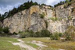
| Leibrecht quarry on Arzberg W von Töging |
 |
176A017 |
Beilngrie's position |
Southern Franconian Alb | The quarry opens up the complete sequence of layers from the upper Malm Alpha via Malm Beta and Platynota marl to the Crussoliensis marl in the lowest layers of the Malm Delta. | 40000 200 × 200 |
Type: Layer sequence Type: Limestone, Marlstone |
Quarry | precious | Landscape protection area, FFH area, bird sanctuary | Bavaria's most beautiful geotopes No. 51 |
| Abandoned quarry on western Arzberg |
 |
176A018 |
Beilngrie's position |
Southern Franconian Alb | A cross-section through the Oxford-Kimeridge profile is open. There is a shooting range at the foot of the cliff. | 45000 450 × 100 |
Type: Layer sequence, Animal fossils Type: Limestone |
Quarry | precious | Nature reserve, landscape protection area, FFH area | |
| Road access at Torleite W von Dollnstein | 176A019 |
Dollnstein position |
Riesalb | The profile shows a cross-section in the Malm Epsilon-Zeta border area. The approx. 20 cm thick marl layer with a reddish weathering color indicates the upper layer boundary of the Malm Epsilon. | 4000 400 × 10 |
Type: Rock Type: Limestone |
embankment | precious | Landscape protection area, nature park | ||
| Former quarries on Hirschberg W von Beilngries |
 |
176A020 |
Beilngrie's position |
Southern Franconian Alb | The quarry at Hirschberg is characterized by its wealth of fossils. | 40000 200 × 200 |
Type: Layer sequence Type: Limestone |
Quarry | precious | Landscape protection area, FFH area, nature park | |
| Street exposure SE from Ensfeld | 176A022 |
Mörnsheim position |
Riesalb | The outcrop shows very thin-layer limestone from the Mörnsheim strata, which are very rich in (but poorly preserved) ammonites here. Corals have also been found here. To the south there is the transition to the massive facies. ATTENTION! DANGER FROM SLIPPING ROCK! | 3000 300 × 10 |
Type: Rock, Animal Fossils Type: Limestone |
embankment | precious | Landscape protection area, FFH area, nature park | ||
| Former Dolomite quarry NW of Böhmfeld | 176A025 |
Hitzhofen position |
Southern Franconian Alb | The small former dolomite quarry opens up a particularly porous variety of rock with holes in it. The weathering of the quarry wall made dolomite concretions visible in the rock. | 100 20 × 5 |
Type: Type of rock, sedimentary structures Type: Dolomite stone |
Quarry | significant | Landscape protection area, nature park | ||
| Former quarry SW of Petersbuch | 176A027 |
Titting position |
Southern Franconian Alb | The former quarry on Treuchtlinger marble was sunk down like a shaft. | 400 20 × 20 |
Type: Rock, Quarry / Pit Type: Limestone |
Quarry | significant | Natural park | ||
| Former Kesseltal slab limestone quarry on the Solnhofener Berg | 176A028 |
Mörnsheim position |
Riesalb | The well-preserved high excavation wall opens up a profile through the upper Solnhofen layers with the hanging Krummen Lage and the overlying Mörnsheim layers. | 7500 150 × 50 |
Type: Layer sequence, Animal fossils, Sedimentary structures Type: Limestone |
Quarry | precious | FFH area, bird sanctuary, nature park | ||
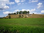
| Former Quarry at Speckberg W of the Speckmühle |
 |
176A031 |
Nassenfels position |
Southern Franconian Alb | In the lower part of the abandoned quarry, banked limestones are exposed, which merge into massive limestone at the top. A unique profile in the limestone of the Malm Zeta 3. | 1000 50 × 20 |
Type: Layer sequence Type: Limestone |
Quarry | precious | Natural monument, landscape protection area, nature park | |
| Collector quarry on the Blumenberg W of Eichstätt |
 |
176A032 |
Eichstätt position |
Southern Franconian Alb | The third skeleton of the ancient bird Archeopteryx was found here in 1877 and was sold to Berlin. This fraction has now been approved for private collectors by the city of Eichstätt. The debris is removed regularly. | 6000 150 × 40 |
Type: Rock, Animal Fossils Type: Limestone |
Quarry | precious | Natural park | |
| Former quarry W von Ettling |
 |
176A033 |
Pförring position |
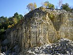
Southern Franconian Alb | The former quarry on the western outskirts of Ettling represents the best outcrop of the plate limestone of the Hartheimer Wanne. In the middle of the approximately 20 m high outcrop wall, an approximately 2 m thick crooked position can be seen. The layer thicknesses range from a few millimeters to a few decimeters. In the break, collectors are active. | 4500 150 × 30 |
Type: Rock type, Sedimentary structures Type: Limestone |
Quarry | precious | no protected area | |
| Digestion at water tank E from Breitenfurt | 176A034 |
Dollnstein position |
Southern Franconian Alb | At the border between the lying limestone layers of the Malm Epsilon and the hanging limestone layers of the Geisental layers (Malm Zeta 1), the approx. 20 cm thick characteristic red layer is exposed. | 75 15 × 5 |
Type: Layer sequence, standard / reference profile Type: Limestone, marlstone |
other information | precious | Landscape protection area, FFH area, nature park | ||
| Chalk exposure in the Wellheimer Oberholz W of Wellheim | 176A035 |
Wellheim position |
Riesalb | In the former quarry, the layers of Wellheim chalk with coarse and fine sand and overlying pebble chalk are exposed. Pronounced podsoles and pseudogleye can be found as soil formations. | 6000 120 × 50 |
Type: Type of rock, type of layer sequence : Limestone, sandstone |
Quarry | significant | Landscape protection area, nature park | ||
| Fossil Quarry NW of Pubes | 176A036 |
Altmannstein position |
Southern Franconian Alb | In the Schamhaupten fossil quarry, plate limestone of the Upper Malm was deposited in the so-called Schamhaupten tub. The material is relatively low in fossil fuels, manganese dendrites are common. The geology, mining, use, etc. of the lime are very well explained by a total of seven display boards. | 2100 70 × 30 |
Type: animal fossils, rock type, layer sequence, quarry / pit type: limestone |
Quarry | especially valuable | Landscape protection area, nature park | ||
| Former Imberg E quarry by Walting | 176A037 |
Walting position |
Southern Franconian Alb | The abandoned Imberg quarry has now been almost completely filled. A small part is obviously kept open by collectors as a dig. The almost fossilized Pfalzpainter Plattenkalk is open. | 160 20 × 8 |
Type: Type of rock, sequence of layers, quarry / pit type: Limestone |
Quarry | significant | Landscape protection area, nature park | ||
| Quarries NE of Obereichstätt |
 |
176A038 |
Schernfeld position |
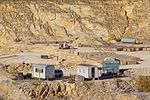
Southern Franconian Alb | In the Schernfeld-Wegscheid-Obereichstätt area there are several active quarries in which the Lower Solnhofen layers are mined. In some cases, backfilling takes place gradually. A circular hiking trail (fossil trail) provides information on geology and paleontology. | 3000000 2000 × 1500 |
Type: Rock type, Layer sequence, Animal fossils, Quarry / Pit Type: Limestone |
Quarry | precious | Natural park | |
| Fossil visitor quarry in Mühlheim | 176A040 |
Mörnsheim position |
Riesalb | The visitor quarry is located on the Schaudiberg southeast of Mühlheim. Plate limestone of the Mörnsheim Formation (Malm Zeta 3) is systematically mined layer by layer and examined for its fossil content. Numerous sensational finds have already been made, including new species. The quarry is also open to visitors every day from April to October. For an entrance fee, you can search for fossils here with a find guarantee. Further information on the Internet at www.besuchersteinbruch.de. There is a quarry educational trail with eight stations in the quarry area. | 8000 100 × 80 |
Type: animal fossils, standard / reference profile, layer sequence, rock type: limestone |
Quarry | especially valuable | Natural park | ||
| Aufgel. Quarry E von Hitzhofen |
 |
176A041 |
Hitzhofen position |
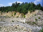
Southern Franconian Alb | It is the only quarry in Malm Zeta 3 (Mörnsheimer layers) in the municipality and one of the five most beautiful outcrops in the entire district. Alternating layers of limestone up to 30 cm in thickness and marly layers are open. The western part of the quarry lies in the municipality of Hitzhofen and has been abandoned - backfilling is prohibited by signs. In contrast, the eastern area (Gde. Böhmfeld) seems to be still in operation. | 12000 120 × 100 |
Type: Rock Type: Limestone |
Quarry | precious | Landscape protection area, nature park | |
| Demlingen quarry N of Großmehring |
 |
176G001 |
Großmehring position |
Southern Franconian Alb | The large funnel-like break provided the material for building the fortress in Ingolstadt. Fossil-rich reef dolomites and reef rubble limestone of the Malm Zeta 3–4 are exposed. | 60000 300 × 200 |
Type: Quarry / Pit, Animal Fossils, Rock Type: Dolomite Stone, Limestone |
Quarry | precious | Natural monument | |
| Powder cave near Breitenfurt | 176H001 |
Dollnstein position |
Southern Franconian Alb | Behind the cave entrance, two passages lead further, which meet again after a few meters. Significant prehistoric finds have been made during excavations. | 10 5 × 2 |
Type: Karst Horizontal Cave Type: Limestone |
cave | precious | Landscape protection area, FFH area, nature park | ||
| Arndthöhle near Attenzell | 176H002 |
Kipfenberg position |
Southern Franconian Alb | Concrete stairs can be used to comfortably descend into the spacious cave. | 1000 100 × 10 |
Type: Karst shaft & horizontal cave Type: Dolomite stone |
cave | significant | Landscape protection area, nature park | ||
| Mammoth Cave E by Buchenhüll |
 |
176H003 |
Eichstätt position |
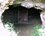
Southern Franconian Alb | After a few meters through the man-high horizontal entrance you reach a larger room, into which the shaft entrance opens from above. Numerous skeletons of large glacial mammals were stored here. Both entrances are closed with bars. | 100 20 × 5 |
Type: Karst shaft & horizontal cave, Animal fossils Type: Dolomite stone |
cave | significant | Landscape protection area, nature park | |
| Stone Age Cave N of Böhmfeld | 176H004 |
Böhmfeld position |
Southern Franconian Alb | The short, spacious cave has a horizontal and a shaft entrance. Numerous remains of Ice Age animals and humans have been found in the sediments on the cave floor. Both entrances are closed with bars. | 150 30 × 5 |
Type: Karst shaft & horizontal cave, Animal fossils Type: Dolomite stone |
cave | significant | Landscape protection area, nature park | ||
| Grafsloch cave near Mörnsheim-Altendorf | 176H005 |
Mörnsheim position |
Riesalb | The cave, also known as the Stone Rosary, is only about 200 m northwest of the center of Mörnsheim-Altendorf. It was created around 20 million years ago through dissolution processes in the reef dolomite (sponge reefs of the Malm) in the area of the Ur-Main. The small, spacious cave was already in the Paleolithic, here: before about 60,000 to 25,000 BC. BC, used by humans (Neanderthals). This was the result of excavation findings from 1924/25. Finds of predatory fauna from the Ice Age were also made. Sinter formation can only be found in inaccessible cave passages. The cave is on a marked hiking trail (Schäfchenweg nature discovery path), is easily accessible and secured by structural measures and is explained by an information board. The object is under special protection as a ground monument (monument no. D-1-7132-0080). | 30 5 × 6 |
Type: Karst horizontal cave Type: Dolomite stone |
cave | precious | Soil monument, landscape protection area, FFH area | ||
| Karst springs Almosmühle N von Pfünz |
 |
176Q001 |
Walting position |
Southern Franconian Alb | Interesting series of source outlets from crevices in the Malm Delta. Tracer tests have proven connections to ponordolines on the plateau. | 48 12 × 4 |
Type: Narrow source, rock wall / slope, rock type: Limestone, dolomite stone |
Slope crack / rock wall | precious | Landscape protection area, FFH area, bird sanctuary | |
| Karst spring Schambach in Schamhaupten |
 |
176Q002 |
Altmannstein position |
Southern Franconian Alb | The relatively even spring discharge is approx. 330 l / s. The outlets are distributed in a large spring pond on the southern edge of the valley. | 3600 120 × 30 |
Type: Constriction Source Type: Dolomite Stone, Limestone |
no information | precious | Natural park | |
| Karst spring Grüner Topf SE from Grösdorf |
 |
176Q003 |
Kipfenberg position |
Southern Franconian Alb | The source outlet is collected. The green pot is connected to ponors between Gelbelsee and Irlahüll. | 48 12 × 4 |
Type: Narrowing source, rock wall / slope Type: Limestone, dolomite stone |
Slope crack / rock wall | significant | Natural monument, nature park | |
| Schutterquelle N of Wellheim |
 |
176Q004 |
Wellheim position |
Southern Franconian Alb | The rubble source was expanded and its drainage straightened. There are information boards on the surrounding hiking trail. | 90 15 × 6 |
Type: Constriction Source Type: Dolomite Stone, Limestone |
no information | significant | Landscape protection area, FFH area, nature park | |
| Source pond W from Kösching |
 |
176Q005 |
Koesching position |
Southern Franconian Alb | The source pot reaches a discharge of approx. 140 l / s. Several small sand volcanoes can be seen at the bottom. | 400 20 × 20 |
Type: Reservoir Type: Limestone, Sand |
no information | precious | Natural monument, landscape protection area, nature park | |
| Karst spring Obereichstätt |
 |
176Q007 |
Dollnstein position |
Southern Franconian Alb | The source (partly in short tunnels) is located on the northern edge of the former quarry. With an average of approx. 700 l / s pouring, it is one of the most important karst springs in the southern Franconian Alb. The source is located within a fenced company premises. | 80 10 × 8 |
Type: Constriction Source Type: Limestone |
no information | precious | Natural park | |
| Karst spring Blaubrunnen W von Altdorf |
 |
176Q008 |
Titting position |
Southern Franconian Alb | The average discharge of the karst spring is well over 100 l / s. Since it is a source from the Shallow Karst, the pouring fluctuates very strongly. | 12 4 × 3 |
Type: Layer Source Type: Limestone |
no information | significant | Natural monument, nature park | |
| Gailach spring in Mühlheim |
 |
176Q009 |
Mörnsheim position |
Riesalb | In Mühlheim the water of the Gailach comes to light again, which seeps away about 4 km above. The connection is proven by a marking experiment. Above the source there are thick-banked dolomites. | 30 6 × 5 |
Type: Constriction Source Type: Dolomite Stone |
Slope crack / rock wall | precious | Natural park | |
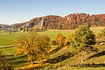
| Wellheim dry valley |
 |
176R001 |
Wellheim position |
Southern Franconian Alb | Until about 200,000 years ago the Danube flowed through this valley and broke a meander on the Galgenberg. Then the Danube looked for a new bed, first briefly over the Schuttertal, then through today's Neuburg breakthrough valley. | 7200000 9000 × 800 |
Type: dry valley, circular mountain / breakthrough mountain, rock tower / needle Type: dolomite stone, limestone, gravel |
Slope crack / rock wall | especially valuable | Landscape protection area, nature park | Bavaria's most beautiful geotopes No. 60 |
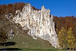
| Jackdaw rock E from Konstein |
 |
176R005 |
Wellheim position |
Southern Franconian Alb | At this point there are massive limestones of the Malm Delta-Zeta. In the area of the Malm Epsilon, dolomite banks are interposed. The striking jackdaw rock is famous as a climbing rock. | 12500 250 × 50 |
Type: Rock tower / needle Type: Limestone, dolomite stone |
Slope crack / rock wall | precious | Landscape protection area, FFH area, bird sanctuary | |
| Burgstein E from Dollnstein |
 |
176R006 |
Dollnstein position |
Southern Franconian Alb | The climbing rock made of mass limestone from the Malm Delta, located at a talcnick in the Altmühl, is well known throughout the world. It is strikingly thundered out of the surrounding dolomite rocks. At its foot you can partially recognize the rock-forming silicified plate sponges. Towards the top, ooid limestone developed, indicating that it was formed in shallow water. | 90000 300 × 300 |
Type: Rock tower / needle, rock castle Type: Limestone |
Slope crack / rock wall | precious | Nature reserve, landscape protection area, FFH area | Bavaria's most beautiful geotopes No. 3 |
| Doline between Buch and Oberemmendorf | 176R007 |
Kipfenberg position |
Southern Franconian Alb | Felddoline with a long inlet ditch at the edge of a large shallow depression. | 400 20 × 20 |
Type: sinkhole Type: dolomite stone |
no information | significant | Landscape protection area, nature park | ||
| Saufelsen SE from Unteremmendorf | 176R008 |
Kipfenberg position |
Southern Franconian Alb | Rock formations in the forest. | 50 10 × 5 |
Type: Rock tower / needle Type: Dolomite stone |
Slope crack / rock wall | significant | Landscape protection area, nature park | ||
| Langfelsen S of Unteremmendorf |
 |
176R009 |
Kinding position |
Southern Franconian Alb | Rock group at the edge of the plateau in the Malm Delta. | 100 20 × 5 |
Type: Rock wall / slope Type: Dolomite stone |
Slope crack / rock wall | inferior | Landscape protection area, nature park | |
| St. Michälsberg S from Kipfenberg | 176R010 |
Kipfenberg position |
Southern Franconian Alb | A castle used to stand on the prominent dolomite rock spur. On the ascent from Kipfenberg you pass a small cave in which prehistoric finds were made. | 10000 200 × 50 |
Type: rock castle, karst horizontal cave Type: dolomite stone |
Slope crack / rock wall | precious | Landscape protection area, FFH area, bird sanctuary | ||
| Ponordoline guard cell | 176R011 |
Pollen field position |
Southern Franconian Alb | At the edge of the dry valley there is a small rock wall of table-bank sponge limestone with silicified sponges. Below this, an inactive ponor cave opens up, which stretches to under a neighboring rocky sinkhole. Another small sinkhole is located in the middle of the dry valley. | 1800 60 × 30 |
Type: sinkhole, karst shaft & horizontal cave, rock wall / slope Type: limestone |
Slope crack / rock wall | precious | Landscape protection area, nature park | ||
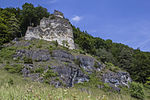
| Slopes of the Pfahlbuck N from Böhming |
 |
176R012 |
Kipfenberg position |
Southern Franconian Alb | The stratified facies of the Weißjura Gamma are overlaid by reef dolomite. | 3000 150 × 20 |
Type: Rock wall / slope Type: Limestone, dolomite stone |
Slope crack / rock wall | significant | Landscape protection area, nature park | |
| Mushroom W by Kinding | 176R013 |
Kinding position |
Southern Franconian Alb | The mushroom rock, made up of the dolomites with a flat bank, is a typical form of weathering. Today it is supported by concrete foundations. | 60000 300 × 200 |
Type: Rock wall / slope Type: Limestone, Marlstone |
Slope crack / rock wall | significant | Landscape protection area, FFH area, bird sanctuary | ||
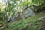
| Hubertusfelsen W of Unteremmendorf |
 |
176R014 |
Kinding position |
Southern Franconian Alb | Dolomite rocks on the edge of the plateau. | 100 20 × 5 |
Type: Rock wall / slope Type: Dolomite stone |
no information | inferior | Landscape protection area, nature park | |
| Breakthrough mountain Arzberg E from Beilngries |
 |
176R015 |
Beilngrie's position |
Southern Franconian Alb | The Arzberg is the largest breakthrough mountain in Europe. The breakthrough of the Sulz into the valley of the Altmühldonau probably took place during the Riss-Late Glacial or Riss-Würm-Interglacial. The Ottmaringer valley, through which the Main-Danube Canal runs today, fell dry. | 2000000 2000 × 1000 |
Type: Umlauf- / breakthrough mountain Type: Limestone, marlstone |
no information | especially valuable | Landscape protection area, nature park | |
| Arnsberger Leite N from Arnsberg |
 |
176R016 |
Kipfenberg position |
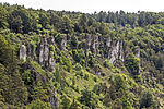
Southern Franconian Alb | The Arnsberger Leite is an extensive steep slope with impressive rock exposures in the dolomite. The area is one of the most species-rich arid sites in the natural area of the southern Franconian Alb with occurrences of extremely rare plant species and is therefore designated as a nature reserve. | 450000 1500 × 300 |
Type: Rock wall / slope Type: Dolomite stone |
Slope crack / rock wall | significant | Nature reserve, landscape protection area, FFH area | |
| Pliocene gravel terrace in Eichstätt | 176R017 |
Eichstätt position |
Southern Franconian Alb | Small outcrop of solidified Pliocene gravel. | 20 10 × 2 |
Type: Terrace Type: Conglomerate |
no information | precious | Natural park | ||
| Torfelsen S from Unteremmendorf |
 |
176R018 |
Kinding position |
Southern Franconian Alb | The natural bridge with a diameter of approx. 4 m was created when a cave collapsed. It lies in the continuation of a short dry valley. There are other small caves just to the west and east below the rock gate. | 150 30 × 5 |
Type: Rock wall / slope Type: Dolomite stone |
Slope crack / rock wall | precious | Landscape protection area, nature park | |
| Maderfelsen NE of Dollnstein |
 |
176R019 |
Dollnstein position |
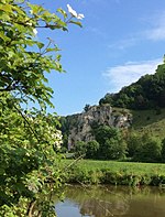
Southern Franconian Alb | The rock formation stands on the outskirts of Dollnstein, where the confluence of the Ur-Danube and Ur-Altmühl was once located. | 500 50 × 10 |
Type: Rock Tower / Needle Type: Limestone |
Slope crack / rock wall | significant | Nature reserve, landscape protection area, FFH area | |
| Old Burgstein rock in Dollnstein |
 |
176R020 |
Dollnstein position |
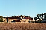
Southern Franconian Alb | The rock is assigned to the Malm Delta and opens up layers of Treuchtlinger marble. The backs of the houses are built directly on the rocks, the ruins of a castle have been preserved on the summit. The former meander was cut off from the Altmühl. | 1000 50 × 20 |
Type: Umlauf- / breakthrough mountain Type: Limestone |
Slope crack / rock wall | precious | Natural park | |
| Mühlfelsen N of the Bubenrother mill |
 |
176R021 |
Dollnstein position |
Southern Franconian Alb | The rock hidden in the forest is crossed by a cave ruin. | 600 30 × 20 |
Type: Rock tower / needle, Karst horizontal cave Type: Limestone |
Slope crack / rock wall | precious | Landscape protection area, FFH area, bird sanctuary | |
| Old castle rock E of Aicha | 176R022 |
Wellheim position |
Southern Franconian Alb | The wide rock massif in the mass limestone is hidden in the forest. | 15000 150 × 100 |
Type: Rock Castle Type: Limestone |
Slope crack / rock wall | significant | Landscape protection area, nature park | ||
| Schloßberg in Wellheim with a rock gate |
 |
176R023 |
Wellheim position |
Riesalb | The Schloßberg in Wellheim, a reef that is worth seeing, has a ruined castle on the summit. Directly on the road there is a large rock gate with a view of the meander of the original Danube. | 100000 500 × 200 |
Type: rock castle, karst halfway / natural bridge Type: dolomite stone |
Slope crack / rock wall | significant | Landscape protection area, FFH area, bird sanctuary | |
| Kreuzelbergfelsen in Wellheim | 176R024 |
Wellheim position |
Riesalb | A Stations of the Cross with twelve stations and a chapel leads to the summit. | 200 20 × 10 |
Type: Rock tower / needle Type: Dolomite stone |
Slope crack / rock wall | significant | FFH area, bird sanctuary, nature park | ||
| Finstereckfelsen N of Breitenfurt | 176R026 |
Dollnstein position |
Southern Franconian Alb | Rock tower in the dolomite of the Malm Delta. | 400 20 × 20 |
Type: Rock tower / needle Type: Dolomite stone |
Slope crack / rock wall | significant | Landscape protection area, nature park | ||
| Kirchental NNW from Gungolding |
 |
176R027 |
Walting position |
Southern Franconian Alb | On the characteristic juniper heather there are isolated rocks made of reef dolomite. | 1000000 2000 × 500 |
Type: Dry valley Type: Dolomite stone |
Rock slope / cliff | precious | Nature reserve, landscape protection area, FFH area | |
| Arnsberg Castle Hill |
 |
176R028 |
Kipfenberg position |
Southern Franconian Alb | Impressive rock castle in the dolomitic Malm Delta on the edge of the plateau. | 20000 200 × 100 |
Type: Felsburg Type: Dolomite stone |
Slope crack / rock wall | precious | Landscape protection area, FFH area, bird sanctuary | |
| Rock group near Obereichstätt | 176R029 |
Dollnstein position |
Southern Franconian Alb | To the north and east of the village, the thick-banked to massive rocks of the middle Malm protrude as a striking group of rocks from the slope. | 15000 300 × 50 |
Type: rock group, rock tower / needle Type: dolomite stone, limestone |
Slope crack / rock wall | significant | Landscape protection area, FFH area, bird sanctuary | ||
| Dolomite rock E from Möckenlohe | 176R030 |
Adelschlag position |
Southern Franconian Alb | The reef dolomite rock protrudes from the otherwise flat meadow. | 4 2 × 2 |
Type: Crag Type: Dolomite stone |
Rock slope / cliff | significant | Natural park | ||
| Rock castle with cave ruins at the Wielandshöfen |
 |
176R031 |
Wellheim position |
Riesalb | A massive rock castle protrudes from the forest slope west of the Wielandshöfe, which is criss-crossed by a spacious and branched cave ruin. | 1500 50 × 30 |
Type: rock castle, karst horizontal cave Type: dolomite stone |
Rock slope / cliff | significant | Landscape protection area, nature park | |
| Rock group N of Aicha |
 |
176R032 |
Wellheim position |
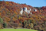
Southern Franconian Alb | Several striking rock towers protrude from the former collision slope of the Altmühl-Danube. At the western end of the rock group there is a short cave in which prehistoric finds were made. | 15000 300 × 50 |
Type: rock group, rock tower / needle, rock castle, karst halfway / natural bridge Type: limestone |
Slope crack / rock wall | significant | Landscape protection area, FFH area, bird sanctuary | |
| Galgenberg near Wellheim |
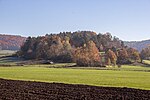 |
176R033 |
Wellheim position |
Southern Franconian Alb | As a circulating mountain, the Galgenberg is reminiscent of the erosive power of the Rissis Age Altmühl-Danube. It is mainly made up of reef dolomites, in the southeast there is an outcrop of limestone from the Malm Epsilon. | 210000 700 × 300 |
Type: Umlauf- / breakthrough mountain , dry valley Type: Dolomite stone, limestone |
Rock slope / cliff | precious | Landscape protection area, FFH area, nature park | |
| Ponordoline Bolusgrube SE from Adelschlag | 176R034 |
Adelschlag position |
Southern Franconian Alb | The wooded Ponordoline has a pronounced inlet ditch in the tertiary surface layers. In the area of the Schluckloch there is dolomite, into which the water has cut like a gorge. | 300 30 × 10 |
Type: Ponor Type: Dolomite stone, clay |
Sinkhole / sinkhole | significant | Natural park | ||
| Ponordoline NW of Hofstetten | 176R035 |
Hitzhofen position |
Southern Franconian Alb | The large Ponordoline has a pronounced inlet ditch. At the edge of the sinkhole gravel is exposed, which was probably deposited by a precursor of the Danube in the Pleistocene. | 600 40 × 15 |
Type: sinkhole, ponor, rock type: dolomite stone, gravel |
Sinkhole / sinkhole | significant | Landscape protection area, nature park | ||
| Ponordoline SE from Schelldorf | 176R037 |
Stammham position |
Southern Franconian Alb | A strikingly steep and deep blind valley ends in this ponordoline. | 2000 100 × 20 |
Type: sinkhole Type: limestone |
no information | significant | Landscape protection area, nature park | ||
| Rock group in the Groppenhofener Leite N of Ried |
 |
176R038 |
Dollnstein position |
Riesalb | In several places massive rock castles and rock towers protrude from the slope of the Wellheimer dry valley. In the eastern part of the rock there are also cave ruins. | 30000 600 × 50 |
Type: rock group, rock castle, rock tower / needle, karst halfway / natural bridge Type: dolomite stone |
Slope crack / rock wall | significant | Landscape protection area, FFH area, bird sanctuary | |
| Felddoline N from Langensallach | 176R039 |
Schernfeld position |
Southern Franconian Alb | The steep and deep sinkhole is located in a large hollow in the terrain, on the slope of which limestone limestone of the Upper Malms is in places. | 8000 100 × 80 |
Type: sinkhole Type: limestone |
Sinkhole / sinkhole | precious | Natural monument, nature park | ||
| Uvala in Fuchsschlag N of Schönau | 176R040 |
Schernfeld position |
Southern Franconian Alb | The triangular uvala was created by joining more than a dozen neighboring sinkholes. | 15000 150 × 100 |
Type: Uvala, sinkhole Type: Dolomite stone |
no information | precious | Landscape protection area, nature park | ||
| Ponordoline on Wittmeßberg NE of Wellheim | 176R041 |
Adelschlag position |
Southern Franconian Alb | At the bottom of the very large and steep sinkhole there is access to a short shaft cave, which is in great danger of falling. | 1800 60 × 30 |
Type: sinkhole, karst shaft cave Type: Limestone |
cave | significant | Landscape protection area, nature park | ||
| Ponordoline SW from Denkendorf | 176R042 |
Denkendorf position |
Southern Franconian Alb | The strikingly large Ponordoline has a steep, valley-like inlet ditch. Sections in the loam, some several meters deep, demonstrate the dynamic development in this property, which has a strong inflow during floods. | 9000 300 × 30 |
Type: Ponor Type: Limestone |
no information | precious | Natural park | ||
| Karst tub Kessel NE from Kipfenberg | 176R043 |
Kipfenberg position |
Southern Franconian Alb | Very large karst hollow form with partly steep edges and numerous sinkholes on the otherwise flat ground. Larger than the largest sinkholes, but smaller than the neighboring karst basins of Buch and Gelbelsee. | 200000 500 × 400 |
Type: Polje, Dolinenfeld Type: Dolomite stone |
Sinkhole / sinkhole | precious | Landscape protection area, nature park | ||
| Row of sinkholes N of Gelbelsee | 176R044 |
Denkendorf position |
Southern Franconian Alb | For almost two kilometers there are dolines after dolines, some with rock outcrops, in the W and E with large ponordolines. | 190000 1900 × 100 |
Type: Dolinenfeld, Ponor Type: Dolomite stone |
Sinkhole / sinkhole | precious | Landscape protection area, nature park | ||
| Doline with shaft in the Schernfeld forest | 176R045 |
Schernfeld position |
Southern Franconian Alb | At the edge of the very large, but flat sinkhole, there is a smaller, steep sinkhole, at the bottom of which there is access to a narrow shaft cave. | 15000 150 × 100 |
Type: sinkhole, karst shaft cave Type: Limestone |
cave | precious | Landscape protection area, nature park | ||
| Sandstone rocks N of the Sächenfartmühle | 176R046 |
Nassenfels position |
Southern Franconian Alb | A chalk-sandstone rock was left standing in a former mining site. This shows bizarre, holey weathered forms. | 20 5 × 4 |
Type: rock group, rock type, relict rock type: sandstone |
Rock slope / cliff | precious | Landscape protection area, nature park | ||
| Sandstone rocks at Hohenstein | 176R047 |
Nassenfels position |
Southern Franconian Alb | Beautiful large coarse sandstone rock with interesting weathering forms. A few more sandstone blocks in the area. | 20 5 × 4 |
Type: Rock Tower / Needle Type: Sandstone |
Rock slope / cliff | precious | Natural monument, landscape protection area, nature park | ||
| Pfünzer rocks | 176R048 |
Walting position |
Southern Franconian Alb | Striking rock group in the dolomite (Malm Delta) at the confluence of a dry valley in the Altmühltal above the village of Pfünz. | 1000 50 × 20 |
Type: Group of rocks Type: Dolomite stone |
Slope crack / rock wall | precious | Landscape protection area, nature park | ||
| Rocks on Speckberg W of the Speckmühle | 176R049 |
Nassenfels position |
Southern Franconian Alb | Rock slope in thick banked to massive reef rubble limestone of Malm Zeta 3. This rock is only exposed here in this quality. | 200 20 × 10 |
Type: rock wall / slope, rock type: limestone |
Rock slope / cliff | precious | Natural monument, landscape protection area, nature park | ||
| Felskanzeln V by Hagenacker | 176R050 |
Schernfeld position |
Southern Franconian Alb | To the north of Hagenacker, there are several rock pulpits on a rocky slope of the Urmain. The massive dolomites of the Malm Delta in the lower part of the rocks are overlaid in a pagoda-like manner by the thin, flat-banked dolomites of the Malm Epsilon. | 10000 200 × 50 |
Type: rock wall / slope, sequence of layers, impact slope Type: dolomite stone, limestone |
Rock slope / cliff | significant | Landscape protection area, FFH area, bird sanctuary | ||
| Doline NW of Hofstetten | 176R051 |
Hitzhofen position |
Southern Franconian Alb | One of the largest sinkholes in the district is located northwest of Hofstetten. Its formation can be traced back to erosion processes in the reef dolomite of the Upper Jura. Due to the flanks that slide down again and again and the particular growth form of the trees standing there, a persistent lowering of the ground cannot be ruled out. | 4875 75 × 65 |
Type: sinkhole Type: dolomite stone |
Sinkhole / sinkhole | precious | Natural monument, landscape protection area, nature park | ||
| Ponordoline NW of Oberzell | 176R052 |
Hitzhofen position |
Southern Franconian Alb | At the edge of the forest northwest of Oberzell there is an active ponor in the reef dolomite. It is fed by a side ditch. The funnel-shaped inlet is separated in the upper third by a massive wall, whereby the upper pictures 1 and 2). Almost 100 m west of the Ponordoline there is another, apparently active sinkhole in the high forest (the area has been converted into a water reservoir (Figures 3 and 4). A presumed sinkhole field, as mentioned in the landscape management concept, could not (anymore?) Be determined in spring 2016 . | 108 18 × 6 |
Type: Ponor Type: Dolomite stone |
Sinkhole / sinkhole | precious | Landscape protection area, nature park | ||
| Schmiedfelsen near Mörnsheim | 176R057 |
Mörnsheim position |
Riesalb | The striking, almost free-standing, approximately 15 m high sponge reef stump (reef dolomite of the Malm) is located directly behind the Maxbergweg 1 property in Mörnsheim. It is surrounded by dry / poor grass and is therefore particularly impressive. | 25 5 × 5 |
Type: Rock tower / needle Type: Dolomite stone |
Slope crack / rock wall | significant | FFH area, bird sanctuary, nature park |
See also
- List of nature reserves in the Eichstätt district
- List of landscape protection areas in the Eichstätt district
- List of FFH areas in the Eichstätt district
Individual evidence
- ↑ Data source: Bavarian State Office for the Environment, www.lfu.bayern.de, Geotoprecherche (accessed on September 16, 2017)
Web links
Commons : Geotopes in the Eichstätt district - collection of images, videos and audio files