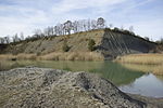
List of geotopes in the Erlangen-Höchstadt district
This list contains the geotopes of the Central Franconian district of Erlangen-Höchstadt in Bavaria . The list contains the official names and numbers of the Bavarian State Office for the Environment (LfU) as well as their geographical location. This list is incomplete. Around 3,400 geotopes (as of March 2020) are recorded in the Bavarian geotope register. The LfU does not consider some geotopes suitable for publication on the Internet. For example, some objects are not safely accessible or may only be entered to a limited extent for other reasons.
| Surname | image | Geotope ID | Municipality / location | Geological unit of space | description | Area m² / extension m | geology | Digestion type | value | Protection status | comment |
|---|---|---|---|---|---|---|---|---|---|---|---|
| Shift level NE from Rathsberg |
 |
562R001 |
Bubenreuth position |
Northern Albrand region | Striking layer of the Rhätolias sandstone near Rathsberg . In the south the step breaks up into many small knolls and valleys. In the north exposure of the profile on a ten meter high rock face. Below is a rock fall with large sandstone blocks. | 200000 2000 × 100 |
Type: Layer level, layer sequence Type: sandstone, claystone |
Slope crack / rock wall | precious | Nature reserve, landscape protection area | |
| Former Sandstone quarries on the Hinteren Giesberg E von Dechsendorf |
 |
572A001 |
Mark position |
Sandstone Keuper Region | Several old quarries in the Middle Burgsandstein near Dechsendorf . The walls are partly used for climbing. | 250000 500 × 500 |
Type: Rock Type: Sandstone |
Quarry | significant | Landscape reserve, bird sanctuary | |
| Former clay pit N von Marloffstein |
 |
572A002 |
Marloffstein position |
Northern Albrand region | Disused clay pit in the Lias Delta with numerous fossils, e.g. B. Pyritized cephalopods . In Toneisensteinknollen also are barite , galena , pyrite and sphalerite find. | 112500 450 × 250 |
Type: Standard / Reference Profile, Animal Fossils Type: Clay Marlstone |
Clay pit / clay pit / marl pit | especially valuable | no protected area | |
| Exposure at the Wunderburg E von Marloffstein |
 |
572A003 |
Marloffstein position |
Northern Albrand region | Old quarry in the Rhaetian sandstone , with plant clays on its west side. In the upper part, ariet sandstone has been developed in places. | 700 70 × 10 |
Type: Layer sequence Type: Sandstone |
Quarry | significant | no protected area | |
| Former Sand pit W of Kleinseebach | 572A004 |
Möhrendorf position |
Sandstone Keuper Region | Former sand pit in the castle sandstone and its base. Loose sandstone with quartz pebbles and sandstone pebbles. | 37500 250 × 150 |
Type: Rock Type: Sand |
Gravel pit / sand pit | significant | Bird sanctuary | ||
| Lias outcrop in the Teufelsgraben S of Oedhof |
 |
572A005 |
Eckental position |
Northern Albrand region | Outcrop of rocks of the Lias Delta and Epsilon over a length of approx. 50 m. From bottom to top: approx. 1.3 m Lias Epsilon, the Amaltheenton Formation (Lias Delta), approx. 0.4 m marl slate with calcareous Siemensi tubers, three approx. 10 cm thick limestone banks separated by equally thick layers of marl slate , another 30 cm marl slate, 5 cm thick fossil-rich marl limestone (so-called belemnite battlefield ). | 150 50 × 3 |
Type: Layer sequence, Animal fossils Type: Mudstone, Marlstone |
Impact slope / river bed / stream profile | precious | no protected area | |
| Teufelsbadstube gorge in SW Kalchreuth |
 |
572R001 |
Kalchreuther Forst position |
Northern Albrand region | Gorge in the Rhätsandstein. Good outcrops at a waterfall, otherwise strongly overgrown. | 37500 500 × 75 |
Type: Canyon, Rock Type: Sandstone |
Impact slope / river bed / stream profile | significant | Part of the landscape, bird sanctuary | |
| Gründlach (stream bed) SW of Heroldsberg |
 |
572R002 |
Kalchreuther Forst position |
Sandstone Keuper Region | Meander , impact and sliding slopes of the green roof in its natural state. | 150,000 1000 × 150 |
Type: meander, stream / river course, impact slope Type: silt, sand |
Impact slope / river bed / stream profile | significant | Part of the landscape, bird sanctuary |
See also
- List of nature reserves in the Erlangen-Höchstadt district
- List of landscape protection areas in the district of Erlangen-Höchstadt
- List of FFH areas in the Erlangen-Höchstadt district
Web links
Commons : Geotopes in the Erlangen-Höchstadt district - collection of images, videos and audio files
Individual evidence
- ↑ Data source: Bavarian State Office for the Environment, www.lfu.bayern.de, Geotoprecherche (accessed on September 16, 2017)