List of geotopes in the Munich district
This list contains the geotopes of the Upper Bavarian District of Munich in Bavaria . The list contains the official names and numbers of the Bavarian State Office for the Environment (LfU) as well as their geographical location. This list may not be complete. Around 3,400 geotopes (as of March 2020) are recorded in the Bavarian geotope register. The LfU does not consider some geotopes suitable for publication on the Internet. For example, some objects are not safely accessible or may only be entered to a limited extent for other reasons.
| Surname | image | Geotope ID | Municipality / location | Geological unit of space | description | Area m² / extension m | geology | Digestion type | value | Protection status | comment |
|---|---|---|---|---|---|---|---|---|---|---|---|
| Baierbrunn climbing garden |
 |
184A001 |
Baierbrunn position |
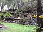
Paar-Isar region | In the area of the climbing garden, high-terrace gravel is laid over solidified gravel ( Nagelfluh ) from the Günz to Minde Ice Age. Low terrace gravel is just west of it. Geological organs and paleo floors are clearly recognizable . The outcrop is one of the key points in Ice Age research. | 3000 300 × 10 |
Type: Standard / Reference Profile, Fossil Soil, Layer Sequence, Geological Organ Type: Conglomerate |
Slope crack / rock wall | especially valuable | Landscape protection area, FFH area | Bavaria's most beautiful geotopes No. 18 |
| Outcrop on the Baierbrunn landslide |
 |
184A002 |
Baierbrunn position |
Paar-Isar region | The landslide (1979) created an approx. 28 meter high steep slope made of middle to old Pleistocene gravel, some of which are baked into Nagelfluh. Over a width of 75 meters, a channel is filled with residual gravel and fine sediment. The gravel is superimposed here, in contrast to the Riß-Iller-Lech areas, which is why the outcrop should be viewed as a very rare occurrence. | 2500 250 × 10 |
Type: Sequence of layers, sediment structures, landslide Type: Conglomerate |
Slope crack / rock wall | especially valuable | Landscape protection area, FFH area | |
| Former Deisenhofen quarry |
 |
184A003 |
Oberhaching position |
Paar-Isar region | In the quarry there are gravel baked in to Nagelfluh. Immediately below the top of the pit, geological organs with a filling of weathered clay and stones dig several meters deep into the gravel. A separating layer with fine-grain sandstone indicates a sedimentation interruption between two beds. The outcrop is part of a profile that serves as a guide profile for structuring the Munich gravel plain. | 2400 150 × 16 |
Type: Layer sequence, geological organ Type: Conglomerate |
Quarry | especially valuable | Landscape protection area | |
| Gleißental SW of Deisenhofen |
 |
184R002 |
Oberhaching position |
Paar-Isar region | The now dry valley was eroded by the meltwater flow from the glacier gate of the Deininger glacier globe (part of the Loisach glacier). | 400000 2000 × 200 |
Type: Schmelzwassertal Type: Moraine, gravel |
no information | precious | Landscape protection area | |
| Georgenstein E from Baierbrunn |
 |
184R004 |
Grünwalder forest position |
Paar-Isar region | The Georgenstein is a large block of gravel that has been torn from the eastern slope of the Isar and slipped into the river bed on the underlying clayey-marl-like tertiary layers ( Miocene ). The Nagelfluhblock is provided with the statue of St. George. | 70 10 × 7 |
Type: Boulder Type: Blocks |
block | precious | Landscape protection area, FFH area | |
| Bachschwinde Gleißental SE from Großdingharting |
 |
184R005 |
Straßlach-Dingharting position |
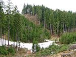
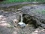
Isar-Loisach young moraine region | The Gleißental is an approximately 40 m deep meltwater channel cut into Mindel gravel from the Isar glacier and today forms a dry valley. The Gleißenbach seeps away after a few hundred meters. This creek shrinkage can also be traced morphologically over a distance of about 200 m by means of increasingly flat and indistinct undercut edges. | 4000 200 × 20 |
Type: Stream shrink Type: Moraine, gravel |
no information | precious | Landscape protection area |
See also
- List of nature reserves in the district and in the city of Munich
- List of landscape protection areas in Munich
- List of FFH areas in the city of Munich
Web links
Commons : Geotopes in the Munich district - collection of images, videos and audio files
Individual evidence
- ↑ Data source: Bavarian State Office for the Environment, www.lfu.bayern.de, Geotoprecherche (accessed on September 16, 2017)
- ↑ Iris Hilberth: A quarry from mystical times , article in the Starnberg local edition of the Süddeutsche Zeitung. Online version from August 13, 2017.