List of geotopes in the Augsburg district
This list contains the geotopes of the Swabian district of Augsburg in Bavaria . The list contains the official names and numbers of the Bavarian State Office for the Environment (LfU) as well as their geographical location. This list may not be complete. Around 3,400 geotopes (as of March 2020) are recorded in the Bavarian geotope register. The LfU does not consider some geotopes suitable for publication on the Internet. For example, some objects are not safely accessible or may only be entered to a limited extent for other reasons.
| Surname | image | Geotope ID | Municipality / location | Geological unit of space | description | Area m² / extension m | geology | Digestion type | value | Protection status | comment |
|---|---|---|---|---|---|---|---|---|---|---|---|
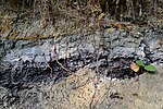
| Former Gravel pit with shale coal on Uhlenberg NW of Lindach |
 |
772A007 |
Spelled shards position |
Iller-Lech region | A profile from the fine sands of the Upper Freshwater Molasse through Lower Cover Gravel, clayey silty floodplain sediments to shale coals and overlaid, gelled loess loam. An important information of supraregional importance for the Pleistocene of the northern foothills of the Alps. The outcrop was examined by paleomagnetic, pollen analysis, paleobotanical and soil science. | 1500 50 × 30 |
Type: plant fossils, fossil soil, layer sequence Type: lignite, gravel, silt |
Slope crack / rock wall | especially valuable | Landscape protection area, nature park | Bavaria's most beautiful geotopes No. 97 |
| Former Sand and gravel pit NE of Gablingen | 772A014 |
Gablingen position |
Iller-Lech region | The outcrop shows cracked glacial high terrace gravel underlain by Miocene fine sands. The gravel wedges to the west. | 750 50 × 15 |
Type: Layer sequence Type: gravel, sand |
Gravel pit / sand pit | significant | no protected area | ||
| Former Gravel pit ENE from Weiherhof | 772A015 |
Gessertshausen position |
Iller-Lech region | In the former gravel pit, individual abri-like Nagelfluhstotzen up to 3 m high and 8 m wide can be seen. Layered structures are sometimes weathered horizontally in layers. The majority of the former pit is overgrown or partially filled. The ballast forms morphologically protruding knolls. On the way to the pit, underlying tertiary freshwater molasses is exposed in places. | 4000 200 × 20 |
Type: Rock Type: Conglomerate |
Gravel pit / sand pit | significant | Landscape protection area, nature park | ||
| Deckenschotter-Nagelfluh at Ziegelberg SE from Konradshofen | 772A016 |
Scherstetten position |
Iller-Lech region | There is an abandoned gravel pit on the heights of the Ziegelberg, southeast of Konradshofen. There are pillars of nagelfluh-like baked, probably Old Pleistocene ceiling gravel that protrude from the largely buried pit wall. The gravel is covered with loess clay and floating earth. About half of the upper surface layer consists of loess loam (main layer). Geological organs were not open in 2001! | 1400 70 × 20 |
Type: Fossil Soil, Geological Organ Type: Conglomerate, Limestone |
Gravel pit / sand pit | significant | Landscape protection area, nature park | ||
| Ore mining sites N of Biburg | 772G002 |
Diedorf position |
Iller-Lech region | On an east-west stretch of approx. 1.5 km in length, prehistoric iron mining sites can be found on the elongated ridge between Dachsberg and Forstberg in the forest east of Hainhofen. The funnel pits have a diameter of up to 4 m and a depth of up to 1.5 m. If there is no undergrowth or moss, the structures are easy to see. The digs are deepened in old Pleistocene gravel and originally reached down to the molasses sediments. As is known from similar fields, concretionary iron deposits have been deposited. The geotope is under protection as a ground monument (monument no. D-7-7630-0007). | 750000 1500 × 500 |
Type: Pinge / nfeld Type: Gravel |
no information | significant | Soil monument, landscape protection area, nature park | ||
| Schmuttertal N of Hirblingen | 772R001 |
Gersthofen position |
Iller-Lech region | The erosion terrace of the Schmutter lies in sediments of the Upper Freshwater Molasse. The upper parts of the slope may also be in crack gravel. | 16000 400 × 40 |
Type: terrace, impact slope Type: gravel |
no information | precious | Natural monument | ||
| Terraces between Stettenhofen and Gersthofen | 772R002 |
Langweid am Lech position |
Iller-Lech region | The cracked glacial high terrace lies morphologically above worm and postglacial deposits. | 14000 1400 × 10 |
Type: Terrace Type: Gravel |
no information | significant | no protected area | ||
| Beaver ice age gravel on the Staufersberg | 772R004 |
Bonstetten position |
Iller-Lech region | The Staufenberg is the highest elevation in the wide area. On top of this are 3 to 4 m thick gravel packages from the beaver ice age. The Ice Age is named after the stream, the beaver, that rises on this mountain. A geological nature trail explains how the landscape was created. | 10440000 3600 × 2900 |
Type: Terrace Type: Conglomerate |
no information | precious | Landscape protection area, nature park |
See also
- List of nature reserves in the Augsburg district
- List of landscape protection areas in the Augsburg district
- List of FFH areas in the Augsburg district
- List of natural monuments in the Augsburg district
- List of nature reserves in the city of Augsburg
- List of landscape protection areas in Augsburg
- List of FFH areas in the city of Augsburg
Individual evidence
- ↑ Data source: Bavarian State Office for the Environment, www.lfu.bayern.de, Geotoprecherche (accessed on September 16, 2017)