List of geotopes in the Regen district
This list contains the geotopes of the Lower Bavarian district of Regen in Bavaria . The list contains the official names and numbers of the Bavarian State Office for the Environment (LfU) as well as their geographical location. This list may not be complete. Around 3,400 geotopes (as of March 2020) are recorded in the Bavarian geotope register. The LfU does not consider some geotopes suitable for publication on the Internet. For example, some objects are not safely accessible or may only be entered to a limited extent for other reasons.
| Surname | image | Geotope ID | Municipality / location | Geological unit of space | description | Area m² / extension m | geology | Digestion type | value | Protection status | comment |
|---|---|---|---|---|---|---|---|---|---|---|---|
| Outcrop on the Burgberg in Kollnburg |
 |
276A001 |
Kollnburg position |
Front Bavarian Forest | On the Burgberg in Kollnburg, three common rocks south of the pile are in contact with each other. Relatively coarse-grained anatectic paragranodiorite and coarse-grained crystal granite (named after the large potassium feldspar large crystals), between which a medium-grain two-mica granite has penetrated, are exposed. Outcrops can be found around the castle hill. | 32 8 × 4 |
Type: rock type, contact, wool sack formation Type: granodiorite, granite |
Slope crack / rock wall | precious | Natural park | |
| Former quarry E von Riedmühle |
 |
276A002 |
Viechtach position |
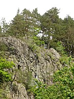
Rear Bavarian Forest | At the edge of the pile quartz there are 20 m thick ultramylonites, the mineral content of which shows a diaphtoritic transformation. | 1200 60 × 20 |
Type: Rock Type: Ultramylonite |
Quarry | precious | Landscape protection area, nature park | |
| Outcrop at the Metten SE pile | 276A005 |
Rain position |
Rear Bavarian Forest | Pile quartz was cut through the road construction. The course of the hardship's train can also be clearly seen here. | 1500 150 × 10 |
Type: Rock type, Fault type: Vein quartz |
embankment | inferior | Natural monument, landscape protection area, nature park | ||
| Former pegmatite quarry Poschingerhütte ENE von Arnbruck | 276A006 |
Arnbruck position |
Rear Bavarian Forest | Upcoming is (or was) a stick-shaped pegmatite in sharp contact with biotite-plagioclase gneisses. Although the outcrop is quite overgrown, it opens up the pegmatite very nicely. The center of the pegmatite consists of coarse quartz. Outwardly, quartz and feldspar follow, with some large feldspars, as well as areas with oriented intergrowth between quartz and feldspar (so-called font granite). The pegmatite was mined in Poschingerhütte for quartz extraction for the glass industry. | 60 15 × 4 |
Type: Rock Type , Mineral Type: Pegmatite |
Quarry | precious | Landscape protection area, nature park | ||
| Birkenhöhe pegmatite block in Zwiesel | 276A007 |
Zwiesel position |
Rear Bavarian Forest | In the green area at the entrance to the parish center is a single pegmatite block with large quartz, feldspar and biotite crystals. In places it also contains black tourmaline. Another small block is right next to the access path. The blocks represent the last remnants of a pegmatite quarry from which the mineral Zwieselite was first described. The blocks have grown pretty much into bushes by now. | 1 1 × 1 |
Type: Minerals Type: Pegmatite |
block | significant | Natural park | ||
| Former quarry NW of Spiegelhütte | 276A008 |
Lindberg position |
Rear Bavarian Forest | The former quarry shows heavily folded, very variable gneisses with calcium silicate rock and marble parts. The break has now completely grown over. Rock and metamorphic structures can only be seen on a few wall areas. | 80 40 × 2 |
Type: Rock type, metamorphic structure Type: Cordierite-sillimanite-gneiss, biotite-plagioclase-gneiss, calcium silicate rock |
Quarry | significant | National park, landscape protection area, FFH area | ||
| Former quarries at Geißruck N von Hausermühle | 276A010 |
Zachenberg position |
Front Bavarian Forest | In the quarry, medium-grain granite is exposed to contact with anatexites. In the contact area, the granite shows reactions such as the formation of aplit fringe and large potassium feldspar crystals. The anatexites generally have a distinct texture. There are stored e.g. Partly broken and deformed feldspar sparrows. Due to the proximity of the pile, the rock shows clear characteristics of tectonic overprinting. Due to backfilling and recultivation, only part of the quarry has survived. | 1200 60 × 20 |
Type: rock type, contact, metamorphic structure Type: granite, anatexite |
Quarry | significant | Landscape protection area, nature park | ||
| Former quarry on Hieselberg NW of Hochbruck | 276A011 |
Bischofsmais position |
Front Bavarian Forest | In the former quarry on Hieselberg, dark, fine-grain quartz mica diorites are exposed. The diorites are partially traversed by quartz and aplite passages. At the edge of the contact with the host rock (anatectic gneiss), the diorite is accompanied by light granite passages. The structure of the rocks clearly shows a tectonic overprint. The diorites are strikingly textured. The quarry is overgrown and the exposed walls are difficult to access. | 1250 50 × 25 |
Type: Rock Type: Diorite, Granite |
Quarry | significant | Natural park | ||
| Former quarry at Teufelstisch NW of Bischofsmais | 276A012 |
Bischofsmais position |
Front Bavarian Forest | In the former quarry there is medium-grain granite, which usually has a directionless structure, but also weakly textured in layers (parallel to the pile fault). The granite shows a clear fissure. Mineral finds (quartz, feldspar, fluorspar, rutile, etc.) were formerly found on fissures. | 3600 120 × 30 |
Type: Rock Type , Minerals Type: Granite |
Quarry | significant | Landscape protection area, nature park | ||
| Former quartz quarry SE from Eging | 276A013 |
Kollnburg position |
Rear Bavarian Forest | The abandoned quarry opens up pile quartz on two levels. | 8800 220 × 40 |
Type: Rock type, Fault type: Vein quartz |
Quarry | inferior | Landscape protection area, nature park | ||
| Underground passages in Zwiesel under the town square | 276A015 |
Zwiesel position |
Rear Bavarian Forest | The exact age and function of the underground passages (refuge castle?) In the crystal substitute, which were originally several 100 m long and up to 20 m deep, is unknown. The passage under the bakery reveals granite penetrated into the gneiss with pegmatite passages. The crystalline is completely decomposed, but shows the original structure in detail. The corridors can be viewed on guided tours. | 50 25 × 2 |
Type: Type of rock, contact, metamorphic structure, minerals, storage conditions, tunnels Type: Cordierite-sillimanite-gneiss, pegmatite, granite |
Tunnel / gallery / shaft | significant | Natural park | ||
| Former pegmatite pit NE of Böbrach (Hubertus pegmatite) | 276A016 |
Böbrach position |
Rear Bavarian Forest | The Hubertus pegmatite is a zonal pegmatite dike up to about 6 m thick. The beginnings of quartz mining may go back to the end of the 18th century. What has been preserved is a trench-like pinge that merges into underground mining and heaps. In the small underground mine remains of the largely dismantled quartz core of the pegmatite are exposed. In quartz you can see feldspar crystals up to 20 cm in length. | 60 12 × 5 |
Type: minerals, rock type, tunnel type: pegmatite |
Tunnel / gallery / shaft | precious | Landscape protection area, nature park | ||
| Street exposure S of Kohlplatz near Bodenmais | 276A017 |
Bodenmais position |
Rear Bavarian Forest | Metatectic to anatectic cordierite-sillimanite gneisses are exposed on state road St2132 south of Bodenmais. Some of these light-colored gneisses have a striking garnet. A large number of metamorphic structural features (such as banding, folds, inclusion of clods, etc.) can be seen in the exposure. Almost directionless structures alternate with clearly oriented structures in a narrow space. | 3750 250 × 15 |
Type: Type of rock, metamorphic structure Type: Cordierite-Sillimanite-Gneiss |
embankment | significant | Landscape protection area, nature park | ||
| Road exposure W from Fahrnbach | 276A021 |
Bischofsmais position |
Front Bavarian Forest | In the embankment there are medium to fine-grain quartz diorites (variable composition: granodiorite, tonalite to diorite), which are interspersed with granitic and pegmatitic corridors. The quartz diorites are deformed to different degrees. | 50 50 × 1 |
Type: Rock type, metamorphic structure Type: diorite, granodiorite, tonalite |
embankment | precious | Natural park | ||
| Pegmatite pit on the Hennenkobel NW of Rabenstein |
 |
276G001 |
Zwiesel position |
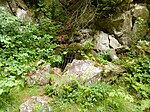
Rear Bavarian Forest | Pegmatites are large to giant-grained dike rocks, some of which contain rare and beautifully formed crystals. The quartz core of the pegmatite on the Hennenkobel was mined in opencast and underground mining for glass production. The dismantling wall was exposed again in 2002. Granite and pegmatite are exposed there. The mining tunnel is closed. The pegmatite pit on the Hennenkobel became known through various mineral finds (e.g. first determination of triphyline, a phosphate mineral). | 16000 200 × 80 |
Type: tunnel, type locality, quarry / pit, minerals Type: pegmatite |
Tunnel / gallery / shaft | precious | Nature reserve, landscape protection area, FFH area | |
| Silberberg Bodenmais show mine |
 |
276G002 |
Bodenmais position |
Rear Bavarian Forest | In the poly-metamorphic sulphide deposit, mining took place at least since 1436 (until 1952). At first, the focus was on metal production, later vitriol and polishing red were also extracted. Over 80 minerals have been described from the Silberberg sulphide ore occurrence. In the show mine, impressive tours through tunnels and huge cavities of the old mine are offered. The geotope is one of Bavaria's hundred most beautiful geotopes and is explained on site with a corresponding information board. | 160000 400 × 400 |
Type: Tunnels, Minerals Type: Gneiss |
Tunnel / gallery / shaft | especially valuable | Nature park, protected landscape area | Bavaria's most beautiful geotopes No. 17 |
| Former Rotkot mine on Kellerberg N von Zwiesel | 276G003 |
Zwiesel position |
Rear Bavarian Forest | Sulphidic ores were broken down on the red droppings. The main ores are magnetic and sulfur pyrites, but copper pyrites, zinc blende and galena also occur. The side rock of the sulphide deposit is garnet-leading cordierite gneiss. First documented mention as early as 1580. The tunnel was operated from 1893 to 1952. The tunnel entrance is closed. In the vicinity there are heaps where sulphide minerals, but also a lot of limonitic material (iron hydroxide) can be found. | 9 3 × 3 |
Type: Gallery Type: Gneiss |
Tunnel / gallery / shaft | significant | Landscape protection area, nature park | ||
| Grübenfeld in the Rannenau | 276G006 |
Lindberg position |
Rear Bavarian Forest | The morphological landforms typical for gold soap mining are called pits. These are e.g. B. funnel pits, trenches, heaps (= soap mounds) and sewer systems. The pit field in the Rannenau at the upper Höllbach shows z. Some very nicely preserved soap mounds. In the vicinity of the Höllbach, the tracks are washed out by occasional flooding. For gold panning, the river gravel was mined up to 5 m below the top of the site. Further mine fields are located downstream. | 80000 800 × 100 |
Type: Soap Laundry, Pinge Field Type: Gravel |
Ping | significant | National park, ground monument, landscape protection area | ||
| Pegmatite mining table height | 276G010 |
Frauenau position |
Rear Bavarian Forest | The quartz pits in the area of Tafelhöhe above Spiegelstrasse probably date from the middle of the 19th century. Numerous heaps, several pings and a short tunnel in pegmatite, as well as a closed underground tunnel in gneiss, testify to the mining activity (quartz for the glassworks). In the short underground mine, the contact between gneiss and zonal pegmatite is open. | 5000 100 × 50 |
Type: Pinge / nfeld, Stollen Type: pegmatite, cordierite-sillimanite-gneiss |
Tunnel / gallery / shaft | significant | Landscape protection area, nature park | ||
| Grübenfeld am Mühlenbach near Unterried | 276G011 |
Drachselsried position |
Rear Bavarian Forest | Approx. 1 km northeast of Unterried, an up to 100 m wide Grübenfeld stretches along the Mühlenbach (Schönbach / Hochfellbach) for about 1300 m. Along the creek, the very coarse stream sediment seems to have been dug up and the fine fraction between the coarse rubble has grown. The mining traces in the ascent to Mühlenberg - with the absence of soap mounds - indicate that in this area in the weathered bedrock a primary gold mineralization could have been the mining target. | 130000 1300 × 100 |
Type: Soap laundry, Schurf Type: Cordierite-Sillimanite-Gneiss |
other information | significant | Landscape protection area, nature park | ||
| Grübenfeld on Rothbach E from Böbrach | 276G012 |
Böbrach position |
Rear Bavarian Forest | Soap hills accompany the course of the Rothbach over a length of almost 1,000 m. The relics of gold panning, up to 5 m high, consist of rubble of gneiss, quartz and granite. The late Middle Ages (oldest documented mention in 1312) and the early modern period are likely to be considered the heyday for the extraction of soap gold. However, there are no historically reliable details regarding the start of the gold prospecting or the yield. A circular hiking trail around Bodenmais and Böbrach (white on blue 4) opens up the area. The property is under special protection as a ground monument (monument no. D-2-6944-0052). | 60000 600 × 100 |
Type: Soap Laundry Type: Gravel |
Ping | precious | Soil monument, landscape protection area, nature park | ||
| Grübenfeld in the Gschwend | 276G013 |
Lindberg position |
Rear Bavarian Forest | The morphological landforms typical for gold soap mining are called pits. These are e.g. B. funnel pits, trenches, heaps (= soap mounds) and sewer systems. The Grübenfeld in the Gschwend am Kolbersbach shows z. Some very nicely preserved soap mounds. For gold panning, the river gravel was mined up to 5 m below the top of the site. Further pit fields are located upstream. The area is largely protected as a medieval-early modern gold soap hill area under No. 920987 as a ground monument. | 150,000 600 × 250 |
Type: Soap Laundry Type: Gravel |
Ping | significant | National park, ground monument, FFH area | ||
| Soap hill at Schwellhäusl |
 |
276G014 |
Bayerisch Eisenstein position |
Rear Bavarian Forest | On the slopes of the Falkenstein massif, traces of former gold mining can be found in various places. The cordierite-sillimanite-gneisses, the main rock of the Falkenstein massif, are deeply weathered in some areas, so that the weathering masses also shifted along the small streams. The gold, which is finely distributed in these rocks, was only transported over very short distances in this way. The very slight deformation of the gold grains, with angular and sometimes bizarre gold grains, speaks in favor of such a short transport route. The property is under special protection as a ground monument (monument no. D-2-6945-0057) | 5000 100 × 50 |
Type: Soap Laundry Type: Cordierite-Sillimanite-Gneiss |
other information | significant | National park, ground monument, FFH area | |
| Grübenfeld Fürhaupten / Theresienthal | 276G015 |
Zwiesel position |
Rear Bavarian Forest | To the north of Theresiental near the Fürhaupten Nord industrial park are the remains of what was originally at least 50,000 m² in size, of which around 12,000 m² were preserved and taken into account in the designation of the industrial area. Gold was once panned here. In particular, the agricultural activity on the edge of the Zwiesel basin and regular floods are likely to be responsible for the leveling of the degradation tracks near the river. The traces of degradation in the forest south of the Fürhaupten road are in the best state of preservation. The object is under special protection as a ground monument (monument no. D-2-6945-0003) | 15000 150 × 100 |
Type: Soap Laundry Type: Cordierite-Sillimanite-Gneiss |
other information | significant | Soil monument, nature park | ||
| Moosbacher post NE by Moosbach |
 |
276R001 |
Prackenbach position |
Rear Bavarian Forest | Elongated, partially interrupted pile quartz train, which rises as a distinctive ridge above the surrounding landscape. Individual rock ridges and blocks can be found in the ridge area. | 36000 1200 × 30 |
Type: hard rock, rock wall / slope, fault type: vein quartz |
Slope crack / rock wall | significant | Nature reserve, landscape protection area, FFH area | |
| Large stake near Viechtach |
 |
276R002 |
Viechtach position |
Rear Bavarian Forest | The towering rock wall made of pile quartz near Viechtach is probably one of the most striking shapes on the entire pile. To the west there is a former quarry where pile quartz was extracted. A nature trail explains the special features of the region. The pile is the quartzized core of the pile zone, a fault zone that runs through the entire Bavarian Forest from NW to SE, which was carved out of the tertiary weathering by the Pleistocene erosion. | 105000 1500 × 70 |
Type: hard rock, rock wall / slope, rock tower / needle, fault, rock type: vein quartz |
Slope crack / rock wall | precious | Nature reserve, landscape protection area, FFH area | Bavaria's most beautiful geotopes No. 1 |
| Fellerhof yard post NE |
 |
276R003 |
Kollnburg position |
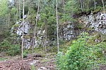
Rear Bavarian Forest | The courtyard post is a ridge that is morphologically distinct from the surroundings. At several points on the distinctive ridge of the hill, the pile quartz forms rock cliffs up to 6 m high with steep rock walls. The pile quartz was created by excretions from hydrothermal solutions that penetrated the shear and pinnate crevices along the depth fault (= pile fault). Movements during and after the quartz deposition led to the brecciated structure of the pile quartz. | 240000 800 × 300 |
Type: Hard , Fault Type: Vein quartz, ultramylonite |
Slope crack / rock wall | significant | Nature reserve, landscape protection area, FFH area | |
| Antonius stake near Viechtach |
 |
276R004 |
Viechtach position |
Rear Bavarian Forest | Morphologically distinctive wall of the post with individual rocks, chapel and Stations of the Cross (Antonius post). The pile quartz is unlocked at the road penetration. | 42000 1400 × 30 |
Type: Hard, Fault Type: Quartz |
Slope crack / rock wall | significant | Nature reserve, landscape protection area, FFH area | |
| Rieslochfall NE from Bodenmais |
 |
276R006 |
Bodenmais position |
Rear Bavarian Forest | A hydrological measuring station is located below the water-rich cascades with a height of the lower drop of 15 m. The Riesbach Falls can be reached via two signposted paths. | 120 20 × 6 |
Type: Waterfall Type: Gneiss |
Impact slope / river bed / stream profile | significant | Nature reserve, landscape protection area, FFH area | |
| Arbersee with Arbersee walls |
 |
276R007 |
Bayerisch Eisenstein position |
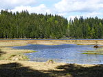
Rear Bavarian Forest | The cirque was created by multiple local glaciations in the Quaternary. The walls have glacial cuts. The Arbersee can be addressed as both Karsee and Zungenbeckensee. | 720000 900 × 800 |
Type: Kar, glacier cut, tongue basin lake Type: Gneiss, moraine |
Slope crack / rock wall | especially valuable | Nature reserve, landscape protection area, FFH area | |
| Wall moraines on the Arbersee | 276R008 |
Bayerisch Eisenstein position |
Rear Bavarian Forest | A total of four chains of wall moraines can be seen on the Arber, which are associated with stages during the Worm Ice Age. | 850000 850 × 1000 |
Type: End (wall) moraine Type: Moraine |
no information | significant | Landscape protection area, nature park | ||
| Valley of the Black Rain between Metten and Teisnach |
 |
276R009 |
Teisnach position |
Rear Bavarian Forest | In the tectonically laid out NW-SE trending rain basin, a drainage system developed from the Oligocene onwards. The river system, which meanders on leveled areas, was bound by lowering the erosion base from around the Upper Miocene onwards. In the course of the Pleistocene, the river sank deeper and deeper and today's Kerbtal was created. There are many boulders on the valley flanks and in the river bed. Rock cliffs (gneiss) emerge on the steep valley flanks. | 1600000 8000 × 200 |
Type: Meander, Kerbtal, Prallhang Type: Gneiss, Diorite |
no information | significant | Landscape protection area, FFH area, nature park | |
| Summit ridge of the Teufelstisch NW of Bischofsmais |
 |
276R010 |
Bischofsmais position |
Front Bavarian Forest | Along the ridge of the Teufelstisch there are several summit cliffs made of fine to medium-grain granite, which usually show a mattress-shaped wool sack weathering. The granites usually show a clear regulation of the crystals, which is due to tectonic overprinting. From the summit to NE there is a sea of boulders. Summit cliffs and boulder seas are the result of Pleistocene erosion and weathering. | 4000 400 × 10 |
Type: Felsburg, Blockmeer Type: Granite |
Slope crack / rock wall | precious | Landscape protection area, nature park | |
| Weissenstein NW stake |
 |
276R011 |
Rain position |
Rear Bavarian Forest | With a length of over 100 km, the pile is one of the most important tectonic structures in Bavaria. The hydrothermal quartz filling of the fracture structure often forms hardnesses. The approx. 30 m high battlements of the Weißenstein were exposed by Pleistocene erosion and form one of the most striking shapes in the pile. | 128000 1600 × 80 |
Type: Felsburg, Härtling, fault, rock type: Vein quartz |
Slope crack / rock wall | especially valuable | Nature reserve, FFH area, nature park | |
| Aitnachtal S from Viechtach |
 |
276R013 |
Kollnburg position |
Front Bavarian Forest | Valley of the Aitnach between Kirchaitnach and its confluence with the Schwarzen Regen: The valley system of the NS running valley, in which the Aitnach meanders many times today, took place in the Old Tertiary. A weak talasymmetry can be seen, which results from the periglacial conditions in the Pleistocene. Upon reaching the pile, the river initially flows parallel to the pile up to the steep-walled but extensive pile breakthrough. | 1950000 6500 × 300 |
Type: Asymmetrical valley, meander Type: gravel |
no information | significant | Natural park | |
| Summit of the Großer Arber with Richard Wagner's head |
 |
276R014 |
Bodenmais position |
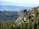
Rear Bavarian Forest | In the summit area of the Großer Arber there are several rock castles made of metatectic cordierite-sillimanite-gneiss. The Bodenmaiser bar, also known as the Richard Wagner head, is particularly striking. A natural history trail leads over the summit plateau. | 100000 400 × 250 |
Type: rock castle, metamorphic structure, rock type: gneiss |
Slope crack / rock wall | precious | FFH area, bird sanctuary, nature park | |
| High fall in Moosbachtal NW of Bodenmais |
 |
276R016 |
Bodenmais position |
Rear Bavarian Forest | The high fall, a 6 - 8 m high, multi-level waterfall into a brook pump, is the most impressive of the numerous waterfalls in the Moosbachtal. The anatectic gneiss is exposed in the stream bed with beautiful pools. The waterfall (natural monument) is accessible via a marked hiking trail. | 240 40 × 6 |
Type: Waterfall Type: Gneiss |
Impact slope / river bed / stream profile | significant | Natural monument, landscape protection area, nature park | |
| Large stake near Viechtach, northwest part |
 |
276R018 |
Viechtach position |
Rear Bavarian Forest | The pile zone, which runs through the entire Bavarian Forest from NW to SE, is one of the most important tectonic structures in Bavaria with a length of more than 100 km. Areas where hydrothermal vein quartz was precipitated in the fracture zone are now often seen in the landscape as hardships. They were uncovered by the Pleistocene erosion, like this striking hardened ring made of pile quartz with several rock cliffs in a beautiful landscape. | 5000 250 × 20 |
Type: hard rock, rock tower / needle, fault, rock type: vein quartz |
Slope crack / rock wall | precious | Nature reserve, landscape protection area, FFH area | |
| Silberberg SE summit area from Bodenmais (Bischofshaube) |
 |
276R019 |
Bodenmais position |
Rear Bavarian Forest | The Bischofshaube is the striking double summit of the Silberberg near Bodenmais. It was created by mining or weathering concordant sulphide ore layers in the gneiss. There are numerous former opencast and underground mines in the area, which testify to centuries of ore mining. | 60000 300 × 200 |
Type: rocky dome, open-cast mining, minerals Type: gneiss |
no information | precious | National park, landscape protection area, FFH area | |
| Steinbachfall at Falkenstein E from Zwieslerwaldhaus |
 |
276R020 |
Lindberg position |
Rear Bavarian Forest | The water of the Steinbach overcomes a gneiss sub-step running parallel to the slope in several small waterfall steps (approx. 10 m in total). This gneiss with a multitude of metamorphic structures (layers, folds, quartz lenses and bands) is beautifully exposed right on the hiking trail next to the waterfall. | 200 20 × 10 |
Type: waterfall, rock type, metamorphic structure Type: gneiss |
Slope crack / rock wall | precious | National park, landscape protection area, FFH area | |
| Summit cliff of the Kleiner Falkenstein E from Zwieslerwaldhaus |
 |
276R021 |
Lindberg position |
Rear Bavarian Forest | The summit of the Kleiner Falkenstein consists of an imposing gneiss summit cliff broken up into several clods. In some places beautiful gneiss structures can be observed on the rock walls: z. For example, the gneiss shows a layer structure with thicknesses of the individual layers <1 mm and fold structures in the cm-dm range. From the summit you have a beautiful view of the Bavarian Forest. | 2000 100 × 20 |
Type: rock castle, type of rock, metamorphic structure Type: cordierite-sillimanite-gneiss |
Rock slope / cliff | precious | National park, landscape protection area, FFH area | |
| Summit cliff of the Großer Falkenstein SE from Zwieslerwaldhaus |
 |
276R022 |
Lindberg position |
Rear Bavarian Forest | The summit area of the Großer Falkenstein is built up by a gneiss cliff that breaks off vertically to the west. The current appearance of the summit goes back to the Ice Age exposure of relatively unweathered rock areas through the removal of the tertiary weathering cover, as well as frost weathering and frost blasting. Various gneiss structures can be seen on the numerous, almost flat surfaces perpendicular to the rock structure, e.g. B. Quartz lenses up to 0.3 m in diameter. | 2000 100 × 20 |
Type: Crag, type of rock, metamorphic structure Type: Cordierite-Sillimanite-Gneiss |
Rock slope / cliff | significant | National park, landscape protection area, FFH area | |
| Höllbachgspreng and Höllbachfall E from Zwieslerwaldhaus |
 |
276R023 |
Lindberg position |
Rear Bavarian Forest | The stream and rock section on the steeply sloping eastern flank of the Großer Falkenstein was already out of use in the 19th century and thus placed under protection. The slope is interspersed with rock cliffs made of gneiss over the entire height. The Höllbach overcomes the rocky areas in several small waterfall steps, the highest of which - the Höllbachfall - is approx. 5 m. Höllbachsee and -schwelle at the bottom of the glacial valley were artificially changed in order to make the wood drift possible. | 400000 800 × 500 |
Type: rock wall / slope, waterfall, rock type, metamorphic structure Type: cordierite-sillimanite-gneiss, biotite-plagioclase-gneiss |
Rock slope / cliff | significant | National park, landscape protection area, FFH area | |
| Gneiss cliff NE of Rabenstein | 276R025 |
Ruhmannsfelden position |
Front Bavarian Forest | To the northeast of the hamlet of Rabenstein there is a hard ridge. Gneiss cliffs are hidden in the wood directly behind the houses, which form a good outcrop and show the different weathering behavior of the rocks. The cliff itself, with a distinctive foliation structure sloping diagonally into the slope, consists of pearl gneiss and quartz mica diorite. At the top there are numerous blocks of anatectic gneiss (paragranodiorite). | 160 20 × 8 |
Type: Hard rock, type of rock, type of storage : anatexite, gneiss, quartz diorite |
Slope crack / rock wall | precious | Natural park | ||
| Solifluction blocks in the Prackenbachtal W of Steinhof |
 |
276R026 |
Prackenbach position |
Rear Bavarian Forest | On the valley flanks of the Prackenbach valley above Steinhof there are loose block streams with blocks of gneiss and anatexite. During the cold periods under permafrost conditions, these blocks made their way down to the valley floor on floating earth as hiking blocks. The blocks were removed from the fields as far as possible for agricultural use. However, individual large blocks (too heavy to transport) are stored on the spot in the meadows and on or in the stream. | 200000 1000 × 200 |
Type: Solifluction phenomenon Type: Anatexite, blocks, clay |
block | significant | Landscape protection area, nature park | |
| Habichtstein NE of Kirchdorf | 276R027 |
Kirchberg in the forest position |
Rear Bavarian Forest | The Habichtstein is an imposing double cliff made of gneiss with vertical or overhanging walls up to 20 m high on all sides. There is a narrow passage between the two rock towers. An ensemble of blocks and cliffs connects to the bottom and west. This is also where a loose block flow begins. Gneiss structures can be seen on the weathered rock on the west side of the Habichtsstein. | 450 30 × 15 |
Type: rock castle, rock tower / needle Type: cordierite-sillimanite-gneiss |
Rock slope / cliff | precious | Landscape protection area, nature park | ||
| Hochmoorgebiet Todtenau SE from Dösingerried |
 |
276R028 |
Kirchberg in the forest position |
Front Bavarian Forest | The high moor core area of Todtenau is one of the most important high moor areas in the Upper Bavarian Forest. In the center, peat thicknesses of 8.5 m are achieved. The peat formation started more than 13,000 years ago with fens. This is followed by intermediate bog peat and raised bog peat for more than 10,000 years. Due to the conservation of pollen, peatland profiles are unique archives of the history of climate, vegetation and settlement. | 210000 700 × 300 |
Type: raised bog Type: peat |
no information | significant | Nature reserve, landscape protection area, FFH area | |
| Great Rachel's summit cliffs |
 |
276R029 |
Frauenau position |
Rear Bavarian Forest | The summit of the Großer Rachel consists of a summit cliff made of gneiss (metatectical cordierite gneiss with biotite-plagioclase gneiss). A large number of metamorphic structural features can be observed in the rock directly in the summit area: layer structure, fold structures in the cm to dm range, numerous quartz lenses, partial mobilization of bright components (leukosomes) that pervade the rock formation in a concordant and discordant manner. | 500 50 × 10 |
Type: rocky dome, metamorphic structure, rock type: gneiss |
Rock slope / cliff | significant | National park, landscape protection area, FFH area | |
| Teisnach between Gotteszell and Ruhmannsfelden |
 |
276R030 |
God's cell position |
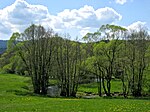
Front Bavarian Forest | In the section of the river between Gotteszell and Ruhmannsfelden, the Teisnach meanders very strongly. The meanders directly at Gotteszell are very even. After that, the river enters the large valley basin south of Ruhmannsfelden, facing towards the SN, with further typical river meanders. The selected river passage is a characteristic example of meandering waters, as they are relatively common in the Bavarian Forest. | 10000 2000 × 5 |
Type: Meander Type: Clay |
no information | significant | Natural park | |
| Rocks on Wagensonnriegel NW of Althütte | 276R033 |
Kirchberg in the forest position |
Rear Bavarian Forest | The rocks at the lookout point and on the hiking trail on the ridge line of the car sun bolt consist of metatectic cordierite-sillimanite-potassium feldspar-gneiss with biotite-plagioclase-gneiss and calcium silicate inclusions. You are e.g. T. heavily folded. | 4000 100 × 40 |
Type: rock wall / slope, metamorphic structure Type: cordierite-sillimanite-gneiss |
Rock slope / cliff | significant | Landscape protection area, nature park |
See also
- List of nature reserves in the Regen district
- List of protected landscape areas in the Regen district
- List of FFH areas in the Regen district
Individual evidence
- ↑ Data source: Bavarian State Office for the Environment, www.lfu.bayern.de, Geotoprecherche (accessed on September 16, 2017)
Web links
Commons : Geotopes in the district of Regen - Collection of images, videos and audio files