Kollnburg
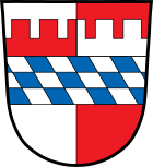
| coat of arms | Germany map | |
|---|---|---|

|
Coordinates: 49 ° 3 ' N , 12 ° 52' E |
|
| Basic data | ||
| State : | Bavaria | |
| Administrative region : | Lower Bavaria | |
| County : | rain | |
| Height : | 655 m above sea level NHN | |
| Area : | 59.51 km 2 | |
| Residents: | 2759 (Dec. 31, 2019) | |
| Population density : | 46 inhabitants per km 2 | |
| Postal code : | 94262 | |
| Area code : | 09942 | |
| License plate : | REG, VIT | |
| Community key : | 09 2 76 128 | |
| Community structure: | 103 districts | |
| Address of the municipal administration: |
Schulstr. 1 94262 Kollnburg |
|
| Website : | ||
| Mayor : | Herbert Preuss ( FW ) | |
| Location of the municipality of Kollnburg in the Regen district | ||
Kollnburg is a municipality in the Lower Bavarian district of Regen and a state-approved resort .
geography
Geographical location
The community is located in the Danube Forest region in the middle of the Bavarian Forest north of the 1050 m high Pröller between Viechtach (five kilometers) and Sankt Englmar (six kilometers). The two cities of Bogen and Regen are each 27 km away, while Deggendorf and Cham are each 31 km.
Community structure
Kollnburg consists of the districts Allersdorf, Kirchaitnach, Kollnburg and Rechertsried.
There are a total of 103 districts:
history
Until the church is planted
The history of Kollnburg is closely linked to the castle of the same name, which was first mentioned in 1153 as Chalnberch . In 1685 it was still called Kalmperg , while Bernhard Grueber and Adalbert Müller referred to it as a coal castle in their book The Bavarian Forest , published in 1846 . In the "Contributions to the Statistics of the Kingdom of Bavaria" the place is already referred to as Kollnburg in issue XXI from 1869.
Kollnburg belonged to the barons of Kastner. The place was part of the Electorate of Bavaria , but formed a closed Hofmark , whose seat was Kollnburg. In the course of the administrative reforms in Bavaria , today's municipality was created with the municipal edict of 1818 .
Incorporations
In the course of the municipal reform , on October 1, 1971, the municipality of Rechertsried and on May 1, 1978 the municipalities of Allersdorf and Kirchaitnach were incorporated into the municipality of Kollnburg.
Population development
Between 1988 and 2018 the number of inhabitants stagnated or decreased minimally from 2,800 to 2,795 by 5 inhabitants or 0.2%.
- 1867: 1027 inhabitants
- 1871: 1060 inhabitants
- 1961: 2764 inhabitants
- 1970: 2695 inhabitants
- 1987: 2786 inhabitants
- 1991: 2838 inhabitants
- 1995: 2905 inhabitants
- 2000: 2970 inhabitants
- 2005: 2891 inhabitants
- 2010: 2894 inhabitants
- 2015: 2787 inhabitants
politics
Municipal council
Since the local elections on March 15, 2020, the municipal council has been composed as follows:
- CSU : 4 seats (33.42% of the vote)
- FW : 5 seats (35.09% of the vote)
- Citizens for Kollnburg: 3 seats (18.76% of the vote)
- GPÖ: 2 seats (12.73% of the vote)
mayor
Herbert Preuß (FW) has been the first mayor since May 1, 2020. In the local elections in 2020 he won the runoff election on March 29, 2020 with 55.1 percent against the previous incumbent Josefa Schmid , who had been the first female mayor since 2008.
Architectural monuments
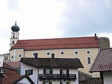
- Kollnburg castle ruins : castle ruins with round tower and castle fountain
statistics
According to official statistics, there were 10 employees at the place of work in the field of agriculture and forestry, 136 in the manufacturing sector and 17 in trade and transport. In other economic sectors 137 people were employed at the place of work subject to social security contributions. There were a total of 895 employees at the place of residence subject to social security contributions. There were no companies in the manufacturing sector and 6 in the construction sector. In addition, in 1999 there were 181 farms with an agricultural area of 2735 ha, of which 2178 ha were permanent green space.
education
The following institutions exist (as of: 1999):
- Kindergarten with 75 kindergarten places and 67 children
- Two elementary schools with 11 teachers and 207 students
Personalities
- Josef Biebl (* 1959), labor lawyer and judge at the Federal Labor Court
- Florian Pledl (* 1984), accordionist with Da Rocka & da Waitler
Individual evidence
- ↑ "Data 2" sheet, Statistical Report A1200C 202041 Population of the municipalities, districts and administrative districts 1st quarter 2020 (population based on the 2011 census) ( help ).
- ^ Community of Kollnburg in the local database of the Bavarian State Library Online . Bayerische Staatsbibliothek, accessed on August 20, 2018.
- ↑ a b Kgl. Statistisches Bureau (Ed.): Directory of the municipalities of the Kingdom of Bavaria according to the status of the population in December 1867 . XXI. Issue of the contributions to the statistics of the Kingdom of Bavaria. Ackermann, Munich 1869, p. 72 ( digitized version ).
- ↑ a b Kgl. Statistical Bureau (ed.): Complete list of localities of the Kingdom of Bavaria. According to districts, administrative districts, court districts and municipalities, including parish, school and post office affiliation ... with an alphabetical general register containing the population according to the results of the census of December 1, 1875 . Adolf Ackermann, Munich 1877, 2nd section (population figures from 1871, cattle figures from 1873), Sp. 645 , urn : nbn: de: bvb: 12-bsb00052489-4 ( digitized version ).
- ^ Wilhelm Volkert (ed.): Handbook of Bavarian offices, communities and courts 1799–1980 . CH Beck, Munich 1983, ISBN 3-406-09669-7 , p. 584 .
- ^ Federal Statistical Office (ed.): Historical municipality directory for the Federal Republic of Germany. Name, border and key number changes in municipalities, counties and administrative districts from May 27, 1970 to December 31, 1982 . W. Kohlhammer GmbH, Stuttgart / Mainz 1983, ISBN 3-17-003263-1 , p. 623 .
- ↑ wahl.info - candidates & results
- ↑ The run-off elections on Sunday, 29 March 2020. In: Wahl.info. March 30, 2020, accessed March 30, 2020 .
Web links
- Entry on the coat of arms of Kollnburg in the database of the House of Bavarian History


