List of geotopes in the Neumarkt district in the Upper Palatinate
This list contains the geotopes of the Upper Palatinate district of Neumarkt in the Upper Palatinate in Bavaria . The list contains the official names and numbers of the Bavarian State Office for the Environment (LfU) as well as their geographical location. This list may not be complete. Around 3,400 geotopes (as of March 2020) are recorded in the Bavarian geotope register. The LfU does not consider some geotopes suitable for publication on the Internet. For example, some objects are not safely accessible or may only be entered to a limited extent for other reasons.
| Surname | image | Geotope ID | Municipality / location | Geological unit of space | description | Area m² / extension m | geology | Digestion type | value | Protection status | comment |
|---|---|---|---|---|---|---|---|---|---|---|---|
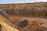
| Sand pit on the Gitzberg NE by Postbauer-Heng |
 |
373A001 |
Postbauer-Heng position |
Southwest Albrand region | Doggersandstein outcrop in rock sandstone from the main seam horizon to the beta / gamma limit. Disciteston horizon and grave passages are open. Part of the outcrops was collapsed by the backfilling. | 20000 200 × 100 |
Type: sequence of layers, sediment structures, trace fossils Type: sandstone, clay |
Gravel pit / sand pit | significant | Landscape protection area | |
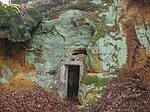
| Hohlweg NW of Gspannberg |
 |
373A002 |
Berg near Neumarkt in the Upper Palatinate position |
Southwest Albrand region | The ravine through which the road runs opens up Unteren Dogger as light brown sandstone with a small amount of Eisenoolith and a small rock cellar. | 60 30 × 2 |
Type: Rock Type: Sandstone, Clay |
embankment | significant | no protected area | |
| Former quarry E von Hadermühle | 373A006 |
Lauterhofen position |
Middle Franconian Alb | The quarry offers an insight into the stratified limestone of the Lower Malm. The steep walls are largely free of vegetation, the bottom of the quarry is covered by successional vegetation. | 1600 80 × 20 |
Type: Rock Type: Limestone |
Quarry | significant | Landscape protection area | ||
| Former quarry on Rödelberg N of Ischhofen | 373A007 |
Neumarkt in the Upper Palatinate position |
Southern Franconian Alb | Stratified limestone of the Lower Malm is open. Some of them are blurred and show fossils. The fracture is almost completely fused, only a few smaller outcrops are visible. | 4 4 × 1 |
Type: Rock Type: Limestone |
Quarry | significant | no protected area | ||
| Former quarry on the Sattelberg SW von Hartenhof | 373A009 |
Pilsach position |
Middle Franconian Alb | In the partially filled quarry, stratified fossil-bearing limestones of the Malm Gamma 2 and Crussoliensis marl are exposed. | 600 30 × 20 |
Type: Rock Type: Limestone |
Quarry | significant | no protected area | ||
| Aufgel. Quarry NE of Sengenthal (Winnberg Quarry) |
 |
373A011 |
Sengenthal position |
Southern Franconian Alb | There is a quarry and a clay pit on the site, both of which show the Upper Dogger (Gamma to Zeta) in a unique way in a continuous profile, overlaid by Malm Alpha and Beta. | 160000 800 × 200 |
Type: Standard / Reference Profile, Animal Fossils, Trace Fossils Type: Limestone, Mudstone |
Quarry | especially valuable | FFH area | |
| Former sand pit in the Upper Haid E von Dennenlohe | 373A012 |
Postbauer-Heng position |
Southwest Albrand region | The only Rhät sand pit in the district is currently partially filled with disordered deposits (household waste, metals, building rubble, ...). | 60 15 × 4 |
Type: rock type, sedimentary structures type: sand |
Gravel pit / sand pit | significant | no protected area | ||
| Former sand pit NW of Arzthofen | 373A014 |
Your position |
Southern Franconian Alb | The outcrop lies in a dune of Quaternary drift sand. | 16 8 × 2 |
Type: rock type, dune type: sand |
Gravel pit / sand pit | significant | no protected area | ||
| Former sand pit SW of Wolfersthal | 373A017 |
Berching position |
Southern Franconian Alb | The former pit is overgrown and only easily accessible at the north end. Here the sediment structures can be seen very well in the outcrop (Dogger Beta, Disciteston with U-shaped burial tunnels, Dogger Gamma with Sowerbyi rubble). | 700 70 × 10 |
Type: Sedimentary structures, layer sequence, trace fossils Type: Sandstone |
Gravel pit / sand pit | precious | Landscape protection area, nature park | ||
| Former quarry N von Rübling | 373A018 |
Berching position |
Southern Franconian Alb | There are two larger quarry pits in the mining area, but there are only a few outcrops from which the rock can be easily recognized. | 1000 200 × 5 |
Type: Layer sequence Type: Marlstone, Limestone |
Quarry | significant | Landscape protection area, FFH area, nature park | ||
| Former quarry W of Ernersdorf | 373A021 |
Berching position |
Southern Franconian Alb | The bank is clearly visible in the limestone, and some cracks are also visible in the quarry wall. The pit is cleanly prepared, an explanatory board says that up to the 1950s six to seven workers mined the lime by hand. | 400 80 × 5 |
Type: Rock Type: Limestone |
Quarry | significant | Landscape protection area, nature park | ||
| Former quarry W von Eglasmühle | 373A025 |
Berching position |
Southern Franconian Alb | The quarry wall has no vegetation and shows individual landslides. Fossils can be found in large numbers, especially on the dumps. Garbage deposits affect the landscape. | 30000 300 × 100 |
Type: Rock Type: Limestone |
Quarry | significant | Landscape protection area, FFH area, bird sanctuary | ||
| Former SSE quarry in Eismannsdorf | 373A026 |
Breitenbrunn position |
Southern Franconian Alb | The relatively large former quarry is located at the top of a Kerb valley in banked limestone. The quarry wall has grown together and is increasingly deteriorating. | 1600 80 × 20 |
Type: Rock Type: Limestone |
Quarry | significant | Landscape protection area, FFH area, bird sanctuary | ||
| Former quarry E of the Fuchsmühle | 373A027 |
Hohenfels position |
Middle Franconian Alb | In the former quarry east of the Fuchsmühle, the mass dolomite of the Lower Franconian Alb formation is exposed. The massive dolomites show a conspicuous, almost vertical crevice. In addition to the massive, only vertically structured areas, there are also those with a wide, mostly indistinct horizontal structure. These mediate between the mass dolomites of the reefs and the banked dolomites of the Pottenstein Formation, as they are exposed on the opposite edge of the Forellenbach valley. | 8000 100 × 80 |
Type: Rock Type: Dolomite Stone |
Quarry | significant | Landscape protection area | ||
| Hollow way in Doggersandstein SE from Deining |
 |
373A029 |
Your position |
Southern Franconian Alb | At the fire station in Deining, a deep ravine begins in the Doggersandstone, which offers excellent outcrops in the rock. Strongly solidified rock areas alternate with more crumbling areas. A large number of former rock cellars are located on both sides of the ravine. | 1200 120 × 10 |
Type: Rock type, ravine, tunnel Type: Sandstone |
Pit / canal / ravine | significant | FFH area | |
| Rock face SE from Niederhofen |
 |
373A030 |
Pilsach position |
Middle Franconian Alb | On the steep step between Niederhofen and Dietkirchen on the southeastern slope of the Schwarzen Laaber valley, iron sandstone from the Dogger Beta is exposed on a rock face up to 5 meters high. The yellowish layered sandstones (fine to medium sandstone) show oblique layers in some places. Numerous rock cellars are carved into the sandstone. The machining marks of the tools are still visible on the door frames. | 1000 200 × 5 |
Type: sedimentary structures, rock type, rock cellar type: sandstone |
Slope crack / rock wall | precious | no protected area | Bavaria's most beautiful geotopes No. 69 |
| Former ENE quarry in Hebersdorf | 373A031 |
Dietfurt at the Altmühl position |
Southern Franconian Alb | In the southern part of the quarry, the work limestone is impressively developed as a continuous wall. There are numerous ammonites and belemnites in the limestones. The northern part is used as a landfill. | 6250 250 × 25 |
Type: Rock, Animal Fossils Type: Limestone |
Quarry | significant | Landscape protection area, nature park | ||
| Former quarry E from Stetterhof | 373A032 |
Dietfurt at the Altmühl position |
Southern Franconian Alb | In the former quarry, the Malm Werkalk is accessible over several levels. Ammonites are often found in the layers. The dismantling has long been stopped and the walls are z. T. already grown together. | 12500 250 × 50 |
Type: Rock, Animal Fossils Type: Limestone |
Quarry | significant | Landscape protection area, FFH area | ||
| Former Quarry E from Breitenegg | 373A034 |
Breitenbrunn position |
Southern Franconian Alb | In the slope section above the road, dolomitized Malm limestone are cut. In the outcrop you can see a change from massive to banked positions. Sponges and ammonites can be found in the rock. In places the wall is covered with a sinter layer. The rock was sheared along two breaks. | 850 170 × 5 |
Type: Rock type, Sedimentary structures, Animal fossils Type: Limestone, Dolomite stone |
embankment | significant | Landscape protection area, FFH area, nature park | ||
| Former quarry E of Pollanten | 373A035 |
Berching position |
Southern Franconian Alb | In the quarry, only the upper areas are accessible. In the upper part, reef rubble limestone is exposed. The sedimentation changes from thick banked, coarser to thinner, fine-grained layers. The coarse layers are rich in fossils from the nearby reef area. The lower part of the break is partly collapsed and partly filled with household waste. A small reef body is exposed in the western part of the break. | 3600 60 × 60 |
Type: Rock type, Sedimentary structures, Fissure / tectonic cave Type: Limestone |
Quarry | inferior | Landscape protection area, nature park | ||
| Abandoned Eastern Slate Quarry S from Parsberg | 373A037 |
Lupburg position |
Southern Franconian Alb | In the quarry, which is partially filled with household waste, platy to thin slab limestone is exposed. The crooked position is clearly developed and occasionally shows sliding folds. | 1050 35 × 30 |
Type: Sequence of layers, sediment structures Type: Limestone |
Quarry | significant | no protected area | ||
| Multi-colored Doggersandstein on Jurasteig W of Mittersthal | 373A038 |
Your position |
Southern Franconian Alb | In a former quarry, an iron ore horizon of the Great Dane sandstone with violet, light red and ocher brown colors is exposed. Leaning bodies can be seen in the sandstone. | 750 50 × 15 |
Type: Rock, Quarry / Pit Type: Sandstone |
Quarry | significant | FFH area | ||
| Former clay pit near Heng | 373G001 |
Postbauer-Heng position |
Southwest Albrand region | The walls reveal monotonous blue-gray, pyrite-containing, slightly chalky slate clays. Often claystone, less often marl limestone concretions are embedded, light-colored gypsum crystals up to 2 cm in length can often be observed. The top meters of the profile weather to brown, lime-free clay. The details are here z. Some of them are older and overgrown with vegetation. | 15000 150 × 100 |
Type: Quarry / Pit, Rock Type: Mudstone |
Clay pit / clay pit / marl pit | precious | Landscape protection area | ||
| Franzosenlöcher SE from Batzhausen | 373G003 |
Seubersdorf in the Upper Palatinate position |
Southern Franconian Alb | The area includes several hundred holes and depressions 1 to 10 in diameter in the forest. These French holes resulted from the mining of stone ore and extensions by French soldiers during the war with Austrian troops. | 160000 400 × 400 |
Type: Pinge / nfeld Type: Limestone |
Ping | significant | no protected area | ||
| Buch silver sand caves on the Dillberg NNE from Buch |
 |
373G004 |
Postbauer-Heng position |
Southwest Albrand region | Up until the Second World War, the light, fine-grain sand in the upper iron sandstone was mined underground in tunnels on the western slope of the Dillberg. This silver sand was used for scrubbing the rooms, as polishing sand and as molding sand in industry and was therefore transported to Nuremberg. The silver sand cave with the two adjacent entrances and information board is located on hiking trail no. 1 on the red rectangle from Buch to the Dillberg plateau. Short secondary tunnels branch off from the main tunnel, which were also broken at the entrance and sandstone pillars were left as protection. Most of the entrances to other tunnels on the Dillberg have fallen into disrepair and can not be entered safely. In winter, the silver sand caves are not allowed to be entered, as they are an important winter roost for bats. | 8000 400 × 20 |
Type: Stud Type: Sandstone |
Tunnel / gallery / shaft | precious | Landscape protection area | |
| König-Otto-Stalactite Cave E of this yard |
 |
373H001 |
Velburg position |
Middle Franconian Alb | The over 200 m long show cave is electrically illuminated. Large sinter cascades, often corkscrew-like twisted stalactites and mighty stalagmites are formed in the cave. A corridor discovered in 1972 connects the König Otto Cave with the Advent Hall. | 40000 200 × 200 |
Type: Karst horizontal cave Type: Dolomite stone |
cave | precious | Natural monument, landscape protection area | |
| The hollow hole W of St. Wolfgang |
 |
373H002 |
Velburg position |
Middle Franconian Alb | The hollow hole impresses with its large entrance. The cave is currently used as a storage room and is locked. There are more caves on the southern slope of the Hohllochberg. | 2000 100 × 20 |
Type: Karst horizontal cave Type: Dolomite stone |
cave | significant | Landscape protection area, FFH area | |
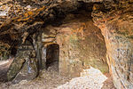
| Krügerloch SW from Eglasmühle |
 |
373H003 |
Berching position |
Southern Franconian Alb | The unique cave in the Doggersandstein was partly artificial, partly natural. The Krügerloch is also known under the name Kruzerloch. | 108 9 × 12 |
Type: Cover cave , eruption / weathering cave, gallery Type: Sandstone |
Slope crack / rock wall | precious | Natural monument, landscape protection area, FFH area | |
| Tufa cave in Holnstein |
 |
373H004 |
Berching position |
Southern Franconian Alb | The very impressive cave in the tuff rock in Holnstein has beautiful sinter formations. Presumably it serves as a shelter for bats. The entrance area serves as a storage area for materials. A total of 25 m are accessible. | 150 50 × 3 |
Type: Tufa cave Type: Travertine |
Slope crack / rock wall | precious | Natural monument, nature park | |
| Hohenberg Cave W of Velburg | 373H005 |
Velburg position |
Middle Franconian Alb | Small beautiful cave in the massive dolomite with sinter formations. | 100 10 × 10 |
Type: Karst horizontal cave, sinter formation Type: Dolomite stone |
cave | significant | Landscape protection area | ||
| Karst spring Mühlbachquelle near Mühlbach |
 |
373Q001 |
Dietfurt at the Altmühl position |
Southern Franconian Alb | The pouring in the beautiful spring pond usually reaches over 200 l / s. Attempts at marking show the connection with sinkholes near Eutenhofen. | 200 20 × 10 |
Type: rubble spring, karst horizontal cave Type: limestone, limestone marl |
no information | especially valuable | Natural monument, nature park | |
| Karst spring SW of Premerzhofen |
 |
373Q002 |
Breitenbrunn position |
Southern Franconian Alb | The small karst spring emerges from a narrow karst tube and shows strong fluctuations in the discharge. The water is used for fish farming. In the immediate vicinity, several springs emerge into the valley filling. | 30 6 × 5 |
Type: layer source, rock type: limestone |
Slope crack / rock wall | significant | Natural monument, landscape protection area, FFH area | |
| High fountain ENE by Rübling |
 |
373Q004 |
Berching position |
Southern Franconian Alb | At the Burgstall Hoher Brunnen there are two sources on the Braunjura / Weißjura border. These are fed from the shallow karst of the plateau between Rübling and Erasbach. The groundwater flow in the shallow karst is very dependent on the weather. In the dry and hot year of 2015, both springs were only sparse rivulets at the beginning of September. On the way through the limestones of the White Jurassic, the cool groundwater dissolves the carbonate. When it emerges from the surface of the earth, the water is heated and the carbonate that is carried along falls out (an effect that everyone in front of the coffee machine at home is familiar with). At the Hohen Brunnen, a tufa cascade has formed on the steep slope of the Braunjura, over which the water falls into the valley - if there is sufficient water flow. The tufa gets its porous character from the participation of algae and moss in the precipitation process. A board on the cascade explains the main features of this process. To protect the cascade from being destroyed, do not enter it! | 100 10 × 10 |
Type: Layer spring, sintered terraces Type: Limestone, tufa, claystone |
no information | significant | Landscape protection area, FFH area, nature park | |
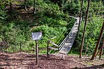
| Kaltenbachquelle S from Dillberg |
 |
373Q006 |
Berg near Neumarkt in the Upper Palatinate position |
Southwest Albrand region | The beautiful natural layer spring emerges from the water-retaining layer of the Opalinus Clay in the Brown Jura (Dogger). In the iron sandstone above, erosion has washed out a small cave. Here and on the slope of the slope, the yellow-colored layers and red-brown iron precipitations are clearly visible. Depending on the weather, the flow of the spring fluctuates greatly. The Kaltenbach spring is signposted on the Kaltenbachweg (hiking trail no.2 on a green rectangle). Wooden stairs and walkways allow access to the source. | 25 5 × 5 |
Type: Layer Source Type: Sandstone |
cave | significant | Landscape protection area | |
| Doline NW of Mantlach | 373R001 |
Velburg position |
Southern Franconian Alb | The sinkhole is between fields and is marked by some tall poplars. | 170 17 × 10 |
Type: sinkhole Type: limestone |
no information | significant | Natural monument | ||
| Mushroom rock WSW from St. Colomann |
 |
373R002 |
Velburg position |
Middle Franconian Alb | On the way to the summit of the Osterberg lies the mushroom-shaped rock with vertical crevices and crevices. | 20 5 × 4 |
Type: Rock tower / needle Type: Dolomite stone |
Slope crack / rock wall | significant | Natural monument, landscape protection area, FFH area | |
| Hohllochberg ENE from Velburg | 373R003 |
Velburg position |
Middle Franconian Alb | On the southern slope of the Hohlochberg there are several caves, including the hollow hole. From the hiking trails, numerous rock outcrops are clearly visible, which have numerous small and large outcrops. | 60000 300 × 200 |
Type: rocky dome, karst horizontal cave Type: dolomite stone |
Slope crack / rock wall | significant | Landscape protection area, FFH area | ||
| Dolomite on the castle hill of the ruin Velburg |
 |
373R004 |
Velburg position |
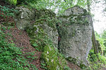
Middle Franconian Alb | Sponge structures in the Malm Delta Dolomite are visible on the way to the ruins. Epsilon reef dolomites and rows of holes and ribbon dolomites on the Delta-Epsilon border directly below the Velburg ruins are also open. | 10000 100 × 100 |
Type: Rock wall / slope Type: Dolomite stone |
Slope crack / rock wall | inferior | Landscape protection area, FFH area | |
| Tuff rock in Holnstein | 373R005 |
Berching position |
Southern Franconian Alb | Lime tuffs are mainly bound to the lime-rich Malm waters, which emerge in numerous springs on the damming clays of the Upper Dogger. The approx. 150 m long and up to 15 m high tuff wall in Holnstein is crossed by a spacious cave. | 2000 100 × 20 |
Type: rock wall / -hang Type: Travertine |
Slope crack / rock wall | precious | Natural monument, nature park | ||
| Doline NW of Gimpertshausen | 373R006 |
Breitenbrunn position |
Southern Franconian Alb | The sinkhole with a small wood is in a field and is closely circumnavigated by the plow, the sinkhole floor is contaminated with rubbish deposits. | 256 16 × 16 |
Type: sinkhole Type: limestone |
no information | significant | Natural monument, nature park | ||
| Rocks in the Schnufenhofener dry valley N of Wissing | 373R007 |
Seubersdorf in the Upper Palatinate position |
Southern Franconian Alb | The dolomite rock shows significantly thicker to thinner banks that lie flat on top of each other like onion skin. Mellow (marlier) layers can be seen as fillets. This shape is typical of shallow sponge reef structures, although the reef formers are largely destroyed by the later dolomitization. | 625 25 × 25 |
Type: rock wall / slope, sedimentary structures Type: dolomite stone, limestone |
Slope crack / rock wall | precious | FFH area | ||
| Plankstetten sinkhole W | 373R008 |
Berching position |
Southern Franconian Alb | The sinkhole is shaped like a shallow bowl. A small basin was excavated in the center. The surface water collects here through the sponging of finer clay material, so the basin can serve as a cattle trough. | 900 30 × 30 |
Type: sinkhole Type: dolomite stone |
no information | significant | Landscape protection area, nature park | ||
| Ball rock SW from Bottelmühle | 373R009 |
Breitenbrunn position |
Southern Franconian Alb | Behind the spherically weathered main rock there is a smaller rock with a short through cave. | 140 20 × 7 |
Type: rock wall / slope, karst halfway / natural bridge Type: limestone |
Slope crack / rock wall | significant | Natural monument, part of the landscape | ||
| Bachhaupter Felsen SE by Bachhaupt |
 |
373R010 |
Breitenbrunn position |
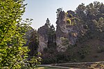
Southern Franconian Alb | These are two steep, separated rocks, made of the dirty gray dolomite typical of the Malm Beta with smooth rounded weathered forms. In the upper part of the rocks you can see several layer joints that dip at 45 degrees to the SW and thus trace the steep reef morphology. | 300 30 × 10 |
Type: rock tower / needle, sedimentary structures Type: dolomite stone |
Slope crack / rock wall | significant | Natural monument, landscape protection area, FFH area | |
| Rocks in the Neutal NW of Mitteldorf | 373R011 |
Dietfurt at the Altmühl position |
Southern Franconian Alb | Numerous rock outcrops can be found on the north-facing steep slope above the Neutal. | 100 10 × 10 |
Type: Rock Wall / Slope Type: Limestone |
Slope crack / rock wall | significant | Natural monument, landscape protection area, FFH area | ||
| Radlerfelsen E from Mühlbach | 373R012 |
Dietfurt at the Altmühl position |
Southern Franconian Alb | The striking dolomite rock face towers over the wooded slope. | 30000 300 × 100 |
Type: Rock tower / needle Type: Dolomite stone |
Slope crack / rock wall | significant | Landscape protection area, FFH area, nature park | ||
| Head rock E from Mühlbach |
 |
373R013 |
Dietfurt at the Altmühl position |
Southern Franconian Alb | The rock section east of Mühlbach is made up of thick, flat-banked dolomite from the Malm Delta with a flat roof of thin-banked light limestone from the highest Malm Delta to the deepest Epsilon. | 600 60 × 10 |
Type: rock tower / needle, layer sequence type: dolomite stone |
Slope crack / rock wall | precious | Natural monument, landscape protection area, FFH area | |
| Rock group NE of the Fuchsmühle | 373R014 |
Hohenfels position |
Middle Franconian Alb | The rock structures of the rock group are mostly clearly recognizable despite the vegetation and can be followed over a length of almost 250 m. The rock face itself is already within the limits of the JMRC Hohenfels. It is therefore not possible to approach the wall (restricted military area - entry prohibited - use of firearms). The indication of Treuchtlinger marble is to be seen as a gap filler for the Bernhof subformation of the Pottenstein formation (i.e. banked dolomite facies). | 7500 250 × 30 |
Type: rock group, layer sequence type: dolomite stone |
Slope crack / rock wall | significant | FFH area, landscape protection area, bird sanctuary | ||
| Dolinenfeld WSW from Pestenrain | 373R015 |
Dietfurt at the Altmühl position |
Southern Franconian Alb | Collection of several especially large and deep sinkholes in a small space. | 180000 600 × 300 |
Type: Dolinenfeld Type: Dolomite stone, limestone |
no information | precious | Landscape protection area, nature park | ||
| Hirschenstein SE from Breitenbrunn | 373R016 |
Breitenbrunn position |
Southern Franconian Alb | The deeper part of the wall consists of indistinctly grooved and friable dolomite, which forms covings. Towards the top, a massive, undivided reef dolomite develops, the roof of which is made up of thin-walled dolomite (this area is probably assigned to the Crussoliensis marl). | 170 17 × 10 |
Type: rock tower / needle, layer sequence type: dolomite stone |
Slope crack / rock wall | precious | Natural monument, landscape protection area, nature park | ||
| Dolinen SE from Predlfing | 373R017 |
Dietfurt at the Altmühl position |
Southern Franconian Alb | The two sinkholes are strongly overgrown, the larger one has a temporary inflow. The connection with the nearby karst spring Parleithen was proven by a marking experiment. | 2400 80 × 30 |
Type: sinkhole Type: limestone |
no information | significant | Natural monument, nature park | ||
| Sand dunes S of Neumarkt |
 |
373R018 |
Neumarkt in the Upper Palatinate position |
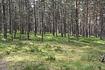
Southwest Albrand region | In the nature reserve south of Neumarkt there are several striking dunes that reach up to 500 m in length and 12 m in height. The loose pine forest vegetation is typical for the type of location. | 400000 800 × 500 |
Type: Dune field Type: Sand |
no information | significant | Nature reserve, FFH area | |
| Zeugenberg NW of Sulzbürg |
 |
373R019 |
Mulhouse position |
Southwest Albrand region | The plateau area on the Sulzbürg testifies to the former further expansion of the Franconian Alb and the erosion down to the Doggersandstein that already took place at that time. Hollows, ditches and rocky slopes around the plateau offer good outcrops in the Doggersandstone, locally also with iron ore seams. The Pandurenloch on the eastern slope of the Zeugenberg is a short scouring cave in the iron sandstone. | 180000 600 × 300 |
Type: Inselberg / Zeugenberg, eruption / weathering cave Type: sandstone, iron, / manganese ore |
Slope crack / rock wall | precious | Landscape protection area | |
| Stone channel S from Erasbach |
 |
373R020 |
Berching position |
Southern Franconian Alb | A small spring rises on the slope at the border of the Dogger and Malm, below which a stone channel about 100 m long and up to 0.8 m high has formed. The moss-covered tufa deposits run very prominently through the light beech forest. | 100 100 × 1 |
Type: Stone gutter Type: Tufa limestone |
no information | significant | Landscape component, landscape protection area, FFH area | |
| Rachental NE from Berching |
 |
373R021 |
Berching position |
Southern Franconian Alb | In the bottom of the Rachental a several meters thick calcareous sinter has deposited over a length of about 150 m. The water from two small springs flows over moss-covered, mostly terraced cascades. | 450 150 × 3 |
Type: Sinterterrassen Type: Travertine |
no information | significant | Landscape protection area, nature park | |
| Sand dunes in Graßaholz E von Graßahof | 373R022 |
Your position |
Southern Franconian Alb | The sand dunes in the grass wood are shifting dunes for which migration has been proven in historical times. Artefacts from historical times were found during excavations in the dunes in the grass wood. The area around the grass wood is the only area with extensive distribution of Aeolian sands on the Alb plateau. The structural build-up of the dunes and the underlying Malmkalk (Malm Beta) are cut along a path. | 20000 200 × 100 |
Type: Dune Field, Fossil Soil Type: Sand |
no information | significant | no protected area | ||
| Wolfsberg SE from Dietfurt |
 |
373R023 |
Dietfurt at the Altmühl position |
Southern Franconian Alb | The Umlaufberg rises above the valley of the former Danube, today's Altmühltal. The Wolfsberg consists of limestones from the Malm. The mountain was probably formed when the original Danube was relocated in the Tertiary. The Wolfsberg is best seen from the north. | 1620000 1800 × 900 |
Type: Umlauf- / breakthrough mountain Type: Limestone, marlstone |
Impact slope / river bed / stream profile | precious | Nature reserve, landscape protection area, FFH area | |
| Dolinen NW of Dietfurt | 373R024 |
Dietfurt at the Altmühl position |
Southern Franconian Alb | Several sinkholes are arranged one behind the other in a subsidence field. The larger sinkholes are fenced, and other smaller ones can still be seen in the field. Trees grow in the larger sinkholes, making them harder to see. | 20000 200 × 100 |
Type: Dolinenfeld Type: Limestone |
Sinkhole / sinkhole | significant | Natural park | ||
| Dolinen N of Gundelshofen | 373R025 |
Dietfurt at the Altmühl position |
Southern Franconian Alb | Many sinkholes can be found in a small forest and in the vicinity. The sinkholes are lined up in a chain of sinkholes, which extends from NW to SE. | 16000 200 × 80 |
Type: Dolinenfeld Type: Limestone, Dolomite stone |
Sinkhole / sinkhole | significant | Landscape protection area, nature park | ||
| Doline ESE by Raitenbuch | 373R030 |
Berching position |
Southern Franconian Alb | Small doline lined with trees in the open field. | 2100 70 × 30 |
Type: sinkhole Type: limestone |
no information | significant | Natural park | ||
| Karst crevices in the Schwedenleite E von Grögling | 373R031 |
Dietfurt at the Altmühl position |
Southern Franconian Alb | In the limestone cliffs in the steep face of the Schwedenleite, the rock is literally perforated on one level. The karst cavities reach a height of 50 cm in places. Sinter formations can be seen on the walls and floor of the caves. | 3000 300 × 10 |
Type: Karst horizontal cave , sinter formation, Type of rock : Limestone |
Slope crack / rock wall | significant | Landscape protection area, FFH area, bird sanctuary | ||
| Polje W from Hohenfels | 373R038 |
Hohenfels position |
Middle Franconian Alb | At Stallhof, west of Hohenfels, there is a shallow depression with a level floor, which is a polje (large karst hollow). | 200000 1000 × 200 |
Type: Polje Type: Dolomite stone |
no information | significant | no protected area | ||
| Rock clearance on the Parsberg castle hill | 373R041 |
Parsberg position |
Southern Franconian Alb | On the Burgberg in Parsberg, exceptionally thick-banked dolomite is exposed. Another special feature are so-called sponge ghosts - the sponges that have been weathered out can be clearly seen as dark cavities. | 75 25 × 3 |
Type: Rock wall / slope Type: Dolomite stone |
Rock slope / cliff | significant | no protected area | ||
| Marienbild-Felsen in Darshofen | 373R042 |
Parsberg position |
Southern Franconian Alb | Banked dolomites of the Hartmannshof formation (= factory lime). | 100 10 × 10 |
Type: Rock wall / slope Type: Dolomite stone |
Slope crack / rock wall | precious | no protected area |
See also
- List of nature reserves in the Neumarkt district in the Upper Palatinate
- List of landscape protection areas in the Neumarkt district in the Upper Palatinate
- List of protected landscape components in the Neumarkt district in the Upper Palatinate
- List of natural monuments in the Neumarkt district in the Upper Palatinate
- List of FFH areas in the Neumarkt district in the Upper Palatinate
Individual evidence
- ↑ Data source: Bavarian State Office for the Environment, www.lfu.bayern.de, Geotoprecherche (accessed on September 16, 2017)
Web links
Commons : Geotopes in the Neumarkt district in the Upper Palatinate - collection of images, videos and audio files