List of geotopes in the district of Roth
This list contains the geotopes of the Middle Franconian district of Roth in Bavaria . The list contains the official names and numbers of the Bavarian State Office for the Environment (LfU) as well as their geographical location. This list may not be complete. Around 3,400 geotopes (as of March 2020) are recorded in the Bavarian geotope register. The LfU does not consider some geotopes suitable for publication on the Internet. For example, some objects are not safely accessible or may only be entered to a limited extent for other reasons.
| Surname | image | Geotope ID | Municipality / location | Geological unit of space | description | Area m² / extension m | geology | Digestion type | value | Protection status | comment |
|---|---|---|---|---|---|---|---|---|---|---|---|
| Historic stone quarries SE von Wernsbach |
 |
576A001 |
Georgensgmünd position |
Sandstone Keuper Region | The abandoned quarries near Wernsbach comprise the largest contiguous quarry area in the Upper Burgsandstein of the district. They provide impressive evidence of the importance of this natural stone in the construction industry. The year 1895 is engraved over a tunnel. The high break walls are visited intensively by climbers (numerous hooks!). A hiking trail leads through the area. | 125000 500 × 250 |
Type: rock type, quarry / pit, tunnel type: sandstone, mudstone |
Quarry | significant | Landscape protection area | Bavaria's most beautiful geotopes No. 95 |
| Former quarry NE of Kühedorf |
 |
576A002 |
Büchenbach position |
Sandstone Keuper Region | Several historical quarries (strongly overgrown). The western part of the outcrop offers good outcrops in the Upper Burgsandstein, in which intermediate laces are occasionally turned on. | 50000 250 × 200 |
Type: Rock Type: Sandstone |
Quarry | significant | Landscape protection area | |
| Former quarry in the SW of Greding |
 |
576A003 |
Greding position |
Southern Franconian Alb | The outcrop provides the best insight into the Oxford strata in Roth County. | 12500 250 × 50 |
Type: Layer sequence Type: Limestone |
Quarry | significant | Landscape protection area, FFH area, nature park | |
| Rock-forming sponge banks in the Kaising Valley SSE of Kaising |
 |
576A004 |
Greding position |
Southern Franconian Alb | At the upper edge of the valley there are rocks made of fossil-bearing, stratified sponge limestone of the Malm Gamma. | 600 30 × 20 |
Type: Type of rock, rock face / slope Type: Dolomite stone |
Slope crack / rock wall | significant | Landscape protection area, FFH area, nature park | |
| Former quarry W of Götzenreuth | 576A005 |
Büchenbach position |
Sandstone Keuper Region | In the historical quarries, Unterer Burgsandstein is open. | 10000 200 × 50 |
Type: Rock Type: Sandstone |
Quarry | significant | Landscape protection area | ||
| Former Offenbau WNW quarry | 576A006 |
Thalmassing position |
Southwest Albrand region | The lower marl limestone of the Malm Alpha is developed in this fracture. | 400 20 × 20 |
Type: Rock Type: Limestone |
Quarry | significant | Landscape protection area, nature park | ||
| Outcrop SW of Esselberg | 576A007 |
Greding position |
Southern Franconian Alb | The outcrop runs along the east side of the dry valley. The grasslands above are grazed. | 14000 350 × 40 |
Type: Rock Type: Limestone, Marlstone |
embankment | significant | Landscape protection area, nature park | ||
| ESE cave system from Euerwang |
 |
576H001 |
Greding position |
Southern Franconian Alb | During the mining of dolomite gravel, a paleo cave system was uncovered on the southern slope of the Euerwanger Bühl. 15 find horizons were located over a height difference of 30 m. A rich fauna as well as stone tools and artfully worked bones have been found during the excavations. | 150 30 × 5 |
Type: Karst shaft & horizontal cave Type: Dolomite stone |
Slope crack / rock wall | precious | Landscape protection area, FFH area, nature park | |
| Massendorfer Schlucht NNE from Spalt |
 |
576R001 |
Gap position |
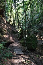
Southwest Albrand region | The narrow gorge has some good outcrops in the Upper Burgsandstein. The Deutsche Bahn had the trees in the gorge cut down to secure their electricity pylons. The geotope was also affected. | 15000 300 × 50 |
Type: Canyon, Rock Type: Sandstone |
Impact slope / river bed / stream profile | significant | Landscape protection area | |
| Gorge Schnittlinger Loch ENE from Fünfbronn |
 |
576R002 |
Gap position |
Southwest Albrand region | The approx. 50 m deep gorge begins in the west with a narrow gorge. It opens up the Upper Burgsandstein, and sediment structures are also clearly visible. | 250 50 × 5 |
Type: Gorge, Gorge, Rock Type: Sandstone |
Impact slope / river bed / stream profile | precious | Natural monument, landscape protection area | |
| Sinter terraces in Heinrichsgraben SE von Untermässing |
 |
576R003 |
Greding position |
Southern Franconian Alb | A lime-rich spring rises in Heinrichsgraben at the Malm lower limit, which feeds the small stream in the ditch. Due to the high lime content, tuff precipitates in small mossy cascades over a length of approx. 100 m. | 15000 300 × 50 |
Type: sintered terraces, stratified spring type: limestone, tufa |
Impact slope / river bed / stream profile | precious | Landscape component, landscape protection area, FFH area | |
| Druid stone NE from Untersteinbach |
 |
576R004 |
Georgensgmünd position |
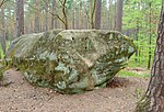
Sandstone Keuper Region | The large rock, weathered on all sides, lies on a wooded knoll. | 10 5 × 2 |
Type: Ridge Type: Sandstone |
Rock slope / cliff | significant | Landscape protection area |
See also
- List of nature reserves in the district of Roth
- List of landscape protection areas in the district of Roth
- List of protected landscape components in the district of Roth
- List of FFH areas in the district of Roth
Individual evidence
- ↑ Data source: Bavarian State Office for the Environment, www.lfu.bayern.de, Geotoprecherche (accessed on September 16, 2017)
Web links
Commons : Geotopes in the district of Roth - collection of images, videos and audio files