
Kalchreuther Forest

The Kalchreuther Forest is a community-free area in the Central Franconian district of Erlangen-Höchstadt .
The 6.10 km² state forest is the part of the Sebalder Reichswald west of Kalchreuth . The Stephansquelle, which feeds the Teufelsgraben, is located in it.
Geotopes
There are two geotopes designated by the Bavarian State Office for the Environment in the Kalchreuther Forest :
- Teufelsbadstube gorge southwest of Kalchreuth (572R001)
- Gründlach east of Heroldsberg (572R002)
See also
photos

Geotop Teufelsbadstube with rock cellar

Stettenberger Gorge
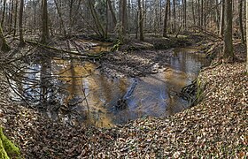
Geotope, meander of the Gründlach

The red torture


Individual evidence
- ↑ Area information at www.destatis.de, as of December 31, 2018 , accessed on August 1, 2020.
- ↑ OpenStreetMap: Kalchreuther Forst (accessed on January 8, 2015)
Web links
- Unregulated area of Kalchreuther Forst in OpenStreetMap (accessed on August 19, 2017)
Coordinates: 49 ° 32 ′ 0 ″ N , 11 ° 6 ′ 56 ″ E

Adelsdorf | Aurachtal | Baiersdorf | Bubenreuth | Buckenhof | Eckental | Gremsdorf | Großenseebach | Hemhofen | Heroldsberg | Herzogenaurach | Hessdorf | Höchstadt an der Aisch | Kalchreuth | Lonnerstadt | Marloffstein | Möhrendorf | Mulhouse | Oberreichenbach | Röttenbach | Savings Village | Uttenreuth | Vestenbergsgreuth | Wachenroth | Weisendorf
Unregulated areas in the district of Erlangen-Höchstadt
Birkach |
Buckenhofer Forest |
Dormitzer Forest |
Erlenstegen Forest |
Forest Tennenlohe |
Geschaidt |
Kalchreuther Forest |
Kraftshofer Forest |
Mark |
Neunhofer Forest