
Aurach Valley
| coat of arms | Germany map | |
|---|---|---|

|
Coordinates: 49 ° 34 ' N , 10 ° 49' E |
|
| Basic data | ||
| State : | Bavaria | |
| Administrative region : | Middle Franconia | |
| County : | Erlangen-Höchstadt | |
| Management Community : | Aurach Valley | |
| Height : | 344 m above sea level NHN | |
| Area : | 18.4 km 2 | |
| Residents: | 3050 (Dec. 31, 2019) | |
| Population density : | 166 inhabitants per km 2 | |
| Postal code : | 91086 | |
| Area code : | 09132 | |
| License plate : | ERH, HÖS | |
| Community key : | 09 5 72 114 | |
| Community structure: | 9 parts of the community | |
| Address of the municipal administration: |
Lange Straße 2 91086 Aurachtal |
|
| Website : | ||
| First Mayor : | Klaus Schumann (ÜWB) | |
| Location of the Aurachtal community in the Erlangen-Höchstadt district | ||
  |
||

Aurachtal is a municipality and a place in the Central Franconian district of Erlangen-Höchstadt and the seat of the Aurachtal administrative community . It was created during the municipal reform by amalgamating several places.
geography
location
The community is located in the valley of the Middle Aurach, west of Herzogenaurach .
Neighboring communities
Neighboring communities are starting clockwise in the north Weisendorf , Herzogenaurach , Emskirchen and Oberreichenbach .
Parish parts
There are nine officially named districts :
history
Community merger
The municipality Aurachtal was (partially) formed on January 1, 1972 from the formerly independent municipalities Falkendorf, Münchaurach and Unterreichenbach and has adopted the name Aurachtal. On May 1, 1978 Neundorf was added. At the same time, an area ( Dondörflein , Eckenmühle ) with around 50 inhabitants at that time was ceded to the city of Herzogenaurach.
Early history
The Benedictine monastery Münchaurach was consecrated in 1128 by Bishop Otto von Bamberg (1102 to 1139) and abolished in 1528 by the Margraves of Brandenburg-Bayreuth . During the Thirty Years War , Münchaurach, like other places in the region, was attacked by a raiding band of robbers in November 1631. The whole of today's municipality was in the area of the Münchaurach Office of the Principality of Bayreuth, which became Prussian in 1792, and from 1500 also in the Franconian Empire . In the Peace of Tilsit in 1807 it fell with the principality to France and in 1810 it became part of the Kingdom of Bavaria .
politics
Municipal council
The municipal council has 16 members (14 members until 2020) plus the first mayor.
| ÜWB (non-partisan electoral bloc Aurachtal) | CSU (Christian Social Union) | WGA (Aurachtal Voting Association) | total | |
| 2020 | 10 | 4th | 2 | 16 seats |
| 2014 | 7th | 4th | 3 | 14 seats |
(Status: local election on March 15, 2020 )
coat of arms
The description of the coat of arms reads: Above the corrugated shield footed in silver and black (representing the river Aurach) in green under a silver falcon head (as a symbol for the municipality of Falkendorf), two diagonally crossed golden keys.
The coat of arms was designed by Karl Haas in 1983.
Community partnerships
-
 A community partnership has existed with Reichenfels in Carinthia since 1975 .
Culture and sights

The former monastery complex in Münchaurach , which was built between 1123 and 1139 as a Romanesque basilica , is worth seeing .
Personalities
- Hiltegund von Münchaurach , local saint from the 12th century
- Johann Jakob Palm (1750–1826), German bookseller who died in Münchaurach
- Georg Ludwig Lehnes (1799–1849), German archive clerk born in Neundorf and early homeland researcher
- Michael Kreß (1843–1929), a Franconian farmer, mayor and folk poet born in Falkendorf
- Emil Iwanow (* 1970), Bulgarian archaeologist involved in researching the history of the Münchaurach Monastery
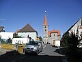
View from the west of Münchaurach with the monastery church St. Peter and Paul

Building of the municipal administration Aurachtal in Langen Straße 2

Half-timbered house with a half-hipped roof (in monastery 10) in the municipality of Aurachtal

Small hipped roof house at Mühlberg 3 in Münchaurach

Rectory in a former monastery wing in Münchaurach (Mühlberg 1)
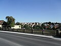
View over the Aurach valley from the town hall in Münchaurach

Former monastery church

View into the former cloister courtyard with the pointed helmet of the evangelical parish church Münchaurach in the left background


literature
- Franz Krug (ed.): The district of Erlangen-Höchstadt . Publishing house for authorities a. Wirtschaft, Hof (Saale) 1979, ISBN 3-921603-00-5 , p. 83-86 .
- Wolf-Armin von Reitzenstein : Lexicon of Franconian place names. Origin and meaning . Upper Franconia, Middle Franconia, Lower Franconia. CH Beck, Munich 2009, ISBN 978-3-406-59131-0 , p. 29 .
Web links
- Homepage
- Aurachtal in the Topographia Franconiae of the University of Würzburg , accessed on September 28, 2019.
- Entry on the coat of arms of Aurachtal in the database of the House of Bavarian History
Individual evidence
- ↑ "Data 2" sheet, Statistical Report A1200C 202041 Population of the municipalities, districts and administrative districts 1st quarter 2020 (population based on the 2011 census) ( help ).
- ^ Municipality of Aurachtal: Mayor and councilors. Retrieved May 19, 2020 .
- ^ Municipality of Aurachtal in the local database of the Bavarian State Library Online . Bavarian State Library, accessed on September 28, 2019.
- ^ Wilhelm Volkert (ed.): Handbook of Bavarian offices, communities and courts 1799–1980 . CH Beck, Munich 1983, ISBN 3-406-09669-7 , p. 484 .
- ^ Federal Statistical Office (ed.): Historical municipality directory for the Federal Republic of Germany. Name, border and key number changes in municipalities, counties and administrative districts from May 27, 1970 to December 31, 1982 . W. Kohlhammer, Stuttgart / Mainz 1983, ISBN 3-17-003263-1 , p. 711 .
- ^ Max Döllner : History of the development of the city of Neustadt an der Aisch up to 1933. Ph. C. W. Schmidt, Neustadt a. d. Aisch 1950; New edition ibid 1978, ISBN 3-87707-013-2 , p. 237.
- ↑ [1]
- ↑ http://www.aurachtal.de/geschichte.html

Adelsdorf | Aurachtal | Baiersdorf | Bubenreuth | Buckenhof | Eckental | Gremsdorf | Großenseebach | Hemhofen | Heroldsberg | Herzogenaurach | Hessdorf | Höchstadt an der Aisch | Kalchreuth | Lonnerstadt | Marloffstein | Möhrendorf | Mulhouse | Oberreichenbach | Röttenbach | Savings Village | Uttenreuth | Vestenbergsgreuth | Wachenroth | Weisendorf
Unregulated areas in the district of Erlangen-Höchstadt
Birkach |
Buckenhofer Forest |
Dormitzer Forest |
Erlenstegen Forest |
Forest Tennenlohe |
Geschaidt |
Kalchreuther Forest |
Kraftshofer Forest |
Mark |
Neunhofer Forest