
Middle Aurach
|
Middle Aurach Aurach |
||
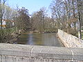
 The Aurach between Niederndorf (Herzogenaurach) and Neuses (Erlangen). Look upriver roughly to the west. |
||
| Data | ||
| Water code | DE : 24236 | |
| location |
Swiss franc amount
|
|
| River system | Rhine | |
| Drain over | Regnitz → Main → Rhine → North Sea | |
| origin |
designated “Aurachquelle”: approx. 1.1 km west of Markt Erlbach - Klausaurach opposite ponds on the lower Leitengraben 49 ° 30 '34 " N , 10 ° 34' 53" O |
|
| Source height | approx. 433 m above sea level NHN | |
| muzzle | A little below Frauenaurach in the Regnitz coordinates: 49 ° 34 ′ 16 ″ N , 10 ° 59 ′ 0 ″ E 49 ° 34 ′ 16 ″ N , 10 ° 59 ′ 0 ″ E |
|
| Mouth height | approx. 274 m above sea level NHN | |
| Height difference | approx. 159 m | |
| Bottom slope | approx. 4 ‰ | |
| length | 39.3 km | |
| Catchment area | 164.79 km² | |
| Discharge at the gauge Emskirchen A Eo : 41.59 km² Location: 24.4 km above the mouth |
NNQ MNQ 1968–2012 MQ 1968–2012 Mq 1968–2012 MHQ 1968–2012 HHQ (01/26/1995) |
18 l / s 86 l / s 252 l / s 6.1 l / (s km²) 7.18 m³ / s 28.7 m³ / s |
| Discharge at the Frauenaurach A Eo gauge: 167.39 km² Location: 1.79 km above the mouth |
NNQ MNQ 1966–2012 MQ 1966–2012 Mq 1966–2012 MHQ 1966–2012 HHQ (02/22/1970) |
89 l / s 297 l / s 882 l / s 5.3 l / (s km²) 14.7 m³ / s 50.6 m³ / s |
The Middle Aurach , sometimes just called Aurach , is a 39 km long left tributary of the Regnitz in Middle Franconia .
Surname
The name Aurach means something like "brook where aurochs graze" (from ahd. Ūr 'aurochs' and aha , 'flowing water').
To distinguish it from other rivers called Aurach , in particular another Aurach , which also flows further downwards into the Regnitz from the left and a third Aurach , which flows into the Regnitz main upper reaches Rednitz from the left , the second tributary of this name treated here is used in the main stream the Regnitz is usually referred to as the Middle Aurach .
geography
course
The two source brooks of the Aurach arise on the Frankenhöhe in the southern Hohenecker Forest , just in the area of Markt Ipsheim in the Neustadt an der Aisch-Bad Windsheim district . The higher of the two origins is about 433 m above sea level. NHN . After less than a kilometer approximately eastward, the two brooks unite shortly after the municipality border to Markt Erlbach in the forest, which the Mittlere Aurach then soon leaves near the Erlbach parish village of Linden . It now swings under the town of Linden on the right ridge of the slope to a long-maintained, on a larger scale, approximately east-northeast flow direction. Even before the first small village of Klausaurach am Ufer, it takes up the half-length Leitenbach from the forest of its origins, near the mouth of which an Aurach spring is shown on maps; here some spring catchments collect drinking water from the sub-catchment area of the Leitenbach.
In the municipality of Markt Erlbach, it then crosses or passes through the villages and hamlets of Klausaurach, Mettelaurach, Morbach, Losaurach, Mosbach and Kotzenaurach, each about a kilometer apart, where the still less than 150 meters wide valley floor is now about 60 meters below the right valley height. After a last mill settlement in Erlbach, she moved to the Markt Emskirchen area . After another small mill town, it runs between Neuschauerberg on the left bank and the Altschauerberg , a little further away in a short right side valley , and then crosses the eponymous main town of the community itself after a water level house.
Two more old mills are located downhill on a branched mill stream on the left edge of the valley floor into which the Floresbach flows, the first of the longer left tributaries with an extensive chain of ponds on the upper reaches. Across from Gunzendorf, the community of Wilhelmsdorf briefly borders the left bank; The Albach runs through the nearby main town and then takes up the aforementioned Mühlbach before it flows into the Aurach. The Albach also drains a large number of ponds, mostly on the upper reaches, called Oberalbacher Weiher there. The valley floor then becomes somewhat wider and after two smaller settlement areas the last village of Oberniederndorf von Emskirchen follows. Then the municipality of Aurachtal begins behind the border with the Erlangen-Höchstadt district . The river Neundorf and the parish village of Münchaurach runs through it and then reaches its northernmost point at Falkendorf, where the Reichenbach flows into, its longest tributary, at the upper reaches of which the pond farm fills a flat band of side troughs even beyond the valley floor.
The Aurach now flows almost eastwards in an arc that extends only slightly to the south to its mouth and, after passing two last mill places at their corner mill, crosses into the city of Herzogenaurach . At the mill, the slightly shorter Welkenbach flows from the left to the even larger drained pond area on the upper reaches. The only longer right tributary, Schleifmühlbach , now approaches through a gap in the settlement between the town itself , it flows between the main village and the Niederndorf , which is built together with Herzogenaurach and stands on the opposite left slope.
The next town, Neuses, on the left-hand side of the river, already belongs to the city of Erlangen , where the Altaurach tributary branches off to the right , with which the Mittlere Aurach flows under the valley bridge of the B 3 . On the back curve of the lower course, which runs a little further to the north, the river crosses the Frauenaurach district , where its two branches reunite. Further down, it is led on the eastern edge of the settlement from Frauenaurach to the Regnitz valley under the Main-Danube Canal , which accompanies it on the left. Through the almost one kilometer wide Regnitzwiesen , the Middle Aurach reaches the west bank of its receiving water and flows there opposite Erlangen- Bruck at about 274 m above sea level. NHN from the left into the Regnitz .
The Middle Aurach runs its approx. 39.3 km long path from the origin of the higher right source brook to the mouth, which is around 159 meters lower, with a mean bed gradient of around 4 ‰.
Catchment area
The Herzogenaurach has a 164.8 km² large catchment area stretching from its western point in the still market in the form of a generally thin crescent Ipsheim belonging Oberdorfer community forest with a slight bend to the left about 33 km wide east-northeast to the mouth of the Regnitz opposite Erlangen - Bruck extends; across it, at its widest point, it measures only a little more than 8 km. From a natural point of view, its uppermost part belongs to the lower area of the northern Franconian height of the Franconian height , with the vast majority of the remainder to the Middle Franconian Basin , of which the lower area of the Feuchtwanger Basin wedges narrowly from the south towards the upper reaches, while the vast majority of the area is in the lower area of the Nuremberg Basin with sand plates lies.
The catchment area of the Aisch borders on the northwestern watershed, which also flows significantly further downwards into the Rednitz, and on the north that of the Seebach , which already flows into the Main-Danube Canal accompanying it on the left at Möhrendorf . In the south, the Zenn collects the runoff beyond the right watershed of the catchment area over almost its entire length .
The highest point is on the western tip in the Oberndorfer community forest near the district road NEA 25 from Ipsheim -Eichelberg to the state road St 2252 in the area of the Totermannsäule at a little over 445 m above sea level. NHN .
The catchment area has a high proportion of forest, which partly takes up large closed areas on the northwestern and northern watershed, part of which is also on the slopes of the Aurach valley and on the nearby plateau. The open corridor is mostly plowed. On the northern border to the Seebach catchment area, pond management is practiced, ponds are laid out from Herzogenaurach- Kaltneuses, closer from Emskirchen- Tanzhaid to Herzogenaurach-Hammerbach in the east, close to the upper reaches of the left tributaries.
Tributaries
Hierarchical list of tributaries and ![]() lakes from source to mouth. With water length, lake area, catchment area and altitude. Other sources for the information are noted. Selection.
lakes from source to mouth. With water length, lake area, catchment area and altitude. Other sources for the information are noted. Selection.
Origin of the Middle Aurach at about 433 m above sea level. NHN approx. 2.5 km west of Markt Erlbach- Linden in the Oberndorfer community forest . The stream initially flows east, immediately after exiting the forest, it turns to a not very directional north-east course.
- Leitengraben, from the left and west-northwest to about 388 m above sea level. NHN in the middle of a group of ponds on the edge of the forest north of Linden, approx. 1.5 km and approx. 1.9 km².
Shortly before the mouth of the Leitengraben, the groundwater wells of the so-called Aurach spring are to the left of the course . - Fischstubengraben, from the right and southwest to about 379 m above sea level. NHN right after Klausaurach, approx. 1.2 km and approx. 1.1 km².
- Hardgraben, from the left and northwest to about 375 m above sea level. NHN between Klausaurach and Mettelaurach, approx. 1.7 km and approx. 1.7 km².
- Leitenbächlein, from the right and west-northwest to about 390 m above sea level. NHN at the top of the forest between Rimbach in the north and Klausaurach in the south, approx. 0.9 km and approx. 0.9 km².
- Morbach , from the left and west-northwest to about 362 m above sea level. NHN on the outskirts of Morbach, approx. 2.1 km and approx. 2.3 km².
-
Mosbach , from the left and northwest to about 351 m above sea level. NHN in Mosbach, approx. 3.4 km and approx. 4.3 km².
- Schellbach, from the right and west-southwest to about 377 m above sea level. NHN on the eastern edge of the village Schellert von Neustadt an der Aisch , approx. 1.4 km and approx. 1.2 km². * Neidbächlein, from the right and south-east to about 331 m above sea level. NHN at the end of the Finkenmühle site, approx. 1.8 km and approx. 2.7 km².
- Küferbächlein, from the left and northwest about 0.2 km after the canal exit, about 1.9 km and about 1.6 km².
- Flugsbach, from the left and west-northwest at 323 m above sea level. NHN about 0.3 km in front of the gauge before entering the village in Emskirchen itself, about 4.6 km and about 5.7 km².
- Stubengraben, from the right and east-southeast to about 323 m above sea level. NHN almost a hundred meters after the previous inflow, approx. 1.2 km and approx. 1.5 km².
- (Departure of the Mühlbach to Albach), to the left to about 321 m above sea level. NHN shortly before the end of the village Emskirchens. It flows into the Albach just before it flows into it, see below.
-
Albach , from the left and northwest at 315 m above sea level. NHN near Wilhelmsdorf -Stadelhof, 3.8 km and 18.4 km².
- (More important Albach upper course), from the left and north-west to about 338 m above sea level. NHN on the southern edge of Oberalbach, approx. 2.4 km and approx. 3.4 km².
The numerous Oberalbach ponds lie on it and its inlets .- (Stream through the Moosweiher ), from the right and west to about 344 m above sea level. NHN at the exit of the forest north of Oberalbach, approx. 1.1 km and approx. 0.6 km².
 By flows to around 360 350 m above sea level. NHN half a dozen moss ponds on the edge of the forest, together approx. 1.6 ha.
- (Stream through the Moosweiher ), from the right and west to about 344 m above sea level. NHN at the exit of the forest north of Oberalbach, approx. 1.1 km and approx. 0.6 km².
- (Inflow of the Mühlbach from the Mittlerer Aurach), from the right just before the mouth
- Floresbach, from the left and northwest to about 319 m above sea level. NHN after the Sixtmühle from Emskirchen, approx. 5.4 km with the section sequence Brunner Teiche → Mühlbach → Floresbach and approx. 1.6 km on the name run from the Weihermühle from Emskirchen and approx. 9.2 km². Flows at the Weihermühle at about 332 m above sea level. NHN from Mühlbach and Moorgraben together.
- Mühlbach, left and north-western main course upper course of the Floresbach, approx. 3.7 km together with the upper course through the Brunner ponds and approx. 1.3 km on the course of the name from the beginning of Brunn and approx. 5.4 km². The upper course is inconsistent at about 379 m above sea level. NHN northeast of the Emskirchen hamlet Kaltenneuses near the edge of the glass forest .
- [...]
- Moorgraben, right and west-north-western side branch upper course of the Floresbach, approx. 2.1 km with its upper course Marbach (approx. 1.8 km²) and approx. 0.6 km on the name course as well as approx. 2.3 km². The upper course flows from a pond in the well field at about 367 m above sea level. NHN a little west of the district road NEA 22 from the federal road 8 to Brunn.
- (Stream through the ox ponds ), from the right and west to 345 m above sea level. NHN still on the Marbach section southwest of Brunn at the edge of the forest, approx. 1.3 km and approx. 1.0 km². Arises at about 373 m above sea level. NHN east of the Emskirchener Einöde Wulkersdorf next to the Würzburg – Nuremberg railway line .
- Fed and drained to about 357- 351 m above sea level. NHN in the forest half a dozen ox ponds on the middle reaches, together approx. 1.1 ha.
- (Stream through the ox ponds ), from the right and west to 345 m above sea level. NHN still on the Marbach section southwest of Brunn at the edge of the forest, approx. 1.3 km and approx. 1.0 km². Arises at about 373 m above sea level. NHN east of the Emskirchener Einöde Wulkersdorf next to the Würzburg – Nuremberg railway line .
- Mühlbach, left and north-western main course upper course of the Floresbach, approx. 3.7 km together with the upper course through the Brunner ponds and approx. 1.3 km on the course of the name from the beginning of Brunn and approx. 5.4 km². The upper course is inconsistent at about 379 m above sea level. NHN northeast of the Emskirchen hamlet Kaltenneuses near the edge of the glass forest .
- Floresbach, from the left and northwest to about 319 m above sea level. NHN after the Sixtmühle from Emskirchen, approx. 5.4 km with the section sequence Brunner Teiche → Mühlbach → Floresbach and approx. 1.6 km on the name run from the Weihermühle from Emskirchen and approx. 9.2 km². Flows at the Weihermühle at about 332 m above sea level. NHN from Mühlbach and Moorgraben together.
- (More important Albach upper course), from the left and north-west to about 338 m above sea level. NHN on the southern edge of Oberalbach, approx. 2.4 km and approx. 3.4 km².
- Erlachbächlein, from the right opposite the Albach near Emskirchen-Gunzendorf, approx. 2.7 km and approx. 2.5 km².
- Griesbach, from the right at the Grieshof von Emskirchen
- Gründleinsbach, from the left before Emskirchen-Oberniederndorf
- Kressengraben, from the right to Oberniederndorf
- Käsergraben, from the left before Aurachtal- Neundorf
- Maidelsgraben, from the left in Münchaurach
- Reichenbach , from the left and west-northwest to about 301 m above sea level. NHN on the western edge of Aurachtal- Falkendorf, 8.1 km with upper course Erlesbach and another upper course and 13.8 km².
- Grüdlgraben, on the upper reaches of Stockweihergraben , from the right in Falkendorf
- Welkenbach , from the left and west-northwest to about 296 m above sea level. NHN near Herzogenaurach -Eckenmühle, 7.2 km and 16.1 km².
- Weihersbach, from the right in Herzogenaurach next to Ansbacher Straße
- Schleifmühlbach , from the right and west-southwest to about 290 m above sea level. NHN next to the bridge on Hauptendorfer Strasse from Herzogenaurach- Niederndorf to Hauptendorf , 7.2 km with the right upper course Krebsbach and 13.0 km².
- Eichholzbächlein, from the left on the outskirts of the town and settlement of Niederndorf towards Erlangen - Neuses
- (Departure of the Altaurach ), to the right at Neuses
- Öhrbach, from the right at the Herzogenaurach sewage treatment plant in the Altaurach
- (Return of the Altaurach ), from the right in Erlangen- Frauenaurach
- Crosses under the Main-Danube Canal on the eastern edge of Frauenaurach
Localities
Locations on the run with their affiliations. Only the names of the lowest nesting level denote neighboring settlements.
Neustadt an der Aisch-Bad Windsheim district
- Ipsheim market
- Forest without settlement on the run
-
Erlbach market
- Klausaurach (village, mainly on the left)
- Mettelaurach (village, mainly on the left)
- Morbach (hamlet, left slope)
- Losaurach (village, mainly on the left)
- Mosbach (village, mainly on the left)
- Mosbacher Mühle (settlement area, left)
- Kotzenaurach (village, mainly on the left)
- Wood mill (wasteland, left)
- Emskirchen market
- Finkenmühle (wasteland)
- Neuschauerberg (village, left slope) with Schauerberger Mühle (left)
- Emskirchen (main town)
- Sixtmühle (hamlet, left foot of the slope)
- Snow mill (wasteland, left foot of the slope)
- Gunzendorf (village, right foot of the slope)
- Municipality Wilhelmsdorf
- Stadelhof (wasteland, left edge of the valley level)
- Emskirchen market
- Leitsmühle (wasteland, right)
- Grieshof (hamlet, right foot of the slope)
- Oberniederndorf (village, left foot of the slope)
- Aurachtal municipality
- Neundorf (village)
- Münchaurach (parish village)
- Falkendorf (village, mostly on the left)
- Hessenmühle (desert, still opposite Falkendorf on the right)
- Lenzenmühle (wasteland, right)
- City of Herzogenaurach
- Eckenmühle (wasteland, left)
- Herzogenaurach (main town)
- Eichelmühle (place, on the left in building continuity to Herzogenaurach)
- Niederndorf (parish village, left slope)
- Heinrichsmühle (wasteland, left below Niederndorf)
- Hauptendorf (village, right slope opposite Niederndorf)
District-free city of Erlangen
- Neuses (left)
- Frauenaurach
freetime and recreation
A continuous cycle path runs through the Aurach Valley from Herzogenaurach to Erlangen .
Individual evidence
BayernAtlas ("BA")
Official online waterway map with a suitable section and the layers used here: Course and catchment area of the Middle Aurach
General introduction without default settings and layers: BayernAtlas of the Bavarian State Government ( notes )
- ↑ a b c Height requested on the background layer Official map (right click).
- ↑ Length measured on the official map background layer .
- ↑ Catchment area measured on the official map background layer .
- ↑ a b Height according to the blue lettering on the official map background layer .
Water directory Bavaria ("GV")
- ↑ a b c d e Length according to: Directory of brook and river areas in Bavaria - Main river area, page 49 of the Bavarian State Office for the Environment, as of 2016 (PDF; 3.3 MB)
- ↑ a b c d catchment area according to: Directory of stream and river areas in Bavaria - Main river area, page 49 of the Bavarian State Office for the Environment, as of 2016 (PDF; 3.3 MB)
Other evidence and comments
- ↑ a b Flood news service of the Bavarian State Office for the Environment ( information ) (queried 01.01.2016)
- ↑ Flood news service of the Bavarian State Office for the Environment ( information ) (queried 01.01.2016)
- ↑ Herbert Erich Baumert: The coats of arms of the cities, markets and communities of Upper Austria, 6th supplement (1980–1983) . In: Oberösterreichische Heimatblätter, Heft 3, 1984, p. 222, online (PDF; 8.2 MB) in the forum OoeGeschichte.at
- ↑ According to the flood news service of the Bavarian State Office for the Environment ( information ), however, the catchment area of the Middle Aurach already covers 167.4 km² 1.8 km before the mouth. See the master data for the Frauenaurach gauge.
- ^ Karl Albert Habbe: The natural space units on sheet 153 Bamberg - A bundle of problems and a proposal for a structure. In: Announcements of the Franconian Geographical Society 2003/2004, pp. 55–102 ( PDF download )
literature
- Official topographic map (ATK) 1: 25,000. in the cut sheet the No. G07 Markt Erlbach, No. F08 Herzogenaurach, No. G08 Langenzenn and No. F09 Erlangen of the State Office for Digitization, Broadband and Surveying Bavaria
- Johann Kaspar Bundschuh : Aurach . In: Geographical Statistical-Topographical Lexicon of Franconia . tape 1 : A-egg . Verlag der Stettinische Buchhandlung, Ulm 1799, DNB 790364298 , OCLC 833753073 , Sp. 206 ( digitized version ).
Web links
- Map of the course and catchment area of the Middle Aurach on: BayernAtlas of the Bavarian State Government ( information )
- Map of the catchment area in the basic data for flowing waters of Bavaria, Bavarian State Office for the Environment
gallery
The Aurach in Herzogenaurach
The Aurach near Neuses (Erlangen)

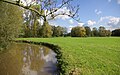
The Aurach valley west of Frauenaurach

Overgrown Aurach just before it flows into the Regnitz in the Erlangen district of Bruck


