
Swiss franc amount
| Swiss franc amount | ||
|---|---|---|
| Highest peak | Hornberg ( 554 m above sea level ) | |
| location | Bavaria , Baden-Wuerttemberg | |
| part of | Franconian Keuper-Lias-Landes / Keuperberglandes | |
| Classification according to | Handbook of the natural spatial structure of Germany | |
|
||
| Coordinates | 49 ° 23 ' N , 10 ° 25' E | |
| rock | Keuper | |
| surface | 653.3 km² | |

The Frankenhöhe is one to 554 m above sea level. NN high ridges in Bavaria and Baden-Württemberg in southern Germany .
Location and limits
The Frankenhöhe lies in the west of the Franconia region on both sides of the border from Bavaria in the east (districts Neustadt adAisch-Bad Windsheim and Ansbach ) to Baden-Württemberg in the west ( Schwäbisch Hall , Schnipsel in the Ostalb district ).
The greater part is in Bavaria, the significantly smaller part in Baden-Württemberg in the southwest. It encompasses the southern part of the so-called Crailsheimer Hardt , which lies in an eastward bulging arch around the city of Crailsheim from the eaves rise of the A 6 northeast of Satteldorf in the north to the Jagst near Stimpfach in the south, where it merges into the Virngrund . Then there is the small basin of the upper Zwergwörnitz near Kreßberg to the southeast .
The Franconia, whose plateau partly the character of a hilly area which is located south of the considerably lower Steigerwald , east of the Hohenlohe plain and northeast of the Ellwanger Berge and not quite halfway distance from Nuremberg to Stuttgart east of Rothenburg .
The Frankenhöhe Nature Park covers most of the Frankenhöhe, but not its south; conversely, it extends to the west at Rothenburg and to the north of Feuchtwangen on the Sulzach well beyond the ridge.
Natural structure
The Swiss franc amount naturally represents a main unit (three-digit) and is divided into sub-units (decimal places ) as follows; The following letters and names in quotation marks for the actual mountain ranges do not come from the natural spatial structure and serve for better orientation:
-
(to the south-west German step country )
-
(to 11 Franconian Keuper-Lias-Land )
-
114 Frankenhöhe (653.3 km²)
-
114.0 Southern Franconian Height
- 114.00 Crailsheimer Hardt in the broader sense , from north (east) to south (west):
- 114.00a " Schillingsfürst - Wettringer Hardt"
- 114.00b " Schnelldorfer Hardt" (south of the Wettringen– Arzbach road )
- 114.00c "Kesselberg-Kreßberg-ridge" (southeast of the Schnelldorf– Ellrichshausen road , facing southeast)
- 114.00d Crailsheimer Hardt in the narrower sense (as shown on the maps; with calm as a transverse ridge moving from north to southeast)
- 114.01 Zwergwörnitz basin
- 114.02 Wörnitz basin
- 114.03 Sulzachrand Heights (west and north of the Sulzach )
- 114.03a Northeastern Sulzachrand Heights (left of the Sulzach and northeast of a fault between Schillingsfürst and Kloster Sulz )
- 114.03b Western Sulzachrand Heights (north-south facing)
- 114.00 Crailsheimer Hardt in the broader sense , from north (east) to south (west):
-
114.1 Average Swiss franc
- 114.10 Rothenburger Hardt in the broader sense , from north to south:
- 114.10a " Burgbernheimer Hardt" (north of the Nordenberg - Windelsbach line )
- 114.10b Rothenburger Hardt in the narrower sense
- 114.11 Erlbacher pool (the outlet of the Altmühlberg ; Erlbach and Erlacher Bach, the upper reaches of Great Herzogenaurach Bach )
- 114.12 Gastenfeld (s) he basin (on the Hagenbach , well above the confluence with the Altmühl)
- 114.13 Colmberg Basin (on the uppermost upper reaches of the Altmühl )
- 114.14 Bucher Höhe (on both sides of the Altmühl, below 114.13, but above 114.11)
- 114.10 Rothenburger Hardt in the broader sense , from north to south:
-
114.2 Northern franc amount
- 114.20 Hohenecker Heights
- 114.21 Petersberg - Virnsberg - Heights
- 114.22 Colmberg heights
- 114.22a Northern Colmberghöhen (north of the road Oberhegenau - Grafe book )
- 114.22b Middle Colmberg Heights
- 114.22c Southern Colmberg Heights (south of the Colmberg– Zailach road )
- 114.23 Upper Zenn valley
- 114.24 Upper Rezat valley
- 114.25 Lehrberger valley landscape (Franconian Rezat between 114.24 and Ansbach )
-
114.0 Southern Franconian Height
-
114 Frankenhöhe (653.3 km²)
-
(to 11 Franconian Keuper-Lias-Land )
The core ridges of the Northeast part are (114.2), from north to south from about Neustadt to Talung the Zenn reaching Hohenecker heights (114.20) which Petersberg Virnsberg heights (114.21) between Zenn and Fränkischer Rezat and Colmberghöhen (114.22) on the watershed between the Rezat above Ansbach and the Altmühl above Leutershausen and thus on the main European watershed .
The watershed runs from here towards the northwest, where it meets the extreme north of the Rothenburger Hardt in the broader sense (114.10), core ridge of the middle part (114.1). Along with the watershed, this ridge only runs briefly to the northwest and then changes its direction to the south-southeast, where it flanks the eponymous town of Rothenburg ob der Tauber to the east. Between the south of the Colmberg heights and the Rothenburger Hardt, the Bucher Höhe (114.14) pushes itself on both sides of the Altmühl, which gradually flattens out towards the Colmberg heights , but breaks off on a steep flank in the west immediately east of the Rothenburger Hardt. Geologically, the border to the Colmberg heights is a Hercynian, that is, a fault running to the southeast .
At Schillingsfürst , the Rothenburger Hardt on the main watershed is replaced by the Crailsheimer Hardt in the broader sense (114.00). This is offset slightly to the southeast compared to the Rothenburg and has in the northern part roughly the structure of a ridge, which repeatedly changes its direction at right angles from southwest to southeast. Some side ridges branch off to the southeast from the main ridge following the watershed; the longest follows the state border between Bavaria and Baden-Württemberg ( "Kesselberg-Kreßberg- ridge"). In the southern part (Crailsheimer Hardt in the narrower sense ) the city of Crailsheim is finally framed to the east and south-east until the ridge flattens towards the Jagst . To the east, almost parallel to the Crailsheimer Hardt, but directed quite regularly to the south, the Sulzachrand Heights (114.03) run between the Wörnitz in the west and the Sulzach in the east, extending to the southwest of Feuchtwangens .
geology
From a geological point of view, the Frankenhöhe belongs to the Keuper Hills , which stretches through the Franconian Keuper-Lias-Land as well as the Swabian Keuper-Lias-Land to the southwest and is bordered by the Lias Lands. Its northern continuation is the up to 499 m high Steigerwald , which continues beyond the Main in the Haßberge (up to 512 m). Its southerly continuation, the Swabian-Franconian Forest Mountains , extend from the interface mainly to the west and with up to 586 meters reach a little more absolute height.
On the west side, the Frankenhöhe has a distinctive steep drop (also known as the eaves ) and tapers flat to the east. The dominant rock type is ( Keuper ) sandstone, the soils are comparatively sandy. Former quarries like the one in Obergailnau near Wettringen testify to the earlier importance of this stone for house building in the region.
traffic
The Frankenhöhe is crossed by the A 6 and A 7 motorways , which meet at the Feuchtwangen / Crailsheim motorway junction in the Wörnitz valley basin. The well-known climbing section of the A 6 after the Crailsheim junction, still in the upstream Hohenlohe plain up to the west eaves, clearly shows the morphological limit. A rest area on the A 6 about 10 km east of the cross is named after the landscape.
flora
In the west, the Frankenhöhe is characterized by mixed forests with oak, beech and fir trees. Pure spruce and pine stands increase towards the east . In addition, there are also primitive forms of management such as B. the hut forests , orchards and juniper heaths that were once grazed with cattle . The latter feature the poor grassland , which is important due to its biodiversity , such as in the Wacholderberg-Geigerswasen nature reserve east of Crailsheim. Viticulture is practiced on the eaves of the northern Frankenhöhe.
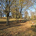
Hutewald east of Crailsheim

Orchard meadow on Petersberg near Marktbergel

Viticulture on the northern Frankenhöhe near Ipsheim . View of Hoheneck Castle.


mountains
The following peaks and mountains belong to the main unit Frankenhöhe (numbers on 114) or are related to it (heights above sea level):
| Surname | height | Location to place | place | Location to natural space | Natural space | No. | River basins |
|---|---|---|---|---|---|---|---|
| Hornberg | 554.0 | north | ASS Schnelldorf | West eaves | "Schnelldorfer Hardt" | 114.00b | |
| Birkenberg | 547.2 | west | ASS Schnelldorf | West eaves | "Schnelldorfer Hardt" | 114.00b | Ampfrach |
| Grüber tendrils | 545.8 | southwest | Wettringen - Grüb | West eaves | "Schnelldorfer Hardt" | 114.00b | Waldhausener Mühlbach |
| Wölfleinsberg | 544.8 | northeast | Wettringen - Obergailnau | West eaves | "Schillingsfürst-Wettringer Hardt" | 114.00a | |
| Gailnauer Berg | 543.0 | southern | Wettringen - Obergailnau | West eaves | "Schillingsfürst-Wettringer Hardt" | 114.00a | |
| Hill northeast of the Galgenberg s | 542.4 | southern | Schillingsfürst | extreme north | Sulzachrand Heights (western) | 114.03b | Wörnitz / Sulzach |
| Hill south of the A 7 | 539.9 | northwest | Schnelldorf | West eaves | "Schnelldorfer Hardt" | 114.00b | Ampfrach |
| Kesselberg | 538 | southern | Schnelldorf | West eaves | "Kesselberg-Kreßberg-Ridge" | 114.00c | |
| Klosterberg | 537 | northeast | Dombühl Monastery Sulz | southeast | Sulzachrand Heights (northeastern) | 114.03a | Sulzach |
| Red mountain | 535.3 | southeast | Satteldorf- Ellrichshausen | West eaves | Crailsheimer Hardt i. e. S. | 114.00d | Dwarf Wörnitz |
| Simonsberg | 534.7 | west | Schnelldorf | West eaves | "Schnelldorfer Hardt" | 114.00b | Ampfrach |
| Kellerberg | 534.1 | east | Wörnitz | north | Sulzachrand Heights (western) | 114.03b | Wörnitz / Sulzach |
| Sandberg | 533.8 | east | Colmberg - Poppenbach | southwest | Colmberghöhen (northern) | 114.22a | Altmühl / Franconian Rezat |
| Schlossberg | 533.5 | northeast | Schnelldorf -Oberampfrach | "Schnelldorfer Hardt" | 114.00b | Wörnitz / Ampfrach | |
| Pechberg / Beegberg | 532.2 | northeast | Satteldorf -Beeghof | West eaves | "Kesselberg-Kreßberg-Ridge" | 114.00c | |
| Wühlberg | 530.7 | southeast | Diebach - Oberoestheim | West eaves | "Schillingsfürst-Wettringer Hardt" | 114.00a | |
| Eichelberg | 530.1 | southwest | Schillingsfürst | West eaves | "Schillingsfürst-Wettringer Hardt" | 114.00a | |
| Miner | 530.1 | east | Schnelldorf - Oberampfrach | "Schnelldorfer Hardt" | 114.00b | Wörnitz / Ampfrach | |
| Büttelberg | 530 | southern | Marktbergel | extreme south east | "Burgbernheimer Hardt" | 114.10a | |
| Vetschenberg | 529.2 | southern | Schillingsfürst | Sulzachrand Heights (western) | 114.03b | Wörnitz | |
| Quiet | 528.4 | in the north of | Kreßberg | Crailsheimer Hardt i. e. S. | 114.00d | Dwarf Wörnitz | |
| Ulrichshausener Mountain | 528.3 | southeast | Wörnitz - Ulrichshausen | Western edge | Sulzachrand Heights (western) | 114.03b | Wörnitz |
| Schulzenhöhe | 528.0 | east | Colmberg | Southwest edge | Colmberghöhen (middle) | 114.22b | Altmühl / Franconian Rezat |
| Kreßberg | 528 | northeast | Hohenkressberg Castle | "Kesselberg-Kreßberg-Ridge" | 114.00c | Zwergwörnitz / Wörnitz | |
| Muhlberg | 526.9 | east | Feuchtwangen - Ungetsheim | Sulzachrand Heights (western) | 114.03b | Wörnitz / Sulzach | |
| German Bühl | 526.5 | north | Lehrberg - Obersulzbach | south | Colmberghöhen (northern) | 114.22a | Altmühl / Franconian Rezat |
| Nameless hill on the Kohlplatte | 525 | north | Schillingsfürst- Faulenberg | east south | Rothenburger Hardt i. e. S. | 114.10b | |
| Schäfersberg | 523 | southern | Geslau- Aidenau | East, opposite the Ameisberg | Rothenburger Hardt i. e. S. | 114.10b | |
| horn | 522.8 | northeast | Leutershausen- Oberramstadt | Northwest | Colmberghöhen (southern) | 114.22c | Altmühl / Franconian Rezat |
| Straubenberg | 522.2 | southwest | Dombühl | Sulzachrand Heights (western) | 114.03b | Wörnitz / Sulzach | |
| Steinberg | 521.3 | southwest | Feuchtwangen- Oberransbach | south | Sulzachrand Heights (western) | 114.03b | |
| Burghartsleite | 521.2 | southern | Marktbergel | North eaves | "Burgbernheimer Hardt" | 114.10a | |
| Thierschingberg | 520.5 | west | Dombühl - Binsenweiler | East slope | Sulzachrand Heights (western) | 114.03b | Sulzach |
| Schlossberg | 519.7 | southeast | Feuchtwangen - Zischendorf | Western edge | Sulzachrand heights | 114.03b | Wörnitz |
| Klosterberg | 518.3 | north | Aurach- Vehlberg | extreme southeast | Sulzachrand Heights (northeastern) | 114.03a | Sulzach |
| Laubersberg | 517 | north | Diebach- Wolfsau | West eaves, south | Rothenburger Hardt i. e. S. | 114.10b | |
| Heuberg | 516.6 | southeast | Leutershausen- Oberramstadt | west | Colmberghöhen (southern) | 114.22c | Altmuehl |
| High level | 515.3 | northeast | Steinsfeld - Urphershofen | Northwest eaves | "Burgbernheimer Hardt" | 114.10a | |
| Deer bar | 514.3 | north | Windelsbach - Nordenberg | West eaves, extreme southwest | "Burgbernheimer Hardt" | 114.10a | |
| Upper ridge | 513.6 | southern | Traisdorf | West (seam) | Sulzachrand Heights (northeastern) | 114.03a | Erlbach / Hagenbach |
| Red mountain | 513.2 | southeast | between Leutershausen (W) and Ansbach (O) | extreme south | Colmberghöhen (southern) | 114.22c | Altmühl / Franconian Rezat |
| Nameless hill on the Diebach –Faulenberg road | 512 | west | Schillingsfürst- Faulenberg | West eaves; extreme south | Rothenburger Hardt i. e. S. | 114.10b | |
| Ameisberg | 510 | north | Book at the forest - Morlitz winds | extreme northwest | Bucher Höhe (western part) | 114.14 | Altmuehl |
| Felberg | 508.2 | southwest | Virnsberg | Petersberg-Virnsberg-Heights | 114.21 | Franconian Rezat (l) / Bibert | |
| Nameless hill in the Birkach | 507.7 | west | Virnsberg | Petersberg-Virnsberg-Heights | 114.21 | Franconian Rezat (l) | |
| Lower ridge | 507 | north | Schillingsfürst- Neureuth | Northeast | Sulzachrand Heights (northeastern) | 114.03a | Erlbach / Hagenbach |
| Nameless hill in the southern Vogelbachwald | 504.8 | west | Windelsbach- Linden | West eaves; north | Rothenburger Hardt i. e. S. | 114.10b | |
| Sandbuck | 504.3 | east | Feuchtwangen- Heiligenkreuz | south | Sulzachrand Heights (western) | 114.03b | |
| Petersberg | 504 | southeast | Marktbergel | Northwest eaves | Petersberg-Virnsberg-Heights | 114.21 | |
| Fichtenleiten | 503.8 | northwest | Lehrberg | southeast | Colmberghöhen (middle) | 114.22b | Franconian Rezat |
| Schwander mountain | 503.6 | west | Leutershausen - Schwand | East ridge | Sulzachrand Heights (northeastern) | 114.03a | Altmuehl |
| Lerchenberg | 503.2 | east | Oberdachstetten | Petersberg-Virnsberg-Heights | 114.21 | Franconian Rezat (l) | |
| Eichbuck | 502.9 | east | Marktbergel | Northwest eaves | Petersberg-Virnsberg-Heights | 114.21 | |
| Ramholz | 501.6 | north | Competition | northwestern witness mountain | Rothberg-Ramholz-Ridge, Hohenlohe level |
127.90 | |
| Nameless hill on the south eaves | 501.3 | southern | Schillingsfürst- Faulenberg | South eaves; extreme south | Rothenburger Hardt i. e. S. | 114.10b | |
| Breithart | 499.8 | southern | Burgbernheim | North eaves | "Burgbernheimer Hardt" | 114.10a | |
| Steinberg | 499.5 | north | Leutershausen - Steinberg | Zeugenberg in the north | Erlbach basin | 114.11 | Erlbach |
| Rothberg | 499.3 | west | Competition | northwestern witness mountain | Rothberg-Ramholz-Ridge, Hohenlohe level |
127.90 | |
| Schlossberg | 498 | southeast | Neusitz | West eaves | Rothenburger Hardt i. e. S. | 114.10b | |
| Pfannenberg | 496.2 | northwest | Weipertshofen | Southwest spur | Crailsheimer Hardt i. e. S. | 114.00d | |
| Schlossberg | 495 | southwest | Burgbernheim | North eaves | "Burgbernheimer Hardt" | 114.10a | |
| Büchelberg | 491.9 | southwest | Leutershausen - Steinberg | Zeugenberg on the eastern edge | Erlbach basin | 114.11 | Erlbach |
| Spielberg | 488.3 | north | Colmberg - Auerbach (Colmberg) | Northeast | Bucher Höhe (eastern part) | 114.14 | Altmuehl |
| Backyard wood | 487.8 | west | Schopfloch | "Kesselberg-Kreßberg-Ridge" | 114.00c | Zwergwörnitz / Wörnitz | |
| Endseer Berg | 471.2 | southern | Steinsfeld - Endsee | northwestern witness mountain | Hohenloher level | 127.72 | |
| Nameless hill in the birch loft | 464.9 | north | Obernzenn - Rappenau | Hohenecker heights | 114.20 | Zenn (l) | |
| Schlossberg | 462.7 | southeast | Bad Windsheim - Ickelheim | Hohenecker heights | 114.20 | Zenn (l) / Aisch |
Localities
The localities of the Frankenhöhe include:
|
|
|
Flowing waters
The Frankenhöhe encompasses a large part of the spur-like bulge of the drainage system oriented towards the Danube , which protrudes spur-like to the northwest , and which remained with the Black Sea tributary when the Rhenish erosion penetrated, mainly through river reversal and tapping in the Franconian region. In the old roughly south-easterly drainage direction, the Wörnitz run in the southern western part of the natural area , parallel to this in the next valley then their large tributary Sulzach , both originate at Schillingsfürst and initially move south in the natural area. The largest and longest river in the part of this that drains down the Danube is the Altmühl , which runs a valley further east from its north-western tip at Burgbernheim, which runs strictly southeast . The Altmühl still flow from the natural area from the west to the Kreuthbach, the Hagenbach and the Erlbacher Mühlbach , before it leaves it via the line between Leutershausen and Ansbach.
All other more important waters of the Frankenhöhe and their foreland run the Rhine to, either in relatively short barrel on tributaries of the River Neckar in the west where therefore the stronger by deep and near the base of erosion in the area of the step edge from the Keuper Bergland lying in front limestone landscape of Hohenlohe plain one has created a sharp eaves, or on the east side in a progressively longer curve to the northeast, east and even southeast over Regnitz and the Main, which then runs westwards .
On its west side, the Jagst flows in the south close to the natural boundary to the north and then turns to the north-west soon after the border on the edge of the Crailsheim Bay has become an eaves. From there, only short and small tributaries run to it, mostly through the foreland. A little further north, at the foot of the edge of the step, the Tauber , which flows mostly northwards to the Main , is already emerging a little below Rothenburg ob der Tauber , where it is still less than 10 kilometers from the eaves, which is now north-northeast has reached, turns away for a certain distance to the northwest; Even on the section up to this point there are therefore only insignificant bodies of water on the pigeon-side eaves.
At Burgbernheim , the edge of the Frankenhöhe steps jumps in about ten kilometers to the east and then moves to the northeast. To the north of the edge of the step, which is still very pronounced here, lies the Windsheim Bay . The Aisch arises in it , which is also fed by the Ens , which is created close to the Altmühl spring, and a few other small tributaries from the Frankenhöhe, runs northeast to the lower Regnitz and separates the Frankenhöhe on your right from the Steigerwald on your left. The Middle Aurach arises in the Hohenecker Forest east of Bad Windsheim at a much lower altitude here and soon flows out of the natural area in an approximately eastern course and the Regnitz towards its middle course. The longer Zenn rises south of Bad Windsheim on the Frankenhöhe and runs parallel to the Aurach river to the upper Regnitz. The Bibert runs a little south parallel to the Rednitz , it arises east of the natural area boundary and drains only insignificant parts of it.
The Franconian Rezat rises near Marktbergel in the Hohen Steig between Altmühl- and Zennquelle on the still distinctive step edge down to Windsheimer Bucht. From a hydrological point of view, it is the source river of the Rednitz / Regnitz and, strictly speaking, also of the Main and flows almost all of its course in the old direction up to its tapping knee, far outside the natural area in the southeast. It leaves the Frankenhöhe near Ansbach and has only short tributaries to the right from the low mountain ridge between its and the nearby valley of the Altmühl on its right.
history
At the time of Charlemagne , the area was part of the Virngrund or vircunnia . The name Virngrund is probably derived from the Old High German fergunna , which means something like "mountains". In the early Middle Ages the name Virngrund was also used for a large part of the area in the area of the river valleys of Jagst, Wörnitz , Altmühl and Fränkischer Rezat . A diploma from Charlemagne for Ansbach on March 29, 768 describes this area as Vircunnia ( infra Ualdo, qui vocatur Vircunnia ). A castle north of Ansbach is called Virnsberg .
In the document defining the boundaries of the wild ban by Emperor Otto III. From May 1, 1000, a large part of the area of the Frankenhöhe is outlined in this boundary description. The emperor gives Bishop Heinrich von Würzburg the ban on wild animals over the forest belonging to the castellum Bernheim and Villa Liuthereshusun .
Starting from Burgbernheim , the approximately 90 km long border runs via Galemaresgarden , Alberichsdale (in the Einigenouua district ), into the Cnonoldespah district , from there to Haginouua , Draitesdorph in a straight line to the Breitenbrunnen (?), The Alt-Weg , the on top of the Xillingesfirst follows to the Perenuuarda (?), further to Bortenberg , over the Echinenberg ( Eichelberg ), from there over a certain descent (Heusteige?) to the brook Uracha (small Aurach) to the Altmuna , to Ramesgarten , Urbruch , from here over the mountain Eichineberg to the village Ueldun , again to the Altmuna and then to Brungeresfeldun , Uuilere (hamlet), Nenthereshusun (left), from there on a direct path to the mountain Hirzperg (Irsberg) , from here to Perenwigshouun , from there again to Galemaresgarden .
This hunting area was claimed by Würzburg and is called the Pernheim Forest in old maps of Würzburg provenance . "Bernheimer Wald" can be seen as the designation of origin for the Frankenhöhe, which was later named in this way.
Individual evidence
- ↑ Map services of the Federal Agency for Nature Conservation ( information )
- ↑ a b c Emil Meynen , Josef Schmithüsen (ed.): Handbook of the natural spatial structure of Germany . Federal Institute for Regional Studies, Remagen / Bad Godesberg 1953–1962 (9 deliveries in 8 books, updated map 1: 1,000,000 with main units 1960).
- ↑ a b Wolf-Dieter Sick : Geographical Land Survey: The natural space units on sheet 162 Rothenburg o. D. Deaf. Federal Institute for Regional Studies, Bad Godesberg 1962. → Online map (PDF; 4.7 MB)
- ^ A b Franz Tichy : Geographical land survey: The natural spatial units on sheet 163 Nuremberg. Federal Institute for Regional Studies, Bad Godesberg 1973. → Online map (PDF; 4.0 MB)
- ^ Karl Albert Habbe: The natural space units on sheet 153 Bamberg - A bundle of problems and a proposal for a structure. In: Announcements of the Franconian Geographical Society 2003/2004. Pp. 55–102 (only marginal parts, north of 114.20 and possibly more; not yet included!)
- ↑ a b GeoViewer of the Federal Institute for Geosciences and Raw Materials ( information )
- ↑ On sheet Nuremberg, 114.11 includes, in addition to the actual basin southwest of Leutershausen to the south-east, a section of the Altmühl valley in the Franconian basin (113), which is usually not included in the franc height.
- ↑ on sheet Rothenburg with, on sheet Nuremberg without letters in brackets
- ↑ State Institute for the Environment Baden-Württemberg (LUBW) ( information )
- ↑ The name Schäfersberg is marked on the northern spur, west of Aidenau ; the 523 contour line is noticeably exceeded.
- ↑ Viktor Burr: Vita Hariolfi. In Ellwangen 764–1964. Schwabenverlag Ellwangen, 1964, p. 41.
- ↑ Archived copy ( memento of the original from January 26, 2016 in the Internet Archive ) Info: The archive link was inserted automatically and has not yet been checked. Please check the original and archive link according to the instructions and then remove this notice. Map with the Pernheim forest
- ↑ http://www.regesta-imperii.de/regesten/2-3-0-otto-iii/nr/1000-05-01_1_0_2_3_0_1111_1360.html (MGD O III. No. 358)
- ↑ Archived copy ( Memento of the original from March 4, 2016 in the Internet Archive ) Info: The archive link was inserted automatically and has not yet been checked. Please check the original and archive link according to the instructions and then remove this notice. Certificate from May 1st, 1000 Image with translation
Web links
- Landscape profiles of the BfN
- Swiss franc amount (displayed limit does not include the entire Swiss franc amount, as the upper Altmühltal is excluded)
- Upper Altmühltal (only located in the northwest in the Frankenhöhe)