
Schopfloch (Middle Franconia)
| coat of arms | Germany map | |
|---|---|---|

|
Coordinates: 49 ° 7 ' N , 10 ° 18' E |
|
| Basic data | ||
| State : | Bavaria | |
| Administrative region : | Middle Franconia | |
| County : | Ansbach | |
| Height : | 484 m above sea level NHN | |
| Area : | 15.34 km 2 | |
| Residents: | 2909 (Dec. 31, 2019) | |
| Population density : | 190 inhabitants per km 2 | |
| Postal code : | 91626 | |
| Area code : | 09857 | |
| License plate : | AN , DKB, FEU, ROT | |
| Community key : | 09 5 71 200 | |
| Market structure: | 13 parts of the community | |
Market administration address : |
Friedrich-Ebert-Str. 15 91626 Schopfloch |
|
| Website : | ||
| Mayor : | Oswald Czech ( SPD - Independent Voters ) | |
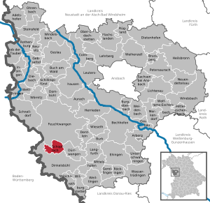
| Location of the Schopfloch market in the Ansbach district | ||
  |
||

Schopfloch is a market in the district of Ansbach in Middle Franconia ( Bavaria ).
geography
Geographical location
The market is located on the Romantic Road between the towns of Feuchtwangen and Dinkelsbühl in a landscape surrounded by meadows and forests on a gently westward sloping valley slope of the Wörnitz .
The market is located in the western border area of Middle Franconia. It is only a few kilometers to the Schwäbisch Hall district in Baden-Württemberg .
Community structure
The political municipality of Schopfloch has 13 officially named parts of the municipality (the type of settlement is given in brackets ):
|
|
Neighboring communities
In the north, Schopfloch borders the town of Feuchtwangen , in the east on the municipality of Dürrwangen and in the south on the large district town of Dinkelsbühl . In the west, the borders of Dinkelsbühl and Feuchtwangen meet.
history


The first written mention of the place goes back to a deed of donation from March 11, 1260, in which the name "Ulricus de Schopfloch" is mentioned as a witness. The von Schopfloch noble family later settled there. The place name is derived from a field name of the same name, the basic word of which is "lôch" ( mhd. For bushes, forest, wood) and the defining word "schopf" (mhd. For barn) and therefore means wood in a barn .
Only sparse remains of Castle Schopfloch in the center of the village have survived. There are no documents proving the origin of the village.
The Fraisch over Schopfloch was claimed by both the Ansbach Oberamt Feuchtwangen and the Oberamt Dürrwangen in Oettingen- Spielberg . The imperial city of Dinkelsbühl wanted to assert them on their property. The village and community rulership was disputed between the caste office Feuchtwangen and the Oberamt Dürrwangen.
In terms of social and cultural history, there are some special features in Schopfloch: During the Thirty Years War , Protestants from the Salzburg area settled in Schopfloch in 1634. They brought traditional professions such as bricklaying and stonemasonry with them to their new home. Since the immediate vicinity of Schopfloch did not offer enough work in the construction sector, the bricklayers and stonemasons, mostly in groups of six to eight men, migrated through southern Germany, Switzerland and Austria from spring to autumn . The masons' wives raised the children and worked part-time farming; many women came from Bohemia and had worked on construction sites as unskilled workers, so-called "mortars", before they got married.
In 1732 the place consisted of 77 properties with 88 teams. There was also an Ansbach castle (Streifer and Schultheiss apartment) with a curtain wall, a church (Protestant), a rectory, a school and sacristan's house and a shepherd's house. Were landlords
- the Vogtamt Schopfloch : 39 estates and houses (including a tavern with brewing and baking rights and 11 estates and houses with double crews), 1 cone with baking rights, 4 bakeries, 1 forge, 1 stoner, 1 bath room, 5 Jewish houses
- the Oberamt Dürrwangen: 32 goods and houses (including 1 tavern with brewing rights, 1 cone with baking rights, 1 bakery and 16 Jewish houses)
- the German Order : 1 good
- the imperial city of Dinkelsbühl: 4 estates, 1 estate with baking rights.
Towards the end of the 18th century there were 117 properties plus communal, ecclesiastical and manorial buildings. The manorial distribution was as follows:
- the Vogtamt Schopfloch: 1 mill, 1 inheritance tavern with baking right, 4 half yards (1 with taps upright), 8 Gütlein, 5 Söldengütlein (1 with baking and 1 with blacksmithing), 2 half Söldengütlein, 5 Sölden, 26 half Sölden, 4 Viertelsölden, 4 Sölden houses, 1 house, 8 half Sölden houses
- the Oberamt Dürrwangen: 1 inn, approx. 41 small goods (including approx. 25 Jewish houses)
- the Ämtlein Weidelbach of the Teutonic Order: 1 good
- the imperial city of Dinkelsbühl (predicature maintenance: 1 good, 1 good; hospital: 2 goods, 1 good).
From 1797 to 1808 the place was subordinate to the Justice and Chamber Office Feuchtwangen .
In 1806 Schopfloch came to the Kingdom of Bavaria . With the municipality edict was 1,809 tax district Schopfloch made to the places Buchhof , Deuenbach , Dickersbronn , Flin , Franz mill , Froschmühle , Gersbronn , Goschenhof , Hellenbach , Kemmleinsmühle , Köhlau , fiefdom book , Lehengütingen , Lohe , Neumühle , Neuses , Pfaffenhof and tube mill belonged . At the same time the rural community of Schopfloch was formed, to which Buchhof, Deuenbach, Neumühle and Rohrmühle belonged. It was subordinate to the Dinkelsbühl regional court in terms of administration and jurisdiction and to the Dinkelsbühl tax office ( renamed Dinkelsbühl tax office in 1919 , Ansbach tax office since 1973 ). The jurisdiction remained with the District Court of Dinkelsbühl until 1879, from 1879 to 1973 the District Court of Dinkelsbühl was responsible, which has been a branch of the District Court of Ansbach since 1973 . The administration was taken over by the newly created Dinkelsbühl district office in 1862 (renamed the Dinkelsbühl district in 1938 ). The community originally had an area of 4.287 km².
After Schopfloch was connected to the railway network in 1881, the "Schopflocher Maurerzug" (also "Architect's Train"), which was tailored to the needs of weekend commuters , ran. At that time, the bricklayers from Schopfloch preferred to work in the major cities of Nuremberg and Stuttgart. In 1938 around a third of the population still lived from the building trade.
The “clairaudience of what was happening in the world through work-related wandering” led to the early adoption of democratic and union-social-democratic ideas in Schopfloch in the 19th century. The SPD local association, founded in 1897, had around 250 members in January 1932 with a population of almost 2000 in the village. In 1905, Schopfloch was the first municipality in Bavaria to elect a social democrat, stone carver Heinrich Grimm, as mayor. After the dissolution of the local association in 1933 during the National Socialist era , the SPD local association was re-established in December 1945. In the local elections in 1946, the SPD won nine out of ten seats.
In 1965 the village received market rights. With the dissolution of the Dinkelsbühl district in 1972, Schopfloch came to the Ansbach district. In March 1979, Schopfloch received the approval of the Middle Franconia government to adopt a coat of arms and to use a flag (see below ).
Jewish community
The Jewish fellow citizens played a very important role in Schopfloch's social life. The first Jews settled here in the early 16th century, as evidenced in the first documentary mentions for the years 1561 and 1566. Due to the political situation in the 17th and 18th centuries, which divided Schopfloch into two administrative districts, two emerged in the place Jewish communities, one under the rule of Oettingen-Wallerstein , the other under the rule of the Margraves of Ansbach . Both communities only merged to form a Jewish community at the beginning of the 19th century.
The Jewish cemetery was laid out in 1612 (or a few years earlier) and has been expanded several times since then, with the last major expansion taking place in 1802. As an association cemetery - until some burial sites were established - it was the central cemetery for the Jewish communities in a wide region, including for Dinkelsbühl , Feuchtwangen , Mönchsroth and Wittelshofen as well as for several communities that are now in Baden-Württemberg : especially until 1841 for Crailsheim , Goldbach , Ingersheim an der Jagst , Hengstfeld and until 1840 for Michelbach an der Lücke , Steinbach , Unterdeufstetten , Wiesenbach . The last burials took place in 1938 (Paula Jordan from Wittelshofen and Fanny Benjamin née Dinkelsbühl). The extremely extensive area required the repeated expansion and the cemetery area is ultimately 12,980 m². In the far east of the site are the oldest grave monuments, some of them sunken. According to recent counts, there are 1,172 tombstones in the cemetery. The first synagogue was built on the Oettingian side in 1679. It was shared by the Jewish community in the Brandenburg-Ansbach part of Schopfloch. It was not until the 19th century that the two Jewish communities merged and were subordinate to the district rabbinate Schopfloch under the district rabbi Nathan Ehrlich (1841–1872). In 1830 a Jewish elementary school was built in Schopfloch, in which, in addition to the mikveh , the teacher's apartment was integrated. A new synagogue building was built in 1877. Around 1900 a third of Schopfloch's citizens were members of the Jewish religious community. At the beginning of the 20th century, however, many local Jews emigrated to America, so that the number of Jewish residents fell significantly. The long peaceful coexistence between Jews and Christians came to an end when the National Socialists came to power in 1933. In 1938 the last 18 remaining Jewish citizens had to leave Schopfloch. The synagogue was destroyed in the night of the Reichspogrom . A total of 54 Jews from Schopfloch perished in various concentration camps. Another visible trace of Jewish life is the building at Bahnhofstrasse 8 (Jewish school). A memorial stone that was placed in front of the Bahnhofstrasse 5 building commemorates the destroyed synagogue. A prominent contemporary witness, Hans Rosenfeld , played a key role in describing the Jewish living conditions in Schopfloch in the form of numerous documentations and lectures until his death in 2015.
Incorporations
| Former parish |
Residents (1970) |
date | annotation |
|---|---|---|---|
| Dickersbronn | 128 | May 1, 1978 | |
| Lehengütingen | 172 | July 1, 1970 | |
| Forest house | 147 | 1st January 1971 | Incorporation of 69 of the 147 residents, reclassification of the other residents to Dinkelsbühl |
| Zwernberg | 111 | May 1, 1978 |
Population development
In the period from 1988 to 2018, the population increased from 2,632 to 2939 by 307 inhabitants or by 11.7%.
Schopfloch community
| year | 1818 | 1840 | 1852 | 1861 | 1867 | 1871 | 1875 | 1880 | 1885 | 1890 | 1895 | 1900 | 1905 | 1910 | 1919 | 1925 | 1933 | 1939 | 1946 | 1950 | 1961 | 1970 | 1987 | 2005 | 2011 | 2016 |
|---|---|---|---|---|---|---|---|---|---|---|---|---|---|---|---|---|---|---|---|---|---|---|---|---|---|---|
| Residents | 1128 | 1419 | 1593 | 1616 | 1788 | 1834 | 1896 | 2286 | 1945 | 1880 | 1770 | 1806 | 1879 | 1934 | 1778 | 1910 | 1851 | 1744 | 2350 | 2207 | 2000 | 2107 | 2640 | 2922 | 2838 | 2960 |
| Houses | 218 | 214 | 235 | 271 | 309 | 342 | 368 | 413 | 713 | 894 | 909 | |||||||||||||||
| source |
Part of the community Schopfloch
| year | 1818 | 1840 | 1861 | 1871 | 1885 | 1900 | 1925 | 1950 | 1961 | 1970 | 1987 |
|---|---|---|---|---|---|---|---|---|---|---|---|
| Residents | 987 | 1250 | 1452 | 1650 | 1791 | 1654 | 1743 | 2026 | 1843 | 1936 | 1943 |
| Houses | 188 | 187 | 245 | 274 | 310 | 335 | 378 | 547 | |||
| source |
language
One of the traces of Jewish life mentioned is the so-called Lachoudisch (also: Lachodisch ), sometimes also called Schopfloch's secret language . It is a mixture of Hebrew , Rotwelsch and own word creations. The name Lachoudisch developed from the Hebrew expression Loschaun hakaudesch (in Ashkenazi pronunciation) or Leschon hakodesch (in Sephardic pronunciation), which means 'holy language' in German. The language can be traced back to the trading activities of the Jews and to the years of traveling of the masons. Since the language was incomprehensible to outsiders, the Schopfloch dealers (Schacherer) were able to use this language to their advantage in their conversations. Lachoudisch is still used and cared for, especially by the older generation.
politics
Municipal council
After the last local election on March 16, 2014, the local council has 14 members. The turnout was 54.57%. The choice brought the following result:
| CSU / Free Voters | 6 seats | (41.23%) | |
| SPD / Independent voters | 5 seats | (36.99%) | |
| Voter group | 3 seats | (21.78%) |
Another member and chairman of the municipal council is the mayor.
mayor
In March 2014, Mayor Oswald Czech (in office since May 2002) was re-elected with 84.32 percent of the vote.
badges and flags
The community of Schopfloch has had a coat of arms since 1979.
|
|
Blazon : "Under the black shield head , inside a silver tray , five times diagonally divided by silver and red."
White and red municipal flag |
| Foundation of the coat of arms: The manor Schopfloch was owned by the Lords of Ellrichshausen from 1390 to 1616, with a brief interruption . Her coat of arms (divided diagonally five times by silver and red) is a reminder of her rule. After 1616 the Counts of Oettingen and the Margraves of Brandenburg-Ansbach were the most important landlords. Both also claimed high jurisdiction at the same time. The tray from the coat of arms of the Counts of Oettingen and the colors silver and black from the margravial coat of arms remind of this . |
Culture and sights
Regular events
Schopfloch is traditionally a Franconian carnival stronghold . According to tradition, the Drudenzug goes back to pagan times. This tradition has been carried on over many generations up to the present day. A special crowd puller are the annual meetings of the Fastnachtsgesellschaft Medine e. V., which are known far beyond the borders of Schopfloch. The F. G. Medine e. V. is one of the eight founding members of the Fastnacht-Verband Franken e. V. and in the Bund Deutscher Karneval . The term Medine is taken from Schopfloch's secret language Lachoudisch and means "home".
Architectural monuments

- Evangelical Church of St. Martin
- town hall
- Jewish cemetery on the steep road to Deuenbach
- Evangelical branch church St. Lorenz in Zwernberg
Advertising slogan
Schopfloch owes its advertising slogan "Green point between medieval cities" to the green, agricultural environment and the location almost exactly between the towns of Feuchtwangen and Dinkelsbühl .
Economy and Infrastructure

traffic
Schopfloch is conveniently located at the federal autobahn 6 and 7 . A 6 exits: Schnelldorf (13 km), Feuchtwangen-Nord / Dorfgütingen (11 km), Aurach (27 km). A 7 exits: Feuchtwangen-West / Schopfloch (9 km), Dinkelsbühl-Fichtenau (10 km). The federal highway 25 ( Romantic Road ) runs north of Feuchtwangen and south over Lehengütingen to Dinkelsbühl . The district road AN 42 runs west via Buchhof to Weidelbach and east via Lehenbuch and Flisnberg to Dürrwangen . Communal roads run northeast to Mögersbronn and northwest to Deuenbach .
In 1881 the place received the rail connection to the Nördlingen – Dombühl railway line through the commissioning of the link between Feuchtwangen and Dinkelsbühl; Both places had their rail connection to Dombühl to the Nuremberg – Crailsheim line and Nördlingen to the Ludwig-Süd-Nord-Bahn in 1876. Passenger traffic was stopped by the DB on June 1, 1985.
Romantic rail: In summer, the Bavarian Railway Museum operates on Sundays on the museum railway with steam trains and the red rail bus VT 98 of BayernBahn on the Nördlingen – Feuchtwangen section of the Nördlingen – Dombühl railway, stopping at the former Schopfloch (Mittelfr) station . In Nördlingen there is a connection to the DB routes. Since Bayernbahn did not renew the lease agreement with DB for the route from Dombühl to Wilburgstetten after December 31, 2018, there are currently no museum trains.
The infrastructure company Mittelfränkische Eisenbahn-Betriebsgesellschaft MFEG was founded on March 8, 2019. This company wants to upgrade the infrastructure of the route according to the specifications of the BEG by 2024 at the latest, so that scheduled passenger train operations between Dombühl and Wilburgstetten can take place again. A future continuous connection from Dombühl to Nördlingen is not ruled out. Currently, only the section from Dombühl to Wilburgstetten meets the requirements of the BEG regarding the number of kilometers traveled by travelers.
The railway line near Schopfloch has served as a location for film and TV productions several times. In November 2016, scenes for the multi-part ARD crime series “ Babylon Berlin ” and in summer 2011 for RTL “ The Hunt for the Amber Room ” were recorded here.
Established businesses
Some medium-sized companies have settled in the market. Metal and textile processing companies have the largest share.
literature
- Johann Kaspar Bundschuh : Schopfloch . In: Geographical Statistical-Topographical Lexicon of Franconia . tape 5 : S-U . Verlag der Stettinische Buchhandlung, Ulm 1802, DNB 790364328 , OCLC 833753112 , Sp. 179-180 ( digitized version ).
- August Gebeßler : City and district of Dinkelsbühl (= Bavarian art monuments . Volume 15 ). Deutscher Kunstverlag, Munich 1962, DNB 451450930 , p. 191-192 .
- Karl Heinrich von Lang , Heinrich Christoph Büttner , Knappe: District Court Dinkelsbühl (= historical and statistical description of the Rezatkreis . Issue 2). Johann Lorenz Schmidmer, Nuremberg 1810, OCLC 165619678 , p. 25 ( digitized version ).
- Teresa Neumeyer: Dinkelsbühl: the former district (= Historical Atlas of Bavaria, part of Franconia . I, 40). Michael Laßleben, Kallmünz 2018, ISBN 978-3-7696-6562-8 .
- Gunther Reese (ed.): Traces of Jewish life around the Hesselberg (= small series of publications Hesselberg region. Volume 6). Unterschwaningen 2011, ISBN 978-3-9808482-2-0 , pp. 88-93.
- Wolf-Armin von Reitzenstein : Lexicon of Franconian place names. Origin and meaning . Upper Franconia, Middle Franconia, Lower Franconia. CH Beck, Munich 2009, ISBN 978-3-406-59131-0 , p. 202 .
- Anton Steichele (Ed.): The diocese Augsburg historically and statistically described . tape 3 . Schmiedsche Verlagbuchhandlung, Augsburg 1872, p. 503-505 ( digitized version ).
- Gottfried Stieber: Schopffloch . In: Historical and topographical news from the Principality of Brandenburg-Onolzbach . Johann Jacob Enderes, Schwabach 1761, p. 709-711 ( digitized version ).
Web links
- Map of Markt Schopfloch on the BayernAtlas
- Schopfloch in the Topographia Franconiae of the University of Würzburg , accessed on September 17, 2019.
- Examples of Lachoudish
- Schopfloch (Middle Franconia): Official statistics of the LfStat
Individual evidence
- ↑ "Data 2" sheet, Statistical Report A1200C 202041 Population of the municipalities, districts and administrative districts 1st quarter 2020 (population based on the 2011 census) ( help ).
- ^ Community Schopfloch in the local database of the Bavarian State Library Online . Bayerische Staatsbibliothek, accessed on September 17, 2019.
- ↑ W.-A. v. Reitzenstein, p. 202.
- ↑ a b T. Neumeyer, pp. 459f.
- ↑ According to the Vetterische description of the Oberamt Feuchtwangen from 1732 ( see also Schopfloch ( manor ) on the website geschichte-feuchtwangen.de).
- ^ Johann Bernhard Fischer : Schopfloch . In: Statistical and topographical description of the Burggraftum Nürnberg, below the mountain, or the Principality of Brandenburg-Anspach. Second part. Containing the economic, statistical and moral condition of these countries according to the fifteen upper offices . Benedict Friedrich Haueisen, Ansbach 1790, p. 192 ( digitized version ). (= JK Bundschuh, Vol. 5, Col. 179 f.)
- ↑ a b c T. Neumeyer, p. 577.
- ↑ T. Neumeyer, pp. 532f. and 539.
- ^ Address and statistical manual for the Rezatkreis in the Kingdom of Baiern . Buchdruckerei Chancellery, Ansbach 1820, p. 30 ( digitized version ).
- ↑ a b c Bavarian State Statistical Office (ed.): Official city directory for Bavaria, territorial status on October 1, 1964 with statistical information from the 1961 census . Issue 260 of the articles on Bavaria's statistics. Munich 1964, DNB 453660959 , Section II, Sp. 764 ( digitized version ).
- ^ Anton Großmann: Milieu conditions of persecution and resistance using the example of selected local SPD associations. In: Martin Broszat , Hartmut Mehringer : The parties KPD, SPD and BVP in persecution and resistance (= Bavaria in the Nazi era. Volume 5). Oldenbourg, Munich 1983, ISBN 3-486-42401-7 , pp. 433-540, here: pp. 481 f.
- ↑ Großmann: Environment conditions. Pp. 484 f., 491.
- ^ T. Neumeyer, p. 539.
- ↑ Gunther Reese (ed.): Traces of Jewish life around the Hesselberg (= small series of publications Hesselberg region. Volume 6). Unterschwaningen 2011, ISBN 978-3-9808482-2-0 , p. 88.
- ^ Eva Maria Kraiss, Marion Reuter: Bet Hachajim. House of life. Jewish cemeteries in Württemberg Franconia. Swiridoff Verlag, Künzelsau 2003, ISBN 3-89929-009-7 , p. 34 ( preview in Google book search).
- ↑ Gunther Reese (ed.): Traces of Jewish life. P. 91 f.
- ^ Jewish history: prayer hall / synagogue. In: Alemannia Judaica . August 30, 2016, accessed December 8, 2017.
- ↑ Schopfloch: Jewish cemetery. In: alemannia-judaica.de. October 29, 2016, accessed December 8, 2017.
- ^ For the year 1905 111 Jews out of 655 inhabitants are given. Eva Maria Kraiss, Marion Reuter: Bet Hachajim. House of life. Jewish cemeteries in Württemberg Franconia. Swiridoff Verlag, Künzelsau 2003, ISBN 3-89929-009-7 , p. 72 ( preview in Google book search).
- ↑ Gunther Reese (ed.): Traces of Jewish life. P. 88 f.
- ↑ a b Federal Statistical Office (ed.): Historical municipality register for the Federal Republic of Germany. Name, border and key number changes in municipalities, counties and administrative districts from May 27, 1970 to December 31, 1982 . W. Kohlhammer, Stuttgart / Mainz 1983, ISBN 3-17-003263-1 , p. 707 .
- ↑ a b Wilhelm Volkert (Ed.): Handbook of the Bavarian offices, communities and courts 1799–1980 . CH Beck, Munich 1983, ISBN 3-406-09669-7 , p. 448 .
- ↑ a b Only inhabited houses are given. In 1818 these were designated as fireplaces , in 1840 as houses , and from 1871 to 2016 as residential buildings.
- ↑ a b Alphabetical index of all the localities contained in the Rezatkreise according to its constitution by the newest organization: with indication of a. the tax districts, b. Judicial Districts, c. Rent offices in which they are located, then several other statistical notes . Ansbach 1818, p. 83 ( digitized version ). For the community of Schopfloch plus the residents and buildings of Buchhöfe (p. 14), Deuenbach (p. 18), Neumühle (p. 63) and Rohrmühle (p. 77).
- ^ A b Eduard Vetter (Ed.): Statistical handbook and address book of Middle Franconia in the Kingdom of Bavaria . Self-published, Ansbach 1846, p. 75 ( digitized version ).
- ↑ a b c d e f g h i j k l Bavarian State Statistical Office (Hrsg.): Historical municipality directory: The population of the municipalities of Bavaria from 1840 to 1952 (= contributions to Statistics Bavaria . Issue 192). Munich 1954, DNB 451478568 , p. 168 , urn : nbn: de: bvb: 12-bsb00066439-3 ( digitized ).
- ↑ a b Joseph Heyberger, Chr. Schmitt, v. Wachter: Topographical-statistical manual of the Kingdom of Bavaria with an alphabetical local dictionary . In: K. Bayer. Statistical Bureau (Ed.): Bavaria. Regional and folklore of the Kingdom of Bavaria . tape 5 . Literary and artistic establishment of the JG Cotta'schen Buchhandlung, Munich 1867, Sp. 1001–1002 , urn : nbn: de: bvb: 12-bsb10374496-4 ( digitized version ).
- ↑ a b Kgl. Statistical Bureau (ed.): Complete list of localities of the Kingdom of Bavaria. According to districts, administrative districts, court districts and municipalities, including parish, school and post office affiliation ... with an alphabetical general register containing the population according to the results of the census of December 1, 1875 . Adolf Ackermann, Munich 1877, 2nd section (population figures from 1871, cattle figures from 1873), Sp. 1167 , urn : nbn: de: bvb: 12-bsb00052489-4 ( digital copy ).
- ↑ a b K. Bayer. Statistical Bureau (Ed.): Localities directory of the Kingdom of Bavaria. According to government districts, administrative districts, ... then with an alphabetical register of locations, including the property and the responsible administrative district for each location. LIV. Issue of the contributions to the statistics of the Kingdom of Bavaria. Munich 1888, Section III, Sp. 1099 ( digitized version ).
- ↑ a b K. Bayer. Statistical Bureau (Ed.): Directory of localities of the Kingdom of Bavaria, with alphabetical register of places . LXV. Issue of the contributions to the statistics of the Kingdom of Bavaria. Munich 1904, Section II, Sp. 1164 ( digitized version ).
- ↑ a b Bavarian State Statistical Office (ed.): Localities directory for the Free State of Bavaria according to the census of June 16, 1925 and the territorial status of January 1, 1928 . Issue 109 of the articles on Bavaria's statistics. Munich 1928, Section II, Sp. 1202 ( digitized version ).
- ↑ a b Bavarian State Statistical Office (ed.): Official place directory for Bavaria - edited on the basis of the census of September 13, 1950 . Issue 169 of the articles on Bavaria's statistics. Munich 1952, DNB 453660975 , Section II, Sp. 1039 ( digitized version ).
- ↑ a b Bavarian State Statistical Office (Hrsg.): Official local directory for Bavaria . Issue 335 of the articles on Bavaria's statistics. Munich 1973, DNB 740801384 , p. 171 ( digitized version ).
- ↑ a b Bavarian State Office for Statistics and Data Processing (Ed.): Official local directory for Bavaria, territorial status: May 25, 1987 . Issue 450 of the articles on Bavaria's statistics. Munich November 1991, DNB 94240937X , p. 331 ( digitized version ).
- ↑ a b Schopfloch (Middle Franconia): Official statistics of the LfStat
- ^ A b Jüdisch-Historischer Verein Augsburg: Lachoudisch - Remnants of the Jewish language from Schopfloch. In: jhva.wordpress.com. Jüdisch Historischer Verein Augsburg, August 2010, accessed on February 28, 2012.
- ^ Eva Maria Kraiss, Marion Reuter: Bet Hachajim. House of life. Jewish cemeteries in Württemberg Franconia. Swiridoff Verlag, Künzelsau 2003, ISBN 3-89929-009-7 , p. 34 ( preview in Google book search).
- ↑ Entry on the coat of arms of Schopfloch (Middle Franconia) in the database of the House of Bavarian History
- ↑ Schopfloch. In: Kommunalflaggen.eu. Retrieved July 21, 2020 .
- ↑ Film recordings for the crime series “Babylon Berlin”. In: woernitz-franken.de. Retrieved on June 18, 2017 (press release from BayernBahn GmbH Nördlingen; photos from the film set).
- ↑ Railway line between Feuchtwangen and Schopfloch as a film set. "The hunt for the amber room". Retrieved June 18, 2017 (report with photos from the film set).

Adelshofen | Arberg | Aurach | Bechhofen | Bruckberg | Book at the forest | Burgoberbach | Burk | Colmberg | Dentlein am Forst | Diebach | Dietenhofen | Dinkelsbühl | Dombühl | Dürrwangen | Ehingen | Feuchtwangen | Flachslanden | Gebsattel | Gerolfingen | Geslau | Heilsbronn | Herrieden | Insingen | Langfurth | Lehrberg | Leutershausen | Lichtenau | Merkendorf | Mitteleschenbach | Mönchsroth | Neuendettelsau | Neusitz | Oberdachstetten | Ohrbach | Ornbau | Petersaurach | Röckingen | Rothenburg ob der Tauber | Rügland | Saxony near Ansbach | Schillingsfürst | Schnelldorf | Schopfloch | Steinsfeld | Unterschwaningen | Wassertrüdingen | Weidenbach | Weihenzell | Weiltingen | Wettringen | Wieseth | Wilburgstetten | Windelsbach | Windsbach | Wittelshofen | Wolframs-Eschenbach | Wörnitz
Unregulated areas:
Lower Forest