
Herrieden
| coat of arms | Germany map | |
|---|---|---|

|
Coordinates: 49 ° 14 ' N , 10 ° 30' E |
|
| Basic data | ||
| State : | Bavaria | |
| Administrative region : | Middle Franconia | |
| County : | Ansbach | |
| Height : | 423 m above sea level NHN | |
| Area : | 81.71 km 2 | |
| Residents: | 8048 (Dec. 31, 2019) | |
| Population density : | 98 inhabitants per km 2 | |
| Postal code : | 91567 | |
| Primaries : | 09825, 09804, 09855 | |
| License plate : | AN , DKB, FEU, ROT | |
| Community key : | 09 5 71 166 | |
| LOCODE : | DE RRI | |
| City structure: | 39 districts | |
City administration address : |
Herrnhof 10 91567 Herrieden, Germany |
|
| Website : | ||
| Mayoress : | Dorina Jechnerer ( BürgerForumHerrieden ) | |
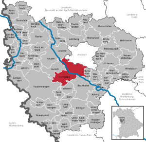
| Location of the city of Herrieden in the district of Ansbach | ||
  |
||


Herrieden is a town in the Central Franconian district of Ansbach .
geography
Geographical location
The municipality is located in the metropolitan region of Nuremberg , on the upper reaches of the Altmühl and in the center of the city pentagon Rothenburg ob der Tauber - Feuchtwangen - Dinkelsbühl - Gunzenhausen - Ansbach .
Neighboring communities are (starting in the north clockwise) Ansbach , Burgoberbach , Bechhofen , Wieseth , Feuchtwangen , Aurach and Leutershausen .
Community structure
Herrieden has 39 districts :
|
|
|
The deserted Altmühle , Kugelmühle , Rösmühle and Schreinermühle are not official districts.
climate

Diagram of average precipitation values in Herrieden for the period from 1961 to 1990


In Herrieden, the average annual rainfall is 700 mm.
history
Until the church is planted
In 782 the Franconian landlord Cadolt founded a Benedictine monastery in the area of today's Church of Our Lady and gave it to the Frankish king Karl . He appointed his confidante and confessor Deocar as the first abbot. Deocar played a leading role in the Christianization of the country. However, the monastery not only had a famous first abbot, but was also in a convenient location, as on the one hand the Altmühl formed a waterway and on the other hand the trade route Donauwörth - Fürth passed this point. However, clearing the land meant a lot of work. The roots of the place name probably go back to this fact: "Hasareoda" (first mentioned in a document in 797) means clearing and reclamation of inhospitable land , the main task of the monks in the first phase of settlement. The name later became "Hasenried" (845) and then "Harrriede" (1122), before the modern "Herrieden" (1231) emerged from it.
The monastery had extensive possessions as early as 791: Melk, today's twin town, Grünz and Pielach in Lower Austria were among them. In 793 Charlemagne visited Deocar in Herrieden. In 796, when Deocar got into trouble with some of his monks, Alkuin , the most important theologian under Charlemagne , intervened personally. A few years later Deocar appeared several times as the Sendgraf (royal messenger) of Charles. In 802 the Herrieden monastery was granted patronage rights over the Salvator Church in Duisburg. Abbot Luitpert von Herrieden became Archbishop of Mainz in 863 . In 865 he acted as guarantor in a contract between Charles the Bald and Ludwig the German . In 870 he finally became arch chaplain and arch chancellor of the kingdom. In 887 he moved from Herrieden to Ellwangen. In 888 the monastery was converted into a canon monastery and was now subordinate to a provost or the bishop of Eichstätt. The first buildings around the collegiate church, which the canons had erected, date from this time.
In the 10th century Herrieden suffered from several Hungarian invasions. Then the city fortifications began. The city palace , first mentioned in a document in 1122, goes back to these origins, as does the construction of the city wall.
In 1230 the fortified Herrieden received city rights. In 1305 a fire caused devastating damage to the city.
In 1316 the city became a victim of Ludwig of Bavaria . He had large parts of Herriedens destroyed. In 1314 Ludwig IV was elected the Bavarian German King and at the same time Frederick the Fair was elected. In this conflict Herrieden stood on the side of Frederick the Beautiful and opposed King Ludwig. In the course of these battles the permanent place Herrieden was besieged by Ludwig, where he received support from the "ballistics experts" from Nuremberg . The defenders under the power of Hohenlohe were able to free themselves from the burning city with a savage counter-attack, but the place was stormed after a long siege, the walls and towers razed. On March 23 and 24, 1316 King Ludwig stayed in the camp in front of Herrieden. The place was plundered, Ludwig had the bones of St. Deokar raised, donated some of them to the Nuremberg support troops and took some with him to his Munich residence (where they fell victim to the bombs of the Second World War). In Nuremberg Deokar became the third city saint alongside St. Sebald and St. Lorenz.
In 1358 the Herrieden monastery received a gilded monstrance , a relic of St. Vitus and a letter of protection for the monastery from Emperor Charles IV . The gifts of the emperor are still in the possession of the church today.
In 1470 Jakob Fugger was one of the students at the collegiate school. In 1490, a second city fire caused widespread destruction. From 1500 Herrieden was part of the Franconian Empire .
During the witch hunt in the Hochstift Eichstätt at least seven women from Herrieden were executed for witchcraft. Four of the executions took place in 1590 (Margaretha Christin, Anna Schmiedtin, Barbara Scharpfin, Ursula Freiin) and three in 1617 (Alte Wirtin von Großenried, NN, Alte Becken Bärbel). Maria Magdalena Windeisin, alias the Alt Schmidin von Leibelbach, was arrested for the same reason on November 24, 1617 at the age of about 70 and remained steadfast for months despite repeated tortures. Her husband Abraham Windeisen repeatedly used legal means to appeal to the Kastner and Prince-Bishop for her release and achieved this on October 31, 1619 after almost two years, but the costs of detention drove him to ruin. By 1617 at the latest, a witch's prison was set up in Herrieden under Prince-Bishop Johann Christoph von Westerstetten ("Gefengnuß, so the wicked women and witches built up"). This was in a barn of the poor foundation (so-called poor house, demolished in 1956) next to the servant house and later the maiden house. It is the oldest verifiable witch prison in Franconia.
In 1633 the Swedish invasion claimed many victims.
From 1703 and 1704 Herrieden was the seat of government of the Eichstätt prince-bishop Johann Martin von Eyb , who fled here during the War of the Spanish Succession. He died here on December 6, 1704; his entrails were buried in the collegiate church.
With the secularization in 1803, the Eichstättian Oberamt Wahrberg-Herrieden was dissolved and the towns were assigned to the Ansbacher and Crailsheimer districts , both of which were administered by Prussia.
In 1806 Herrieden came to the Kingdom of Bavaria . With the community edict (early 19th century) the tax district Herrieden was formed, to which the places Mühlbruck , Regmannsdorf and Schernberg belonged. A little later, the municipality of Herrieden was formed with Mühlbruck. It was subject to the Herrieden district court in terms of administration and jurisdiction . The municipality originally had an area of 8,911 km².
20th and 21st centuries
In 1903 Herrieden was connected to the railway network, and in 1918 the market square was paved. In 1933 an SA warehouse was set up in the former cigar factory . In 1944, the hay press , in which feed for the Wehrmacht horses had to be delivered, was set on fire by an airplane pilot. It remained unclear whether this was an act of sabotage by a German aviator.
In the 1960s, passenger traffic on the Ansbach – Bechhofen line was initially discontinued, followed by all rail traffic on this line. The route, which was never profitable, was later dismantled.
In 2010 the museum opened on the way ; Since then, eight stations and the catwalk tell the story of the city within and directly in front of the city wall.
Incorporations
On July 1, 1971, the previously independent communities of Elbersroth, Heuberg, Hohenberg, Lammelbach, Rauenzell, Roth and Stadel were incorporated. On January 1, 1972, Neunstetten and areas of the dissolved communities Aichau and Oberschönbronn were added.
Population development
In the period from 1988 to 2018, the population rose from 6,321 to 7,999, or by 26.6%.
Herrieden community
| year | 1818 | 1840 | 1852 | 1861 | 1867 | 1871 | 1875 | 1880 | 1885 | 1890 | 1895 | 1900 | 1905 | 1910 | 1919 | 1925 | 1933 | 1939 | 1946 | 1950 | 1961 | 1970 | 1987 | 1995 | 2005 | 2015 |
|---|---|---|---|---|---|---|---|---|---|---|---|---|---|---|---|---|---|---|---|---|---|---|---|---|---|---|
| Residents | 997 | 1093 | 1117 | 1068 | 1077 | 1041 | 991 | 1072 | 1027 | 991 | 969 | 935 | 1011 | 1041 | 1071 | 1102 | 1108 | 1182 | 1851 | 2085 | 2251 | 2510 | 6250 | 7187 | 7718 | 7830 |
| Houses | 316 | 231 | 234 | 274 | 205 | 218 | 262 | 394 | 1636 | 2338 | ||||||||||||||||
| source |
Part of the municipality of Herrieden
| year | 1818 | 1840 | 1861 | 1871 | 1885 | 1900 | 1925 | 1950 | 1961 | 1970 | 1987 |
|---|---|---|---|---|---|---|---|---|---|---|---|
| Residents | 975 | 1067 | 1047 | 1009 | 1003 | 909 | 1077 | 2041 | 2213 | 2486 | 3011 |
| Houses | 312 | 226 | 271 | 202 | 214 | 258 | 390 | 806 | |||
| source |
politics
City council
The city council consists of 20 members and First Mayor Dorina Jechnerer (BürgerForumHerrieden).
- CSU : 5 seats
- Alliance 90 / The Greens : 4 seats
- FW : 3 seats
- Progressive Citizens : 4 seats
- BürgerForumHerrieden: 4 seats
(Status: local elections in March 2020 )
badges and flags
The coat of arms is first attested since 1366.
|
|
Blazon : "In red a crouching golden hare holdingan upright silver bishop's staff."
Red and white municipal flag |
| Justification of the coat of arms: The hare stands for the former name "Hasaried" of the Herrieden abbey. The crosier represents the long-standing connection to the diocese of Eichstätt , which only ended with secularization in 1803. In some coats of arms the hare appears turned to the left, its hind paws are supported on the outwardly directed staff. The current city coat of arms goes back to the second city seal from the middle of the 15th century. |
Town twinning
Sister cities of the city of Herrieden are:
Culture and sights
Buildings
Secular buildings
The stork tower is one of the few buildings in the Altmühltal on which storks nest. After the tower was destroyed by Ludwig the Bavarian in 1316 , it was rebuilt in 1340 under Bishop Heinrich V. Schenk von Reicheneck . The archway is still used for moving traffic.
- Stone Altmühlbrücke
The stone bridge over the Altmühl was given its present form in 1711. A previous building is mentioned in a document as early as 836 AD; it is the oldest known documentary evidence of bridge construction in Middle Franconia. Today the bridge is used for motor vehicle traffic that passes the gate in the Storchenturm, whereas other road users can get into the old town via an adjacent footbridge and through a passage in the city wall.
- Former Herrieden Castle
In the 12th century the complex was the seat of the Lords of Herrieden. Ludwig the Bavarian had it destroyed in 1316; the reconstruction took place in 1342. This successor building was laid in 1633 by the Swedes in rubble and ashes. From 1685 to 1717 the remains were converted into a prince-bishop's brewery. From 1802 a private brewery had its seat here.
- Residence of the provost
The building that now houses the city library was built around 1492 as the official and residence of the provost. The building has been owned by the city since 1988.
- Former hospital
A hospital had been located at the site of today's old people's and nursing home since 1476. This first building fell victim to the Herriedens fire in 1490, and a later building was pillaged by the Swedes in 1633. However, the hospital was rebuilt at the same location. From 1840 it served as a cholera quarantine station for the Feuchtwangen district, and from 1884 to 1979 as a municipal hospital.
The Fronveste was originally a defense tower with a square floor plan. In the years 1415 to 1429 it was reinforced by a semicircular porch, which promised better protection against cannon fire. The building served as a prison until 1901; today it is used as a commercial and residential building.
- box
Today's parish hall dates from the first third of the 16th century. Under the Prince-Bishop Gabriel von Eyb and later, the taxes of the citizens subject to interest were collected and stored here; later the building was used for different purposes. It was completely renovated between 1997 and 2000.
- Gabrieli House
The building, which today houses a residential home for Lebenshilfe , served as the prince-bishop's office in the 18th century and was therefore Herrieden's administrative seat. Later the district court, regional court , notary's office and rent office and from 1921 the city's tax office were housed here. The building from the 17th century was changed in the first third of the 18th century by the Eichstätter Hofbaudirektor Gabriel de Gabrieli.
- Post stable
For only thirteen years, from 1890 to 1903, the post stable served its intended purpose. The facility became superfluous with the connection of Herriedens to the railway network.
- Brothaus (former town hall)
The bread house served as the town hall from 1835 to 1944. In 1752 it got its present form. On the house, however, the coat of arms of the provost Bernhard Arzat can still be seen, which comes from a previous building.
- Today's town hall
Since 1945 the building has been used as the town hall , which was built in 1901 as the Royal Bavarian District Court . A memorial stone in front of the building commemorates the victims of the wars. Another war memorial is located at the collegiate church.
- Rectory
Built according to plans by Gabriel der Gabrieli and furnished with interior fittings by Maurizio Pedetti , the rectory served as the seat of the monastery dean until 1806.
Churches


- Collegiate Basilica of St. Vitus and St. Deocar . In 1071 the original church was consecrated under Bishop Gundekar II . From 1490 to 1533 the building was enlarged and designed in a late Gothic style. The furnishings by Gabriel de Gabrieli are baroque and date from the middle of the 18th century. On July 14, 2010, Pope Benedict XVI. the collegiate church to the Basilica minor .
- St. Martin mountain church . The baroque design in which the church presents itself today goes back to Gabrieli. The St. Martin mountain church, however, is one of the oldest churches in the upper Altmühltal and may originally have had a different shape.
- Church to Our Lady
- Christ Church . With the Christ Church, Herrieden has also had a Protestant church since 1951.
- Sanctuary of St. Salvator
Architectural monuments
Saints
- Holy Abbot Deocar , patron of the city of Herrieden
Economy and Infrastructure
The largest employers are:
- Schüller Möbelwerk (fitted kitchens) with over 1300 employees
- Sielaff company (machine) with 800 employees
- Hapa company (roller shutters and plastic windows) with 400 employees
- geobra Brandstätter ( Playmobil and Lechuza), toy industry and planters
traffic
The State Road 2248 leads past Regmannsdorf to junction 51 of the federal motorway 6 or via Leibelbach to Wieseth . The state road 2249 leading to Neunstetten or after Rauenzell . Communal roads lead to Stegbruck , Hohenberg and Roth .
From 1903 to 1966 Herrieden had a train station on the Leutershausen-Wiedersbach-Bechhofen line . In the vernacular, the railway was called the "Bockerla".
Telephone prefixes
In Herrieden and most other districts the area code 09825 applies. Exceptions are
- 09804 for Elbersroth, Gräbenzüge, Leukersdorf, Sickersdorf and Stadel
- 09855 for Böckau, Buschhof and Oberschönbronn
- 0981 for Rös
Personalities
- Anonymus von Herrieden , Eichstätter biography writer of the 11th century, described Herrieden as his home ("patria").
- Josef Göppel (* 1950), CSU politician, born in Rauenzell
- Gregor Maria Hanke , 82nd Bishop of Eichstätt, born in Elbersroth
- Ludwig Heumann (1869–1918), “herb pastor”, lived and worked in Elbersroth .
- Werner Rank (* 1968), former soccer player, born in Herrieden
- Johann Michael Vogler (1670–1731), watchmaker
- Brigitta Westphal (* 1944), painter, lives in Herrieden
literature
- City of Herrieden (Ed.): Herrieden. City on the Altmühl . Fritz Majer & Sohn, Leutershausen 1982, ISBN 3-922175-08-2 .
- Herrieden 1225 years: 782/83 to 2007/2008; Time window into the past. City of Herrieden, Herrieden 2013, ISBN 978-3-00-041834-1
- Johann Kaspar Bundschuh : Herrieden . In: Geographical Statistical-Topographical Lexicon of Franconia . tape 2 : El-H . Verlag der Stettinische Buchhandlung, Ulm 1800, DNB 790364298 , OCLC 833753081 , Sp. 607-631 ( digitized version ).
- Hans Karlmann Ramisch: District Feuchtwangen (= Bavarian art monuments . Volume 21 ). Deutscher Kunstverlag, Munich 1964, DNB 453909426 , p. 66-84 .
- Wolf-Armin von Reitzenstein : Lexicon of Franconian place names. Origin and meaning . Upper Franconia, Middle Franconia, Lower Franconia. CH Beck, Munich 2009, ISBN 978-3-406-59131-0 , p. 100-101 .
- Pleikard Joseph Stumpf : Herrieden . In: Bavaria: a geographical-statistical-historical handbook of the kingdom; for the Bavarian people . Second part. Munich 1853, p. 730-731 ( digitized version ).
Web links
- City of Herrieden
- Herrieden in the Topographia Franconiae of the University of Würzburg , accessed on September 16, 2019.
- Herrieden: Official statistics of the LfStat
Individual evidence
- ↑ "Data 2" sheet, Statistical Report A1200C 202041 Population of the municipalities, districts and administrative districts 1st quarter 2020 (population based on the 2011 census) ( help ).
- ^ Herrieden community in the local database of the Bavarian State Library Online . Bavarian State Library, accessed on September 16, 2019.
- ↑ According to W.-A. v. Reitzenstein, p. 101, is the defining word of the feminine personal name Hasa, which would mean the place name for clearing the Hasa.
- ↑ Hermann Dallhammer: Herrieden, City Altmuhl. Majer, Leutershausen 1982, ISBN 3-922175-08-2 , pp. 135-136.
- ↑ Stürzl, Heinrich: On the witch hunt in the upper pen of the Hochstift Eichstätt. Addendum to: Executions for witchcraft in Eichstätt . In: Leaflets of the Bavarian State Association for Family Studies . Self-published, Munich. 2016, p. 133 f.
- ↑ Thoma, Hermann: On the persecution of witches in the upper foundation offices of the Hochstift Eichstätt and their peripheral areas - Part II. In: Alt-Gunzenhausen. Ed. Association for local history Gunzenhausen. Gunzenhausen. 2006, p. 63 ff.
- ^ Address and statistical manual for the Rezatkreis in the Kingdom of Baiern . Buchdruckerei Chancellery, Ansbach 1820, p. 45-46 ( digitized version ).
- ↑ a b c Bavarian State Statistical Office (ed.): Official city directory for Bavaria, territorial status on October 1, 1964 with statistical information from the 1961 census . Issue 260 of the articles on Bavaria's statistics. Munich 1964, DNB 453660959 , Section II, Sp. 776 ( digitized version ).
- ^ Wilhelm Volkert (ed.): Handbook of Bavarian offices, communities and courts 1799–1980 . CH Beck, Munich 1983, ISBN 3-406-09669-7 , p. 461 .
- ↑ a b Only inhabited houses are given. In 1818 these were designated as fireplaces , in 1840 as houses and from 1871 to 2015 as residential buildings.
- ↑ a b Alphabetical index of all the localities contained in the Rezatkreise according to its constitution by the newest organization: with indication of a. the tax districts, b. Judicial Districts, c. Rent offices in which they are located, then several other statistical notes . Ansbach 1818, p. 39 ( digitized version ). For the municipality of Herrieden plus the residents and buildings of Mühlbruck (p. 61).
- ^ A b Eduard Vetter (Ed.): Statistical handbook and address book of Middle Franconia in the Kingdom of Bavaria . Self-published, Ansbach 1846, p. 155-156 ( digitized version ). According to the historical municipality register 1953, the municipality had 1049 inhabitants.
- ^ A b c d e f g h i Bavarian State Statistical Office (Hrsg.): Historical municipality directory: The population of the municipalities of Bavaria from 1840 to 1952 (= contributions to Statistics Bavaria . Issue 192). Munich 1954, DNB 451478568 , p. 171 , urn : nbn: de: bvb: 12-bsb00066439-3 ( digitized ).
- ↑ a b Joseph Heyberger, Chr. Schmitt, v. Wachter: Topographical-statistical manual of the Kingdom of Bavaria with an alphabetical local dictionary . In: K. Bayer. Statistical Bureau (Ed.): Bavaria. Regional and folklore of the Kingdom of Bavaria . tape 5 . Literary and artistic establishment of the JG Cotta'schen Buchhandlung, Munich 1867, Sp. 1024 , urn : nbn: de: bvb: 12-bsb10374496-4 ( digitized ).
- ↑ Kgl. Statistisches Bureau (Ed.): Directory of the municipalities of the Kingdom of Bavaria according to the status of the population in December 1867 . XXI. Issue of the contributions to the statistics of the Kingdom of Bavaria. Ackermann, Munich 1869, p. 161 ( digitized version ).
- ↑ a b Kgl. Statistical Bureau (ed.): Complete list of localities of the Kingdom of Bavaria. According to districts, administrative districts, court districts and municipalities, including parish, school and post office affiliation ... with an alphabetical general register containing the population according to the results of the census of December 1, 1875 . Adolf Ackermann, Munich 1877, 2nd section (population figures from 1871, cattle figures from 1873), Sp. 1189 , urn : nbn: de: bvb: 12-bsb00052489-4 ( digital copy ).
- ↑ K. Bayer. Statistical Bureau (ed.): Community directory for the Kingdom of Bavaria. Manufactured due to the new organization of government districts, district offices and judicial districts. Addendum to issue 36 of the articles on Bavaria's statistics. Munich 1879, p. 63 ( digitized version ).
- ↑ K. Bayer. Statistical Bureau (ed.): Community directory for the Kingdom of Bavaria. Results of the census of December 1, 1880. Issue 35 of the articles on Bavaria's statistics. Munich 1882, p. 181 ( digitized version ).
- ↑ a b K. Bayer. Statistical Bureau (Ed.): Localities directory of the Kingdom of Bavaria. According to government districts, administrative districts, ... then with an alphabetical register of locations, including the property and the responsible administrative district for each location. LIV. Issue of the contributions to the statistics of the Kingdom of Bavaria. Munich 1888, Section III, Sp. 1120 ( digitized version ).
- ↑ a b K. Bayer. Statistical Bureau (Ed.): Directory of localities of the Kingdom of Bavaria, with alphabetical register of places . LXV. Issue of the contributions to the statistics of the Kingdom of Bavaria. Munich 1904, Section II, Sp. 1188 ( digitized version ).
- ↑ a b Bavarian State Statistical Office (ed.): Localities directory for the Free State of Bavaria according to the census of June 16, 1925 and the territorial status of January 1, 1928 . Issue 109 of the articles on Bavaria's statistics. Munich 1928, Section II, Sp. 1225 ( digitized version ).
- ↑ a b Bavarian State Statistical Office (ed.): Official place directory for Bavaria - edited on the basis of the census of September 13, 1950 . Issue 169 of the articles on Bavaria's statistics. Munich 1952, DNB 453660975 , Section II, Sp. 1056 ( digitized version ).
- ↑ a b Bavarian State Statistical Office (Hrsg.): Official local directory for Bavaria . Issue 335 of the articles on Bavaria's statistics. Munich 1973, DNB 740801384 , p. 170 ( digitized version ).
- ↑ a b Bavarian State Office for Statistics and Data Processing (Ed.): Official local directory for Bavaria, territorial status: May 25, 1987 . Issue 450 of the articles on Bavaria's statistics. Munich November 1991, DNB 94240937X , p. 328 ( digitized version ).
- ↑ Herrieden: Official statistics of the LfStat
- ↑ Herrieder City Council members, legislative period 2020 to 2026. Herrieden community, accessed on August 16, 2020 .
- ^ Runoff election for the First Mayor 2020 on March 29, 2020. Herrieden community, accessed on August 16, 2020 .
- ↑ Entry on Herrieden's coat of arms in the database of the House of Bavarian History
- ↑ Herrieden. In: Kommunalflaggen.eu. Retrieved March 3, 2020 .

Adelshofen | Arberg | Aurach | Bechhofen | Bruckberg | Book at the forest | Burgoberbach | Burk | Colmberg | Dentlein am Forst | Diebach | Dietenhofen | Dinkelsbühl | Dombühl | Dürrwangen | Ehingen | Feuchtwangen | Flachslanden | Gebsattel | Gerolfingen | Geslau | Heilsbronn | Herrieden | Insingen | Langfurth | Lehrberg | Leutershausen | Lichtenau | Merkendorf | Mitteleschenbach | Mönchsroth | Neuendettelsau | Neusitz | Oberdachstetten | Ohrbach | Ornbau | Petersaurach | Röckingen | Rothenburg ob der Tauber | Rügland | Saxony near Ansbach | Schillingsfürst | Schnelldorf | Schopfloch | Steinsfeld | Unterschwaningen | Wassertrüdingen | Weidenbach | Weihenzell | Weiltingen | Wettringen | Wieseth | Wilburgstetten | Windelsbach | Windsbach | Wittelshofen | Wolframs-Eschenbach | Wörnitz
Unregulated areas:
Lower Forest