
Windsbach
| coat of arms | Germany map | |
|---|---|---|

|
Coordinates: 49 ° 15 ' N , 10 ° 50' E |
|
| Basic data | ||
| State : | Bavaria | |
| Administrative region : | Middle Franconia | |
| County : | Ansbach | |
| Height : | 417 m above sea level NHN | |
| Area : | 68.11 km 2 | |
| Residents: | 6050 (Dec. 31, 2019) | |
| Population density : | 89 inhabitants per km 2 | |
| Postal code : | 91575 | |
| Primaries : | 09871, 09876 | |
| License plate : | AN , DKB, FEU, ROT | |
| Community key : | 09 5 71 226 | |
| LOCODE : | DE WWH | |
| City structure: | 28 parts of the community | |
City administration address : |
Hauptstrasse 15 91575 Windsbach |
|
| Website : | ||
| Mayor : | Matthias Seitz ( SPD ) | |
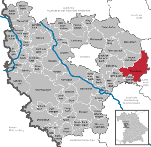
| Location of the town of Windsbach in the district of Ansbach | ||
  |
||


Windsbach (coll. Winschba ) is a town in the Central Franconian district of Ansbach .
geography
Geographical location
Windsbach is located in Rangau , 20 kilometers east of the district town of Ansbach and 40 kilometers southwest of Nuremberg . The Franconian Rezat , the Aurach , tributaries of the Rezat (right: Hopfengraben, Seeleingraben, Erlbach ; left: Wernsbach, Schwalbenbach, Goldbach), tributaries of the Aurach (right: Watzendorfer Bach, Almesbach, Kettersbach; left: Lanzenbach, Klingengraben) flow through the municipality ).
The highest peaks are the Rötelbuck ( 441 m above sea level ) east of Brunn, the Kellerberg ( 432 m above sea level ) southwest of Windsbach and the Goldberg ( 420 m above sea level ) north of Untereschenbach. The lowest point is at Untereschenbach at 374 m above sea level. NHN . The Prünst is the largest contiguous forest area. It is located in the Auf dem Sand corridor area and extends between Windsbach and Ismannsdorf. The Seeleinshölzlein and the Seehölzlein adjoin this in the south . The Brand forest area extends north of Moosbach and west of Suddersdorf .
Community structure
The political municipality of Windsbach has 28 officially named parts of the municipality (the type of settlement is given in brackets ):
|
|
|
The main town of Windsbach is divided into the Upper and Lower Suburbs, the industrial area Fohlenhof , Fallhaus and Bergmichl. Wernsmühle, Moosbach and Retzendorf have largely grown together with the main town. Former parts of the community, now devastated, are: The Grünthalhof (was no longer mentioned after 1818) and the ball mill (demolished in 2012).
Neighboring communities
| Neuendettelsau | Heilsbronn | Kammerstein , pipe |
| Lichtenau |
.svg)
|
Abenberg |
| Wolframs-Eschenbach | Mitteleschenbach | gap |
history
After Georg Rusam, this area was colonized at the end of the 8th century. Because of the sandy soil, settlement was slow. In 1130 the place was first mentioned in a document as Windesbach . The place name contains the personal name Winid, who can be seen as the founder of the place. In 1278, Windsbach was granted city rights. The burgraves of Nuremberg acquired their first goods in Windsbach in 1292 and were able to expand their property in the village in 1400.
Since the 14th century Windsbach was the seat of an upper office of the Principality of Ansbach .
In the 16-point report of the Windsbach Oberamt from 1608, 77 teams are recorded for Windsbach, of which 10 teams lived outside the city walls. 76 properties were subordinate to the Windsbach caste office , 1 property to the Merkendorf administration office . There was also an office building, two aristocratic free houses, town hall, school and sacristan's house, chaplain house, rectory and 2 shepherds' houses. The high court exercised the Brandenburg-Ansbach caste and city bailiff's office in Windsbach .
During and after the Thirty Years' War , the city and its surrounding area became an important settlement area for evangelical expellees from Austria , who found a new home here and whose descendants have lived here to this day.
The Oberamt Windsbach was enlarged in 1750 by the Oberamt Heilsbronn, which was established in 1741. From 1791/92 the principality of Ansbach was administered by the Prussian state as Ansbach-Bayreuth . With that the Oberamt Windsbach became part of the Ansbach district .
At the end of the 18th century there were 155 properties in Windsbach. The high court and the rulership of the city were exercised by the caste and city bailiff's office in Windsbach. All properties in Brandenburg-Ansbach (Kastenamt Windsbach: 153, Kapellamt Windsbach: 1, administration office Merkendorf: 1) as landlords. There were 101 households within the city walls and 54 in the suburbs. In addition, there were stately, communal and church buildings. From 1797 to 1808 the place was under the Justice and Chamber Office Windsbach .
In 1806 Windsbach came to the Kingdom of Bavaria . As part of the municipal edict, the tax district Windsbach was formed in 1808 , which included the places Fallhaus, Schwalbenmühle, Wernsmühle and Windsbach. The municipal community of Windsbach was founded in 1810 and was congruent with the tax district. It was subject to the Heilsbronn Regional Court in administration and jurisdiction and the Windsbach Rent Office in the financial administration . From 1862 to 1879 Windsbach was administered by the Heilsbronn District Office , since 1880 by the Ansbach District Office (renamed the Ansbach District in 1938 ) and the Heilsbronn Rent Office (1920–1929: Heilsbronn Tax Office , from 1929: Ansbach Tax Office ). The jurisdiction remained with the district court Heilsbronn until 1879, 1880–1956 district court Heilsbronn , since 1956 district court Ansbach . The community originally had an area of 5,890 km².
Between 1954 and 1958, the Wernsmühle was reorganized from Windsbach to Wernsbach .
Incorporations
In the course of the regional reform in the 1970s, the following incorporations took place:
| Former local community |
Residents (1970) |
Incorporation date |
Remarks |
|---|---|---|---|
| Bertholdsdorf | 252 | May 1, 1978 | with kitsch village and winter farm |
| Well | 260 | January 1, 1972 | with Leipersloh and Kettersbach |
| Elpersdorf near Windsbach | 122 | January 1, 1972 | with ball mill |
| Hergersbach | 96 | July 1, 1972 | |
| Ismannsdorf | 180 | July 1, 1972 | with Speckheim |
| Moosbach | 117 | January 1, 1972 | |
| Retzendorf | 95 | January 1, 1972 | with Wolfsau and Hölzleinsmühle |
| Sauernheim | 131 | 1st January 1974 | with hop mill |
| Suddersdorf | 144 | July 1, 1973 | with forest house |
| Untereschenbach | 171 | July 1, 1972 | |
| Veitsaurach | 382 | May 1, 1978 | with Lanzendorf and Buckenmühle |
| Wernsbach near Windsbach | 372 | January 1, 1972 | Incorporation of Neuses and the rest of Wernsmühle (238 of the 372 inhabitants), reclassification of the place Wernsbach to Neuendettelsau |
| Winkelhaid | 110 | July 1, 1972 | with Thonhof |
Population development
In the period from 1988 to 2018, the population increased from 5,033 to 6,018 by 985 inhabitants or by 19.6%.
Windsbach community
| year | 1818 | 1840 | 1852 | 1861 | 1867 | 1871 | 1875 | 1880 | 1885 | 1890 | 1895 | 1900 | 1905 | 1910 | 1919 | 1925 | 1933 | 1939 | 1946 | 1950 | 1961 | 1970 | 1987 | 1995 | 2005 | 2015 |
|---|---|---|---|---|---|---|---|---|---|---|---|---|---|---|---|---|---|---|---|---|---|---|---|---|---|---|
| Residents | 976 | 1363 | 1350 | 1343 | 1525 | 1483 | 1460 | 1521 | 1562 | 1556 | 1623 | 1583 | 1575 | 1645 | 1686 | 1614 | 1708 | 1710 | 2936 | 3035 | 2877 | 2869 | 4973 | 5825 | 6182 | 6094 |
| Houses | 178 | 183 | 222 | 229 | 247 | 257 | 292 | 339 | 466 | 1267 | 1665 | |||||||||||||||
| source |
City of Windsbach
| year | 1818 | 1840 | 1852 | 1861 | 1871 | 1885 | 1900 | 1925 | 1950 | 1961 | 1970 | 1987 |
|---|---|---|---|---|---|---|---|---|---|---|---|---|
| Residents | 949 | 1330 | 1317 | 1315 | 1455 | 1535 | 1558 | 1588 | 3021 | 2873 | 2862 | 2847 |
| Houses | 174 | 178 | 218 | 242 | 253 | 288 | 336 | 465 | 730 | |||
| source |
politics

mayor
- First Mayor: Matthias Seitz (SPD / UW)
- Second Mayor: Norbert Kleinöder (surrounding area)
- Third Mayor: Karl Schuler (SPD)
Seitz was elected on March 16, 2014 with 54.61% of the vote, followed by Norman Blevins (CSU) and Nicolette Seeghitz (FW). He was re-elected on March 15, 2020.
City council
The city council has 21 members including the First Mayor:
| Political party | Seats 2020 | Seats 2014 ( municipal elections in Bavaria 2014 ) |
| SPD / Independent voters | 5 | 5 |
| CSU / committed citizens | 5 | 5 |
| Windsbach-Umland voter community | 7th | 5 |
| Green | 3 | 2 |
| Free voters / Windsbacher Bürgerblock (WBB) | - | 3 |
badges and flags
|
|
Blazon : “ Split ; front quartered of silver and black , back in red a silver oblique wave beams . "
Red and white municipal flag |
| Justification of the coat of arms: The quartered Zollern shield stands for the burgraves of Nuremberg , who began to purchase goods in Windsbach between 1281 and 1292. The inclined wave bar stands for the Franconian Rezat . As a country town of the Hohenzollern, Windsbach had only the quartered Zollern shield with the brackish head as a crest in its seals since 1402 . In a seal from 1610 it appears for the first time as a double coat of arms, which Margrave Joachim Ernst von Brandenburg-Ansbach confirmed with a coat of arms letter in 1614: on the right the crossing and on the left an oblique left green wavy bar . Since the mayor's medal in 1819, both coats of arms have been in a shield and the wavy bar has been in silver. |
Others
From 2004 to 2016 Windsbach was part of the municipal alliance (Komm, A) to which the political communities Bruckberg, Dietenhofen, Heilsbronn, Neuendettelsau and Petersaurach also belonged. Since 2016, the community has been part of the Allianz Kernfranken , which arose from the merger of Komm, A and LiSa (Lichtenau, Sachsen b. Ansbach).


Culture and sights
Boys' choir
In 1946, Hans Thamm founded the now internationally known Windsbach boys' choir in Windsbach in the tradition of the Dresden Kreuzchor . From 1978 to January 2012 the choir was led by Karl-Friedrich Beringer . Martin Lehmann has been the choirmaster since February 2012 .
Buildings
Of the former five towers and the city wall, only the Upper (Schwabacher Tor) and the Lower Gate (Bridge Gate) as well as parts of the city fortifications remain. Around the city tower from the 13th century, which can be climbed as a lookout tower by appointment , you can see the second defense system, the official castle. The former third defense system, the fortified church, stands on the church square. The town church of St. Margareta , built in 1730, replaced the previous church from around 800.
The town hall , which was built from 1748 to 1752, forms the center of the historic old town. Next to it was the old castle, which was demolished in 1736. In the years 1737 and 1738 the rent office was built on this site. The plans came from the court building director Leopoldo Retti and the young agricultural inspector Johann David Steingruber . The building served as the tax office and seat of the bailiffs. In 2003 and 2004 the rent office was completely restored. The building is currently used by the Rezat-Mönchswald music school, among others.
A special gem is the Gottesruhkapelle , built around 1400 by the bailiff Ritter von Hellberg, with fresco paintings around 1430.
From 1790 to 1792 a sandstone vault bridge was built over the Franconian Rezat , the so-called Margrave Bridge. In 1992 this monument was completely renovated.
traffic
The national road 2223 performs eight kilometers further northwest the junction Lichtenau (AS 53) of the A 6 ( E 50 ) and the southeast to Elpersdorf and Untereschenbach over after Wassermungenau to federal highway 466 . The national road 2410 offers six kilometers north, the junction Neuendettelsau (AS 54) of A 6. The national road 2220 into an easterly direction crossing the B 466 by Abenberg or west to tungsten-Eschenbach . The district road AN 15 leads south past Gersbach to Mitteleschenbach and north-east to Moosbach . Communal roads lead to Retzendorf and Wernsmühle .
Windsbach is the end point of the R71 regional railway from Wicklesgreuth via Petersaurach and Neuendettelsau to Windsbach. In Wicklesgreuth there is a connection to the Nuremberg – Crailsheim (R7) railway . The train station in Windsbach was built in 1894.
Educational institutions
- Windsbach elementary school, elementary and middle school
- Johann-Sebastian-Bach-Gymnasium Windsbach
- Rezat Mönchswald music school
Personalities
Honorary citizen
- Johann Jungmaier, Former Mayor
- Hans Thamm (1921–2007), founder of the Windsbach Boys Choir
sons and daughters of the town
- Leonhard Murr (1896–1967), Member of the Bundestag for the FDP , farmer and potato grower
- Gottfried Koller (1902–1959), zoologist, biologist and university professor
- Karl Steinbauer (1906–1988), Evangelical Lutheran theologian and member of the Confessing Church
- Christa Götz (* 1948), former member of the CSU state parliament in the Bavarian state parliament and farmer
People connected to the city
- Karl Dunz (* 1917), author and former mayor of Windsbach
literature
Monographs
- Maria Tabea Armanski-Dauscher: The street of my childhood. 1995, 2nd edition 2000.
- Hansjörg Dodenhöft: From the municipal Latin school to the Johann Sebastian Bach grammar school, 475 years of higher education in Windsbach. Ed .: Friends and Sponsors of the JSBG, 2012.
- Hansjörg Dodenhöft: The Windsbacher Progymnasium from 1898 to 1946, a search for traces in troubled times. Ed .: Friends and Sponsors of the JSBG, 2018.
- Karl Dunz : Fate of the Jews in Windsbach . Freimund print shop, Neuendettelsau 1947.
- Karl Dunz : Windsbach - home and cultural history of the city with all districts . Neuendettelsau 1985.
- Johann Friedrich Fresisen: ... and then the Americans came: Windsbach before and after zero hour - a review of a ten year old at the time. Nuremberg 1986.
- Johann Friedrich frischisen (ed.): Winsbeke: the Windsbacher contribution to the minnesang of the high Middle Ages. Regensburg 1994.
- Johann Jungmaier: The town of Windsbach and its history. Roth 1938.
- Eberhard Krauss: Exiles in the Evangelical Luth. Deanery Windsbach in the 17th century. A family history investigation (= sources and research on Franconian family history . Volume 19 ). Society for Family Research in Franconia, Nuremberg 2007, ISBN 978-3-929865-12-7 .
items
- Johann Kaspar Bundschuh : Windsbach . In: Geographical Statistical-Topographical Lexicon of Franconia . tape 6 : V-Z . Verlag der Stettinische Buchhandlung, Ulm 1804, DNB 790364328 , OCLC 833753116 , Sp. 260-261 ( digitized version ).
- Elisabeth Fechter: The place names of the district of Ansbach . Inaugural dissertation. Erlangen 1955, DNB 480570132 , p. 204 .
- Günther P. Fehring : City and district of Ansbach (= Bavarian art monuments . Volume 2 ). Deutscher Kunstverlag, Munich 1958, DNB 451224701 , p. 154-159 .
- Johann Bernhard Fischer : Windspach . In: Statistical and topographical description of the Burggraftum Nürnberg, below the mountain, or the Principality of Brandenburg-Anspach. Second part. Containing the economic, statistical and moral condition of these countries according to the fifteen upper offices . Benedict Friedrich Haueisen, Ansbach 1790, p. 420-422 ( digitized version ).
- Manfred Jehle: Ansbach: the margravial chief offices Ansbach, Colmberg-Leutershausen, Windsbach, the Nuremberg nursing office Lichtenau and the Deutschordensamt (Wolframs-) Eschenbach (= historical atlas of Bavaria, part Franconia . I, 35). Commission for Bavarian State History, Munich 2009, ISBN 978-3-7696-6856-8 .
- Wolf-Armin von Reitzenstein : Lexicon of Franconian place names. Origin and meaning . Upper Franconia, Middle Franconia, Lower Franconia. CH Beck, Munich 2009, ISBN 978-3-406-59131-0 , p. 245 .
- Konrad Rosenhauer et al. (Ed.): The district of Ansbach. Past and present . Publishing house for authorities and business Hoeppner, Aßling-Pörsdorf 1964, DNB 450093387 , p. 211-212 .
- Gottfried Stieber: Windspach . In: Historical and topographical news from the Principality of Brandenburg-Onolzbach . Johann Jacob Enderes, Schwabach 1761, p. 959-970 ( digitized version ).
- Pleikard Joseph Stumpf : Windsbach . In: Bavaria: a geographical-statistical-historical handbook of the kingdom; for the Bavarian people . Second part. Munich 1853, p. 728-729 ( digitized version ).
Web links
- Website of the city of Windsbach
- Windsbach: Official statistics of the LfStat
- Windsbach in the Topographia Franconiae of the University of Würzburg , accessed on September 14, 2019.
- Windsbach in the historical directory of the association for computer genealogy
Individual evidence
- ↑ "Data 2" sheet, Statistical Report A1200C 202041 Population of the municipalities, districts and administrative districts 1st quarter 2020 (population based on the 2011 census) ( help ).
- ↑ E. Fechter, p. 204.
- ↑ Windsbach in the Bavaria Atlas
- ^ Windsbach in the local database of the Bayerische Landesbibliothek Online . Bayerische Staatsbibliothek, accessed on September 14, 2019. There: 29 parts of the community. The ball mill , which was demolished in 2012, is still run as a community part.
- ↑ Georg Rusam: Basics and beginnings of church organization at the middle Rezat . In: Journal for Bavarian Church History . tape 17 . Verlag die Egge, Nuremberg 1949, p. 98 ( digitized version ). The terrain is described as "swampy or at least wet ground in a flat valley basin".
- ↑ W.-A. v. Reitzenstein, p. 245. E. Fechter, p. 204 explicitly rules out the fact that the first part of the name refers to the Wends , since the defining word is in the genitive singular and not in the plural. - The Wends were settled around Ansbach in the 10th century, which is also reflected in the place names.
- ^ State Archives Nuremberg , 16-point reports 43/2. Quoted from M. Jehle, Vol. 2, p. 729.
- ↑ E. Krauss, p. 76ff.
- ↑ JB Fischer: Statistical and topographical description , Vol. 2, p. 398.
- ↑ M. Jehle, Vol. 2, pp. 929f.
- ↑ State Archives Nuremberg , Government of Middle Franconia, Chamber of the Interior, Levy 1952, 3850: Formation of the municipal and rural communities in the district court Heilsbronn 1810. Quoted from M. Jehle, vol. 2, p. 963.
- ^ Address and statistical manual for the Rezatkreis in the Kingdom of Baiern . Buchdruckerei Chancellery, Ansbach 1820, p. 45 ( digitized version ).
- ↑ M. Jehle, Vol. 2, pp. 1016f.
- ↑ a b c Bavarian State Statistical Office (ed.): Official city directory for Bavaria, territorial status on October 1, 1964 with statistical information from the 1961 census . Issue 260 of the articles on Bavaria's statistics. Munich 1964, DNB 453660959 , Section II, Sp. 760 ( digitized version ).
- ↑ E. Fechter (p. 201) describes the place as belonging to the municipality of Windsbach, whereas G. Fehring (p. 153) describes it as the municipality of Wernsbach.
- ↑ a b c d Federal Statistical Office (Hrsg.): Historical municipality register for the Federal Republic of Germany. Name, border and key number changes in municipalities, counties and administrative districts from May 27, 1970 to December 31, 1982 . W. Kohlhammer, Stuttgart / Mainz 1983, ISBN 3-17-003263-1 , p. 706 f .
- ↑ a b c d e f g h i Wilhelm Volkert (ed.): Handbook of the Bavarian offices, municipalities and courts 1799–1980 . CH Beck, Munich 1983, ISBN 3-406-09669-7 , p. 421 .
- ↑ a b Only inhabited houses are given. In 1818 these were designated as fireplaces , in 1840, in 1852 as houses , and from 1871 to 2015 as residential buildings.
- ↑ a b Alphabetical index of all the localities contained in the Rezatkreise according to its constitution by the newest organization: with indication of a. the tax districts, b. Judicial Districts, c. Rent offices in which they are located, then several other statistical notes . Ansbach 1818, p. 104 ( digitized version ). For the municipality of Windsbach plus the residents and buildings of Schwalbenmühle (p. 84) and Wernsmühle (p. 102).
- ^ A b Eduard Vetter (Ed.): Statistical handbook and address book of Middle Franconia in the Kingdom of Bavaria . Self-published, Ansbach 1846, p. 154 ( digitized version ).
- ^ A b Eduard Vetter (Ed.): Statistical handbook and address book of Middle Franconia in the Kingdom of Bavaria . Brügel'sche Officin, Ansbach 1856, p. 188-189 ( digitized version ).
- ↑ a b Joseph Heyberger, Chr. Schmitt, v. Wachter: Topographical-statistical manual of the Kingdom of Bavaria with an alphabetical local dictionary . In: K. Bayer. Statistical Bureau (Ed.): Bavaria. Regional and folklore of the Kingdom of Bavaria . tape 5 . Literary and artistic establishment of the JG Cotta'schen Buchhandlung, Munich 1867, Sp. 1044 , urn : nbn: de: bvb: 12-bsb10374496-4 ( digitized version ).
- ↑ Kgl. Statistisches Bureau (Ed.): Directory of the municipalities of the Kingdom of Bavaria according to the status of the population in December 1867 . XXI. Issue of the contributions to the statistics of the Kingdom of Bavaria. Ackermann, Munich 1869, p. 165 ( digitized version ).
- ↑ a b Kgl. Statistical Bureau (ed.): Complete list of localities of the Kingdom of Bavaria. According to districts, administrative districts, court districts and municipalities, including parish, school and post office affiliation ... with an alphabetical general register containing the population according to the results of the census of December 1, 1875 . Adolf Ackermann, Munich 1877, 2nd section (population figures from 1871, cattle figures from 1873), Sp. 1210 , urn : nbn: de: bvb: 12-bsb00052489-4 ( digitized ).
- ↑ K. Bayer. Statistical Bureau (ed.): Community directory for the Kingdom of Bavaria. Manufactured due to the new organization of government districts, district offices and judicial districts. Addendum to issue 36 of the articles on Bavaria's statistics. Munich 1879, p. 61 ( digitized version ).
- ↑ K. Bayer. Statistical Bureau (ed.): Community directory for the Kingdom of Bavaria. Results of the census of December 1, 1880. Issue 35 of the articles on Bavaria's statistics. Munich 1882, p. 174 ( digitized version ).
- ↑ a b K. Bayer. Statistical Bureau (Ed.): Localities directory of the Kingdom of Bavaria. According to government districts, administrative districts, ... then with an alphabetical register of locations, including the property and the responsible administrative district for each location. LIV. Issue of the contributions to the statistics of the Kingdom of Bavaria. Munich 1888, Section III, Sp. 1096-1097 ( digitized version ).
- ↑ a b c d e f g h Bavarian State Statistical Office (Hrsg.): Historical municipality register: The population of the municipalities of Bavaria from 1840 to 1952 (= contributions to Statistics Bavaria . Issue 192). Munich 1954, DNB 451478568 , p. 165 , urn : nbn: de: bvb: 12-bsb00066439-3 ( digitized version ).
- ↑ a b K. Bayer. Statistical Bureau (Ed.): Directory of localities of the Kingdom of Bavaria, with alphabetical register of places . LXV. Issue of the contributions to the statistics of the Kingdom of Bavaria. Munich 1904, Section II, Sp. 1162 ( digitized version ).
- ↑ a b Bavarian State Statistical Office (ed.): Localities directory for the Free State of Bavaria according to the census of June 16, 1925 and the territorial status of January 1, 1928 . Issue 109 of the articles on Bavaria's statistics. Munich 1928, Section II, Sp. 1199-1200 ( digitized version ).
- ↑ a b Bavarian State Statistical Office (ed.): Official place directory for Bavaria - edited on the basis of the census of September 13, 1950 . Issue 169 of the articles on Bavaria's statistics. Munich 1952, DNB 453660975 , Section II, Sp. 1032 ( digitized version ).
- ↑ a b Bavarian State Statistical Office (Hrsg.): Official local directory for Bavaria . Issue 335 of the articles on Bavaria's statistics. Munich 1973, DNB 740801384 , p. 172 ( digitized version ).
- ↑ a b Bavarian State Office for Statistics and Data Processing (Ed.): Official local directory for Bavaria, territorial status: May 25, 1987 . Issue 450 of the articles on Bavaria's statistics. Munich November 1991, DNB 94240937X , p. 333 ( digitized version ).
- ^ Windsbach: Official statistics of the LfStat
- ↑ City of Windsbach: Preliminary result of the election of the city council on March 15, 2020. Retrieved June 10, 2020 .
- ^ Entry on the coat of arms of Windsbach in the database of the House of Bavarian History
- ^ Claus Broser: Coat of arms in the district of Ansbach . Ed .: District of Ansbach. Hercynia Verlag, Ansbach 1990, ISBN 3-925063-23-4 , p. 118-119 .
- ↑ Windsbach. In: Kommunalflaggen.eu. Retrieved February 8, 2020 .
- ↑ www.kernfranken.eu
- ↑ City tower on the Fränkisches Seenland website

Adelshofen | Arberg | Aurach | Bechhofen | Bruckberg | Book at the forest | Burgoberbach | Burk | Colmberg | Dentlein am Forst | Diebach | Dietenhofen | Dinkelsbühl | Dombühl | Dürrwangen | Ehingen | Feuchtwangen | Flachslanden | Gebsattel | Gerolfingen | Geslau | Heilsbronn | Herrieden | Insingen | Langfurth | Lehrberg | Leutershausen | Lichtenau | Merkendorf | Mitteleschenbach | Mönchsroth | Neuendettelsau | Neusitz | Oberdachstetten | Ohrbach | Ornbau | Petersaurach | Röckingen | Rothenburg ob der Tauber | Rügland | Saxony near Ansbach | Schillingsfürst | Schnelldorf | Schopfloch | Steinsfeld | Unterschwaningen | Wassertrüdingen | Weidenbach | Weihenzell | Weiltingen | Wettringen | Wieseth | Wilburgstetten | Windelsbach | Windsbach | Wittelshofen | Wolframs-Eschenbach | Wörnitz
Unregulated areas:
Lower Forest