
Kettersbach
|
Kettersbach
City of Windsbach
Coordinates: 49 ° 16 ′ 30 ″ N , 10 ° 53 ′ 15 ″ E
|
|
|---|---|
| Height : | 404 m above sea level NHN |
| Residents : | 72 (May 25 1987) |
| Postal code : | 91575 |
| Area code : | 09871 |
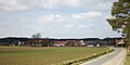
 View of the town from Brunn
|
|


Kettersbach (colloquially: Ked ə schba ) is a district of the town of Windsbach in the district of Ansbach in Middle Franconia .
geography
The Kettersbach, a right tributary of the Aurach, flows through the village . Half a kilometer east of the village is the Hundsücken ( 412 m above sea level ), about 0.5 km northwest of the Leimenbuck ( 418 m above sea level ). Immediately to the west is the Oberer Grund corridor .
The district road AN 15 / RH 15 leads through the village, which connects the village with Brunn (1.5 km southeast) and Rudelsdorf (1.8 km east). A community road leads to Veitsaurach to AN 17 (1.6 km north) or to Leipersloh (1.8 km south).
history
Around 1050 the place was owned by the Count of Abenberg , from 1296 it was under the Eichstätt Monastery . In 1296 the place was first mentioned in a document as "Köterspach". The place name is derived from the same name of the water body. The defining word of the name of the water is probably the Slavic personal name "Choterad". According to this, it could be a Wendensiedlung , which was relocated to Franconia as planned under Charlemagne around 800. In any case, this interpretation of the name seems more accurate than the explanation that a number of springs between Brunn and Kettersbach were referred to as a chain, that is, Kettersbach is the settlement on the brook with the many springs. In 1312 the place is called "Chötgerzbach", 1407 "Köttersbach".
In the 16-point report of the Windsbach Regional Office from 1608, ten teams are listed for Kettersbach who lived in 5 farms and 5 Köbler estates . There was also a shepherd's house. The Abenberg caste office exercised the manorial rule over all properties , the high court was held by the Brandenburg-Ansbach caste and city bailiff's office in Windsbach .
In the Thirty Years' War Ketter Bach suffered severe damage. Eight out of 13 farms had burned down and five deserted because the residents fled. Reconstruction began around 1650.
Towards the end of the 18th century there were 10 properties in Kettersbach (3 courtyards, 2 half courtyards, 5 estates) and a community pastor's house. The high court was exercised by the caste and municipal bailiff's office in Windsbach. The Abenberg caste office held the village and community rulership and the lordship over all properties. From 1797 to 1808 the place was under the Justice and Chamber Office Windsbach .
As part of the community edict, Kettersbach was assigned to the Bertholdsdorf tax district formed in 1808 . It also belonged to the rural community of Bertholdsdorf, founded in 1810 . With the second community edict (1818), Kettersbach was re-incorporated into the newly formed rural community of Brunn . This was incorporated into the municipality of Windsbach on January 1, 1972 as part of the regional reform .
Historical description
In the geographical statistical-topographical lexicon of Franconia (1801) the place is described as follows:
“ Kettersbach, very Eichstättischer in the Fraischbezirke of the Ansbach Oberamt Windsbach, 2 hours northwest of Abenberg beyond Kapsdorf between Rudelsdorf and Bruner and parish to Veitsaurach hamlet of 10 households, all of which belong to the Eichstättischen care and caste office Abenberg.
The old road from Nuremberg to Swabia and Schweitzerland goes through this hamlet. The Spalter collegiate monastery has two thirds of the large and small tithe there and the Marienburg monastery a third.
In the year 1425 the Eichstättische Bishop Johann II, a Herr von Heydeck, the Messrs Konrad and Heinrich von Lentersheim let the last federation of the third part of the tithe von Kettersbach, whereas these make several of their own estates loanable to the barn of the Eichstätt church. "
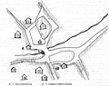
Historical location maps

Map from 1820
House numbers


Architectural monuments
- In the direction of Brunn there is a medieval stone cross made of bubble sandstone. On it you can see two fishermen and a scythe. It is said that two fishermen got into an argument at this point, and one of them stabbed the other with a scythe. He had been pardoned for erecting an atonement cross and caring for the bereaved
- At house no. 10 there is a path chapel with a barrel vault and gable roof, which is profiled with volutes on the front side, it was built in the 17th and 18th centuries. Built in the 16th century and originally contained a wooden figure of Saint Sebastian.
See also: → List of architectural monuments in Windsbach # Kettersbach
Population development
| year | 1805 | 1818 | 1840 | 1861 | 1871 | 1885 | 1900 | 1925 | 1950 | 1961 | 1970 | 1987 |
|---|---|---|---|---|---|---|---|---|---|---|---|---|
| Residents | 77 | 64 | 100 | 78 | 82 | 107 | 75 | 84 | 102 | 70 | 73 | 72 |
| Houses | 13 | 13 | 21st | 17th | 13 | 15th | 16 | 17th | ||||
| source |
religion
The Catholics parish to St. Vitus (Veitsaurach) . There have also been Protestants since 1867. They are parish to St. Georg (Bertholdsdorf) .
Trivia
Johann Wolfgang von Goethe traveled on Nürnberger Strasse through Kettersbach in 1797 and drew house no. 11 (today's Wiesinger estate), which he particularly liked.
photos

Place view
Coming from Brunn

Coming from Rudelsdorf

Town entrance


literature
- Johann Kaspar Bundschuh : Kettersbach . In: Geographical Statistical-Topographical Lexicon of Franconia . tape 3 : I-Ne . Verlag der Stettinische Buchhandlung, Ulm 1801, DNB 790364301 , OCLC 833753092 , Sp. 84-85 ( digitized version ).
- Karl Dunz : Windsbach - home and cultural history of the city with all districts . Neuendettelsau 1985, p. 247-249 .
- Elisabeth Fechter: The place names of the district of Ansbach . Inaugural dissertation. Erlangen 1955, DNB 480570132 , p. 114 .
- Günther P. Fehring : City and district of Ansbach (= Bavarian art monuments . Volume 2 ). Deutscher Kunstverlag, Munich 1958, DNB 451224701 , p. 117 .
- Ludwig Hefele: History of the parish Veitsaurach . Funk Druck, Eichstätt 1977, p. 163-173, 372-407 .
- Manfred Jehle: Ansbach: the margravial chief offices Ansbach, Colmberg-Leutershausen, Windsbach, the Nuremberg nursing office Lichtenau and the Deutschordensamt (Wolframs-) Eschenbach (= historical atlas of Bavaria, part Franconia . I, 35). tape 2 . Commission for Bavarian State History, Munich 2009, ISBN 978-3-7696-6856-8 , p. 875 .
Web links
- Kettersbach in the location database of the Bavarian State Library Online . Bavarian State Library
- Kettersbach in the Topographia Franconiae of the University of Würzburg , accessed on September 14, 2019.
- Kettersbach in the historical directory of the association for computer genealogy
Individual evidence
- ↑ a b Bavarian State Office for Statistics and Data Processing (Ed.): Official local directory for Bavaria, territorial status: May 25, 1987 . Issue 450 of the articles on Bavaria's statistics. Munich November 1991, DNB 94240937X , p. 333 ( digitized version ).
- ↑ a b c E. Fechter, p. 114.
- ^ Kettersbach in the Bavaria Atlas
- ↑ a b c K. Dunz, p. 247.
- ↑ L. Hefele, pp. 163-170.
- ↑ State Archives Nuremberg , 16-Punkt -berichte 43/1, 10. Quoted from M. Jehle, Vol. 2, p. 731.
- ↑ M. Jehle, Vol. 2, p. 875.
- ^ Johann Bernhard Fischer : Kettersbach . In: Statistical and topographical description of the Burggraftum Nürnberg, below the mountain, or the Principality of Brandenburg-Anspach. Second part. Containing the economic, statistical and moral condition of these countries according to the fifteen upper offices . Benedict Friedrich Haueisen, Ansbach 1790, p. 406 ( digitized version ). . Only 9 subject families are recorded there.
- ^ State Archives Nuremberg , Government of Middle Franconia, Chamber of the Interior, Levy 1952, 3850: Formation of the municipal and rural communities in the Heilsbronn district court in 1810. Quoted from M. Jehle, Volume 2, p. 963.
- ^ JK Bundschuh: Geographical Statistical-Topographical Lexicon of Franconia. Volume 3, Col. 84 f.
- ↑ a b G. P. Fehring, p. 117.
- ↑ Only inhabited houses are given. In 1818 these were designated as fireplaces , in 1840 as houses , and from 1871 to 1987 as residential buildings.
- ↑ after Hefele
- ↑ Alphabetical index of all the localities contained in the Rezatkkreis according to its constitution by the newest organization: with indication of a. the tax districts, b. Judicial Districts, c. Rent offices in which they are located, then several other statistical notes . Ansbach 1818, p. 47 ( digitized version ).
- ↑ Eduard Vetter (Ed.): Statistical handbook and address book of Middle Franconia in the Kingdom of Bavaria . Self-published, Ansbach 1846, p. 146 ( digitized version ).
- ^ Joseph Heyberger, Chr. Schmitt, v. Wachter: Topographical-statistical manual of the Kingdom of Bavaria with an alphabetical local dictionary . In: K. Bayer. Statistical Bureau (Ed.): Bavaria. Regional and folklore of the Kingdom of Bavaria . tape 5 . Literary and artistic establishment of the JG Cotta'schen Buchhandlung, Munich 1867, Sp. 1042 , urn : nbn: de: bvb: 12-bsb10374496-4 ( digitized version ).
- ↑ Kgl. Statistical Bureau (ed.): Complete list of localities of the Kingdom of Bavaria. According to districts, administrative districts, court districts and municipalities, including parish, school and post office affiliation ... with an alphabetical general register containing the population according to the results of the census of December 1, 1875 . Adolf Ackermann, Munich 1877, 2nd section (population figures from 1871, cattle figures from 1873), Sp. 1207 , urn : nbn: de: bvb: 12-bsb00052489-4 ( digitized version ).
- ↑ K. Bayer. Statistical Bureau (Ed.): Localities directory of the Kingdom of Bavaria. According to government districts, administrative districts, ... then with an alphabetical register of locations, including the property and the responsible administrative district for each location. LIV. Issue of the contributions to the statistics of the Kingdom of Bavaria. Munich 1888, Section III, Sp. 1093 ( digitized version ).
- ↑ K. Bayer. Statistical Bureau (Ed.): Directory of localities of the Kingdom of Bavaria, with alphabetical register of places . LXV. Issue of the contributions to the statistics of the Kingdom of Bavaria. Munich 1904, Section II, Sp. 1158 ( digitized version ).
- ↑ Bavarian State Statistical Office (ed.): Localities directory for the Free State of Bavaria according to the census of June 16, 1925 and the territorial status of January 1, 1928 . Issue 109 of the articles on Bavaria's statistics. Munich 1928, Section II, Sp. 1195 ( digitized version ).
- ↑ Bavarian State Statistical Office (ed.): Official place directory for Bavaria - edited on the basis of the census of September 13, 1950 . Issue 169 of the articles on Bavaria's statistics. Munich 1952, DNB 453660975 , Section II, Sp. 1024 ( digitized version ).
- ↑ Bavarian State Statistical Office (ed.): Official city directory for Bavaria, territorial status on October 1, 1964 with statistical information from the 1961 census . Issue 260 of the articles on Bavaria's statistics. Munich 1964, DNB 453660959 , Section II, Sp. 753 ( digitized version ).
- ^ Bavarian State Statistical Office (ed.): Official place directory for Bavaria . Issue 335 of the articles on Bavaria's statistics. Munich 1973, DNB 740801384 , p. 172 ( digitized version ).
- ↑ Konrad Rosenhauer et al. (Ed.): The district of Ansbach. Past and present . Publishing house for authorities and business Hoeppner, Aßling-Pörsdorf 1964, DNB 450093387 , p. 123 .

Bertholdsdorf | Brunn | Buckenmühle | Elpersdorf | Hergersbach | Hölzleinsmühle | Hop mill | Ismannsdorf | Kettersbach | Kitsch Village | Ball mill | Lanzendorf | Leipersloh | Moosbach | Neuses near Windsbach | Retzendorf | Sauernheim | Swallow Mill | Speckheim | Suddersdorf | Thonhof | Untereschenbach | Veitsaurach | Forest house | Wernsmühle | Windsbach (with Fallhaus and Fohlenhof ) | Winkelhaid | Winterhof | Wolf sow