
Neuses near Windsbach
|
Neuses near Windsbach
City of Windsbach
Coordinates: 49 ° 15 ′ 6 ″ N , 10 ° 48 ′ 3 ″ E
|
|
|---|---|
| Height : | 381 (379-396) m above sea level NHN |
| Residents : | 120 (May 25 1987) |
| Postal code : | 91575 |
| Area code : | 09871 |
_13.JPG) View of the town from Bechhofen
|
|
_2.JPG)
Neuses at Windsbach (officially Neuses b.Windsbach , commonly known Naises ) is a district of the city Windsbach in Ansbach in Middle Franconia .
geography
The village lies on the Franconian Rezat . The Wolfsgrund begins to the southwest and rises to an altitude of 445 m above sea level. NHN leads. The corridors closest to the village are Keilfeld, Hohe Straße, Luderbuck, Wolfsgründle, Kuhtrieb, Hirtenbuck and Hasenbuck .
The state road 2223 leads to Windsbach (km) or to Bechhofen (1.2 km northwest). Municipal roads lead to Wernsbach (1 km north), to Windsbach (1.7 km south-east) and via the hop mill to Sauernheim (3 km west).
history
Shards from the urnfield period were found near Neuses .
In 1132 a "Chunrat de Niusaze" is mentioned, which is the first time that the place is attested. The place name means new place of residence. The monastery Heilsbronn where he gained little by five property.
In the 16-point report of the Oberamt Windsbach from 1608, 10 teams are listed for Neuses: 2 goods belonged to the Windsbach council , 3 farms and 2 goods to the Heilsbronn monastery administration office , 1 farm to the Abenberg caste office in Eichstätt , 1 Gut Rieter von Kornburg and 1 mill and 2 courtyards in the imperial city of Nuremberg . There was also a communal shepherd's house. The high court exercised the Brandenburg-Ansbach caste and city bailiff's office in Windsbach . According to the 16-point report of the Heilsbronn Monastery Office, also from 1608, only 4 Heilsbronn properties are given (3 courtyards and 1 Köblergut ).
The last wolf in the area was killed in Neuses in 1686. He was about to jump on a tap and fell into a poorly covered well. The "Neusemer Wolf" also appears in the coat of arms of the former municipality of Wernsbach, to which Neuses belonged.
In the official description of the Lichtenau Nursing Office from 1748, 13 subject families are specified for the location, 2 of which were subordinate to the Immeldorf Nursing Office and the remaining other landlords.
Towards the end of the 18th century there were 12 properties and a community shepherd's house in Neuses. The high court and the village and community rulership exercised the Brandenburg-Ansbach caste and city bailiff's office in Windsbach. The landlords were the principality of Ansbach ( box office Windsbach : 1 estate, 1 inn; cloister administration office Heilsbronn: 1 courtyard, 2 courtyards, 1 estate), the imperial city of Nuremberg ( St. Klara monastery office : 1 Mühlgut, hospital and Katharinenklosteramt : 1 courtyard) , the Hochstift Eichstätt (box office Abenberg: 1 good; box office Spalt : 1 good) and the Rieter Foundation administration Kornburg (1 good). In addition to the households, there was the shepherd's house, which was a communal building. There were 13 subject families at that time, 8 of which were Ansbachian. From 1797 to 1808 the place was under the Justice and Chamber Office Windsbach .
As part of the community edict , Neuses was assigned to the Immeldorf tax district formed in 1808 . It also belonged to the rural community of Immeldorf, founded in 1810 . With the second community edict (1818) Neuses was re-incorporated into the newly formed rural community of Wernsbach . On January 1, 1972 Neuses was incorporated into Windsbach as part of the regional reform .
monument
- House No. 40: Stable house with a single-storey gable roof and half-timbered gable from the 18th century; the transverse gable was expanded in 1815.
See also: → List of architectural monuments in Windsbach
Population development
| year | 1818 | 1840 | 1861 | 1871 | 1885 | 1900 | 1925 | 1950 | 1961 | 1970 | 1987 |
|---|---|---|---|---|---|---|---|---|---|---|---|
| Residents | 90 | 94 | 116 | 105 | 112 | 116 | 117 | 206 | 152 | 142 | 120 |
| Houses | 16 | 18th | 22nd | 22nd | 21st | 31 | 30th | 33 | |||
| source |
religion
The inhabitants were originally parish to St. Maria (Großhaslach) , from 1473 to 1545 to St. Kunigund (Reuth) , from 1545 to 1603 to St. Michael (Weißenbronn) . Since 1603 the inhabitants of the Evangelical Lutheran denomination have been parish in St. Margareta (Windsbach) . The residents of Roman Catholic denomination are parish to St. Bonifatius (Windsbach) .
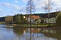
photos

Town center
At light flood

old house

In the town

War memorial
_3.JPG)
_4.JPG)

_11.JPG)

literature
- Johann Kaspar Bundschuh : New . In: Geographical Statistical-Topographical Lexicon of Franconia . tape 3 : I-Ne . Verlag der Stettinische Buchhandlung, Ulm 1801, DNB 790364301 , OCLC 833753092 , Sp. 775 ( digitized version ).
- Karl Dunz : Windsbach - home and cultural history of the city with all districts . Neuendettelsau 1985, p. 266-270 .
- Elisabeth Fechter: The place names of the district of Ansbach . Inaugural dissertation. Erlangen 1955, DNB 480570132 , p. 141 .
- Manfred Jehle: Ansbach: the margravial chief offices Ansbach, Colmberg-Leutershausen, Windsbach, the Nuremberg nursing office Lichtenau and the Deutschordensamt (Wolframs-) Eschenbach (= historical atlas of Bavaria, part Franconia . I, 35). tape 2 . Commission for Bavarian State History, Munich 2009, ISBN 978-3-7696-6856-8 , p. 893 .
- Georg Muck: History of Heilsbronn Monastery from prehistoric times to modern times . tape 2 . For Kunstreprod. Schmidt, Neustadt an der Aisch 1993, ISBN 3-923006-90-X , p. 243–247 (first edition: Beck, Nördlingen 1879).
Web links
- News at Windsbach on the website windsbach.de
- Neuses bei Windsbach in the local database of the Bayerische Landesbibliothek Online . Bavarian State Library
- Neuses near Windsbach in the Topographia Franconiae of the University of Würzburg , accessed on September 14, 2019.
- Neuses near Windsbach in the historical directory of the association for computer genealogy
Individual evidence
- ↑ a b Bavarian State Office for Statistics and Data Processing (Ed.): Official local directory for Bavaria, territorial status: May 25, 1987 . Issue 450 of the articles on Bavaria's statistics. Munich November 1991, DNB 94240937X , p. 333 ( digitized version ).
- ↑ a b E. Fechter, p. 141.
- ↑ Neuses near Windsbach in the Bavaria Atlas
- ↑ M. Jehle, Vol. 1, p. 23.
- ↑ G. Muck, Vol. 2, p. 243ff.
-
↑ State Archives Nuremberg , 16-Punkt -berichte 43/1, 17. Quoted from M. Jehle, Vol. 2, pp. 731f.
The property, which, according to the 16-point report, should be subordinate to the Abenberg caste office, is listed as a property in the Salbuch of the Spalter Kollegiatstiftes from 1619 for Neuses. F. Eigler, p. 114. - ↑ State Archives Nuremberg , 16-Punkt -berichte 43/2, 12. Quoted from M. Jehle, Vol. 2, p. 739.
- ↑ K. Dunz, p. 268ff.
- ↑ M. Jehle, Vol. 2, p. 746.
- ↑ M. Jehle, Vol. 2, p. 893.
- ^ Johann Bernhard Fischer : Neuses b. Windspach . In: Statistical and topographical description of the Burggraftum Nürnberg, below the mountain, or the Principality of Brandenburg-Anspach. Second part. Containing the economic, statistical and moral condition of these countries according to the fifteen upper offices . Benedict Friedrich Haueisen, Ansbach 1790, p. 407 ( digitized version ).
- ↑ JK Bundschuh, Vol. 3, Col. 775.
- ↑ State Archives Nuremberg , Government of Middle Franconia, Chamber of the Interior, Levy 1952, 3850: Formation of the municipal and rural communities in the district court Heilsbronn 1810. Quoted from M. Jehle, vol. 2, p. 963.
- ↑ Only inhabited houses are given. In 1818 these were designated as fireplaces , in 1840 as houses , and from 1871 to 1987 as residential buildings.
- ↑ Alphabetical index of all the localities contained in the Rezatkkreis according to its constitution by the newest organization: with indication of a. the tax districts, b. Judicial Districts, c. Rent offices in which they are located, then several other statistical notes . Ansbach 1818, p. 64 ( digitized version ).
- ↑ Eduard Vetter (Ed.): Statistical handbook and address book of Middle Franconia in the Kingdom of Bavaria . Self-published, Ansbach 1846, p. 154 ( digitized version ).
- ^ Joseph Heyberger, Chr. Schmitt, v. Wachter: Topographical-statistical manual of the Kingdom of Bavaria with an alphabetical local dictionary . In: K. Bayer. Statistical Bureau (Ed.): Bavaria. Regional and folklore of the Kingdom of Bavaria . tape 5 . Literary and artistic establishment of the JG Cotta'schen Buchhandlung, Munich 1867, Sp. 1044 , urn : nbn: de: bvb: 12-bsb10374496-4 ( digitized version ).
- ↑ Kgl. Statistical Bureau (ed.): Complete list of localities of the Kingdom of Bavaria. According to districts, administrative districts, court districts and municipalities, including parish, school and post office affiliation ... with an alphabetical general register containing the population according to the results of the census of December 1, 1875 . Adolf Ackermann, Munich 1877, 2nd section (population figures from 1871, cattle figures from 1873), Sp. 1210 , urn : nbn: de: bvb: 12-bsb00052489-4 ( digitized ).
- ↑ K. Bayer. Statistical Bureau (Ed.): Localities directory of the Kingdom of Bavaria. According to government districts, administrative districts, ... then with an alphabetical register of locations, including the property and the responsible administrative district for each location. LIV. Issue of the contributions to the statistics of the Kingdom of Bavaria. Munich 1888, Section III, Sp. 1096 ( digitized version ).
- ↑ K. Bayer. Statistical Bureau (Ed.): Directory of localities of the Kingdom of Bavaria, with alphabetical register of places . LXV. Issue of the contributions to the statistics of the Kingdom of Bavaria. Munich 1904, Section II, Sp. 1162 ( digitized version ).
- ↑ Bavarian State Statistical Office (ed.): Localities directory for the Free State of Bavaria according to the census of June 16, 1925 and the territorial status of January 1, 1928 . Issue 109 of the articles on Bavaria's statistics. Munich 1928, Section II, Sp. 1199 ( digitized version ).
- ↑ Bavarian State Statistical Office (ed.): Official place directory for Bavaria - edited on the basis of the census of September 13, 1950 . Issue 169 of the articles on Bavaria's statistics. Munich 1952, DNB 453660975 , Section II, Sp. 1032 ( digitized version ).
- ↑ Bavarian State Statistical Office (ed.): Official city directory for Bavaria, territorial status on October 1, 1964 with statistical information from the 1961 census . Issue 260 of the articles on Bavaria's statistics. Munich 1964, DNB 453660959 , Section II, Sp. 760 ( digitized version ).
- ^ Bavarian State Statistical Office (ed.): Official place directory for Bavaria . Issue 335 of the articles on Bavaria's statistics. Munich 1973, DNB 740801384 , p. 172 ( digitized version ).

Bertholdsdorf | Brunn | Buckenmühle | Elpersdorf | Hergersbach | Hölzleinsmühle | Hop mill | Ismannsdorf | Kettersbach | Kitsch Village | Ball mill | Lanzendorf | Leipersloh | Moosbach | Neuses near Windsbach | Retzendorf | Sauernheim | Swallow Mill | Speckheim | Suddersdorf | Thonhof | Untereschenbach | Veitsaurach | Forest house | Wernsmühle | Windsbach (with Fallhaus and Fohlenhof ) | Winkelhaid | Winterhof | Wolf sow