Weiltingen
| coat of arms | Germany map | |
|---|---|---|

|
Coordinates: 49 ° 2 ' N , 10 ° 27' E |
|
| Basic data | ||
| State : | Bavaria | |
| Administrative region : | Middle Franconia | |
| County : | Ansbach | |
| Management Community : | Wilburgstetten | |
| Height : | 440 m above sea level NHN | |
| Area : | 24.02 km 2 | |
| Residents: | 1383 (December 31, 2019) | |
| Population density : | 58 inhabitants per km 2 | |
| Postal code : | 91744 | |
| Area code : | 09853 | |
| License plate : | AN , DKB, FEU, ROT | |
| Community key : | 09 5 71 218 | |
| LOCODE : | DE WGI | |
| Market structure: | 9 parts of the community | |
Market administration address : |
Schlossweg 11 91744 Weiltingen |
|
| Website : | ||
| Mayor : | Christoph Schmidt ( Free Association of Voters ) | |
| Location of the Weiltingen market in the Ansbach district | ||
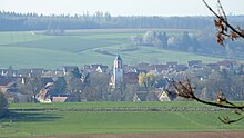
Weiltingen is a market in the Central Franconian district of Ansbach ( Bavaria ). He is a member of the Wilburgstetten administrative association .
geography
Geographical location
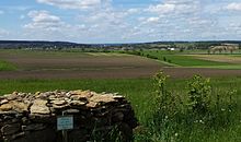
Weiltingen is located on the Wörnitz near Dinkelsbühl not far from the Hesselberg , at 689 m the highest mountain in Middle Franconia. Neighboring communities are (starting from the north clockwise): Wittelshofen , Gerolfingen , Wassertrüdingen , Fremdingen and Wilburgstetten .
Community structure
The political municipality of Weiltingen has nine officially named parts of the municipality (the type of settlement is indicated in brackets ):
|
|
history
Until the church is planted
The place was first mentioned as "Wilitingen" in a document, which must have been created between 1096 and 1133. The place name is based on a personal name, possibly the feminine personal name Wīhilt, which was derived from the affiliation suffix -ingen . The place name would mean With the people of the Wīhilt .
Near the town of Dinkelsbühl is the Weiltingen market, once the seat of a branch of the Württemberg house. In addition to Weiltingen itself, the hamlets Veitsweiler and Wolfsbühl as well as part of the villages Frankenhofen and Greiselbach belonged to the rule. In the 14th century, the son of the Reich chef de cuisine of Rothenburg , Lupoldus, called himself von Weiltingen. In the 17th century, the rule was given to the Lords of Knöringen as a fief. When this male family died out in 1616, the fiefdom fell back to Duke Johann Friedrich von Württemberg . In 1617, the ruling duke and his brothers concluded the “brotherly prince settlement”, in which the indivisibility of the Duchy of Württemberg was established. At the same time, the younger brother Julius Friedrich (1588–1635) received the rule of Weiltingen and the market town of Brenz as apanage. In Weiltingen he founded a line of the House of Württemberg, in which, however, numerous sons remained unmarried. Julius Friedrich's son, Duke Silvius Nimrod of Württemberg-Weiltingen (1622–1664), founded the Württemberg-Oels line.
The dukes of Württemberg ruled Weiltingen for three generations. Duke Ferdinand Friedrich (1654–1705) died without a surviving son, whereupon the Württemberg-Weiltingen line became extinct in the male line. Thereupon the rule of Weiltingen fell back to the main line and was administered by the Kammerschreiberei in Stuttgart as the administrative authority for the ducal's private assets. In 1729 the Chamber of Commerce left the rule to the landscape for a period of 50 years for 330,000 guilders; after this period the pledge was extended for a further 20 years.
The Fraisch over Weiltingen was controversial. It was claimed by both the Ansbach Oberamt Wassertrüdingen and the Oberamt Aufkirchen in Oettingen- Spielberg as well as the Württemberg Oberamt Weiltingen . The upper office of Weiltingen held the village and community rulership and the land rulership over all properties. There were 153 properties in total: 1 sawmill and Lohmühle, 5 taverns, 1 sheep farm, 4 half farm estates, 8 Köbler estates , 1 half Köbler estate , 2 Sölden with blacksmiths, 91 Sölden estates , 38 half Sölden estates, 1 two-thirdsöldengut, 1 thirdsöldengut . There were also stately buildings, a church, a rectory, a school and a community pastor's house.
After the reorganization of the clerk's office into a court and domain chamber, King Friedrich von Württemberg set up a “court and domain chamber administration” in Weiltingen in 1807 and appointed the civil servant Friedrich August Christlieb. In the Paris Treaty of May 18, 1810, however, the king ceded the rule to the Kingdom of Bavaria and received the former Teutonic rule Altshausen . With this, the court and domain chamber administration in Weiltingen ceased to exist. The castle was completely demolished by 1814.
The administration and jurisdiction of the rural community of Weiltingen was subordinate to the Regional Court of Nördlingen (from 1831 Regional Court of Dinkelsbühl ) and the financial administration of the Oettingen Rent Office (from 1832 Dinkelsbühl Rent Office, renamed Dinkelsbühl Tax Office in 1919 , branch of the Ansbach Tax Office since 1973 ). The jurisdiction remained with the District Court of Dinkelsbühl until 1879, from 1879 to 1973 the District Court of Dinkelsbühl was responsible, which has been a branch of the District Court of Ansbach since 1973 . The administration was taken over by the newly created Dinkelsbühl district office in 1862 (renamed the Dinkelsbühl district in 1938 ). When the Dinkelsbühl district was dissolved in 1972, Wittelshofen came to the Ansbach district. Until the regional reform, the municipality of Weiltingen had an area of 7.362 km².
Incorporations
On January 1, 1971, Wörnitzhofen was incorporated. On May 1, 1978 Frankenhofen and Veitsweiler as well as the place Bosacker of the community Schopflohe ( district Donau-Ries ) were added.
Population development
In the period from 1988 to 2018, the population increased from 1266 to 1392 by 126 inhabitants or 10%.
Municipality of Weiltingen
| year | 1979 | 1987 | 1991 | 1995 | 2000 | 2005 | 2010 | 2011 | 2012 | 2013 | 2014 | 2015 | 2016 | 2017 | 2018 |
|---|---|---|---|---|---|---|---|---|---|---|---|---|---|---|---|
| Residents | 1283 | 1289 | 1285 | 1317 | 1406 | 1377 | 1385 | 1383 | 1359 | 1371 | 1358 | 1343 | 1381 | 1369 | 1418 |
| Houses | 356 | 417 | 418 | 420 | 423 | 426 | 428 | ||||||||
| source |
Part of the municipality of Weiltingen (= municipality of Weiltingen until the regional reform)
| year | 1818 | 1840 | 1852 | 1855 | 1861 | 1867 | 1871 | 1875 | 1880 | 1885 | 1890 | 1895 | 1900 | 1905 | 1910 | 1919 | 1925 | 1933 | 1939 | 1946 | 1950 | 1952 | 1961 | 1970 | 1987 |
|---|---|---|---|---|---|---|---|---|---|---|---|---|---|---|---|---|---|---|---|---|---|---|---|---|---|
| Residents | 726 | 797 | 809 | 770 | 784 | 768 | 767 | 780 | 805 | 805 | 755 | 772 | 768 | 766 | 741 | 720 | 715 | 709 | 704 | 1044 | 980 | 917 | 739 | 752 | 717 |
| Houses | 145 | 156 | 148 | 157 | 164 | 162 | 160 | 173 | 218 | ||||||||||||||||
| source |
politics
Market council
The municipal council of Weiltingen has 13 members including the mayor. In the local elections on March 2, 2014, the nomination only contained a list from the Free Voting Community of Markt Weiltingen. No separate lists were drawn up by the community bloc and the Frankenhofen Free Voting Community.
| Parish block | FWG
Weiltingen market |
FWG
Frankenhofen |
total | |
| 2002 | 6th | 6th | 1 | 13 seats |
| 2008 | 5 | 8th | 0 | 13 seats |
| 2014 | --- | 13 | --- | 13 seats |
(Status: local election on March 2, 2014 )
mayor
Christoph Schmidt was elected to office on May 29, 2016 with 91.65% of the vote.
badges and flags
The municipality of Wörnitz has had a coat of arms since the 17th century.
|
Blazon : “ Divided by green and red; above a floating golden stech helmet in front view, below on a blue rock mountain a five-towered silver castle with blue roofs. "
Red-white-green municipal flag |
|
| Justification of the coat of arms: The stech helmet represents the many families of knights who owned Weiltingen. He can be seen in a court seal from 1561. In 1566 the place came into the possession of the Lords of Knöringen. They expanded the castle into a palace, which was demolished in 1814 due to disrepair. The castle in the coat of arms reminds of this imposing building. King Ludwig I confirmed the coat of arms in 1847. |
Economy and Infrastructure
traffic
The state road 2385 runs southwest to Wilburgstetten to national road 25 and north-east over Ruffenhofen to State Road 2218 approximately 0.5 kilometers west of Wittelshofen . The district road AN 47 runs southeast to Frankenhofen . Communal roads run northwest to Illenschwang to St 2218 and south to Veitsweiler .
Local public transport is ensured by the transport association for the greater Nuremberg area .
Long-distance cycle routes
The German Limes Cycle Route runs through the municipality . It follows the Upper German-Raetian Limes over 818 km from Bad Hönningen on the Rhine to Regensburg on the Danube .
Long-distance hiking trails
Weiltingen lies on the Limesweg of the Franconian Alb Association , a section of the German Limes hiking trail .
Public facilities
- State Forest Service
education
- Day care center (kindergarten)
- Primary school in Weiltingen (1st to 4th grade)
- library
Culture and sights
Museums
- Ruffenhofen Roman Park
- Museum of traditional costumes and local history
Buildings
- St. Peters Church with the princely crypt, Schäufelin altar and historical belfry
- St. Nicholas Church in Ruffenhofen
- St. Vitus Church in Veitsweiler
- Remains of the Upper German-Raetian Limes in the Weiltinger Forest
Architectural monuments
Sons and daughters of the church
- Silvius I. Nimrod (1622–1664), First Duke of Württemberg-Oels
- Hedwig Friederike von Württemberg-Weiltingen (1691–1752), by marriage Princess of Anhalt-Zerbst
- Johann Eberhard Fischer (1697–1771), historian and linguist in Siberia, participant in the Great Nordic Expedition 1733–1743.
- Johann Christian Bernhardt (1710–1758), surgeon and chemist
Other personalities associated with the place
- Samuel Gottfried Christoph Cloeter , d. 1894 in Weiltingen, suspended pastor of the Bavarian regional church, who founded the Gnadenburg emigration settlement in the Russian Caucasus in 1881
literature
- The sideline of Weiltingen . In: Sönke Lorenz / Dieter Mertens / Volker Press (ed.): The House of Württemberg. A biographical lexicon. Stuttgart 1997. pp. 188-200.
- Johann Kaspar Bundschuh : Weiltingen . In: Geographical Statistical-Topographical Lexicon of Franconia . tape 6 : V-Z . Verlag der Stettinische Buchhandlung, Ulm 1804, DNB 790364328 , OCLC 833753116 , Sp. 128-129 ( digitized version ).
- August Gebeßler : City and district of Dinkelsbühl (= Bavarian art monuments . Volume 15 ). Deutscher Kunstverlag, Munich 1962, DNB 451450930 , p. 221-227 .
- Teresa Neumeyer: Dinkelsbühl: the former district (= Historical Atlas of Bavaria, part of Franconia . I, 40). Michael Laßleben, Kallmünz 2018, ISBN 978-3-7696-6562-8 , p. 472 f. and 583 .
- Wolf-Armin von Reitzenstein : Lexicon of Franconian place names. Origin and meaning . Upper Franconia, Middle Franconia, Lower Franconia. CH Beck, Munich 2009, ISBN 978-3-406-59131-0 , p. 237 .
- Anton Steichele (Ed.): The diocese Augsburg historically and statistically described . tape 3 . Schmiedsche Verlagbuchhandlung, Augsburg 1872, p. 533-544 ( digitized version ).
- Pleikard Joseph Stumpf : Weiltingen . In: Bavaria: a geographical-statistical-historical handbook of the kingdom; for the Bavarian people . Second part. Munich 1853, p. 702 ( digitized version ).
Web links
- Map of Markt Weiltingen on the BayernAtlas
- Website of the market in Weiltingen
- Weiltingen in the Topographia Franconiae of the University of Würzburg , accessed on September 17, 2019.
- Weiltingen: Official statistics of the LfStat
Individual evidence
- ↑ "Data 2" sheet, Statistical Report A1200C 202041 Population of the municipalities, districts and administrative districts 1st quarter 2020 (population based on the 2011 census) ( help ).
- ^ Community Weiltingen in the local database of the Bavarian State Library Online . Bayerische Staatsbibliothek, accessed on September 17, 2019.
- ↑ W.-A. v. Reitzenstein, p. 237.
- ↑ H. Bauer: The Butigler von Weiltingen, the Lords of Insingen and Rotenburg also the Lords of Seldeneck, Appendix IV, in the annual report of the Historical Association for Middle Franconia, Volume 35, p. 6.
- ^ T. Neumeyer, p. 472 f.
- ↑ Johann Bernhard Fischer : Waildingen . In: Statistical and topographical description of the Burggraftum Nürnberg, below the mountain, or the Principality of Brandenburg-Anspach. Second part. Containing the economic, statistical and moral condition of these countries according to the fifteen upper offices . Benedict Friedrich Haueisen, Ansbach 1790, p. 385 ( digitized version ). (= JK Bundschuh, Vol. 6, Col. 128). According to this there were 120 subject families.
- ^ Harald Schukraft: Die Seitenlinie Weiltingen (1617–1705) . In: Sönke Lorenz, Dieter Mertens, Volker Press: Das Haus Württemberg. A biographical lexicon . Stuttgart, Berlin, Cologne 1997, p. 190.
- ↑ T. Neumeyer, p. 583.
- ↑ a b Bavarian State Statistical Office (ed.): Official city directory for Bavaria, territorial status on October 1, 1964 with statistical information from the 1961 census . Issue 260 of the articles on Bavaria's statistics. Munich 1964, DNB 453660959 , Section II, Sp. 765 ( digitized version ).
- ^ Wilhelm Volkert (ed.): Handbook of Bavarian offices, communities and courts 1799–1980 . CH Beck, Munich 1983, ISBN 3-406-09669-7 , p. 448 .
- ^ Federal Statistical Office (ed.): Historical municipality directory for the Federal Republic of Germany. Name, border and key number changes in municipalities, counties and administrative districts from May 27, 1970 to December 31, 1982 . W. Kohlhammer, Stuttgart / Mainz 1983, ISBN 3-17-003263-1 , p. 707 f .
- ↑ a b Bavarian State Office for Statistics and Data Processing (Ed.): Official local directory for Bavaria, territorial status: May 25, 1987 . Issue 450 of the articles on Bavaria's statistics. Munich November 1991, DNB 94240937X , p. 332 ( digitized version ).
- ↑ a b c d e f g Weiltingen: Official statistics of the LfStat
- ↑ [1]
- ↑ Only inhabited houses are given. In 1818 these were designated as fireplaces , in 1840 as houses and from 1871 to 1987 as residential buildings.
- ↑ Alphabetical index of all the localities contained in the Rezatkkreis according to its constitution by the newest organization: with indication of a. the tax districts, b. Judicial Districts, c. Rent offices in which they are located, then several other statistical notes . Ansbach 1818, p. 101 ( digitized version ).
- ↑ Eduard Vetter (Ed.): Statistical handbook and address book of Middle Franconia in the Kingdom of Bavaria . Self-published, Ansbach 1846, p. 77 ( digitized version ).
- ↑ a b c d e f g h i j k Bavarian State Statistical Office (Hrsg.): Historical municipality directory: The population of the municipalities of Bavaria from 1840 to 1952 (= contributions to Statistics Bavaria . Issue 192). Munich 1954, DNB 451478568 , p. 168 , urn : nbn: de: bvb: 12-bsb00066439-3 ( digitized ).
- ^ Joseph Heyberger, Chr. Schmitt, v. Wachter: Topographical-statistical manual of the Kingdom of Bavaria with an alphabetical local dictionary . In: K. Bayer. Statistical Bureau (Ed.): Bavaria. Regional and folklore of the Kingdom of Bavaria . tape 5 . Literary and artistic establishment of the JG Cotta'schen Buchhandlung, Munich 1867, Sp. 1002 , urn : nbn: de: bvb: 12-bsb10374496-4 ( digitized version ).
- ↑ Kgl. Statistisches Bureau (Ed.): Directory of the municipalities of the Kingdom of Bavaria according to the status of the population in December 1867 . XXI. Issue of the contributions to the statistics of the Kingdom of Bavaria. Ackermann, Munich 1869, p. 156 ( digitized version ).
- ↑ Kgl. Statistical Bureau (ed.): Complete list of localities of the Kingdom of Bavaria. According to districts, administrative districts, court districts and municipalities, including parish, school and post office affiliation ... with an alphabetical general register containing the population according to the results of the census of December 1, 1875 . Adolf Ackermann, Munich 1877, 2nd section (population figures from 1871, cattle figures from 1873), Sp. 1168 , urn : nbn: de: bvb: 12-bsb00052489-4 ( digitized version ).
- ↑ K. Bayer. Statistical Bureau (ed.): Community directory for the Kingdom of Bavaria. Manufactured due to the new organization of government districts, district offices and judicial districts. Addendum to issue 36 of the articles on Bavaria's statistics. Munich 1879, p. 61 ( digitized version ).
- ↑ K. Bayer. Statistical Bureau (ed.): Community directory for the Kingdom of Bavaria. Results of the census of December 1, 1880. Issue 35 of the articles on Bavaria's statistics. Munich 1882, p. 175 ( digitized version ).
- ↑ K. Bayer. Statistical Bureau (Ed.): Localities directory of the Kingdom of Bavaria. According to government districts, administrative districts, ... then with an alphabetical register of locations, including the property and the responsible administrative district for each location. LIV. Issue of the contributions to the statistics of the Kingdom of Bavaria. Munich 1888, Section III, Sp. 1100 ( digitized version ).
- ↑ K. Bayer. Statistical Bureau (Ed.): Directory of localities of the Kingdom of Bavaria, with alphabetical register of places . LXV. Issue of the contributions to the statistics of the Kingdom of Bavaria. Munich 1904, Section II, Sp. 1166 ( digitized version ).
- ↑ Bavarian State Statistical Office (ed.): Localities directory for the Free State of Bavaria according to the census of June 16, 1925 and the territorial status of January 1, 1928 . Issue 109 of the articles on Bavaria's statistics. Munich 1928, Section II, Sp. 1204 ( digitized version ).
- ↑ Bavarian State Statistical Office (ed.): Official place directory for Bavaria - edited on the basis of the census of September 13, 1950 . Issue 169 of the articles on Bavaria's statistics. Munich 1952, DNB 453660975 , Section II, Sp. 1040 ( digitized version ).
- ^ Bavarian State Statistical Office (ed.): Official place directory for Bavaria . Issue 335 of the articles on Bavaria's statistics. Munich 1973, DNB 740801384 , p. 172 ( digitized version ).
- ^ Bulletin of the market town of Weiltingen, February 2014. Accessed on August 8, 2017 .
- ^ Bulletin of the market town of Weiltingen, March 2014. Accessed on August 8, 2017 .
- ^ Minutes of the mayoral election in Markt Weiltingen on May 29, 2016. Retrieved August 8, 2017 .
- ↑ Entry on the coat of arms of Weiltingen in the database of the House of Bavarian History
- ↑ Wörnitz. In: Kommunalflaggen.eu. Retrieved March 27, 2020 .
- ↑ Community library : Markt Weiltingen. Retrieved October 31, 2018 .


