
Röckingen
| coat of arms | Germany map | |
|---|---|---|

|
Coordinates: 49 ° 3 ' N , 10 ° 34' E |
|
| Basic data | ||
| State : | Bavaria | |
| Administrative region : | Middle Franconia | |
| County : | Ansbach | |
| Management Community : | Hesselberg | |
| Height : | 456 m above sea level NHN | |
| Area : | 10.91 km 2 | |
| Residents: | 726 (Dec. 31, 2019) | |
| Population density : | 67 inhabitants per km 2 | |
| Postal code : | 91740 | |
| Area code : | 09832 | |
| License plate : | AN , DKB, FEU, ROT | |
| Community key : | 09 5 71 192 | |
| Community structure: | 4 parts of the community | |
| Address of the municipal administration: |
Brauhausstrasse 21 91740 Röckingen |
|
| Website : | ||
| Mayor : | Martin Schachner ( FW ) | |
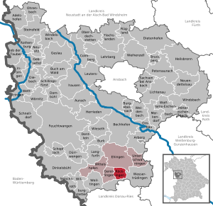
| Location of the community Röckingen in the district of Ansbach | ||
  |
||


Röckingen (Franconian: Rägging ) is a municipality in the Ansbach district in Middle Franconia . It is a member of the Hesselberg administrative community based in Ehingen .
geography
Röckingen lies at the foot of the Hesselberg .
Neighboring communities
Neighboring communities are (starting from the north clockwise): Ehingen , Wassertrüdingen and Gerolfingen .
Community structure
The municipality has four officially named municipal parts (the type of settlement is given in brackets ):
- Gugelmühle ( wasteland )
- Opfenried ( village )
- Röckingen ( parish village )
- Schmalzmühle (wasteland)
There is also Rothhof, which is not an officially named part of the municipality. The Hardhof became deserted in the 19th century .
history
The place was first mentioned in a document in 1053 as "Rochingen". The place name is based on the personal name Rocco , which was derived from the affiliation suffix -ingen . The place name means With the people of the Rocco . Since the early 17th century at the latest, the place name has been linked to rye cultivation (see the section on coat of arms ).
After the terrible devastation of the Thirty Years' War , the numerous religious refugees from Austria, who had to give way to the Counter Reformation, were involved in the resurgence of the town .
Röckingen was in the Fraisch district of the Ansbach Oberamt Wassertrüdingen . The village and community rulership was held by the Ansbach administration office in Röckingen . At the end of the 18th century there were 103 properties in Röckingen. Were landlords
- Ansbach offices (94 properties; Heidenheim administration office : 2 half Meierhöfe , 4 half yards , 4 Sölden , 2 Half Sölden , 2 half houses; Röckingen administration office : 1 inheritance tavern , 1 half yard, 2 quarter yards, 10 estates, 2 half estates, 12 estates, 1 estate with forge , 9 half-houses, 12 houses, 1 house with baking rights, 5 houses, 1 basket, 6 half-houses; box office Wassertrüdingen : 3 goods, 4 little houses, 6 houses, 4 little houses)
- the Principality of Oettingen-Spielberg (6 properties; Sammenheim Office : 3 Söldengüter, 1 Söldengütlein, 2 houses)
- the Hochstift Eichstätt ( Vogtamt Cronheim : 2 houses)
- Freeigen (1 good).
There was also a castle, a servant's apartment, a church, a rectory, a chaplain's house and a community pastor's house. From 1797 to 1808 the place was subordinate to the Justice and Chamber Office Wassertrüdingen .
In 1806 Röckingen came to the Kingdom of Bavaria . With the community edict, the Röckingen tax district was formed in 1809 , to which the towns of Berghaus , Gerolfingen , Gugelmühle , Hardhof , Opfenried and Schmalzmühle belonged. At the same time, two rural communities emerged :
- Gerolfingen with Berghaus
- Röckingen with Gugelmühle, Hardhof, Opfenried and Schmalzmühle.
The municipality Röckingen was subordinate in administration and jurisdiction to the district court Wassertrüdingen and in the financial administration to the rent office Wassertrüdingen (1919 renamed in Finanzamt Wassertrüdingen , 1932–1973 tax office Gunzenhausen , since 1973 tax office Ansbach ). The jurisdiction remained with the district court Wassertrüdingen until 1879, from 1879 to 1956 the district court Wassertrüdingen was responsible, from 1956 to 1970 the district court Gunzenhausen and from 1970 to 1973 the district court Dinkelsbühl , which has been a branch of the district court Ansbach since 1973 . The administration was taken over by the newly created Dinkelsbühl district office in 1862 (renamed the Dinkelsbühl district in 1938 ). With the dissolution of the Dinkelsbühl district in 1972, Röckingen came to the Ansbach district.
Population development
In the period from 1988 to 2018, the population increased from 714 to 726 by 12 inhabitants or 1.7%.
Röckingen community
| year | 1818 | 1840 | 1852 | 1861 | 1867 | 1871 | 1875 | 1880 | 1885 | 1890 | 1895 | 1900 | 1905 | 1910 | 1919 | 1925 | 1933 | 1939 | 1946 | 1950 | 1961 | 1970 | 1987 | 2005 | 2011 | 2016 |
|---|---|---|---|---|---|---|---|---|---|---|---|---|---|---|---|---|---|---|---|---|---|---|---|---|---|---|
| Residents | 773 | 810 | 800 | 774 | 727 | 731 | 728 | 757 | 741 | 737 | 727 | 688 | 670 | 687 | 718 | 698 | 669 | 647 | 938 | 905 | 713 | 705 | 705 | 763 | 735 | 742 |
| Houses | 138 | 148 | 156 | 154 | 157 | 147 | 156 | 155 | 197 | 231 | 246 | |||||||||||||||
| source |
Part of the municipality Röckingen
| year | 1818 | 1840 | 1861 | 1871 | 1885 | 1900 | 1925 | 1950 | 1961 | 1970 | 1987 |
|---|---|---|---|---|---|---|---|---|---|---|---|
| Residents | 643 | 650 | 613 | 586 | 597 | 545 | 551 | 723 | 580 | 593 | 542 |
| Houses | 108 | 118 | 124 | 126 | 120 | 126 | 125 | 153 | |||
| source |

religion
80% of the residents of Röckingen are Protestant, 14% Catholic. The parish of Röckingen with its St. Laurentius Church belongs to the Evangelical Lutheran Dean's Office in Wassertrüdingen . The local Catholics are assigned to the Heilig Geist parish in Wassertrüdingen , which belongs to the Herrieden dean's office in the Eichstätt diocese .
politics
Municipal council
After the last municipal election held on 16 March 2014 , the municipal council has eight members, six members belonging to the group of voters FDP , two members belong to the group of voters Open list . The turnout was 74.9%. Another member and chairman of the municipal council is the mayor.
mayor
Martin Schachner (Free Voters) was elected in March 2014 with 91.74 percent of the vote, making him the successor to Waltraud Hüttner.
badges and flags
The Röckingen community has had a coat of arms since 1618.
|
|
Blazon : “Above a green three-mountain split by silver and black, occupied by a golden sheaf of rye standing on the three-mountain. Behind the shield an angel with goldcurlswith golden wings, who holds the shield with his hands at both corners and is clad in a green robe with white sleeves and a white band tied crosswise over the body. "
Green and yellow municipal flag |
| Reasons for the coat of arms: The rye stands for the place name. The colors silver and black indicate the rule of the Margraves of Brandenburg. The meaning of the angel is still unclear. |
Culture and sights
Buildings

The Schenkenstein Castle is an old ministerial seat, consisting of a stately proportioned main building, a quarry stone building with corner blocks, in the core a medieval tower hill castle, around 1550 the old tower hill castle was built over with the new castle and expanded to its present size. A stepped gable from the Renaissance period (around 1550) is still preserved today. Above the archway is the coat of arms of the Schenkenstein taverns . Today the castle is partly a tenement house and lies within the largely filled moat complex.
In 1468, Hans von Seckendorff gave Margrave Albrecht von Ansbach his part of Röckingen as a fiefdom and sold it to Hans von Schenkenstein as a margravial fief. The last representative of this family built the castle that is still standing together with his stepbrother Georg von Gundelsheim . The last Schenkenstein murdered his wife Cäcilie von Rechenberg in his castle in 1572.
As a punishment, his fiefs were withdrawn from him by Margrave Georg Friedrich and he was sentenced to life in prison. The goods returned to Georg Wilhelm von Gundelsheim. He sold them in 1584 to the Margraves of Ansbach, who regularly stayed in Röckingen. During this time, the prince's estate was established in the Laurentius Church in Röckingen. In 1793 the castle came into private hands. It later became the property of the brewery owner Gutmann. After the First World War, the rooms were used as an office for the lime works. It then changed hands several times.
Architectural monuments
Economy and Infrastructure
Röckingen is a member of the Romantic Franconian Tourist Association and participates in the Franconian Moststrasse campaign .
traffic
The district road AN 47 runs northeast to Lentersheim to state road 2248 and southwest crossing state road 2218 to Fürnheim . A community road runs southeast to Opfenried , another runs west to St 2218, immediately west of Gerolfingen .
Sons and daughters of the church
- Marie Kalteissen (born May 4, 1885 in Röckingen), deaconess and diaconal entrepreneur
literature
- Johann Kaspar Bundschuh : Röckingen . In: Geographical Statistical-Topographical Lexicon of Franconia . tape 4 : Ni-R . Verlag der Stettinische Buchhandlung, Ulm 1801, DNB 790364301 , OCLC 833753101 , Sp. 542-544 ( digitized version ).
- August Gebeßler : City and district of Dinkelsbühl (= Bavarian art monuments . Volume 15 ). Deutscher Kunstverlag, Munich 1962, DNB 451450930 , p. 180-184 .
- Teresa Neumeyer: Dinkelsbühl: the former district (= Historical Atlas of Bavaria, part of Franconia . I, 40). Michael Laßleben, Kallmünz 2018, ISBN 978-3-7696-6562-8 , p. 453-454 and 575 .
- Wolf-Armin von Reitzenstein : Lexicon of Franconian place names. Origin and meaning . Upper Franconia, Middle Franconia, Lower Franconia. CH Beck, Munich 2009, ISBN 978-3-406-59131-0 , p. 189 .
- Gottfried Stieber: Röckingen . In: Historical and topographical news from the Principality of Brandenburg-Onolzbach . Johann Jacob Enderes, Schwabach 1761, p. 654-665 ( digitized version ).
- Pleikard Joseph Stumpf : Röckingen . In: Bavaria: a geographical-statistical-historical handbook of the kingdom; for the Bavarian people . Second part. Munich 1853, p. 767-768 ( digitized version ).
Web links
- Map of the municipality of Röckingen in the BayernAtlas
- Röckingen in the Topographia Franconiae of the University of Würzburg , accessed on September 17, 2019.
- Röckingen: Official statistics of the LfStat
Individual evidence
- ↑ "Data 2" sheet, Statistical Report A1200C 202041 Population of the municipalities, districts and administrative districts 1st quarter 2020 (population based on the 2011 census) ( help ).
- ^ Community Röckingen in the local database of the Bayerische Landesbibliothek Online . Bayerische Staatsbibliothek, accessed on September 17, 2019.
- ↑ W.-A. v. Reitzenstein, p. 189.
- ↑ Eberhard Krauss: Exulanten im Evang.-Luth. Deanery Wassertrüdingen (sources and research on Franconian family history, 28) . GFF, Nuremberg 2014, ISBN 978-3-929865-61-5 .
- ↑ T. Neumeyer, pp. 453f.
- ^ Johann Bernhard Fischer : Röckingen . In: Statistical and topographical description of the Burggraftum Nürnberg, below the mountain, or the Principality of Brandenburg-Anspach. Second part. Containing the economic, statistical and moral condition of these countries according to the fifteen upper offices . Benedict Friedrich Haueisen, Ansbach 1790, p. 384 ( digitized version ). (= JK Bundschuh, Vol. 4, Col. 542). According to this, there were only 102 subject families, 94 of which were Ansbachian.
- ^ A b T. Neumeyer, p. 575.
- ^ T. Neumeyer, p. 534.
- ^ Address and statistical manual for the Rezatkreis in the Kingdom of Baiern . Buchdruckerei Chancellery, Ansbach 1820, p. 72 ( digitized version ).
- ↑ a b Only inhabited houses are given. In 1818 these were designated as fireplaces , in 1840 as houses , and from 1871 to 2016 as residential buildings.
- ↑ a b Alphabetical index of all the localities contained in the Rezatkreise according to its constitution by the newest organization: with indication of a. the tax districts, b. Judicial Districts, c. Rent offices in which they are located, then several other statistical notes . Ansbach 1818, p. 76 ( digitized version ). For the municipality of Röckingen plus the residents and buildings of Gugelmühle (p. 33), Haardhof (p. 34), Opfenried (p. 70) and Schmalzmühle (p. 82).
- ^ A b Eduard Vetter (Ed.): Statistical handbook and address book of Middle Franconia in the Kingdom of Bavaria . Self-published, Ansbach 1846, p. 254 ( digitized version ). According to the historical municipality register , the municipality had 808 inhabitants.
- ^ A b c d e f g h i Bavarian State Statistical Office (Hrsg.): Historical municipality directory: The population of the municipalities of Bavaria from 1840 to 1952 (= contributions to Statistics Bavaria . Issue 192). Munich 1954, DNB 451478568 , p. 168 , urn : nbn: de: bvb: 12-bsb00066439-3 ( digitized ).
- ↑ a b Joseph Heyberger, Chr. Schmitt, v. Wachter: Topographical-statistical manual of the Kingdom of Bavaria with an alphabetical local dictionary . In: K. Bayer. Statistical Bureau (Ed.): Bavaria. Regional and folklore of the Kingdom of Bavaria . tape 5 . Literary and artistic establishment of the JG Cotta'schen Buchhandlung, Munich 1867, Sp. 1006 , urn : nbn: de: bvb: 12-bsb10374496-4 ( digitized version ).
- ↑ Kgl. Statistisches Bureau (Ed.): Directory of the municipalities of the Kingdom of Bavaria according to the status of the population in December 1867 . XXI. Issue of the contributions to the statistics of the Kingdom of Bavaria. Ackermann, Munich 1869, p. 157 ( digitized version ).
- ↑ a b Kgl. Statistical Bureau (ed.): Complete list of localities of the Kingdom of Bavaria. According to districts, administrative districts, court districts and municipalities, including parish, school and post office affiliation ... with an alphabetical general register containing the population according to the results of the census of December 1, 1875 . Adolf Ackermann, Munich 1877, 2nd section (population figures from 1871, cattle figures from 1873), Sp. 1172 , urn : nbn: de: bvb: 12-bsb00052489-4 ( digitized version ).
- ↑ K. Bayer. Statistical Bureau (ed.): Community directory for the Kingdom of Bavaria. Manufactured due to the new organization of government districts, district offices and judicial districts. Addendum to issue 36 of the articles on Bavaria's statistics. Munich 1879, p. 61 ( digitized version ).
- ↑ K. Bayer. Statistical Bureau (ed.): Community directory for the Kingdom of Bavaria. Results of the census of December 1, 1880. Issue 35 of the articles on Bavaria's statistics. Munich 1882, p. 176 ( digitized version ).
- ↑ a b K. Bayer. Statistical Bureau (Ed.): Localities directory of the Kingdom of Bavaria. According to government districts, administrative districts, ... then with an alphabetical register of locations, including the property and the responsible administrative district for each location. LIV. Issue of the contributions to the statistics of the Kingdom of Bavaria. Munich 1888, Section III, Sp. 1104 ( digitized version ).
- ↑ a b K. Bayer. Statistical Bureau (Ed.): Directory of localities of the Kingdom of Bavaria, with alphabetical register of places . LXV. Issue of the contributions to the statistics of the Kingdom of Bavaria. Munich 1904, Section II, Sp. 1170 ( digitized version ).
- ↑ a b Bavarian State Statistical Office (ed.): Localities directory for the Free State of Bavaria according to the census of June 16, 1925 and the territorial status of January 1, 1928 . Issue 109 of the articles on Bavaria's statistics. Munich 1928, Section II, Sp. 1208 ( digitized version ).
- ↑ a b Bavarian State Statistical Office (ed.): Official place directory for Bavaria - edited on the basis of the census of September 13, 1950 . Issue 169 of the articles on Bavaria's statistics. Munich 1952, DNB 453660975 , Section II, Sp. 1039 ( digitized version ).
- ↑ a b Bavarian State Statistical Office (ed.): Official city directory for Bavaria, territorial status on October 1, 1964 with statistical information from the 1961 census . Issue 260 of the articles on Bavaria's statistics. Munich 1964, DNB 453660959 , Section II, Sp. 763 ( digitized version ).
- ↑ a b Bavarian State Statistical Office (Hrsg.): Official local directory for Bavaria . Issue 335 of the articles on Bavaria's statistics. Munich 1973, DNB 740801384 , p. 171 ( digitized version ).
- ↑ a b Bavarian State Office for Statistics and Data Processing (Ed.): Official local directory for Bavaria, territorial status: May 25, 1987 . Issue 450 of the articles on Bavaria's statistics. Munich November 1991, DNB 94240937X , p. 330 ( digitized version ).
- ↑ a b c Röckingen: Official statistics of the LfStat
- ↑ 2011 census
- ↑ Local elections in Bavaria on March 16, 2014. Bavarian State Office for Statistics, accessed on August 16, 2019 .
- ^ Entry on Röckingen's coat of arms in the database of the House of Bavarian History
- ↑ Röckingen. In: Kommunalflaggen.eu. Retrieved April 21, 2020 .

Adelshofen | Arberg | Aurach | Bechhofen | Bruckberg | Book at the forest | Burgoberbach | Burk | Colmberg | Dentlein am Forst | Diebach | Dietenhofen | Dinkelsbühl | Dombühl | Dürrwangen | Ehingen | Feuchtwangen | Flachslanden | Gebsattel | Gerolfingen | Geslau | Heilsbronn | Herrieden | Insingen | Langfurth | Lehrberg | Leutershausen | Lichtenau | Merkendorf | Mitteleschenbach | Mönchsroth | Neuendettelsau | Neusitz | Oberdachstetten | Ohrbach | Ornbau | Petersaurach | Röckingen | Rothenburg ob der Tauber | Rügland | Saxony near Ansbach | Schillingsfürst | Schnelldorf | Schopfloch | Steinsfeld | Unterschwaningen | Wassertrüdingen | Weidenbach | Weihenzell | Weiltingen | Wettringen | Wieseth | Wilburgstetten | Windelsbach | Windsbach | Wittelshofen | Wolframs-Eschenbach | Wörnitz
Unregulated areas:
Lower Forest