
Gerolfingen
| coat of arms | Germany map | |
|---|---|---|

|
Coordinates: 49 ° 3 ' N , 10 ° 31' E |
|
| Basic data | ||
| State : | Bavaria | |
| Administrative region : | Middle Franconia | |
| County : | Ansbach | |
| Management Community : | Hesselberg | |
| Height : | 430 m above sea level NHN | |
| Area : | 12.59 km 2 | |
| Residents: | 968 (Dec. 31, 2019) | |
| Population density : | 77 inhabitants per km 2 | |
| Postal code : | 91726 | |
| Area code : | 09854 | |
| License plate : | AN , DKB, FEU, ROT | |
| Community key : | 09 5 71 154 | |
| Community structure: | 4 parts of the community | |
| Address of the municipal administration: |
Aufkirchen 50 91726 Gerolfingen |
|
| Website : | ||
| Mayor : | Karl Fickel jun. ( Voter group ) | |
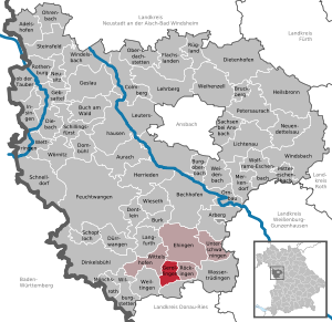
| Location of the municipality of Gerolfingen in the district of Ansbach | ||
  |
||


Gerolfingen (East Franconian: Gerlfing ) is a municipality and a town in the Central Franconian district of Ansbach and a member of the Hesselberg administrative community based in Ehingen .
geography
geology
The majority of the municipality is located in the Upper Keuper . The ascent to the Hesselberg consists of all three layers of the Jura (mainly Dogger ).
Neighboring communities
West of Gerolfingen is the municipality of Wittelshofen (East Franconian: Wittlshoff ), in the east Röckingen (East Franconian: Regging ), in the north (north of the Hesselberg and not directly accessible from Gerolfingen by vehicle) Ehingen (East Franconian: Ehing ), in the south Wassertrüdingen with its incorporated village Fürnheim (East Frankish: Fürnna ) and southwest Weiltingen (East Frankish: Wailting ).
In terms of area, Gerolfingen (12.59 km²) is only slightly larger than Röckingen (10.91 km²), but considerably smaller than Wittelshofen (24.23 km²) and Ehingen (47.63 km²).
Community structure

The political municipality of Gerolfingen has four officially named municipal parts (the type of settlement is indicated in brackets ):
- Aufkirchen , East Franconian: Aufkirch
- Berghaus ( wasteland )
- Gerolfingen ( parish village )
- Irsingen ( village ), East Franconian: Ihsching
Gerolfingen itself is the elongated place in the lower part of the picture. Beyond the Wörnitz (East Franconian: Wenns ), Aufkirchen is followed by Irsingen.
Historically, the Wörnitz flowing between Gerolfingen and Aufkirchen was the border between the Principality of Oettingen, to which Aufkirchen and Irsingen belonged, and the Margraviate of Ansbach, to which Gerolfingen belonged.
history
The first written mention of Irsingen (" villa Ursingen ") dates from the year 1053, the Aufkirchens (" burgum ufkirchin ") from 1188 and the Gerolfingen (" Gerlifingen ") from 1228. The place name is based on the personal name Gerolf, derived from the membership suffix -ingen . The place name means With the people of Gerolf .
The Irsinger date falls into the Salier period , the other two dates from the Staufer period . At that time, Aufkirchen, Gerolfingen and Irsingen were part of the Eastern Franconian Empire ( Regnum francorum orientalium ), which arose from the division of the Franconian Empire ( Treaty of Verdun (843) ) and from the 14th century as the Holy Roman Empire (German Nation) [ Sacrum Romanum Imperium (nationis Germanicae) ]. The Irsinger documentary date falls into the reign of Henry III. , while the Aufkirchner documented date (1188) falls into that of Frederick I (Barbarossa) , who was emperor of the empire from 1152 until his death in 1190. The Gerolfinger documented date (1228) falls during the reign of Barbarossa's grandson, Friedrich II .
Gerolfingen is, however, probably much older than these documents suggest: The local ending -ingen indicates that it was originally settled by Alemanni ; maybe the place was created shortly after the Limes fall in 259/260 AD. However, there is no archaeological or historical evidence for this. The Alemannic settlement area extended far north to the area of origin of Fulda and Werra until the Battle of Zülpich . Numerous originally Alemannic settlements can be found in the area, the district of Irsingen and the neighboring communities Röckingen and Ehingen as well as places such as Hüssingen, Hechlingen, Polsingen, etc. All of these -ingen names have Swabian-Alemannic and non-Franconian characteristics. Franconian and thus of later origins, however, are the names of the neighboring communities Wittelshofen , Frankenhofen and Fürnheim , which end in - hofen or - heim .
Aufkirchen was probably built in the middle of the 6th century as a Franconian castle within the march of the Alemannic settlement Gerolfingen. It is possible that the castle was built on the remains of a wall of a previous Roman military settlement that was destroyed by the Alemanni. The rectangular town hall square and the originally rectangular settlement area of Aufkirchen, which was enclosed by a circular wall with four gates, could speak for this. Even such an originally “Roman church” has not been archaeologically or historically documented. Perhaps the foundation of Aufkirchen as a Franconian castle in the area of the Alemannic Gerolfingen was the reason that Gerolfingen, Aufkirchen and Irsingen had a common hallway for centuries. It was not divided up until 1783, with 7/12 going to Gerolfingen and 5/12 to Aufkirchen.
The Celtic period
The origin of the settlement history of the Gerolfing area lies in the dark. The oldest archaeological traces have been left by the Celts , which began at least 1000 BC. BC ruled here until about 100 years before the new era. The Hesselberg area and the Altmühl area seem to have belonged to the settlement area of the Rucinates ( rucinates ), one of the four sub-tribes of the Celtic Vindeliker . The Celtic ramparts (fortified settlement or Fliehburg) on the Osterwiese, which were probably built from 300 BC. BC and with a circumference of 1,850 meters represent one of the largest ramparts in Europe, testify to the fact that this must have been an important Celtic site. Another Celtic settlement probably existed at the Keltenschanze behind the Wunibaldsquelle (towards Reichenbach) ( Viereckschanze ), according to another opinion, this hill is a Roman supply warehouse (which the square outline of the facility could suggest); Archaeological excavations carried out in 1958 did not come to a clear conclusion in this regard. Unfortunately, the Celts did not leave anything in writing for posterity. We therefore do not know the Celtic name of the castle on the Hesselberg, nor that of the settlement behind the Wunibald spring.
From around 100 BC Germanic tribes coming from the north also pushed their way into the Gerolfing area, including the Suebi (from which the later tribal name of the Swabians is derived) and among them the Semnones . It is not known whether the encounter between the Teutons and the native Celts was peaceful or whether the Teutons subjugated the Celts. In late antique writings (3rd century AD), some other names of Germanic (Alemannic) tribes are mentioned that seem to have settled in or around the Gerolfing area: On the one hand the Rätovarians , whose core area was probably the Nördlinger Ries, and on the other others the Juthungen , who seem to have been resident in the area north of the Danube and Altmühl .
The Roman Period: The Tenth Country and the Roman Province of Raetia
Around the turn of the century, and increasingly during the reign of Emperor Tiberius , the Romans also began repeatedly to advance into the Gerolfing area from the south and west without initially taking possession of it officially. In practice, this did not happen until the construction of the Limes began again around 100 years later.
The Roman (Upper Germanic-Raetian) Limes enclosed the Hesselberg at the time and ran just five kilometers as the crow flies north of the area of today's municipality of Gerolfingen. As a border area, this was just within the Roman Empire and was part of the so-called Dekumatlandes (" Tenth Country " - Agri decumates ). The Limes crossed the Wörnitz at the Red Ford near Weiltingen. Neither the Latin name for the Wörnitz nor the Latin name for the Hesselberg have survived. In 90 AD, during the reign of the Roman Emperor Domitian , the Romans formally annexed the tithe land and thus also the Gerolfingen area and divided it into two of their provinces: The western part of the tithe land became part of the newly formed Roman province Germania superior ("Upper Germany"), whose capital was Mainz ( Mogontiacum ). The eastern part of the Tenth Country, on the territory of which today's Gerolfingen area was located, became part of the Roman province of Raetia , the capital of which was initially Kempten im Allgäu ( Cambodunum ) and later Augsburg ( Augusta Vindelicorum , whose name alludes to the Vindeliker mentioned above). The border between these two Roman provinces at the time ran in a north-south direction near Lorch (Württemberg) , 90 km west of Gerolfingen. On the other hand, the Germania magna , the so-called “Free Germania” , began beyond the Limes .
The Gerolfing area was to remain Roman for the next 170 years. A Celtic-Germanic mixed population seems to have lived in the tenth country. In his work Germania (AD 98) , however, Tacitus does not describe the Zehntländer as Germanic tribes, but as adventurers and daredevils who immigrated from Gaul, who risked settling in this area out of necessity, whose (tribal) affiliation at the time the arrival of the Romans seems to have been unclear.
At the time of Emperor Trajan (98–117 AD), a stone fort for the Roman army was built almost halfway between Aufkirchen and Ruffenhofen (see Ruffenhofen Castle ). It is believed that its regular crew was a cavalry unit ( Ala ) with over 100 men. Subsequently, a camp village ( vicus ) was built south of the fort around the source of the Denzenbach . The fort and the camp village existed for almost 150 years until they were destroyed by fire around 250 AD and thus possibly in connection with the imminent great Alemannic invasion. For the first time in the year 233 n. Chr. And then massively in 259/260 n. Chr. (And thus during the reign of the Roman emperor Gallienus ) broke through Alemanni the Limes ( Alemanni storm ). As a result, the Roman Empire showed considerable signs of disintegration over the years (see Imperial Crisis of the 3rd Century and Soldier Emperors ). Among other things, a Gallic special empire ( Imperium Galliarum ) was formed between AD 260 and AD 274 under the counter-emperor Postumus , of which the Augsburg victory altar , which was only discovered in 1992, testifies and which, among other things, alongside the then Roman provinces of Gaul, Upper Germany and Lower Germany also included the province of Raetia and thus also the tenth country, insofar as this was not already in Alemannic hands at that time.
The Alemannic and Franconian times: The Alemannic Gerolfingen, the Franconian Aufkirchen and the Riesgau
For the next 240 years after the Alemannic storm, the Gerolfing area remained Alemannic. The localities Gerolfingen, Irsingen, Röckingen and Ehingen were probably founded during this time. Towards the end of the 5th century the situation changed again fundamentally: The Alemanni were in turn defeated by the rising Franks under their King Clovis I ( Battle of Zülpich [probably around 496] and Battle of Strasbourg in 506) and then fell under Frankish (Merovingian) rule. From now on, Franconians also settled around the Hesselberg and founded their own localities (Wittelshofen, Frankenhofen, Ruffenhofen, Fürnheim and probably also Aufkirchen). Today's municipality of Gerolfingen was in the following years in the southeastern corner of the area of the tribal duchy of Franconia , directly on the border with the tribal duchy of Swabia (Alamannien).
The Franks converted to Christianity around 497 with Clovis I. It was through the Franks that the pagan Alemanni Gerolfingens and Irsingens first came into contact with Christianity.
Around 300 years later, at the time of the Carolingians under Charlemagne , the Franconian Empire , which had meanwhile risen to become a great power, was administratively reorganized into counties, each headed by a Gaugraf ( comes, grafio ). Gerolfingen, Aufkirchen and Irsingen fell into the Riesgau , but were close to the border with Sualafeldgau to the east , whose core area was today's community of Marxheim . The border between the two districts ran straight across the Hesselberg and crossed the Wörnitz at the "Rintgazza" (Renngass - near the Wippler). The Sualafeldgau (also known as "Schwalbfeldgau") was named after the Schwalb river , a left tributary to the Wörnitz near the village of Bühl im Ries , which rises at Schwalbmühle, 3 km south of Wemding on the eastern edge of the Ries. This division remained in place for centuries.
At that time Gerolfingen was on the important Nibelungenstrasse. This linked western and southeastern Europe. Coming from the west, it crossed Gerolfingen and ran on the current Ringstrasse over the Steinweg to the east.
In the first half of the 8th century, the English traveling missionary and later abbot of the Heidenheim Wunibald monastery evangelized the pagan Alemanni in the Gerolfing area. The converting baptisms took place at the Wunibaldsquelle named after him, which had previously been called "Kallbrunn".
In the 10th century, the Gerolfing area fell victim to the then repeated incursions of the Hungarians into Eastern Franconia . A Hungarian arrowhead found on the Hesselberg (exhibited in the Gunzenhausen Museum) from this time testifies to this. The Fliehburg (refuge castle) that existed on the Hesselberg at that time was sacked. It is probable - although not historically proven - that Gerolfingen, Aufkirchen and Irsingen suffered the same fate at the time.
middle Ages
At least since the middle of the 8th century, Aufkirchen has been the political and ecclesiastical capital of the wider Hesselberg area. On February 5, 1209 Otto IV. , Who was crowned Emperor of the Holy Roman Empire of the German Nation in the autumn of the same year, stayed in Aufkirchen on his way to Ulm and Augsburg. As an empire-free fortified trading center, Aufkirchen retained its prominent local position well into the High Middle Ages. It only began to decline in the middle of the 14th century as a result of its pledging by the emperor to the counts (who were only raised to the rank of prince in 1674) of Oettingen.
In the centuries that followed, Aufkirchens / Irsingens and Gerolfingen's paths were divided, with the Wörnitz mostly forming the border. Gerolfingen was owned by the Counts of Truhendingen , whose ancestral seat was Altentrüdingen, since the 10th century at the latest . This is documented for the period from 1228 through the (first) mention of Gerolfingen ("Gerlvingen"). In this document, Friedrich I von Truhendingen renounces the Gerlvingen estate in favor of the Kaisheim monastery . It is no longer known who Gerlvingen belonged to before the Truhendinger rule. In 1362 the Count of Oettingen received Gerlvingen feudal and in 1371 Gerolfingen and Wassertrüdingen were sold to the Burgrave Friedrich V of Nuremberg (who was to call himself "Margrave of Ansbach" from 1427) and thus came into the possession of the Hohenzollern for centuries : in the 14th century Gerolfingen belongs to the so-called Lower Mountain Country of the Burgraviate of Nuremberg and is then part of the Principality (Margraviate) of Ansbach and its Oberamt Wassertrüdingen until after the time of the French Revolution . Aufkirchen (as Oberamt: Oberamt Aufkirchen ) and Irsingen, on the other hand, become part of the County of Oettingen and, since the 17th century, of the Principality of Oettingen-Spielberg .
In 1262 the Wörnitz ( Werinza ) was mentioned for the first time (in a Kaisheimer document), in 1418 the Aufkirchner mill was mentioned for the first time. 300 years later, in the first scientific land survey of the Duchy of Bavaria from 1568 (Landtafeln by Philipp Apian ) the Wörnitz is already reproduced almost with its current name ( Wernitz ).
The knowledge about the origin of the Wörnitzer waterfall (“rubbish”) lies in the darkness of history: the rubbish lies 300 meters upstream of the upper Wörnitz bridge. It is a man-made dam, possibly built on an originally natural waste. Its purpose is to supply the Wörnitzarm leading to the Aufkirchner Mühle - probably also artificially dug - with sufficient water. It is no longer known when the waste was built. Obviously, it can be assumed that it was built around the time the Aufkirchner mill was built. That would also make him at least 600 years old.
In the 14th century (especially from 1349) the German lands were ravaged by the plague (the " Black Death "). For Gerolfingen, Aufkirchen and Irsingen there are no longer any known casualties. However, it can be assumed that Gerolfingen - like the rest of Germany - lost around a third of its population at that time.
In 1449/1450 the Second South German City War (also known as the First Margrave War ) broke out. This was due to a protracted battle of strength between the southern German city federations (including Augsburg and Nuremberg) and the southern German sovereigns (including von Oettingen and Ansbach). In 1450 Aufkirchen (as the property of the Count of Oettingen) and Gerolfingen (as the property of the Margrave of Ansbach) were partially sacked by 200 mercenaries from the city of Augsburg. In the same year, peace was finally concluded between the sovereigns and the southern German cities.
When the Holy Roman Empire was divided into imperial circles in the course of the imperial reform under Maximilian I to improve the imperial administration in 1500 , the area of today's municipality of Gerolfingen is again exactly on the border: Aufkirchen and Irsingen fall over the county of Oettingen to the Swabian Empire , while Gerolfingen falls through the Margraviate of Ansbach into the Franconian Empire .
In 1525 the peasantry in southern Germany rose up against the existing social injustice caused by the feudal lords ( South German Peasants' War ), namely against the oppressive tax burden, the forced labor and the expropriation of the commons. The peasantry of Gerolfingen, Aufkirchens and Irsingen also coveted: A first farmers' meeting (disguised as "Sausäck", the expression for butcher's soup at the time) in the villages around the Hesselberg took place on March 17, 1525 in Weiltingen, another shortly afterwards (29. March 1525) on the Hesselberg. It is no longer known exactly where this was on the Hesselberg. Spokesman for the Hesselberg peasantry was Thoma Wiedemann (Schmalzmüller) from the Schmalzmühle . Just two weeks later, the rulers of Oettingen, Ansbach and Würzburg came together and passed a resolution on mutual arms aid against what they saw as rebellious farmers. Shortly afterwards, the Hesselberg peasantry rose violently against the sovereigns: Irsinger and Aufkirchner participated as part of the Rieser Haufen on May 6th and 7th, 1525 in the sacking of the Auhausen monastery (see also Auhausen monastery ), whereby according to the Aufkirchner Chronik the Aufkirchner Hans Schmidt (Rottmeister) is said to have particularly distinguished. Gerolfinger and Aufkirchner then fought on May 7, 1525 with 40 men as part of the Deiniger group in the battle of Ostheim , in which the peasantry was defeated by the mercenaries of the Margrave of Ansbach and around 400 of the 8,000 peasants involved in the battle were killed. The free farmers of the Schmalzmühle and the Gugelmühle then lost their free peasant status, the Aufkirchner Hans Schmidt was tortured by the sovereigns on June 21, 1525. In 1528, high fines were imposed on all villages in the Hesselberg area that were involved in the Peasants 'War for participating in the Peasants' War.
In 1528 the Margraviate of Brandenburg-Ansbach (and with it Gerolfingen) introduced the Reformation. Aufkirchen follows as part of the County of Oettingen in 1541 and 1546. In 1547, Emperor Karl V. Aufkirchen documented an (imperial) tax relief that Aufkirchen had already received in 1323 from Emperor Ludwig IV .
Early modern age
At the time of the Thirty Years' War (1618–1648) and especially in its final phase (from 1630), today's Central Franconia became a battlefield several times. The area of today's municipality of Gerolfingen was also in the danger zone. The records of Pastor Friedrich Mag (1578–1636) provide detailed information about the devastation of the Thirty Years' War. By the end of the 18th century at the latest, it had been firmly assumed that Gustav II Adolf of Sweden , one of the most important military leaders of the Thirty Years' War alongside Wallenstein and Johann T'Serclaes von Tilly , made a detour to Hesselberg as part of his campaigns in 1632 and there I rested at the so-called “hanging stone” (“Weißenstein”, “Gustav-Adolf-Ruh”, “Schwedenstein”). Today, however, this is considered historically improbable, because the first written evidence of Gustav Adolf's presence dates back to 1798, over 150 years after the alleged event. It is only historically proven that Gustav Adolf stayed in Dinkelsbühl (September 30 to October 4, 1632) and in Gunzenhausen. The "hanging stone" was a conspicuous, horizontally lying, elongated rock slab on the Ehinger Hesselberg side (only a few meters below the gravel road leading to the Osterwiese today and around 50 meters behind today's Gustav Adolf monument) in the shape of a tabletop and was several meters long. Today the site is overgrown with bushes. The hanging stone was willfully blown up by American occupation soldiers shortly after the Second World War and no longer exists today. The Gustav-Adolf-Monument located on the Hesselberg today is historically at least in the wrong place.
Historians assume that the area of what is now Middle Franconia lost around a third of its pre-war population during the Thirty Years' War through looting, pillage and subsequent epidemics, namely during the Swedish War (1630–1635: Battle of the Alte Veste (September 3, 1632) , Battle of Nördlingen (September 6, 1634), see also Dinkelsbühler Kinderzeche ), and the Swedish-French War (1630–1648: Battle of Alerheim (August 3, 1645)). This should therefore also apply to the area of the municipality of Gerolfingen. The plundering and pillaging of Aufkirchen on April 5, 1634 is documented. In the summer of 1645, imperial troops also devastated the villages around the Hesselberg, so that the farmers had to leave the harvest standing. Furthermore, Aufkirchen was sacked again on March 23, 1648, this time by the anti-imperial Swedish Wrangel army . Soon after the end of the Thirty Years' War (June 5, 1681), large parts of Gerolfingen fell victim to a devastating village fire.
Alongside the Black Death, the Thirty Years' War is probably the greatest catastrophe that Gerolfinger, Aufkirchner and Irsinger have ever been struck by. After the Thirty Years' War, some evangelical religious refugees (exiles) from the Ländlein ob der Enns (Upper Austria) settled in Aufkirchen.
The ring wall around Aufkirchen was first mentioned in a document in 1627. It is no longer known exactly when it was later canceled. It comprised a square and had four gates: The Obere Tor (towards Irsingen), the Mühltor at Katzengraben (towards Ruffenhofen ), the Brückentor (at the Obere Wörnitzbrücke, towards Gerolfingen) and the gate in Baltgasse below the Kappenzipfels (towards Reichenbach ) . The Aufkirchner Schlösschen (in the Renaissance style with orangery; dimensions: 56 paces long and 24 paces wide) was not built until 1721 and was demolished again in 1808. In 1699 the Aufkirchner inn "Zum Hirschen" (in Baltgasse) is mentioned for the first time.
Strangely, neither Aufkirchen nor Irsingen nor Gerolfingen ever came into their sphere of influence, despite their small spatial distance from the Free Imperial City of Dinkelsbühl , but remained under the rule of sovereigns throughout.
As far as the Hesselberg is concerned, it has undergone a name change several times over the centuries: it was first mentioned in documents in 1315 and referred to as " Oselberg ". In 1405 there is the name " Eselberg " and in 1634 the name " Hößelberg ". Finally, since 1676, the name " Hesselberg " has become common. For a long time it was assumed that the name of the Hesselberg derives from the hazelnut bushes that are often found here. This assumption, which was valid for several centuries but has now been rejected, was based on a remark in a commentary on Tacitus' Germania from the year 1536, which speaks of a "mons Avellanus". Most likely, however, is that the name of the mountain in its older form without "H" comes from the Old High German adjective "Ôdi" (desolate, deserted, devastated). The cherry trees in the Gerolfingen community on the Hesselberg were laid out in 1903. The Gerolfinger Kastanienallee was planted in 1904; In 2004 it was expanded by around a third at its upper end by planting young chestnuts. The Evangelical Lutheran Adult Education Center on the Hesselberg was not established until 1951.
Modern times
In 1717 Vetter created the first detailed map of the Ansbach region including the Hesselberg area: It shows that the curvature of the Wörnitz on the Renngasse had not yet been excavated, the sheep footbridge above the Reichenbach was still there and the Loh as far as the Reichenbacher Weg how the south side (Gerolfinger side) of the Hesselberg were still wooded.
Potato growing was introduced in Franconia in 1716. In September 1719, a settlement was made between Aufkirchen, Gerolfingen, Irsingen, Reichenbach and Stahlhof about the communal hat: Aufkirchen and Gerolfingen were only allowed to drive 100 sheep each on the communal hat and an unlimited number on their own. In 1721 Johann Christian Keßler wrote the first (handed down) Aufkirchner Chronik. For the same year it is documented that in Gerolfingen Unter der Linde (near today's village fountain) a princely-Oettingian rug court was held. Also in the same year, a child murderer from Röckingen was pilloried in Aufkirchen and beheaded at the old gallows.
At the end of the 18th century there were 93 properties in Gerolfingen. The Fraisch was controversial. It was claimed by both the Ansbach Oberamt Wassertrüdingen and the Oberamt Aufkirchen in Oettingen-Spielberg . The imperial city of Dinkelsbühl wanted to assert them on their estates. The village and community rulership was disputed between the caste office Wassertrüdingen and the Oberamt Aufkirchen. Were landlords
- Ansbach authorities (39 properties; Auhausen administration : 2 fiefdoms, 1 Söldengütlein , 1 house; Röckingen administration : 4 estates, 2 Sölden; Wassertrüdingen caste office : 1 inn, 1 bathing room, 1 estate, 6 estate, 1 estate with forge, 8 houses, 6 little houses, 4 half houses; Vogtamt Wittelshofen : 1 Söldengut)
- the Principality of Oettingen-Spielberg (17 properties; Oberamt Aufkirchen: 13 Sölden, 3 houses, 1 customs house)
- the Duchy of Württemberg ( Oberamt Weiltingen : 19 properties)
- the imperial city of Dinkelsbühl (6 properties; council administration: 1 estate; imperial alms maintenance: 4 estate; city chamber: 1 estate)
- the Teutonic Order ( Obervogteiamt Oettingen : 3 half yards, 2 fiefdoms)
- Freelancers (5 goods, 1 estate with brewing and brandy distilling rights, 1 estate with brewing, brandy distilling and tavern rights)
In addition to the property, there was a church, a rectory, a schoolhouse and a community pastor's house.
The Principality of Ansbach (and thus also Gerolfingen) was incorporated by Prussia on January 1, 1792 under the name Ansbach-Bayreuth . From 1797 to 1808 the place was subordinate to the Justice and Chamber Office Wassertrüdingen . In 1806 Gerolfingen came to the Kingdom of Bavaria . The (rather insignificant) Prussian King Friedrich Wilhelm III. visited the Hesselberg in 1803. Coming from Dennenlohe, he rode from the Röckinger side to the Hesselberg. The Hesselbergmesse (Bergmess) was donated to commemorate this ascent of the Prussian king. The Principality of Oettingen (and thus also Aufkirchen and Irsingen) also became part of the Kingdom of Bavaria (founded at Napoleon's instigation and essentially emerged from the Electorate of Bavaria ) , which in turn became a member of the short-lived Rhine Confederation founded by Napoleon in 1806 and finally in 1871 Became part of the German Empire .
As a result of the municipal edict, Gerolfingen was assigned to the Röckingen tax district in 1809 . At the same time the rural community Gerolfingen was formed, to which Berghaus belonged. In administration and jurisdiction it was subordinate to the Wassertrüdingen Regional Court and the Wassertrüdingen Rent Office ( renamed Wassertrüdingen Tax Office in 1919 , Gunzenhausen Tax Office 1932–1973 , Ansbach Tax Office from 1973 ). The jurisdiction remained with the district court Wassertrüdingen until 1879, from 1879 to 1956 the district court Wassertrüdingen was responsible, from 1956 to 1970 the district court Gunzenhausen and from 1970 to 1973 the district court Dinkelsbühl , which has been a branch of the district court Ansbach since 1973 . The administration was taken over by the newly created Dinkelsbühl district office in 1862 (renamed the Dinkelsbühl district in 1938 ). When the Dinkelsbühl district was dissolved in 1972, Gerolfingen came to the Ansbach district.
Irsingen, Aufkirchen and Reichenbach, on the other hand, were initially assigned to the Mönchsroth rulership of the Prince of Oettingen from 1817 ; the Wassertrüdingen regional court was only responsible from 1850.
At the time of National Socialism, Germany was subdivided into so-called (party) districts. Several of the existing constituencies of the Reichstag were bundled into a party district. The current municipality of Gerolfingen was part of the Dinkelsbühl constituency of the Bavarian government district of Middle Franconia. This became part of the Franconian party division.
The Central Franconia administrative region was a stronghold of the NSDAP as early as the Weimar Republic. In the Reichstag election of July 1932, the NSDAP achieved its highest percentage of votes in all of the Reich. During the time of National Socialism, the so-called "Frankentage" took place on the Hesselberg , staged by Julius Streicher , the "Frankenführer" and head of the Gaus Franken . In 1930 Adolf Hitler was there in his capacity as party leader, Hermann Göring appeared twice as a speaker at the Frankentag. Stylized as the “Holy Mountain of the Franks”, the Hesselberg became the third most important Bavarian Nazi cult site alongside the Nuremberg Nazi Party Rally Grounds and Munich as the “City of Movement”. The construction of an Adolf Hitler School on the Hesselberg was planned, but was no longer realized because of the war. Neither did Julius Streicher's plan to be buried in a mausoleum under a 40 meter high glass dome after his death on the Hesselberg. The local area of Gerolfing survived the Second World War structurally unscathed. However, shortly before the end of the war, German troops, on Easter Sunday, April 15, 1945, blew up the lower bridge leading from Gerolfingen to Aufkirchen over the Wörnitz. American troops moved into Gerolfingen and Aufkirchen three days later. Blowing up the Lower Bridge was pointless; the American troops crossed the shallow Wörnitz with military trucks without any problems a few meters further to the left (seen from Gerolfingen) next to the blown bridge and then advanced to Aufkirchen. The lower bridge was a stone arch bridge over 200 years old (1732). Only the first stone arch (seen from the Gerolfinger side) survived the demolition. When the Lower Bridge was rebuilt as a simple wooden bridge after the war, this first stone arch served as a bridge driveway and formed an almost silted-up Wörnitz river. It was only demolished in 1991 together with the wooden bridge and replaced by a concrete bridge. The Obere Wörnitzbrücke, on the other hand, was originally always a wooden bridge. It was also blown up by the Wehrmacht shortly before the end of the war and rebuilt soon after the end of the war, first as a wooden walkway and then again as a wooden bridge. In 1959 it was replaced by a concrete bridge, which in turn was replaced by a stone bridge in 2006.
After the Second World War, Gerolfingen, Aufkirchen and Irsingen temporarily took in around 1,000 refugees displaced from the eastern provinces. The population of the three villages doubled for several years.
Incorporations
On January 1, 1972, Aufkirchen and Irsingen were incorporated.
Post Code
Since 1941 there were (two-digit) postcodes in the German Reich. The municipality of Gerolfingen was part of the postal code area 13a (Bayreuth, Franconia, Mainfranken). This postal routing system was used for more than twenty years after the end of World War II. In 1961 the four-digit postcodes were introduced (in West Germany); Gerolfingen received the postcode 8821. Since 1993, the five-digit postcodes have been in effect.
Population development
In the period from 1988 to 2018, the number of inhabitants fell from 1,035 to 956 by 79 inhabitants or by 7.6%. Gerolfingen municipality
| year | 1818 | 1840 | 1852 | 1861 | 1867 | 1871 | 1875 | 1880 | 1885 | 1890 | 1895 | 1900 | 1905 | 1910 | 1919 | 1925 | 1933 | 1939 | 1946 | 1950 | 1961 | 1970 | 1987 | 1991 | 1995 | 2005 | 2010 | 2015 |
|---|---|---|---|---|---|---|---|---|---|---|---|---|---|---|---|---|---|---|---|---|---|---|---|---|---|---|---|---|
| Residents | 511 | 551 | 595 | 569 | 586 | 553 | 562 | 587 | 605 | 545 | 566 | 539 | 520 | 517 | 530 | 526 | 498 | 488 | 786 | 891 | 622 | 573 | 1065 | 1061 | 1110 | 1049 | 991 | 951 |
| Houses | 96 | 104 | 124 | 119 | 120 | 116 | 118 | 122 | 273 | 344 | ||||||||||||||||||
| source |
Part of the municipality Gerolfingen
| year | 1818 | 1840 | 1861 | 1871 | 1885 | 1900 | 1925 | 1950 | 1961 | 1970 | 1987 |
|---|---|---|---|---|---|---|---|---|---|---|---|
| Residents | 509 | 546 | 561 | 550 | 601 | 529 | 520 | 887 | 588 | 558 | 590 |
| Houses | 95 | 103 | 118 | 118 | 115 | 117 | 118 | 143 | |||
| source |
religion
The majority of the inhabitants are Protestant , as in most of the municipalities in Middle Franconia . The St. Johannis Church in Aufkirchen has been the mother church for the entire area since the mission by Wunibald. The Evangelical Lutheran parish of Aufkirchen runs a Montessori kindergarten. Since 2000 the parishes Aufkirchen and Gerolfingen have been merged into one parish, the parish seat is Gerolfingen.
politics
Municipal council
After the last local election on March 16, 2014 , the local council has twelve members. The turnout was 77.4%. The choice brought the following result:
| Hesselberg voter group | 6 seats | (49.0%) | |
| Voting group Free Voters | 6 seats | (51.0%) |
Another member and chairman of the municipal council is the mayor.
Mayors and former mayors (years of office in brackets)
- August Ströhlein (-)
- Karl Fickel Sr. (-)
- Ernst Pirner (-)
- Robert Höhenberger (12)
Karl Fickel jun. (* 1957) has been mayor since May 2008, he was re-elected in 2014 and 2020.
badges and flags
The community has had a coat of arms since 1981.
|
|
Blazon : "Under the head of the shield, divided by gold and red, split by silver and black with an eagle in confused colors, which is holding in its claws a horizontal javelin pointing to the left in confused colors."
Black-white-red municipal flag |
| Founding of the coat of arms: The municipality of Gerolfingen has consisted of the formerly independent municipalities of Aufkirchen, Gerolfingen and Irsingen since 1978. The Aufkirchen market had its own seal with the imperial eagle since the 13th century. The eagle refers to belonging to the kingdom. The javelin (Ger) in its claws is speaking for the place name. The colors silver and black are reminiscent of the Margraves of Brandenburg-Ansbach , the shield head, divided by gold and red, of the Counts of Oettingen . |
dialect
The dialect spoken in Gerolfingen, Aufkirchen and Irsingen is East Franconian with Swabian touches, as the three villages are in the transition zone of both dialects . S. a. Linguistic Atlas of Middle Franconia .
Culture and sights
Museums

Architectural monuments
- The municipality part of Aufkirchen is characterized by the widely visible St. John's Church with a striking onion-shaped spire. Its organ , which is considered to be one of the most valuable in Middle Franconia, is famous mainly because it has eight original stops and the prospectus from 1663.
- In the center of Gerolfingen, under a mighty old linden tree, stands the shepherd's fountain , which is used as a meeting place for the village youth. Behind it, away from the street, rises the St. Erhard's Church, which celebrated its 140th anniversary some time ago.
Sports
- Football: SCA (Sportclub Aufkirchen)
- Sport shooters: SSV Gerolfingen Hesselbergdistel
- Equestrian sport: Horse lovers Gerolfingen-Hesselberg
gastronomy
The village has three inns in which mainly traditional Franconian cuisine is served ( Grüner Baum , Roter Ochse and Goldener Löwe ). The Rötter-Bräu brewery with one of the oldest production facilities in Germany was located in the Green Tree until the mid-1990s .
Economy and Infrastructure
Gerolfingen is a member of the Romantisches Franken tourism association and the Hesselberg tourism association. V.
traffic
The national road 2218 , at the same time a portion of the German vacation route Alpine Baltic is running, northwest to Wittelshofen or east to Wassertruedingen . The district road AN 48 leads northeast past the Berghaus to the Hesselberghaus . Two communal roads run south to Aufkirchen .
literature
- Johann Kaspar Bundschuh : Gerolfingen . In: Geographical Statistical-Topographical Lexicon of Franconia . tape 2 : El-H . Verlag der Stettinische Buchhandlung, Ulm 1800, DNB 790364298 , OCLC 833753081 , Sp. 309 ( digitized version ).
- August Gebeßler : City and district of Dinkelsbühl (= Bavarian art monuments . Volume 15 ). Deutscher Kunstverlag, Munich 1962, DNB 451450930 , p. 144-145 .
- Teresa Neumeyer: Dinkelsbühl: the former district (= Historical Atlas of Bavaria, part of Franconia . I, 40). Michael Laßleben, Kallmünz 2018, ISBN 978-3-7696-6562-8 , p. 419-420 and 560-561 .
- Wolf-Armin von Reitzenstein : Lexicon of Franconian place names. Origin and meaning . Upper Franconia, Middle Franconia, Lower Franconia. CH Beck, Munich 2009, ISBN 978-3-406-59131-0 , p. 82 .
- Anton Steichele (Ed.): The diocese Augsburg historically and statistically described . tape 3 . Schmiedsche Verlagbuchhandlung, Augsburg 1872, p. 446-447 ( digitized version ).
- Gottfried Stieber: Gerolfingen . In: Historical and topographical news from the Principality of Brandenburg-Onolzbach . Johann Jacob Enderes, Schwabach 1761, p. 395-396 ( digitized version ).
Web links
- Official website
- Gerolfingen in the Topographia Franconiae of the University of Würzburg , accessed on September 17, 2019.
- Gerolfingen: Official statistics of the LfStat
Individual evidence
- ↑ "Data 2" sheet, Statistical Report A1200C 202041 Population of the municipalities, districts and administrative districts 1st quarter 2020 (population based on the 2011 census) ( help ).
- ^ Community Gerolfingen in the local database of the Bavarian State Library Online . Bayerische Staatsbibliothek, accessed on September 17, 2019.
- ↑ W.-A. v. Reitzenstein, p. 82.
- ^ NN: The district of Ansbach . GfU Verlag GmbH, Heilsbronn 1992, p. 104 .
- ^ Team Hesselberg Citizens' Meeting "60 Years After" (Ed.): Thank you brochure "60 Years After" . Beierlein printing house, Wassertrüdingen 2007, p. 19 .
- ↑ (which the Roman writer Tacitus in his book Germania (Tacitus) (in chapter 39) describes as the original people of the Suebi)
- ^ Albert Schlagbauer: The Hesselberg between Franconia and Swabia . Verlag F. Steinmeier, Nördlingen 1980, p. 88 .
- ↑ Germania (Tacitus) 29.3: Levissimus quisque Gallorum et inopia audax, dubiae possessionis solum occupavere
- ^ Karl Eduard Paulus: Description of the Oberamt Neresheim . H. Lindemann Verlag, Stuttgart 1872, p. 133 . Karl Eduard Paulus describes the border between the Riesgau and the Brenzgau to the west of it, p. 133: “'Ries' in the broader sense of the word ... [is] ... identical ... with Rhaetia. In contrast, the Riesgau in the narrower sense had its western border on the Herdtfeld, where it collided with the Brenzgau ... The Riesgau was administered by the Counts of Oettingen, the Brenzgau by the Counts of Dillingen, and both judicial borders were formerly ... from the mouth of the Werniz at Donauwörth via Oppertshofen, Amerdingen and along the Rennweg to Eglingen and Dunstelkingen to Muße (Misswald near Katzenstein) and to Egau near Dischingen, up the Egau to the source near Neresheim, then to a well near Weilermerkingen, past the Dürrreiß forest to a well near Dorffen to des Botzen Wichstein (according to a note from 1580 a cairn) near Rüffingen, then towards Hohenberg and to the Bopfinger Stock (mountain and forest near Hohenberg), to Eggenbühl (now Eichenbühl) and further via Röttingen to the water eaves of the Herdtfeld, this following to the Kieselberg ( Forest behind Oberalfingen) and from there down to Aalen in the Kocherfurt etc. ”
- ↑ a b c Team Hesselberg Citizens Meeting “60 Years After” (Ed.): Thank you brochure “60 Years After” . Beierlein printing house, Wassertrüdingen 2007, p. 20 .
- ↑ a b Team Hesselberg Citizens' Meeting "60 Years After" (Ed.): Thank you brochure "60 Years After" . Beierlein printing house, Wassertrüdingen 2007, p. 14 .
- ^ NN: Aufkirchen an der Wörnitz (summary from: Gustav Gotthold Sperl, Aufkirchner Chronik, 1908) . S. 2 .
- ↑ a b c Albert Schlagbauer: The Hesselberg between Franconia and Swabia . Verlag F. Steinmeier, Nördlingen 1980, p. 20 .
- ^ NN: Aufkirchen an der Wörnitz (summary from: Gustav Gotthold Sperl, Aufkirchner Chronik, 1908) . S. 3 .
- ^ NN: Aufkirchen an der Wörnitz (summary from: Gustav Gotthold Sperl, Aufkirchner Chronik, 1908) . S. 6 .
- ^ NN: The district of Ansbach . GfU Verlag GmbH, Heilsbronn 1992, p. 131 .
- ↑ a b N.N .: Aufkirchen an der Wörnitz (summary from: Gustav Gotthold Sperl, Aufkirchner Chronik, 1908) . S. 10 .
- ^ NN: Aufkirchen an der Wörnitz . 1908, p. 10 ((Summary from: Gustav Gotthold Sperl, Aufkirchner Chronik)).
- ^ NN: The district of Ansbach . GfU Verlag GmbH, Heilsbronn 1992, p. 20 .
- ^ NN: Aufkirchen an der Wörnitz (summary from: Gustav Gotthold Sperl, Aufkirchner Chronik, 1908) . S. 12 .
- ↑ Eberhard Krauss: Exulanten im Evang.-Luth. Deanery Wassertrüdingen (sources and research on Franconian family history, 28) . GFF, Nuremberg 2014, ISBN 978-3-929865-61-5 .
- ^ Gerfried Arnold: 150 years of the Hesselberg monument (in: Alt-Dinkelsbühl: Messages from the history of Dinkelsbühl and its surroundings, No. 3) . Supplement to the Fränkische Landeszeitung, May 2006, p. 17 .
- ↑ See the photo of the hanging stone, shown in: Gerfried Arnold: 150 years of the Hesselberg monument (in: Alt-Dinkelsbühl: Messages from the history of Dinkelsbühl and its surroundings, No. 3) . Supplement to the Fränkische Landeszeitung, May 2006, p. 19 .
- ^ Gerfried Arnold: 150 years of the Hesselberg monument (in: Alt-Dinkelsbühl: Messages from the history of Dinkelsbühl and its surroundings, No. 3) . Supplement to the Fränkische Landeszeitung, May 2006, p. 17 .
- ^ NN: Aufkirchen an der Wörnitz (summary from: Gustav Gotthold Sperl, Aufkirchner Chronik, 1908) . S. 16 .
- ^ NN: Aufkirchen an der Wörnitz (summary from: Gustav Gotthold Sperl, Aufkirchner Chronik, 1908) . S. 16 .
- ^ NN: Aufkirchen an der Wörnitz (summary from: Gustav Gotthold Sperl, Aufkirchner Chronik, 1908) . S. 15 .
- ^ NN: Aufkirchen an der Wörnitz (summary from: Gustav Gotthold Sperl, Aufkirchner Chronik, 1908) . S. 20 .
- ^ Albert Schlagbauer: The Hesselberg between Franconia and Swabia . Verlag F. Steinmeier, Nördlingen 1980, p. 8 .
- ^ Albert Schlagbauer: The Hesselberg between Franconia and Swabia . Verlag F. Steinmeier, Nördlingen 1980, p. 8 .
- ^ NN: Aufkirchen an der Wörnitz . 1908, p. 24 ((Summary from: Gustav Gotthold Sperl, Aufkirchner Chronik)).
- ^ NN: Aufkirchen an der Wörnitz (summary from: Gustav Gotthold Sperl, Aufkirchner Chronik, 1908) . S. 21 .
- ^ NN: Aufkirchen an der Wörnitz (summary from: Gustav Gotthold Sperl, Aufkirchner Chronik, 1908) . S. 22 .
- ^ NN: Aufkirchen an der Wörnitz (summary from: Gustav Gotthold Sperl, Aufkirchner Chronik, 1908) . S. 22 .
- ↑ T. Neumeyer, pp. 419f.
- ^ Johann Bernhard Fischer : Gerolfingen . In: Statistical and topographical description of the Burggraftum Nürnberg, below the mountain, or the Principality of Brandenburg-Anspach. Second part. Containing the economic, statistical and moral condition of these countries according to the fifteen upper offices . Benedict Friedrich Haueisen, Ansbach 1790, p. 381 ( digitized version ). (= JK Bundschuh, Vol. 2, Col. 309). According to this, there were only 85 subject families, of which 41 were Ansbachian.
- ^ Albert Schlagbauer: The Hesselberg between Franconia and Swabia . Verlag F. Steinmeier, Nördlingen 1980, p. 22 .
- ^ Albert Schlagbauer: The Hesselberg between Franconia and Swabia . Verlag F. Steinmeier, Nördlingen 1980, p. 24 .
- ^ T. Neumeyer, p. 534.
- ↑ T. Neumeyer, pp. 560f.
- ^ Team Hesselberg Citizens' Meeting "60 Years After" (Ed.): Thank you brochure "60 Years After" . Beierlein printing house, Wassertrüdingen 2007, p. 16 .
- ^ Fränkische Landeszeitung: Franconia's cult site of Nazi propaganda . November 27, 2007, p. 15 .
- ^ Fränkische Landeszeitung (with reference to Thomas Greif, Frankens brown pilgrimage, 2007, ISBN 978-3-87707-698-9 (dissertation)): Franconia's cult site of Nazi propaganda . November 27, 2007, p. 15 .
- ^ Wilhelm Volkert (ed.): Handbook of Bavarian offices, communities and courts 1799–1980 . CH Beck, Munich 1983, ISBN 3-406-09669-7 , p. 448 .
- ↑ a b Only inhabited houses are given. In 1818 these were designated as fireplaces , in 1840 as houses , and from 1871 to 2015 as residential buildings.
- ↑ a b Alphabetical index of all the localities contained in the Rezatkreise according to its constitution by the newest organization: with indication of a. the tax districts, b. Judicial Districts, c. Rent offices in which they are located, then several other statistical notes . Ansbach 1818, p. 29 ( digitized version ). For the municipality of Gerolfingen plus the residents and buildings of Berghaus (p. 8).
- ^ A b Eduard Vetter (Ed.): Statistical handbook and address book of Middle Franconia in the Kingdom of Bavaria . Self-published, Ansbach 1846, p. 252 ( digitized version ).
- ^ A b c d e f g h i Bavarian State Statistical Office (Hrsg.): Historical municipality directory: The population of the municipalities of Bavaria from 1840 to 1952 (= contributions to Statistics Bavaria . Issue 192). Munich 1954, DNB 451478568 , p. 167 , urn : nbn: de: bvb: 12-bsb00066439-3 ( digitized version ).
- ↑ a b Joseph Heyberger, Chr. Schmitt, v. Wachter: Topographical-statistical manual of the Kingdom of Bavaria with an alphabetical local dictionary . In: K. Bayer. Statistical Bureau (Ed.): Bavaria. Regional and folklore of the Kingdom of Bavaria . tape 5 . Literary and artistic establishment of the JG Cotta'schen Buchhandlung, Munich 1867, Sp. 1004 , urn : nbn: de: bvb: 12-bsb10374496-4 ( digitized version ).
- ↑ Kgl. Statistisches Bureau (Ed.): Directory of the municipalities of the Kingdom of Bavaria according to the status of the population in December 1867 . XXI. Issue of the contributions to the statistics of the Kingdom of Bavaria. Ackermann, Munich 1869, p. 157 ( digitized version ).
- ↑ a b Kgl. Statistical Bureau (ed.): Complete list of localities of the Kingdom of Bavaria. According to districts, administrative districts, court districts and municipalities, including parish, school and post office affiliation ... with an alphabetical general register containing the population according to the results of the census of December 1, 1875 . Adolf Ackermann, Munich 1877, 2nd section (population figures from 1871, cattle figures from 1873), Sp. 1170–1171 , urn : nbn: de: bvb: 12-bsb00052489-4 ( digitized version ).
- ↑ K. Bayer. Statistical Bureau (ed.): Community directory for the Kingdom of Bavaria. Manufactured due to the new organization of government districts, district offices and judicial districts. Addendum to issue 36 of the articles on Bavaria's statistics. Munich 1879, p. 61 ( digitized version ).
- ↑ K. Bayer. Statistical Bureau (ed.): Community directory for the Kingdom of Bavaria. Results of the census of December 1, 1880. Issue 35 of the articles on Bavaria's statistics. Munich 1882, p. 176 ( digitized version ).
- ↑ a b K. Bayer. Statistical Bureau (Ed.): Localities directory of the Kingdom of Bavaria. According to government districts, administrative districts, ... then with an alphabetical register of locations, including the property and the responsible administrative district for each location. LIV. Issue of the contributions to the statistics of the Kingdom of Bavaria. Munich 1888, Section III, Sp. 1102 ( digitized version ).
- ↑ a b K. Bayer. Statistical Bureau (Ed.): Directory of localities of the Kingdom of Bavaria, with alphabetical register of places . LXV. Issue of the contributions to the statistics of the Kingdom of Bavaria. Munich 1904, Section II, Sp. 1168 ( digitized version ).
- ↑ a b Bavarian State Statistical Office (ed.): Localities directory for the Free State of Bavaria according to the census of June 16, 1925 and the territorial status of January 1, 1928 . Issue 109 of the articles on Bavaria's statistics. Munich 1928, Section II, Sp. 1205-1206 ( digitized version ).
- ↑ a b Bavarian State Statistical Office (ed.): Official place directory for Bavaria - edited on the basis of the census of September 13, 1950 . Issue 169 of the articles on Bavaria's statistics. Munich 1952, DNB 453660975 , Section II, Sp. 1036 ( digitized version ).
- ↑ a b Bavarian State Statistical Office (ed.): Official city directory for Bavaria, territorial status on October 1, 1964 with statistical information from the 1961 census . Issue 260 of the articles on Bavaria's statistics. Munich 1964, DNB 453660959 , Section II, Sp. 762 ( digitized version ).
- ↑ a b Bavarian State Statistical Office (Hrsg.): Official local directory for Bavaria . Issue 335 of the articles on Bavaria's statistics. Munich 1973, DNB 740801384 , p. 169 ( digitized version ).
- ↑ a b Bavarian State Office for Statistics and Data Processing (Ed.): Official local directory for Bavaria, territorial status: May 25, 1987 . Issue 450 of the articles on Bavaria's statistics. Munich November 1991, DNB 94240937X , p. 327 ( digitized version ).
- ↑ a b Gerolfingen: Official statistics of the LfStat
- ↑ http://www.wahlen.bayern.de/kommunalwahlen/
- ↑ Administration. Gerolfingen municipality, accessed on July 19, 2020 .
- ^ Entry on the coat of arms of Gerolfingen in the database of the House of Bavarian History
- ↑ Gerolfingen. In: Kommunalflaggen.eu. Retrieved April 23, 2020 .
- ↑ The organ in portrait and as instrument of the month ( Memento of the original from June 25, 2013 in the Internet Archive ) Info: The archive link was inserted automatically and has not yet been checked. Please check the original and archive link according to the instructions and then remove this notice. on the website of the Orgelklang Foundation , accessed on February 3, 2012.

Adelshofen | Arberg | Aurach | Bechhofen | Bruckberg | Book at the forest | Burgoberbach | Burk | Colmberg | Dentlein am Forst | Diebach | Dietenhofen | Dinkelsbühl | Dombühl | Dürrwangen | Ehingen | Feuchtwangen | Flachslanden | Gebsattel | Gerolfingen | Geslau | Heilsbronn | Herrieden | Insingen | Langfurth | Lehrberg | Leutershausen | Lichtenau | Merkendorf | Mitteleschenbach | Mönchsroth | Neuendettelsau | Neusitz | Oberdachstetten | Ohrbach | Ornbau | Petersaurach | Röckingen | Rothenburg ob der Tauber | Rügland | Saxony near Ansbach | Schillingsfürst | Schnelldorf | Schopfloch | Steinsfeld | Unterschwaningen | Wassertrüdingen | Weidenbach | Weihenzell | Weiltingen | Wettringen | Wieseth | Wilburgstetten | Windelsbach | Windsbach | Wittelshofen | Wolframs-Eschenbach | Wörnitz
Unregulated areas:
Lower Forest