
Neusitz
| coat of arms | Germany map | |
|---|---|---|

|
Coordinates: 49 ° 22 ' N , 10 ° 13' E |
|
| Basic data | ||
| State : | Bavaria | |
| Administrative region : | Middle Franconia | |
| County : | Ansbach | |
| Management Community : | Rothenburg ob der Tauber | |
| Height : | 400 m above sea level NHN | |
| Area : | 13.78 km 2 | |
| Residents: | 2104 (Dec. 31, 2019) | |
| Population density : | 153 inhabitants per km 2 | |
| Postal code : | 91616 | |
| Area code : | 09861 | |
| License plate : | AN , DKB, FEU, ROT | |
| Community key : | 09 5 71 181 | |
| LOCODE : | DE NSZ | |
| Community structure: | 9 parts of the community | |
| Address of the municipal administration: |
In the village 14 91616 Neusitz |
|
| Website : | ||
| Mayor : | Rudolf Glas ( CSU / Free Voters) | |
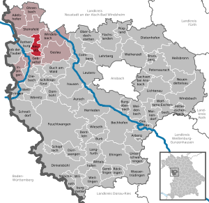
| Location of the community of Neusitz in the district of Ansbach | ||
  |
||

Neusitz is a municipality in the Central Franconian district of Ansbach in Bavaria . It is a member of the Rothenburg ob der Tauber administrative community .
geography
Geographical location
The municipality of Neusitz stretches on the wooded western slope of the Frankenhöhe and at the foot of the slope on the open eastern Hohenlohe plain about 6.5 km from north to south. It is entirely located in the Frankenhöhe Nature Park . Only a very small area of the municipality on its eastern edge lies on the wooded low mountain range, which forms a very flat plateau here, it drains over its uppermost course Karrachbach and some tributaries of the Kreuthbach to the Altmühl and thus to the Danube . The other municipal area belongs entirely to Tauber - and thus to the Main - and the Rhine - the catchment area . At the foot of the downhill slope, the streams flow to the nearby step-edge river Tauber: The Schweinsbach near Schweinsdorf in the north feeds the Steinbach , which flows below Rothenburg ob der Tauber , the Igelsbach in the middle part runs into the river a little above Rothenburg and the other Erlbacher Bach fed from the Wachsenberger Graben in the south via the Kirnberger Mühlbach a little further upstream at Gebsattel .
The two highest points in the municipality are near the main town on the western spurs of the Lug ins Land plateau (approx. 512 m above sea level ) and Schloßberg ( 498 m above sea level ), the two lowest at the outflow of Igelsbach and Erlbacher Bach in their valleys (each approx. 380 m above sea level ).
Neighboring communities
Neighboring communities are Steinsfeld in the north-north-west, Windelsbach in the north-east and east, Gebsattel in the south and south-south-west and Rothenburg ob der Tauber in the west, all of which are also part of the Ansbach district.
Community structure
The municipality has nine officially named municipal parts (the type of settlement is indicated in brackets ):
|
|
Neusitz is the largest place in the municipality. It is located a good three kilometers east of the Rothenburg city center in front of the erosion bay of the Wachsenberger Graben, which is open to the south-southwest. This is framed by the mountain cheeks of the Lug ins Land plateau in the north-north-west and Schloßberg in the south-east. The place lies on a low ridge between the hollows of the Wachsenberg trench and the Igelsbach brook in front of the ditch. The old town center stands under the old parish church in a hillside position on the embankment down into the Igelsbachmulde, the now much more extensive new development areas are mostly on the hill above.
Schweinsdorf in the northern municipality area spreads out in a flatter location at the foot of the slope. To the north of the town center, there is a new development area that has meanwhile reached about its size.
Wachsenberg stands at almost 500 m above sea level. NHN a little northeast of Neusitz on the upper slope shoulder, above the source of the body of water named after him in the slope forest and near the Lug ins Land. It is the only suburb on the plateau, still shaped by agriculture and surrounded by three-quarters of fields.
Horabach , Södelbronn and Erlbach are close to each other in the southern municipality area in or in front of the erosion bay of the Erlbacher Bach. Apart from a few newer stables and barns on the outskirts, the places have remained unchanged in structure, with at most, in the case of Horabach, about a dozen old farms.
Chausseehaus is located a little west of Neusitz on the road to Rothenburg, the Schafhof a little north of it on the road to Schweinsdorf and the Seehäusl in an even closer satellite location to Schweinsdorf.
history
Until the church is planted
The area of the community of Neusitz was settled thousands of years ago. During work on the federal highway 7 , traces of a village from the Bandkeramikzeit (around 5000 BC) were discovered. Mesolithic sites (up to 10,000 BC) can be found near Wachsenberg, Neusitz and Kirnberg. Neusitz itself is still a relatively young village in the Rothenburg area, founded by the master chefs from Nordenberg . The original cell was around 1235 a castle with a manor, 500 days' work of land and a church. There was also a small Dominican monastery in town.
Around 1255 the place was first mentioned as "Nvwseze". The basic word of the place name is “sëz” ( mhd .: Residence) and the final word “niuwe” (mhd .: new).
In the village of Neusitz, the rest of the moth of the Neusitz tower hill castle is in the new district on the ridge of the hill. On the Schlossberg in the south-east, remains of ramparts and moats of an early medieval fortification can still be seen. A flattened moth remains from the Niederungsburg Erlach in the district of the same name.
After belonging to the Rothenburg Dominican convent and the imperial city of Rothenburg for centuries, Neusitz became Bavarian in 1802 and, like Rothenburg, subject to the kingdom.
With the community edict (early 19th century) the tax district Neusitz was formed, to which the places Erlbach , Horabach , Karrachmühle , Schafhof and Wachsenberg belonged. A little later, the rural community of Neusitz was formed with Chausseehaus , Erlbach, Horabach, Schafhof, Södelbronn and Wachsenberg . It was subordinate to the regional court of Rothenburg in administration and jurisdiction . The community of Neusitz originally had an area of 9.174 km².
Incorporations
On May 1, 1978, the previously independent community of Schweinsdorf was incorporated.
Population development
In the period from 1988 to 2018, the population increased from 1,499 to 2,086 by 587 inhabitants or 39.2%.
Neusitz community
| year | 1818 | 1840 | 1852 | 1861 | 1867 | 1871 | 1875 | 1880 | 1885 | 1890 | 1895 | 1900 | 1905 | 1910 | 1919 | 1925 | 1933 | 1939 | 1946 | 1950 | 1961 | 1970 | 1987 | 2005 | 2011 | 2015 |
|---|---|---|---|---|---|---|---|---|---|---|---|---|---|---|---|---|---|---|---|---|---|---|---|---|---|---|
| Residents | 304 | 390 | 409 | 416 | 401 | 411 | 427 | 447 | 423 | 418 | 426 | 450 | 431 | 442 | 442 | 428 | 431 | 395 | 581 | 534 | 488 | 653 | 1437 | 2039 | 2012 | 2036 |
| Houses | 74 | 74 | 80 | 82 | 88 | 92 | 97 | 103 | 408 | 632 | 639 | |||||||||||||||
| source |
Part of the community Neusitz
| year | 1818 | 1840 | 1861 | 1871 | 1885 | 1900 | 1925 | 1950 | 1961 | 1970 | 1987 |
|---|---|---|---|---|---|---|---|---|---|---|---|
| Residents | 117 | 163 | 200 | 170 | 178 | 215 * | 189 * | 270 * | 283 * | 428 | 966 |
| Houses | 33 | 33 | 37 | 43 * | 45 * | 48 * | 55 * | 272 | |||
| source |
politics
mayor
From 1972 to 2002 Werner Heckel was honorary first mayor. For his services he was awarded the Order of Merit of the Federal Republic of Germany on May 12, 2003.
Rudolf Glas (CSU) has been the full-time mayor since 2002. He was re-elected unopposed in the 2014 local elections with 91.95% of the vote. The municipal council appointed Florian Meyer as the second mayor.
Municipal council
The community council of Neusitz has - after 12 before - 14 members since May 2008 because the community now has more than 2000 inhabitants. In addition to the 14 members, there is also the mayor, Rudolf Glas. In the local elections on March 2, 2008 , as in the previous elections, only one nomination was submitted, the corresponding list name was CSU and free voters . It can be confusing, as the nomination did not contain a single candidate from the Free Voters (FW), who ran across Bavaria . Rather, it was a Neusitzer unit list on which the vast majority of candidates are not CSU members. In 2008, out of 24 candidates, only three CSU members ran. In the local elections on March 16, 2014 , there was only this single list.
| CSU | Free voters | total | |
| 2002 | 2 | 10 | 12 seats |
| 2008 | 3 | 11 | 14 seats |
| 2014 | 14 seats |
coat of arms
Neusitz has had its own coat of arms since 1986.
|
|
Blazon : “ Divided ; above three times divided by silver and blue, below in silver a growing black eagle. " |
| Justification of the coat of arms: The division of silver and blue is the coat of arms of the Reichsküchemeister von Nordenberg , who built a castle in Neusitz around 1144. In 1383 their property came to the imperial city of Rothenburg and remained there until 1803. The black eagle commemorates this imperial city rule. |
Architectural monuments

traffic
The national road 2250 runs north from Neusitz and leads to the connection point 108 of the Bundesautobahn 7 or to Geslau over after Colmberg . The district road AN 33 leads to Gebsattel to the state road 2449 . Communal roads lead to Erlbach , to Horabach and past the Schafhof to Schweinsdorf .
leisure offers
Probably because of the proximity to the city of Rothenburg ob der Tauber , which is only two kilometers away, there are only a few leisure activities in Neusitz. Leisure life is mainly organized by the clubs and the two Protestant parishes.
societies
The shooting club SV Neusitz was founded in 1977. He organizes the carnival ball and organizes an annual barbecue.
The Protestant rural youth was founded again in 1995 and has more than 60 active and passive members. Public actions are the annual rural youth festival (with approx. 2500 visitors), the collection of old clothes and participation in various events of the parish. The rural youth use the attic of the church youth center.
The fire brigade association has its fire station in the town hall, sets up the maypole every year on the evening of April 30th and organizes the subsequent celebration. This has developed into a well-attended event, in which families with children also take part.
The 1911 Schweinsdorf choral society consists of 31 active members.
There is also the sociability association, the fruit and horticultural association and the village youth in Schweinsdorf.
Parishes
The parishes of Neusitz and Schweinsdorf belong to the community of Neusitz. The districts of Wachsenberg, Horabach, Erlbach and Södelbronn form the parish of Neusitz. Markus Dörrer is the pastor for both parishes.
The parishes offer a variety of events, groups and circles. Together with the community's associations, they have been organizing the Neusitz Advent market since 2005.
literature
- Johann Kaspar Bundschuh : New . In: Geographical Statistical-Topographical Lexicon of Franconia . tape 3 : I-Ne . Verlag der Stettinische Buchhandlung, Ulm 1801, DNB 790364301 , OCLC 833753092 , Sp. 776-777 ( digitized version ).
- Anton Müller: Neusitz - Chronicle of a Franconian village. Farmers and mayors, shepherds and rags, Köbler and monastery women, knights and rabble ranks. Self-published, Bockenfeld 1992, ISBN 3-927374-09-1 .
- Hans Karlmann Ramisch: District of Rothenburg ob der Tauber (= Bavarian art monuments . Volume 25 ). Deutscher Kunstverlag, Munich 1967, DNB 457879254 , p. 71-74 .
- Wolf-Armin von Reitzenstein : Lexicon of Franconian place names. Origin and meaning . Upper Franconia, Middle Franconia, Lower Franconia. CH Beck, Munich 2009, ISBN 978-3-406-59131-0 , p. 159-160 .
Web links
- Map of the municipality of Neusitz in the Bavaria Atlas
- Neusitz in the Topographia Franconiae of the University of Würzburg , accessed on September 19, 2019.
- Neusitz: Official statistics of the LfStat
Individual evidence
- ↑ "Data 2" sheet, Statistical Report A1200C 202041 Population of the municipalities, districts and administrative districts 1st quarter 2020 (population based on the 2011 census) ( help ).
- ^ Community Neusitz in the local database of the Bavarian State Library Online . Bayerische Staatsbibliothek, accessed on September 19, 2019.
- ↑ W.-A. v. Reitzenstein, p. 159f.
- ^ Address and statistical manual for the Rezatkreis in the Kingdom of Baiern . Buchdruckerei Chancellery, Ansbach 1820, p. 66 ( digitized version ).
- ↑ a b c Eduard Vetter (Hrsg.): Statistical handbook and address book of Middle Franconia in the Kingdom of Bavaria . Self-published, Ansbach 1846, p. 225 ( digitized version ).
- ↑ a b c Bavarian State Statistical Office (ed.): Official city directory for Bavaria, territorial status on October 1, 1964 with statistical information from the 1961 census . Issue 260 of the articles on Bavaria's statistics. Munich 1964, DNB 453660959 , Section II, Sp. 815 ( digitized version ).
- ^ Federal Statistical Office (ed.): Historical municipality directory for the Federal Republic of Germany. Name, border and key number changes in municipalities, counties and administrative districts from May 27, 1970 to December 31, 1982 . W. Kohlhammer, Stuttgart / Mainz 1983, ISBN 3-17-003263-1 , p. 706 .
- ↑ a b Only inhabited houses are given. In 1818 these were designated as fireplaces , in 1840 as houses , and from 1871 to 1987 as residential buildings.
- ↑ a b Alphabetical index of all the localities contained in the Rezatkreise according to its constitution by the newest organization: with indication of a. the tax districts, b. Judicial Districts, c. Rent offices in which they are located, then several other statistical notes . Ansbach 1818, p. 64 ( digitized version ). For the community of Neusitz plus the residents and buildings of Erlbach (p. 23), Horabach (p. 39), Schafhof (p. 80), Södelbronn (p. 86) and Wachsenberg (p. 98).
- ^ A b c d e f g h i Bavarian State Statistical Office (Hrsg.): Historical municipality directory: The population of the municipalities of Bavaria from 1840 to 1952 (= contributions to Statistics Bavaria . Issue 192). Munich 1954, DNB 451478568 , p. 182 , urn : nbn: de: bvb: 12-bsb00066439-3 ( digitized version ).
- ↑ a b Joseph Heyberger, Chr. Schmitt, v. Wachter: Topographical-statistical manual of the Kingdom of Bavaria with an alphabetical local dictionary . In: K. Bayer. Statistical Bureau (Ed.): Bavaria. Regional and folklore of the Kingdom of Bavaria . tape 5 . Literary and artistic establishment of the JG Cotta'schen Buchhandlung, Munich 1867, Sp. 1073 , urn : nbn: de: bvb: 12-bsb10374496-4 ( digitized version ).
- ↑ Kgl. Statistisches Bureau (Ed.): Directory of the municipalities of the Kingdom of Bavaria according to the status of the population in December 1867 . XXI. Issue of the contributions to the statistics of the Kingdom of Bavaria. Ackermann, Munich 1869, p. 171 ( digitized version ).
- ↑ a b Kgl. Statistical Bureau (ed.): Complete list of localities of the Kingdom of Bavaria. According to districts, administrative districts, court districts and municipalities, including parish, school and post office affiliation ... with an alphabetical general register containing the population according to the results of the census of December 1, 1875 . Adolf Ackermann, Munich 1877, 2nd section (population figures from 1871, cattle figures from 1873), Sp. 1239 , urn : nbn: de: bvb: 12-bsb00052489-4 ( digital copy ).
- ↑ K. Bayer. Statistical Bureau (ed.): Community directory for the Kingdom of Bavaria. Manufactured due to the new organization of government districts, district offices and judicial districts. Addendum to issue 36 of the articles on Bavaria's statistics. Munich 1879, p. 68 ( digitized version ).
- ↑ K. Bayer. Statistical Bureau (ed.): Community directory for the Kingdom of Bavaria. Results of the census of December 1, 1880. Issue 35 of the articles on Bavaria's statistics. Munich 1882, p. 195 ( digitized version ).
- ↑ a b K. Bayer. Statistical Bureau (Ed.): Localities directory of the Kingdom of Bavaria. According to government districts, administrative districts, ... then with an alphabetical register of locations, including the property and the responsible administrative district for each location. LIV. Issue of the contributions to the statistics of the Kingdom of Bavaria. Munich 1888, Section III, Sp. 1174 ( digitized version ).
- ↑ a b K. Bayer. Statistical Bureau (Ed.): Directory of localities of the Kingdom of Bavaria, with alphabetical register of places . LXV. Issue of the contributions to the statistics of the Kingdom of Bavaria. Munich 1904, Section II, Sp. 1245 ( digitized version ).
- ↑ a b Bavarian State Statistical Office (ed.): Localities directory for the Free State of Bavaria according to the census of June 16, 1925 and the territorial status of January 1, 1928 . Issue 109 of the articles on Bavaria's statistics. Munich 1928, Section II, Sp. 1285 ( digitized version ).
- ↑ a b Bavarian State Statistical Office (ed.): Official place directory for Bavaria - edited on the basis of the census of September 13, 1950 . Issue 169 of the articles on Bavaria's statistics. Munich 1952, DNB 453660975 , Section II, Sp. 1112 ( digitized version ).
- ↑ a b Bavarian State Statistical Office (Hrsg.): Official local directory for Bavaria . Issue 335 of the articles on Bavaria's statistics. Munich 1973, DNB 740801384 , p. 171 ( digitized version ).
- ↑ a b Bavarian State Office for Statistics and Data Processing (Ed.): Official local directory for Bavaria, territorial status: May 25, 1987 . Issue 450 of the articles on Bavaria's statistics. Munich November 1991, DNB 94240937X , p. 329 ( digitized version ).
- ↑ a b c Neusitz: Official statistics of the LfStat
- ^ Entry on the coat of arms of Neusitz in the database of the House of Bavarian History
- ^ Phillip Schemm: parish of Neusitz & Schweinsdorf. In: www.kg-neusitz-schweinsdorf.de. Retrieved June 14, 2016 .

Adelshofen | Arberg | Aurach | Bechhofen | Bruckberg | Book at the forest | Burgoberbach | Burk | Colmberg | Dentlein am Forst | Diebach | Dietenhofen | Dinkelsbühl | Dombühl | Dürrwangen | Ehingen | Feuchtwangen | Flachslanden | Gebsattel | Gerolfingen | Geslau | Heilsbronn | Herrieden | Insingen | Langfurth | Lehrberg | Leutershausen | Lichtenau | Merkendorf | Mitteleschenbach | Mönchsroth | Neuendettelsau | Neusitz | Oberdachstetten | Ohrbach | Ornbau | Petersaurach | Röckingen | Rothenburg ob der Tauber | Rügland | Saxony near Ansbach | Schillingsfürst | Schnelldorf | Schopfloch | Steinsfeld | Unterschwaningen | Wassertrüdingen | Weidenbach | Weihenzell | Weiltingen | Wettringen | Wieseth | Wilburgstetten | Windelsbach | Windsbach | Wittelshofen | Wolframs-Eschenbach | Wörnitz
Unregulated areas:
Lower Forest