
Mitteleschenbach
| coat of arms | Germany map | |
|---|---|---|

|
Coordinates: 49 ° 13 ' N , 10 ° 48' E |
|
| Basic data | ||
| State : | Bavaria | |
| Administrative region : | Middle Franconia | |
| County : | Ansbach | |
| Management Community : | Wolframs-Eschenbach | |
| Height : | 407 m above sea level NHN | |
| Area : | 10.51 km 2 | |
| Residents: | 1632 (Dec. 31, 2019) | |
| Population density : | 155 inhabitants per km 2 | |
| Postal code : | 91734 | |
| Area code : | 09871 | |
| License plate : | AN , DKB, FEU, ROT | |
| Community key : | 09 5 71 178 | |
| LOCODE : | DE MTX | |
| Community structure: | 4 parts of the community | |
| Address of the municipal administration: |
Rathausstrasse 2 91734 Mitteleschenbach |
|
| Website : | ||
| Mayor : | Stefan Bußinger ( SPD / UW ) | |
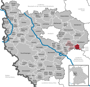
| Location of the community Mitteleschenbach in the district of Ansbach | ||
  |
||


_3376.jpg)
Mitteleschenbach (dialect: "mìdlęsch ɒ bå") is a municipality in the district of Ansbach in Middle Franconia . It is a member of the Wolframs-Eschenbach administrative association .
Geographical location
Mitteleschenbach is on the edge of the Franconian Lake District . The Altbach flows through the village, which at Gersbach merges with the Bambach to the Erlbach, which is a right tributary of the Franconian Rezat . The Bremenwiesbach, which flows into the Erlbach at the Kugelmühle as a right tributary , also flows through the municipality . The Spalter hill country rises south of Mitteleschenbach .
Community structure
The municipality has four officially named municipal parts (the type of settlement is given in brackets ):
The Haselmühle and the Klappermühle are not officially named parts of the municipality.
Neighboring communities
| Windsbach | ||
| Wolframs-Eschenbach |
.svg)
|
gap |
| Haundorf |
climate

Diagram of mean precipitation values in Mitteleschenbach for the period from 1961 to 1990


In Mitteleschenbach, the average annual rainfall is 717 mm.
history
The place was founded in the 11th century. At that time there was already a church in the village, which was dedicated to St. Nicholas and St. Sola. The place was first mentioned in a document as "Eskenbach" in 1183/95. The document from 1157/61 cannot be reliably assigned to this location. The place name is derived from the water body of the same name. The determining word is the ash . The form Mitteleschenbach has been attested since 1287 to distinguish it from nearby places of the same name ( Obereschenbach , Untereschenbach ).
The monastery Heilsbronn acquired in the early 14th century. Some goods. In 1356 a pfennig was added, which Heinz Hofmann signed, and in 1370 two more fields, which Konrad Flurheu donated. In total the monastery had four subjects there.
According to the Salbuch der Deutschordenskommende Nürnberg from 1343, the Eschenbach District Bailiff in Mitteleschenbach owned 3 fiefs and 1 farmstead.
In the 16-point report of the Oberamt Windsbach from 1608, 68 teams were recorded for Mitteleschenbach: 4 properties were subordinate to the Merkendorf administration office , 47 properties to the Spalt caste office , 3 properties to the municipal bailiff's office in Eschenbach, 1 property to the imperial city of Nuremberg and 13 properties to the lords of Lentersheim to Neuenmuhr . The high court exercised the Brandenburg-Ansbach caste and city bailiff's office in Windsbach . According to the 16-point report of the Heilsbronnian Vogtamt Merkendorf from the year 1616, the four properties of the Merkendorf administration office were qualified as 1 half yard and 3 estates.
Towards the end of the 18th century there were 86 properties in Mitteleschenbach with the Klappermühle. The high court exercised the caste and city bailiff's office in Windsbach, and the caste office Spalt held the village and community rulership. The landlords were the Kastenamt Spalt (57 properties: 3 courtyards, 7 semi-courtyards, 25 estates, 4 semi-estates, 1 farm, 1 forge, 8 houses, 8 semi-houses), the Altenmuhr manor owned by the Lords of Lentersheim (16 properties: 1 courtyard, 1 half-courtyard , 2 estates, 7 estates, 1 economy, 1 mill, 3 empty houses ), the Principality of Ansbach (8 properties; Merkendorf administration office: 2 courtyards, 1 estate, 2 estates, 2 empty houses; Gunzenhausen box office : 1 empty house), the German Order ( Stadtvogteiamt Eschenbach: 1 half courtyard, 1 inn; Teutonic Order Nuremberg: 2 half courtyards) and the hospital and Katharinenklosteramt of the imperial city of Nuremberg (1 estate). In addition to the property, there were stately buildings (forester's house, Zehntscheuer), church buildings (parish church, parsonage) and communal buildings (school house, shepherd's house).
From 1797 to 1808 the place was under the Justice and Chamber Office Windsbach . At that time there were 77 subject families, 6 of which were Ansbachian. In 1803 the Hochstift Eichstätt was secularized in favor of Bavaria, which in the same year ceded it to the Principality of Ansbach (main state comparison Bavaria / Prussia ) and returned to Bavaria in 1806 by swap.
In 1806 Mitteleschenbach came to the Kingdom of Bavaria . As part of the municipal edict , the Mitteleschenbach tax district was formed in 1808 , to which Bremenhof , Elpersdorf , Gersbach , Hölzleinsmühle , Käshof , Mitteleschenbach, Moosbach , Retzendorf and Wolfsau belonged. The rural community of Mitteleschenbach was founded in 1810 and was congruent with the Mitteleschenbach tax district. It was subject to the Heilsbronn Regional Court in administration and jurisdiction and the Windsbach Rent Office in the financial administration . With the second community edict (1818) the rural community Mitteleschenbach was split into
- Rural community of Elpersdorf with ball mill;
- Rural community of Mitteleschenbach with Bremenhof, Gersbach and Käshof;
- Rural community Moosbach;
- Rural community of Retzendorf with Hölzleinsmühle and Wolfsau.
From 1862 to 1879 Mitteleschenbach was administered by the Heilsbronn district office, since 1880 by the Gunzenhausen district office (renamed the Gunzenhausen district in 1938 ) and the Gunzenhausen rent office ( renamed the Gunzenhausen tax office in 1920 ). The jurisdiction remained with the district court Heilsbronn until 1879, since 1880 with the district court Gunzenhausen .
128 Mitteleschenbach soldiers lost their lives in World War II. After several days of bombardment, the site was occupied by American forces on April 22, 1945.
Population development
In the period from 1988 to 2018, the population increased from 1,397 to 1,599 by 202 inhabitants or 14.5%.
Mitteleschenbach community
| year | 1818 | 1840 | 1852 | 1861 | 1867 | 1871 | 1875 | 1880 | 1885 | 1890 | 1895 | 1900 | 1905 | 1910 | 1919 | 1925 | 1933 | 1939 | 1946 | 1950 | 1961 | 1970 | 1987 | 1995 | 2005 | 2015 |
|---|---|---|---|---|---|---|---|---|---|---|---|---|---|---|---|---|---|---|---|---|---|---|---|---|---|---|
| Residents | 590 | 583 | 730 | 793 | 833 | 808 | 832 | 885 | 919 | 869 | 859 | 899 | 851 | 881 | 903 | 854 | 918 | 946 | 1088 | 1070 | 1134 | 1300 | 1356 | 1524 | 1581 | 1568 |
| Houses | 116 | 123 | 157 | 164 | 164 | 165 | 199 | 241 | 357 | 480 | ||||||||||||||||
| source |
Part of the municipality Mitteleschenbach
| year | 1818 | 1840 | 1861 | 1871 | 1885 | 1900 | 1925 | 1950 | 1961 | 1970 | 1987 |
|---|---|---|---|---|---|---|---|---|---|---|---|
| Residents | 536 | 527 | 726 | 730 | 808 | 795 | 767 | 946 | 1045 | 1205 | 1282 |
| Houses | 107 | 114 | 149 | 149 | 149 | 181 | 222 | 337 | |||
| source |
Religions
Mitteleschenbach is predominantly Catholic. The residents of the Roman Catholic denomination are parish according to St. Nicholas , the residents of the Evangelical Lutheran denomination to St. Margareta in Windsbach (Gersbach, Mitteleschenbach) or to St. Andreas in Wassermungenau (Bremenhof, Käshof).
politics
Municipal council
The community council of Mitteleschenbach has 13 members including the mayor.
| CSU | SPD | total | |
| 2002 | 9 | 4th | 13 seats |
| 2008 | 8th | 5 | 13 seats |
| 2014 | 7th | 5 | 12 seats |
| 2020 | 7th | 5 | 12 seats |
(Status: local election on March 15, 2020 )
mayor
Mayor from 2001 to 2020 was Stefan Maul (CSU). Stefan Bußinger (SPD / UW) was elected as his successor in 2020.
badges and flags
The community of Mitteleschenbach has had its own coat of arms and flag since 1956.
|
|
Blazon : "A golden crook and a golden rake crossed in red."
Gold-red municipal flag |
| Justification for the coat of arms: The bishop's staff refers to the Archdiocese of Eichstätt, to whose territory Mitteleschenbach belonged, and the Rechen to the Rechenberg family who owned goods there. |
Architectural monuments
- St. Nicholas (Roman Catholic), parish church
- St. Walburga (Roman Catholic), cemetery church
- For the crucified Savior (Roman Catholic), chapel in Gersbach
- St. Michael (Bremen- and Käshof) (Protestant-Lutheran), chapel near Bremen- and Käshof
Soil monuments
There are ten archaeological monuments in the municipality .
Economy and Infrastructure
traffic
The district road AN 59 leads to Selgenstadt or Winkelhaid . The AN 15 / WUG 23 leads to Gersbach or Leidingendorf past Haundorf . A community road leads to Speckheim .
education
There are the following educational institutions:
- primary school
- Rezat-Mönchswald Music School
- Volkshochschule Wolframs-Eschenbach - Mitteleschenbach - Merkendorf
literature
- Johann Kaspar Bundschuh : Eschenbach . In: Geographical Statistical-Topographical Lexicon of Franconia . tape 2 : El-H . Verlag der Stettinische Buchhandlung, Ulm 1800, DNB 790364298 , OCLC 833753081 , Sp. 84 ( digitized version ).
- Johann Kaspar Bundschuh : Mitteleschenbach . In: Geographical Statistical-Topographical Lexicon of Franconia . tape 3 : I-Ne . Verlag der Stettinische Buchhandlung, Ulm 1801, DNB 790364301 , OCLC 833753092 , Sp. 622-623 ( digitized version ).
- Helmut Engst: Heimatbuch Mitteleschenbach; 950 years of Mitteleschenbach am Mönchswald in the Franconian Lake District; History and stories . Riedel, Gunzenhausen 2007.
- Hanns Hubert Hofmann : Gunzenhausen-Weißenburg . In: Historical Atlas of Bavaria , part of Franconia . Series I, Issue 8. Komm. Für Bayerische Landesgeschichte, Munich 1960, DNB 452071089 , p. 237 ( digitized version ).
- Manfred Jehle: Ansbach: the margravial chief offices Ansbach, Colmberg-Leutershausen, Windsbach, the Nuremberg nursing office Lichtenau and the Deutschordensamt (Wolframs-) Eschenbach (= historical atlas of Bavaria, part Franconia . I, 35). Commission for Bavarian State History, Munich 2009, ISBN 978-3-7696-6856-8 , p. 888, 1001 .
- Hansgeorg Klauss et al. (Ed.): The district of Gunzenhausen . Verl. F. Authorities and Economy Hoeppner, Aßling-Pörsdorf / Obb. 1966, DNB 456843604 , p. 223-227 .
- Georg Muck: History of Heilsbronn Monastery from prehistoric times to modern times . tape 2 . For Kunstreprod. Schmidt, Neustadt an der Aisch 1993, ISBN 3-923006-90-X , p. 443–444 (first edition: Beck, Nördlingen 1879).
- Wolf-Armin von Reitzenstein : Lexicon of Franconian place names. Origin and meaning . Upper Franconia, Middle Franconia, Lower Franconia. CH Beck, Munich 2009, ISBN 978-3-406-59131-0 , p. 149 .
- Robert Schuh: Gunzenhausen (= historical book of place names of Bavaria, Middle Franconia . Volume 5 ). Michael Laßleben, Kallmünz 1979, ISBN 3-7696-9922-X , p. 80-82 .
Web links
- Mitteleschenbach website
- Map of the community of Mitteleschenbach on the BayernAtlas
- Mitteleschenbach: Official statistics of the LfStat
- Mitteleschenbach in the Topographia Franconiae of the University of Würzburg , accessed on September 16, 2019.
- Mitteleschenbach in the historical directory of the association for computer genealogy
Individual evidence
- ↑ "Data 2" sheet, Statistical Report A1200C 202041 Population of the municipalities, districts and administrative districts 1st quarter 2020 (population based on the 2011 census) ( help ).
- ↑ R. Schuh, p. 80.
- ^ Community Mitteleschenbach in the local database of the Bavarian State Library Online . Bavarian State Library, accessed on September 16, 2019.
- ↑ After 1885, both places are no longer listed as part of the village in the local registers.
- ↑ W.-A. v. Reitzenstein, p. 149.
- ↑ G. Muck, Vol. 2, p. 443 f.
- ^ State Archives Nuremberg , Reichsstadt Nürnberg, Salbuch 134 (= Gerhard Pfeifer (edit.): The oldest land records of the German Order Committees Nuremberg , Neustadt / Aisch 1981, pp. 55–78). Quoted from M. Jehle, Vol. 1, p. 532.
- ^ State Archives Nuremberg , 16-Punkt -berichte 43/1, 14. Quoted from M. Jehle, Vol. 2, p. 731.
- ↑ State Archives Nuremberg , 16-point reports 25, 18. Quoted from M. Jehle, Vol. 2, p. 742.
- ↑ M. Jehle, Vol. 2, p. 888.
- ^ Johann Bernhard Fischer : Mitteleschenbach . In: Statistical and topographical description of the Burggraftum Nürnberg, below the mountain, or the Principality of Brandenburg-Anspach. Second part. Containing the economic, statistical and moral condition of these countries according to the fifteen upper offices . Benedict Friedrich Haueisen, Ansbach 1790, p. 407 ( digitized version ).
- ↑ JK Bundschuh, Vol. 3, Col. 622.
- ↑ State Archives Nuremberg , Government of Middle Franconia, Chamber of the Interior, Levy 1952, 3850: Formation of the municipal and rural communities in the district court Heilsbronn 1810. Quoted from M. Jehle, vol. 2, p. 963.
- ^ Address and statistical manual for the Rezatkreis in the Kingdom of Baiern . Buchdruckerei Chancellery, Ansbach 1820, p. 43-44 ( digitized version ).
- ↑ M. Jehle, Vol. 2, p. 1001.
- ↑ a b Only inhabited houses are given. In 1818 these were designated as fireplaces , in 1840 as houses , and from 1871 to 1987 as residential buildings.
- ↑ a b Alphabetical index of all the localities contained in the Rezatkreise according to its constitution by the newest organization: with indication of a. the tax districts, b. Judicial Districts, c. Rent offices in which they are located, then several other statistical notes . Ansbach 1818, p. 59 ( digitized version ). For the community of Mitteleschenbach plus the residents and buildings of Bremenhof (p. 12), Gersbach (p. 29) and Käshof (p. 45).
- ^ A b Eduard Vetter (Ed.): Statistical handbook and address book of Middle Franconia in the Kingdom of Bavaria . Self-published, Ansbach 1846, p. 150 ( digitized version ). In the municipality register 1953 643 inhabitants are given.
- ↑ Bavarian State Statistical Office (Hrsg.): Historical municipality register: The population of the municipalities of Bavaria in the period from 1840 to 1952 (= contributions to Statistics Bavaria . Issue 192). Munich 1954, DNB 451478568 , p. 174 , urn : nbn: de: bvb: 12-bsb00066439-3 ( digitized version ).
- ↑ a b Joseph Heyberger, Chr. Schmitt, v. Wachter: Topographical-statistical manual of the Kingdom of Bavaria with an alphabetical local dictionary . In: K. Bayer. Statistical Bureau (Ed.): Bavaria. Regional and folklore of the Kingdom of Bavaria . tape 5 . Literary and artistic establishment of the JG Cotta'schen Buchhandlung, Munich 1867, Sp. 1043 , urn : nbn: de: bvb: 12-bsb10374496-4 ( digitized version ).
- ↑ Kgl. Statistisches Bureau (Ed.): Directory of the municipalities of the Kingdom of Bavaria according to the status of the population in December 1867 . XXI. Issue of the contributions to the statistics of the Kingdom of Bavaria. Ackermann, Munich 1869, p. 165 ( digitized version ).
- ↑ a b Kgl. Statistical Bureau (ed.): Complete list of localities of the Kingdom of Bavaria. According to districts, administrative districts, court districts and municipalities, including parish, school and post office affiliation ... with an alphabetical general register containing the population according to the results of the census of December 1, 1875 . Adolf Ackermann, Munich 1877, 2nd section (population figures from 1871, cattle figures from 1873), Sp. 1208 , urn : nbn: de: bvb: 12-bsb00052489-4 ( digitized version ).
- ↑ K. Bayer. Statistical Bureau (ed.): Community directory for the Kingdom of Bavaria. Manufactured due to the new organization of government districts, district offices and judicial districts. Addendum to issue 36 of the articles on Bavaria's statistics. Munich 1879, p. 64 ( digitized version ).
- ↑ K. Bayer. Statistical Bureau (ed.): Community directory for the Kingdom of Bavaria. Results of the census of December 1, 1880. Issue 35 of the articles on Bavaria's statistics. Munich 1882, p. 183 ( digitized version ).
- ↑ a b K. Bayer. Statistical Bureau (Ed.): Localities directory of the Kingdom of Bavaria. According to government districts, administrative districts, ... then with an alphabetical register of locations, including the property and the responsible administrative district for each location. LIV. Issue of the contributions to the statistics of the Kingdom of Bavaria. Munich 1888, Section III, Sp. 1131 ( digitized version ).
- ↑ a b c d e f g h Bavarian State Statistical Office (Hrsg.): Historical municipality register: The population of the municipalities of Bavaria from 1840 to 1952 (= contributions to Statistics Bavaria . Issue 192). Munich 1954, DNB 451478568 , p. 173 , urn : nbn: de: bvb: 12-bsb00066439-3 ( digitized ).
- ↑ a b K. Bayer. Statistical Bureau (Ed.): Directory of localities of the Kingdom of Bavaria, with alphabetical register of places . LXV. Issue of the contributions to the statistics of the Kingdom of Bavaria. Munich 1904, Section II, Sp. 1200 ( digitized version ).
- ↑ a b Bavarian State Statistical Office (ed.): Localities directory for the Free State of Bavaria according to the census of June 16, 1925 and the territorial status of January 1, 1928 . Issue 109 of the articles on Bavaria's statistics. Munich 1928, Section II, Sp. 1237 ( digitized version ).
- ↑ a b Bavarian State Statistical Office (ed.): Official place directory for Bavaria - edited on the basis of the census of September 13, 1950 . Issue 169 of the articles on Bavaria's statistics. Munich 1952, DNB 453660975 , Section II, Sp. 1070 ( digitized version ).
- ↑ a b Bavarian State Statistical Office (ed.): Official city directory for Bavaria, territorial status on October 1, 1964 with statistical information from the 1961 census . Issue 260 of the articles on Bavaria's statistics. Munich 1964, DNB 453660959 , Section II, Sp. 786 ( digitized version ).
- ↑ a b Bavarian State Statistical Office (Hrsg.): Official local directory for Bavaria . Issue 335 of the articles on Bavaria's statistics. Munich 1973, DNB 740801384 , p. 170 ( digitized version ).
- ↑ a b Bavarian State Office for Statistics and Data Processing (Ed.): Official local directory for Bavaria, territorial status: May 25, 1987 . Issue 450 of the articles on Bavaria's statistics. Munich November 1991, DNB 94240937X , p. 329 ( digitized version ).
- ↑ Mitteleschenbach: Official statistics of the LfStat
- ^ Entry on the coat of arms of Mitteleschenbach in the database of the House of Bavarian History
- ↑ Mitteleschenbach. In: Kommunalflaggen.eu. Retrieved February 9, 2020 .

Adelshofen | Arberg | Aurach | Bechhofen | Bruckberg | Book at the forest | Burgoberbach | Burk | Colmberg | Dentlein am Forst | Diebach | Dietenhofen | Dinkelsbühl | Dombühl | Dürrwangen | Ehingen | Feuchtwangen | Flachslanden | Gebsattel | Gerolfingen | Geslau | Heilsbronn | Herrieden | Insingen | Langfurth | Lehrberg | Leutershausen | Lichtenau | Merkendorf | Mitteleschenbach | Mönchsroth | Neuendettelsau | Neusitz | Oberdachstetten | Ohrbach | Ornbau | Petersaurach | Röckingen | Rothenburg ob der Tauber | Rügland | Saxony near Ansbach | Schillingsfürst | Schnelldorf | Schopfloch | Steinsfeld | Unterschwaningen | Wassertrüdingen | Weidenbach | Weihenzell | Weiltingen | Wettringen | Wieseth | Wilburgstetten | Windelsbach | Windsbach | Wittelshofen | Wolframs-Eschenbach | Wörnitz
Unregulated areas:
Lower Forest