
Water inaccurate
|
Water inaccurate
City of Abenberg
Coordinates: 49 ° 13 ′ 3 ″ N , 10 ° 53 ′ 8 ″ E
|
|
|---|---|
| Height : | 372 (370–395) m above sea level NHN |
| Area : | 6.87 km² |
| Residents : | 1069 (2014) |
| Population density : | 156 inhabitants / km² |
| Incorporation : | May 1, 1978 |
| Postal code : | 91183 |
| Area code : | 09873 |
.JPG) Townscape
|
|

Wassermungau (colloquially Wassermummala ) is a district of the town of Abenberg in the district of Roth in Middle Franconia .
geography
The parish village lies on the Franconian Rezat , which divides it in two halves. In the village , the Fischbach, coming from Dürrenmungenau , flows into the river from the left . About one kilometer to the north is the Auf den Sand corridor area , about one kilometer to the northeast is the Dürrenmungenauer Holz , and the Weiherleite follows immediately to the northeast . About 0.5 km south of the Eichenbühl ( 399 m above sea level ) rises , about 0.5 km southwest of the Pfaffenbühl ( 416 m above sea level ).
The B 466 leads to Obererlbach (5 km southwest) and Barthelmesaurach (7.5 km north). The state road 2223 leads to Untereschenbach (2.5 km northwest) or past the Stiegelmühle to Höfstetten (3 km south), the district road RH 9 leads to Beerbach (1.8 km east).
history
In a sand pit in the Fischbachtal near Wassermungenau, numerous ceramics from the Urnfield period were found, which indicate a settlement.
The place was first mentioned by name in 810 in a deed of donation from the Regensburg Abbot Bishop Adalwin († 816) to the St. Salvator monastery , which was subordinate to the Benedictine monastery of St. Emmeram . The part west of the Rezat was called "Wolfmuntingas" meaning settlement of the Wolfmunt . The part east of the Rezat was called "Altstatt" or "Turunfeld". The place was conveniently located on Burgunderstrasse .
Around 1189, the Eichstatt Bishop Otto consecrated a church in Mungenau. What was meant, however, was probably the church of St. Otto zu Hergersbach, which has now disappeared . A St. Andrew's Church has only been documented for Wasserm inaccurate since the 15th century .
In the castle Count Urbar of 1361/64 a Untertansfamilie was recorded for Wassermungenau that the Office Windsbach shelter.
In 1529, the main Hergersbach team of the Imperial City of Nuremberg was subordinate to 9 subject families in the village.
In the 16-point report of the Windsbach Oberamt from 1608, 34 teams were recorded for water inaccuracy: 2 taverns, 2 courtyards and 6 Köblergüter were subordinate to the Windsbach caste office , 1 mill, 1 tavern, 4 courtyards and 6 goods were subordinate to the Spalt caste office in Eichstätt , 1 Hof the Schwabach hospital , 5 courtyards and 5 estates of the imperial city of Nuremberg and 1 estate Dettelbachischen heirs . There was also the communal shepherd's house. The high court exercised the Brandenburg-Ansbach caste and city bailiff's office in Windsbach . The place was badly devastated in the Thirty Years War. After 1652 the population increased again due to the influx of Protestant religious refugees, v. a. from the Lower Austrian Waldviertel and the Upper Austrian Mühlviertel (here especially from the "Ländlein above the Enns").
In the Eichstätter Salbuch of 1671 16 subject families of the caste office Spalt, 11 U. the caste office Windsbach and 1 U. the caste office Roth are recorded. The Nürnberger U. are not mentioned. There was no congregation ruler at that time. Since 1681 , Wassermungenau, located on the “Land- und Commerzialstrasse” (Nuremberg-Ulm) (today: Bundesstrasse 466 ), had its own post office for the Imperial Post , which was operated by Thurn und Taxis .
In the official description of the Lichtenau Nursing Office from 1748, 42 subject families are specified for the place, 11 of which were subordinate to the Nursing Office and 31 foreign masters.
At the end of the 18th century there were 49 properties in Wassermungenau. The high court and the village and community rulership continued to be exercised by the caste and city bailiff's office in Windsbach. The landlords were the Principality of Ansbach (26 properties; Kastenamt Windsbach: 1 whole courtyard, 3 half courtyards, 1 half courtyard with tavern , 1 Köblergut, 2 estates each with a tavern, 2 estates, 1 estate with inns, 11 empty houses , 1 bath house, 1 forge; Judge's office in Georgensgmünd : 1 empty house; Schwabach hospital : 1 three-quarter courtyard), the Spalt box office (15 properties: 1 whole courtyard with tavern, 4 half-courtyards, 2 Köbler estates, 2 estates, 2 half empties, 1 Mahlmühlgut, 2 smiths estates), the imperial city of Nuremberg ( St .-Klara-Klosteramt : 3 three-quarter courtyards; Landesalmosenamt: 1 half courtyard with restaurant) and Nuremberg owners ( von Ebner : 1 Köblergut; von Stromer : 1 Gütlein; von Tucher : 1 empty house; von Dilherr: 1 half courtyard). In addition to the property, there were also ecclesiastical buildings (rectory, parish church) and communal buildings (school, shepherd's house). From 1797 to 1808 the place was under the Justice and Chamber Office Windsbach . At that time there were 46 subject families, 20 of which were Ansbachian.
In 1806, water inaccuracy came to the Kingdom of Bavaria . As part of the municipal edict , the Wassermungenau tax district was formed in 1808 , to which Beerbach , Hergersbach , Pflugsmühle , Thonhof , Untereschenbach , Wassermungenau and Winkelhaid belonged. The rural community Wassermungenau was founded in 1810 and was congruent with the tax district. It was subject to the Heilsbronn Regional Court in administration and jurisdiction and the Windsbach Rent Office in the financial administration . With the second community edict (1818) five rural communities were formed:
- Beerbach rural community with plow mill;
- Hergersbach rural community;
- Rural community Untereschenbach;
- Rural community Wassermungenau;
- Rural community Winkelhaid with Thonhof.
From 1862 to 1879 Wassermungenau was administered by the Heilsbronn district office, since 1880 by the Schwabach district office ( renamed Schwabach district in 1938 ) and the Spalt rent office ( renamed Spalt tax office in 1920 ). Jurisdiction remained with the Heilsbronn District Court until 1879, and with the Roth District Court from 1880 . In 1932 the Spalt tax office was dissolved. Since then, water inaccuracy has been subordinate to the Schwabach tax office in financial management . The municipality had an area of 6.866 km².
In the 19th century a connection to the existing Georgensgmünd – Spalt and Wicklesgreuth – Windsbach branch lines was planned, but this was not implemented.
On May 1, 1978, the municipality Wassermungenau was incorporated into the city of Abenberg as part of the regional reform in Bavaria .
Population development
| year | 1818 | 1840 | 1852 | 1855 | 1861 | 1867 | 1871 | 1875 | 1880 | 1885 | 1890 | 1895 | 1900 | 1905 | 1910 | 1919 | 1925 | 1933 | 1939 | 1946 | 1950 | 1952 | 1961 | 1970 | 1987 | 2014 |
|---|---|---|---|---|---|---|---|---|---|---|---|---|---|---|---|---|---|---|---|---|---|---|---|---|---|---|
| Residents | 344 | 456 | 433 | 438 | 443 | 469 | 480 | 475 | 485 | 538 | 493 | 494 | 524 | 532 | 543 | 544 | 555 | 516 | 511 | 815 | 799 | 745 | 621 | 681 | 800 | 1069 |
| Houses | 42 | 72 | 85 | 92 | 94 | 102 | 111 | 123 | 207 | |||||||||||||||||
| source |
Architectural monuments
- St. Andreas (water inaccurate) , parish church (Evangelical Lutheran)
- House no. 27: Rectory
- House no. 31: Gasthaus Post
- graveyard
- various houses and barns
- Summer cellar, rock cellar

In the town

Old houses
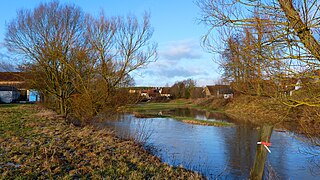
The Rezat

St. Andrew's Church with Rezat

St. Andrew's Church

Flood
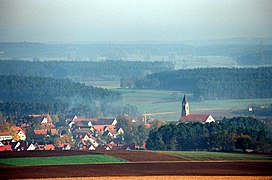
Place view


,_Ortsansicht.jpg)
literature
- Johann Kaspar Bundschuh : Water inaccurate . In: Geographical Statistical-Topographical Lexicon of Franconia . tape 6 : V-Z . Verlag der Stettinische Buchhandlung, Ulm 1804, DNB 790364328 , OCLC 833753116 , Sp. 109-110 ( digitized version ).
- Friedrich Eigler : Schwabach (= Historical Atlas of Bavaria, part of Franconia . I, 28). Michael Laßleben, Kallmünz 1990, ISBN 3-7696-9941-6 , p. 430-431, 487 .
- Karl Gröber, Felix Mader : City and district of Schwabach (= The art monuments of Bavaria . Middle Franconia 7). R. Oldenburg, Munich 1939, DNB 366496239 , p. 391 .
- Manfred Jehle: Ansbach: the margravial chief offices Ansbach, Colmberg-Leutershausen, Windsbach, the Nuremberg nursing office Lichtenau and the Deutschordensamt (Wolframs-) Eschenbach (= historical atlas of Bavaria, part Franconia . I, 35). tape 2 . Commission for Bavarian State History, Munich 2009, ISBN 978-3-7696-6856-8 , p. 923 .
- Eberhard Krauss: Exiles in the Evangelical Luth. Deanery Windsbach in the 17th century. A family history investigation (= sources and research on Franconian family history . Volume 19 ). Society for Family Research in Franconia, Nuremberg 2007, ISBN 978-3-929865-12-7 , p. 62-69 u. passim .
- Wolf-Dieter Pfeifer (Ed.): Water inaccuracy in photographs from 1890 to 1960. A selection of restored reproductions from the photo collection of Helmut Billing . Wassermungenau 2002, ISBN 3-00-009559-4 .
- Gottfried Stieber: Water inaccurate . In: Historical and topographical news from the Principality of Brandenburg-Onolzbach . Johann Jacob Enderes, Schwabach 1761, p. 904-906 ( digitized version ).
- Willi Ulsamer (Ed.): 100 Years of the Schwabach District (1862–1962). A home book . Schwabach 1964, DNB 984880232 , p. 620-623 .
Web links
- Water inaccuracy on the Abenberg website
- Water inaccurate in the location database of the Bavarian State Library Online . Bavarian State Library
- Water inaccurate in the Topographia Franconiae of the University of Würzburg , accessed on September 22, 2019.
- Water inaccuracy in the historical directory of the Association for Computer Genealogy
Individual evidence
- ↑ W. Ullsamer (eds.), Pp 620th
- ↑ Water inaccuracy in the Bavaria Atlas
- ↑ M. Jehle, Vol. 1, p. 23.
- ↑ Günther Zeilinger with e. Working group d. Dekanates (Ed.): Windsbach - a deanery in Franconia (= series of portraits of Bavarian deanery districts ). Verlag der Evangelisch-Lutherischen Mission, Erlangen 1987, ISBN 3-87214-220-8 , p. 80 .
- ↑ W. Ullsamer (Ed.), P. 621.
- ↑ M. Jehle, Vol. 1, p. 501.
- ↑ F. Eigler, p. 347.
- ↑ State Archives Nuremberg , 16-Punkt -berichte 43/1, 11. Quoted from M. Jehle, Vol. 2, p. 733.
- ↑ E. Krauss, p. 62ff.
- ↑ F. Eigler, p. 103.
- ↑ W. Ullsamer (Ed.), P. 622.
- ↑ M. Jehle, Vol. 2, p. 748.
- ↑ M. Jehle, Vol. 2, p. 923 = F. Eigler, p. 430 f.
- ^ Johann Bernhard Fischer : Water inaccurate . In: Statistical and topographical description of the Burggraftum Nürnberg, below the mountain, or the Principality of Brandenburg-Anspach. Second part. Containing the economic, statistical and moral condition of these countries according to the fifteen upper offices . Benedict Friedrich Haueisen, Ansbach 1790, p. 310 ( digitized version ).
- ↑ JK Bundschuh, Vol. 6 , Col. 109 f .: " Wassermungau, insgem. Wassermumela, and in documents from the middle ages Mungawe, also called Mungenowe , is a parish village located in the Fraischbezirke of the Ansbach Oberamt Windsbach a little half an hour north of Wernfels on the Franconian Rezat River next to the Wernfels-Spaltische Fraischgränze with an imperial Reichspost, and it seems that way from the strong and frequent inundations resulting from the frequent emergence of the Frankish Rezat, as well as, on the other hand, from drought inaccurately deriving his own from its brittle and arid region. A von Mungenau family also wrote itself and in 1142 a Chunrat von Mungenowe came before. There are 46 subjects in this village, 15 of which are Eichstättisch and Wernfels Spalt as well as the Erbtafern, Erbschmiedstatt and Mühle. According to the contract, the Kirchweihschuz and common crime are common between Wernfels and Windsbach. "
- ↑ State Archives Nuremberg , Government of Middle Franconia, Chamber of the Interior, Levy 1952, 3850: Formation of the municipal and rural communities in the district court Heilsbronn 1810. Quoted from M. Jehle, vol. 2, p. 963.
- ^ Address and statistical manual for the Rezatkreis in the Kingdom of Baiern . Buchdruckerei Chancellery, Ansbach 1820, p. 43-45 ( digitized version ).
- ↑ F. Eigler, p. 487.
- ↑ a b Bavarian State Statistical Office (ed.): Official city directory for Bavaria, territorial status on October 1, 1964 with statistical information from the 1961 census . Issue 260 of the articles on Bavaria's statistics. Munich 1964, DNB 453660959 , Section II, Sp. 826 ( digitized version ).
- ^ Federal Statistical Office (ed.): Historical municipality directory for the Federal Republic of Germany. Name, border and key number changes in municipalities, counties and administrative districts from May 27, 1970 to December 31, 1982 . W. Kohlhammer, Stuttgart / Mainz 1983, ISBN 3-17-003263-1 , p. 733 .
- ↑ Only inhabited houses are given. In 1818 these were designated as fireplaces , in 1840 as houses , and from 1871 to 1987 as residential buildings.
- ↑ Alphabetical index of all the localities contained in the Rezatkkreis according to its constitution by the newest organization: with indication of a. the tax districts, b. Judicial Districts, c. Rent offices in which they are located, then several other statistical notes . Ansbach 1818, p. 100 ( digitized version ).
- ↑ Eduard Vetter (Ed.): Statistical handbook and address book of Middle Franconia in the Kingdom of Bavaria . Self-published, Ansbach 1846, p. 153 ( digitized version ).
- ↑ a b c Bavarian State Statistical Office (Hrsg.): Historical municipality register: The population of the municipalities of Bavaria in the period from 1840 to 1952 (= contributions to Statistics Bavaria . Issue 192). Munich 1954, DNB 451478568 , p. 174 , urn : nbn: de: bvb: 12-bsb00066439-3 ( digitized version ).
- ^ Joseph Heyberger, Chr. Schmitt, v. Wachter: Topographical-statistical manual of the Kingdom of Bavaria with an alphabetical local dictionary . In: K. Bayer. Statistical Bureau (Ed.): Bavaria. Regional and folklore of the Kingdom of Bavaria . tape 5 . Literary and artistic establishment of the JG Cotta'schen Buchhandlung, Munich 1867, Sp. 1044 , urn : nbn: de: bvb: 12-bsb10374496-4 ( digitized version ).
- ↑ Kgl. Statistical Bureau (ed.): Complete list of localities of the Kingdom of Bavaria. According to districts, administrative districts, court districts and municipalities, including parish, school and post office affiliation ... with an alphabetical general register containing the population according to the results of the census of December 1, 1875 . Adolf Ackermann, Munich 1877, 2nd section (population figures from 1871, cattle figures from 1873), Sp. 1210 , urn : nbn: de: bvb: 12-bsb00052489-4 ( digitized ).
- ↑ K. Bayer. Statistical Bureau (ed.): Community directory for the Kingdom of Bavaria. Manufactured due to the new organization of government districts, district offices and judicial districts. Addendum to issue 36 of the articles on Bavaria's statistics. Munich 1879, p. 69 ( digitized version ).
- ↑ K. Bayer. Statistical Bureau (ed.): Community directory for the Kingdom of Bavaria. Results of the census of December 1, 1880. Issue 35 of the articles on Bavaria's statistics. Munich 1882, p. 199 ( digitized version ).
- ↑ K. Bayer. Statistical Bureau (Ed.): Localities directory of the Kingdom of Bavaria. According to government districts, administrative districts, ... then with an alphabetical register of locations, including the property and the responsible administrative district for each location. LIV. Issue of the contributions to the statistics of the Kingdom of Bavaria. Munich 1888, Section III, Sp. 1192 ( digitized version ).
- ^ A b c d e f g h i Bavarian State Statistical Office (Hrsg.): Historical municipality directory: The population of the municipalities of Bavaria from 1840 to 1952 (= contributions to Statistics Bavaria . Issue 192). Munich 1954, DNB 451478568 , p. 184 , urn : nbn: de: bvb: 12-bsb00066439-3 ( digitized ).
- ↑ K. Bayer. Statistical Bureau (Ed.): Directory of localities of the Kingdom of Bavaria, with alphabetical register of places . LXV. Issue of the contributions to the statistics of the Kingdom of Bavaria. Munich 1904, Section II, Sp. 1266 ( digitized version ).
- ↑ Bavarian State Statistical Office (ed.): Localities directory for the Free State of Bavaria according to the census of June 16, 1925 and the territorial status of January 1, 1928 . Issue 109 of the articles on Bavaria's statistics. Munich 1928, Section II, Sp. 1303 ( digitized version ).
- ↑ Bavarian State Statistical Office (ed.): Official place directory for Bavaria - edited on the basis of the census of September 13, 1950 . Issue 169 of the articles on Bavaria's statistics. Munich 1952, DNB 453660975 , Section II, Sp. 1128 ( digitized version ).
- ^ Bavarian State Statistical Office (ed.): Official place directory for Bavaria . Issue 335 of the articles on Bavaria's statistics. Munich 1973, DNB 740801384 , p. 180 ( digitized version ).
- ↑ Bavarian State Office for Statistics and Data Processing (Ed.): Official local directory for Bavaria, territorial status: May 25, 1987 . Issue 450 of the articles on Bavaria's statistics. Munich November 1991, DNB 94240937X , p. 347 ( digitized version ).
