Waldviertel
Coordinates: 48 ° 40 ' N , 15 ° 15' E
| Districts and districts of Lower Austria |
|---|
|
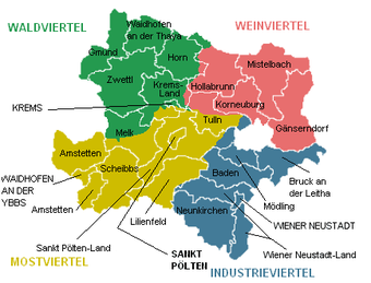
The Waldviertel , an ancient quarter above the Manhartsberg , is the northwestern part of the Austrian state of Lower Austria . It largely corresponds to one of the main regions of the country ( main region Waldviertel ) and in the official statistics to a group of districts ( NUTS: AT 124).
Since the political districts were formed in 1868, the districts in Lower Austria no longer have a legal basis and are purely landscape names. The older district division , which was still based on the old quarters, was replaced.
overview
In the south, the Danube forms the border with the Lower Austrian Mostviertel . Regions bordering clockwise from southwest to east are the Upper Austrian Mühlviertel , the Czech South Bohemia and the Lower Austrian Weinviertel with the distinctive Manhartsberg ridge (537 m). The latter also gave it the name Viertel above Manhartsberg (also Viertel / Kreis Ober-Manharts-Berg , in the 18th and 19th centuries often abbreviated as V. O. M. B. or OMB).
The Waldviertel covers an area of around 4,600 km² and is populated by around 220,000 people (as of 2011), which corresponds to less than 50 inhabitants per km².
Compared to the political borders, the traditional-landscape demarcation includes the districts of Gmünd , Horn , Krems , Waidhofen an der Thaya and Zwettl , plus the Melk district north of the Danube and the westernmost parts of the Hollabrunn district (such as the communities Hardegg , Maissau and Mühlbach am Manhartsberg ). Smaller eastern parts of the Krems and Horn districts, on the other hand, are counted as part of the Weinviertel. Besides Krems, the most important cities are the district capitals Gmünd , Horn , Waidhofen and Zwettl , as well as Eggenburg (at the transition to the Weinviertel), Heidenreichstein , Litschau , Schrems and Weitra .
The Wachau river landscape, with its main towns of Krems on the Danube and Spitz on the Danube, is one of the most structurally strong areas in the district . From a geological point of view, the Wachau lies on both sides of the Danube in the Waldviertel, because the Dunkelsteinerwald also belongs to the Bohemian Massif .
In the center of the Waldviertel is the Allentsteig military training area , which was laid out after the “ Anschluss ” in 1938 and covers an area of 157 km² and a good 3% of the area.
Administration and political structure
Historical administrative region
As part of the Teresian reforms was circular upper Manhartsberg built that as the lowest government unit to local landlords faced. The seat of the district office became Krems an der Donau . After the upheaval in 1848 and the transfer of rulers to free municipalities, district offices (see administrative district ) took over many areas of responsibility of the district offices. Such district offices were established in 1853 for the districts of Allentsteig , Dobersberg , Eggenburg , Geras , Gföhl , Groß Gerungs , Horn , Krems , Langenlois , Litschau , Ottenschlag , Persenbeug , Pöggstall , Raabs , Schrems , Spitz , Waidhofen , Weitra and Zwettl and the district office in Krems now acted as the second instance of the district offices and was also active as a supervisory authority. This administrative structure was in place until 1867. With the compensation in 1867 , the Waldviertel was divided into districts (or district authorities ) in the new constitution of Austria of 1867 , and thus the district of Ober-Manhartsberg was abolished.
Initially, the Waldviertel consisted of the districts of Horn , Krems , Waidhofen and Zwettl . The Gmünd district was not formed until 1899 from parts of the Waidhofen and Zwettl districts. In addition, the Pöggstall district existed between 1899 and 1938 , which was formed from parts of the Amstetten, Krems and Zwettl districts.
The old district structure, however, survived in the area of justice as the Krems district court , which was still the second instance for the district courts of the Waldviertel. In addition, the Waldviertel was a separate constituency for National Council elections with the name Viertel oberm Manhartsberg until the National Council electoral regulations came into effect in 1971 on January 1, 1971 . With the National Election Rules 1992 was regional constituency Waldviertel introduced.
Main region
For spatial planning, Lower Austria is divided into five main regions. Most of the forest area, and offers the same main Waldviertel region , exceptions Krems and the communities along the Danube, to NE-middle part, the district Melk north of the Danube ( main Mostviertel ) and the area around Hardegg that the main region Weinviertel belongs . The communities in the Horn district east of Manhartsberg, on the other hand, belong to the main Waldviertel region.
Statistical region
As a group of districts , that is the NUTS 3 level of the official EU statistics for Austria, the AT124 Waldviertel (status 2015) includes :
- Statutory city of Krems on the Danube
- Gmünd district (complete)
- Horn district (complete)
- Krems district (complete)
- Waidhofen an der Thaya district (complete)
- District Zwettl (complete)
Communities
99 independent communities belong to the Waldviertel and it has around 220,000 inhabitants (as of 2011). After Burgenland and Mühlviertel, the Waldviertel has the third lowest average number of inhabitants per municipality of all regions in Austria with an average of only 2222 inhabitants per municipality, see also municipalities of the states of Europe . In 2015, the whole of Austria had an average of 4086 inhabitants per municipality.
Geography and nature

Division into sub-areas
According to the nature conservation concept of 2015, Lower Austria is divided into 124 sub-areas (this division was developed in the 1990s), which are grouped into 26 regions. The decisive factor are the boundaries of the main regions, so that the division is not purely natural, but is also based on the administrative structure.
See the list of natural spatial units in Lower Austria
Geomorphology and geology
The Waldviertel is a basement landscape of granites and gneisses with heights of up to 1000 m. The most important river in the northeastern part of this landscape north of the Danube is the Kamp . North of Krems it enters the Danube valley, the northern slope of which is formed by old gravel-bearing terraces, the so-called Wagram . The Kamptal is cut about 100 meters deep into the plateau of the Waldviertel. The Waldviertel presents itself today as an undulating hull surface of the Bohemian mass , the Austrian part of which is known as a large granite and gneiss plateau . It forms its eastern edge. Granite blocks ( remnants ) can be found in many places, such as in the Blockheide Gmünd, some of them as so-called rocking stones .
The shape of these boulders is gradually rounded off by weathering , because the erosion has a stronger effect on the corners than on the surfaces. Sometimes the boulders are even more rounded, almost in the shape of an ellipsoid . It can also be caused by pressure relief when the rock comes to the surface. They can also be found in the Mühlviertel , in the Bavarian Forest and in other areas of the Bohemian Massif . Because of their striking, smooth shape, these boulders are sometimes placed as an ornament in some front gardens.
Large parts have weathered soils, but there are also tertiary deposits and loess deposits in the peripheral area (e.g. in the Horner Basin and in the Danube Valley ).
Geologically, the Moldanubic , which occurs in the west, is to be distinguished from the Moravic , which occurs in the east and which dips under the Moldanubic at the eastern edge of the Waldviertel. The Moldanubicum can be further in the mainly of paragneisses constructed Ostronger unit ( Monotone series ), in which consists of various rock series WOHNEN in DROSENDORF unit ( Bunte series ) and the Gföhler unit divided mainly of granulites , the Gföhler gneiss and amphibolite consists. The narrow Drosendorfer unit, coming from Drosendorf , follows the eastern edge of the Moldanubic, then turns in a south-westerly direction and finally reaches Persenbeug west of Gföhl past Spitz , where it dives under younger cover south of the Danube. It also contains mineral resources such as marble or graphite . To the west of it is the Ostronger unit and to the south-east the Gföhler unit. All of these units consist of highly metamorphic rock from the Variscan mountain range. To the west of the Sarmingstein - Bad Traunstein - Zwettl - Kirchberg am Walde - Kautzen line stretches an "island" made of granite intrusive rock , which extends far into the Mühlviertel and the Czech Republic .
The main European watershed runs through the northwestern Waldviertel . The Lainsitz , on which Gmünd is located, drains northwards via the Vltava and Elbe into the North Sea , and thus forms a separate hydrographic unit within Austria ( Elbe river basin ). All other rivers in the Waldviertel, especially the Kamp and Thaya, drain like most of the country over the Danube into the Black Sea .
mountains
At 1063 meters, the Tischberg is the highest mountain in the Waldviertel. At 1,061 meters, the Große Peilstein is the highest mountain in the Ostrong massif and the highest mountain in the southern Waldviertel.
climate
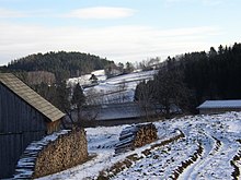
In the Waldviertel there is a continental plateau climate , which changes to the Atlantic plateau climate in the west ( Weinsberger Wald ) and the Pannonian climate in the east ( Manhartsberg , lower Kamptal ). Here it borders on the driest region in Austria: the northern Weinviertel. In the Waldviertel, the average annual rainfall is 400 mm, in some years it only rains 250 mm. In the inner Waldviertel, roughly between Zwettl and Neupölla, there is an inner dry area. Despite the relatively cold winter, the snow depths are therefore rather low.
The climate of the Waldviertel is cold and harsh. Relative to sea level, the Waldviertel has the lowest annual mean temperatures of all ZAMG measuring stations in inhabited places in Austria, with Zwettl also being an outlier. Zwettl also holds Austria's temperature record of -36.6 ° C for the lowest air temperature in an inhabited place. Winter is characterized by snow and sunshine. The summer with warm, not very hot days and cool nights. Precipitation decreases towards the east. There is a thermal disadvantage in the districts of Waidhofen / Thaya, Zwettl and Gmünd. Furthermore, the climate is characterized by a short vegetation period with frequent early and late frosts . The frequency of wind is high and fog is common from autumn to May.
Despite the cool climate, the Waldviertel is the largest rapeseed growing area and the second largest arable farming area in Austria. The yields per unit area are higher than in the Weinviertel or Alpine foothills . This could be due to the excellent soil quality. Due to the altitude, the harvest ripens later, which leads to a disadvantage due to falling prices and low revenues.
fauna and Flora
From a floristic point of view, the Waldviertel - like most of Austria - belongs to the Central European Florentine Region. Only the eastern edge, such as the area around Retz and Eggenburg , the lower Krems and Kamptal , as well as the south-facing slopes of the Wachau on the southern edge, belong to the Pannonian flora province . In the Gmünder Basin, which, in contrast to the rest of Lower Austria, does not drain into the Black Sea but into the North Sea via the Lainsitz , a certain sub-Atlantic influence is noticeable. A typical example are the lambs lettuce corridors in fields in space Gmünd- Litschau , which are due to the intensification of agriculture now threatened with extinction. Due to the geological affiliation to the Bohemian Massif, the rock subsoil is predominantly silicate and the soils are therefore mostly acidic. The area extends from the submontane to the montane altitude . As habitats there are still some small remnants of near-natural deciduous and spruce-fir-beech forests, acidic spruce forests and forests, raised bogs, dry special locations over granite, strongly acidic sandy soils and fields, silicate grasslands in the process of destruction and wet meadows as well as fish farming ponds created since the Middle Ages available.
During the ice ages , the Waldviertel was always unglaciated and at that time had cold steppe vegetation similar to a tundra . With the warming that began around 12,000 years ago, the tree species pine , birch , spruce , oak , beech and fir that had been displaced southwards during the last ice age migrated again until the area was covered by a closed jungle at the time of the birth of Christ . It was not until the turn of the 11th to the 12th century that a planned human settlement began, which was associated with forest clearing. In the struggle against nature, which at that time was waged without any noteworthy technical aids, man created a small-scale cultural landscape and a variety of new habitats . As a result, species could migrate from other areas, were unintentionally introduced by humans or even new species could emerge and biodiversity was significantly increased. In the forest, clearing islands were created and the soil was divided into small, narrow plots on the Lehner . The result was a diverse landscape mosaic made up of fields, meadows, orchards, pastures and ponds, which were often separated from one another by field borders, hedges and embankments. Typical stepped landscapes were created and the laborious creation of the creeks effectively prevented soil erosion . Rock formations protruding from the bedrock within the agriculturally used areas led to the emergence of small, wooded Bicheln ( Büheln ), which together with the rain, Klaubsteinhaufen and hedges offer valuable and varied habitats for many species. In particularly lean places, sparse pine heather forests emerged with the very slowly growing and very frugal red pines as well as blueberries and lingonberries in the herb layer. Due to the increasing demand for wood, more and more forests were cleared in the Waldviertel and some wood, e.g. B. in the vicinity of the glassworks in short supply.
From the time of industrialization onwards , man received techniques, among other things in the form of heavy machinery, artificial fertilizers and drainage systems , which enable the most difficult interventions in nature with little effort. In addition to the destruction by settlements, traffic and industry, the merging of corridors and the destruction of small structures with the help of bulldozers and rock blasting in order to be able to work the areas more easily with larger machines represent a major threat to nature and the cultural landscape that has grown over centuries in the Waldviertel. While meadows were not fertilized at all until the Second World War and the valuable manure was saved for the fields, today many meadows are intensively treated with artificial fertilizers, mowed early and often, plowed up and foreign species sown. As a result, the original, diverse species community is destroyed and species-poor intensive meadows are created. Afforestation in all possible and impossible places - such as B. in Erlenbachauen - with ecologically problematic spruce monocultures. The diverse and high quality wetlands as well as the moors have been and are partly destroyed by regulations and drainage. As a result of these interventions, there was a significant decline in habitat and species diversity in some places and many formerly common species, such as B. Gray shrike , corncrake , lamb salad , wildcat and lynx are endangered today, threatened with extinction or already extinct in the area.
history
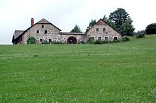
The first documented human traces date from the Pleistocene . There are around 50,000 year old tools and other legacies of the Neanderthals that were found in a cave below the ruins of Hartenstein in the Kremstal .
Numerous records of Ice Age humans are only available for the time of the younger Paleolithic , which are 20,000 to 30,000 years old. These resting and settlement areas were found in the southern edge of the Waldviertel, in the Wachau and in adjacent areas (best known are the sites Krems, Willendorf , Aggsbach , Stratzing ), in the Kamptal ( Gobelsburg , Kammern , Kamegg , Langenlois , Zitternberg ) and in the Horner Basin detected. The human sculptures by Willendorf and Stratzing are world famous . Evidence of the practice of music (flutes from chambers and Gudenus cave , younger strata) has also been found. The numerous sites of the plateau clay palaeolithic in the Thaya region, mainly in the land around Drosendorf , are a separate chapter , the closer dating of which is still controversial within the palaeolithic .
The transition horizon to the Neolithic , the so-called Mesolithic , which has become known from sites in Limberg , Kamegg , Horn, Mühlfeld and Rosenburg , is only sparsely documented .
The rural way of life that began in the 6th millennium ( Neolithic Revolution ) is mainly represented in the Horner Basin , but also around Eggenburg and Weitersfeld by settlements of the oldest linear ceramic . This is followed in the same premises settlement evidence of the note head ceramic , the Stroked Pottery , the painted ceramics ( Lengyel culture ) and Final Neolithic phenomena (such as Corded Ware and Bell Beaker culture , etc.). The early Neolithic of the Waldviertel is particularly characterized by its anthropomorphic and zoomorphic sculptures ( idols ).
The around 2000 BC The beginning of the Bronze Age has been documented for both the early, middle and late periods (Aunjetitz culture, Veterov culture, burial bronze age, urn field cultures). Important settlements and barrows are known z. B. from Roggendorf near Eggenburg, Kamegg, Baierdorf and Theras. From around 750 BC The Hallstatt culture is documented. Large settlements and grave fields (Gars / Kamp, Maiersch) date from this time horizon. The subsequent Latène period (late Iron Age) is already known from numerous settlements from the early phase ( type Kamegg-Poigen-Maiersch ). The later phase is represented by settlements, which can also be fortified (Altenburg, Umlaufberg), in Weitersfeld, Oberthürnau, Obermixnitz and Mühlbach am Manhartsberg.
A horn grave find shows the equipment of the Celtic warrior (lance, sword, shield). The incorporation of the southern Danubian territories into the Roman Empire in 15 BC. For the time being there were no changes to the areas north of the Danube. In today's Waldviertel the Celts lived on undisturbed. Only the Germans who immigrated in the course of the first century AD changed the cultural landscape. From the second century settled in the eastern edge of the Waldviertel Marcomanni . Large settlements are known from Horn, Maiersch and Straning . As the Celts had done before, extensive iron smelting plants were built at suitable locations where lawn iron ore or magnetite is present . The largest facility extends on both sides of the Taffa in the cadastral community of Strögen . With the collapse of the Roman military order in southern Lower Austria, the entire settlement area changed. Of the numerous Germanic tribes that traversed Lower Austria, little has been found in the Waldviertel so far.
There are Gothic and Lombard graves, which are mostly poorly equipped. After the Lombards withdrew to Italy in the middle of the 6th century, Avar equestrian-nomadic population groups moved into Lower Austria . Some graves and individual finds are also known from the Waldviertel. The subsequently immigrating Slavic groups of people can be sparsely traced in the Waldviertel from around the 8th century. In the 9th and 10th centuries there were already larger Slavic settlements and fortified structures such as the "Schanze" above Thunau am Kamp . In the 11th century, the Waldviertel was included in the planned state development. The clearing of the primeval forest (silva nortica) opened up new settlement areas. The oldest castles were built near the villages.
The primeval settlement mainly comprised the eastern and southern peripheral areas of the Waldviertel (Manhartsberg area, the Thaya area and the peripheral areas of the Danube valley). The "Hohe Waldviertel" was apparently almost uninhabited. There are hardly any indications of settlement sites and only a few individual finds in the districts of Gmünd and Zwettl.
The good knowledge of the primeval settlement and the good state of research are thanks to local research. This began in 1837 with Candidus Ponz and extends through Johann Krahuletz , Josef Höbarth , Franz Xaver Kießling , Raimund Bauer , Theobald Wolf , Robert Kammerzell , Friedrich Berg , Ingo Prihoda , Alois Gulder and Hermann Maurer to the present day.
The history association Waldviertler Heimatbund , which has been publishing the quarterly magazine "Das Waldviertel" and Waldviertel books in a series since 1952 , is also engaged in research into the Waldviertel .
During the National Socialist era , the Waldviertel was also called Ahnengau .
Economy and Infrastructure
The Waldviertel has always been a structurally weak agricultural area. In addition to agriculture, a textile industry emerged here very early , which developed from the numerous small weaving mills. Before that, many farms had a loom on which the sheep's wool from their own farm was processed. Ribbon weaving and plaiting were especially created here, which gave the Waldviertel the nickname Bandlkramerland . Even after the Second World War, the Waldviertel was severely disadvantaged by the Iron Curtain . It was only through the opening that the Waldviertel was able to catch up economically through the new hinterland.
A watch industry had developed in the Karlstein an der Thaya area , and this region is also known as the “ land of horology ”. Austria's only watchmaking school is located here.
In 1984 the Waldviertel shoe workshop in Schrems was founded by Minister of Social Affairs Alfred Dallinger . It was a project to fight unemployment and is now an international company. In 2009, the shoe workshop bought a warehouse from the bankrupt Ergee .
Due to the abundance of wood on the one hand and the existing quartz (or gravel, as it is called here) numerous glassworks were built . Some of these factories have survived to this day and still play an economic and cultural role. Several glass museums remind of the history of this branch of industry.
Due to the decline in agriculture, the forest area is increasing. In the originally textile region of the Waldviertel there are only a few textile companies left; the largest are the “Herka Frottier” company in Kautzen and the “Framsohn Frottier” company in Heidenreichstein.
In tourism, the focus is primarily on gentle tourism and wellness tourism, such as the Harbach moor bath , the Sole-Felsen bath in Gmünd or the La Pura women's health resort (formerly Dungl -Hotel ) in Gars am Kamp . In contrast to other regions of Lower Austria, the Waldviertel has seen permanent growth in the tourism industry in recent years. In 2009 alone, the number of overnight stays rose by over seven percent compared to the previous year.
Many agricultural products, such as the Waldviertel gray poppy seeds and articles made from them, are marketed - for example in the "Mohndorf" Armschlag . Agriculture relies heavily on direct marketing ( direct sales ) in the Vienna area. The fish farming in many fish ponds that were massively applied at the time of Empress Maria Theresa, the recurring food crises compensate is a niche product. Every year at Christmas , many carp are fished, especially for the Vienna market.
In the northern Waldviertel there is an attempt to develop its own regional currency , the Waldviertel regional is accepted in around 200 companies.
traffic
The Waldviertler road B 2 and the Kremserstraße B 37 together form the main thoroughfares of the forest area. After the plans for a motorway or expressway were rejected, an expansion of the two roads was tackled (bypasses, 2 + 1 system ).
The Waldviertel has only a few rail lines. Many plans, such as a Groß Gerungs – Zwettl – Danube, Langschlag – Mühlviertel or Litschau – Nová Bystrice railway, could not be implemented due to the First World War . The most important route is the Franz-Josefs-Bahn between Vienna and Gmünd. Trains to Prague and Berlin ( Vindobona ) ran here until the 1990s . Today the route is only of regional importance. The Austrian Northern Railway took over most of the rail traffic towards the Czech Republic. Utilization has also decreased on the branch lines, the Kamptalbahn and the Donauuferbahn . Scheduled passenger traffic has already been stopped on the Waldviertel narrow-gauge railways, the Göpfritz – Raabs local railway , the Thayatal railway and the Schwarzenau – Zwettl – Martinsberg railway .
In order to offer a public transport network nonetheless, since December 21, 2009, the newly established Waldviertel bus has been operating in addition to the existing bus network , and for the most part synchronized bus routes for stronger networking of regional centers. The Waldviertel bus is an initiative of the Province of Lower Austria and comprises a fast bus system made up of two main (Krems – Gmünd and Horn - Waidhofen ad Thaya ) and 19 feeder lines, with regional centers in the immediate vicinity of the Waldviertel also being served ( Hollabrunn , Melk or Retz ).
Culture, sights, tourism
In addition to Krems, the Kamptal and the Wachau, cultural attractions are the pilgrimage sites of Maria Dreieichen , Maria Taferl and Maria Laach am Jauerling , the Altenburg , Geras and Zwettl monasteries, as well as numerous castle complexes such as Rappottenstein , Ottenstein and the Rosenburg . The excursion area around the Kamp reservoirs is also very popular. There are museums worth visiting in the towns of Horn, Drosendorf-Zissersdorf, Eggenburg , Raabs an der Thaya and Zwettl.
The Ysperklamm can also be mentioned as a sight in the southern Waldviertel. For nature lovers, the various nature parks in Gmünd (Blockheide Gmünd), Dobersberg , Geras , Heidenreichstein ( Heidenreichsteiner Moor ), Schrems ( Schrems high moor with underwater kingdom ), Kamptal- Schönberg and the Scandinavian-looking Nordwald nature park in the Bad Großpertholz area are available.
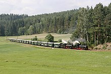
Railway lovers will find various tourist trains in the Waldviertel. From Gmünd the Waldviertel narrow-gauge railways run north towards Litschau with a branch to Heidenreichstein and south towards Groß Gerungs . From Drosendorf the local train Retz – Drosendorf runs in the direction of Weinviertel and in the Wachau you can use the Donauuferbahn or Wachauer Bahn between Krems and Emmersdorf . At the southernmost point of the Waldviertel is the oldest Danube power plant in Austria , the Ybbs-Persenbeug power plant .
Well-known people from the Waldviertel
The list of well-known people from the Waldviertel presents personalities from the past and present who were born in the Waldviertel or who live here or who are particularly associated with this region.
See also
literature
- General
- NÖ.Regional.GmbH : Brochure Main Region Strategy 2024 - Waldviertel. St. Pölten 2015, (PDF; 1.8 MB).
- Elisabeth Gruber, Martin Heintel : The Waldviertel - the eternal region of emigration? Perspectives from the perspective of regional development. In: Das Waldviertel , Volume 67, Issue 3, pp. 427–438. Horn 2018: WHB.
- Elfriede M. Klepoch: The Waldviertel. Sutton 2007, ISBN 978-3-86680-175-2 .
- Barbara Krobath, Mella Waldstein: The land of silence. Waldviertel. Verlag Bibliothek der Provinz, Weitra 2001. ISBN 3-85252-253-6 .
- Franz Obendorfer, Franz K. Obendorfer: Faces of the Waldviertel. Self-published, Mistelbach 2011, ISBN 978-3-200-02119-8 .
- Gerhard Trumler (photo): Granite. The land before winter - Waldviertel. Verlag Bibliothek der Provinz, Weitra 1994. ISBN 3-85252-024-X .
- Mella Waldstein (Red.): The Waldviertel. On solid ground. Verlag Bibliothek der Provinz , Weitra 2009 (= Yearbook Folk Culture Lower Austria 2009). ISBN 978-3-900000-08-0 .
- Specialties
- Antonín Bartoněk, Bohuslav Benes, Wolfgang Müller-Funk: cultural guide Waldviertel, Weinviertel, South Moravia. Deuticke, Vienna 1993, ISBN 978-3-216-30043-0 .
- Evelyn Benesch, Bernd Euler-Rolle , Claudia Haas, Renate Holzschuh-Hofer, Wolfgang Huber, Katharina Packpfeifer, Eva Maria Vancsa-Tironiek, Wolfgang Vogg: Lower Austria north of the Danube (= Dehio-Handbuch . Die Kunstdenkmäler Österreichs ). Anton Schroll & Co, Vienna et al. 1990, ISBN 3-7031-0652-2 .
- Robert Bouchal - Johannes Sachslehner : Waldviertel. Mystical - mysterious - unknown. Vienna: Pichler Verlag 2002, ISBN 3-85431-274-1
- Franz Eppel: The Waldviertel. His works of art, historical forms of life and settlement. Salzburg 1963 (several editions).
- Andrea Komlosy: marginalized. Economic and social history of the Upper Waldviertel (= Austrian texts on social criticism, Volume 34). Publishing house for social criticism , Vienna 1988, ISBN 3-900351-82-1 .
- Georg Kuhr, Gerhard Bauer, Gustav Reingrabner (eds.): The directory of the new converts in the Waldviertel 1652–1654. Codex Vindobonensis 7757 of the National Library Vienna. Nuremberg 1992 ( sources and research on Franconian family history , 3).
- Richard Pils (ed.): The Waldviertel in its legends according to the vernacular. Verlag Bibliothek der Provinz, Weitra 1995, ISBN 3-85252-039-8 .
- Birgit Zotz : The Waldviertel - Between mysticism and clarity. The image of a region as a travel destination. Berlin 2010, ISBN 978-3-89574-734-2 .
Movie
- Waldviertel - The magic of the rough country. Documentary, Austria, 2003, 43:42 min., Script and director: Kurt Mündl , production: ORF , series: Universum . Online video on YouTube
Web links
- Lexicon of the Waldviertel
- The Waldviertel - magazine for local and regional studies of the Waldviertel and the Wachau
- Waldviertel tourism portal
- Tourist regions of Lower Austria - Waldviertel
Individual evidence
- ^ Lower Austria II. Retrieved December 18, 2019 .
- ↑ K. k. Ministry of Finance (Hrsg.): The administrative reports of the kk Berghauptmannschaften on the conditions and results of the Austrian mining industry in the administrative year 1858 . Vienna 1859, p. 3 ( online in Google Book Search [accessed March 2, 2015]).
- ↑ RGBL No. 153/1899
- ↑ Breakdown of Austria into NUTS units. Territory status 1.1.2017. In: statistik.at , (PDF; 26kB).
- ↑ Wikipedia: Municipalities of the States of Europe , accessed on December 27, 2015.
- ↑ Lower Austria nature conservation concept. (PDF; 3.3 MB) In: noe.gv.at. February 2015, accessed July 28, 2019 .
- ^ Climate data from Austria 1971–2000. In: Central Institute for Meteorology and Geodynamics , accessed on February 14, 2017.
- ↑ Wikipedia: Lowest temperatures (since records began)
- ^ Bernhard Fürst, Cornelia Jöbstl, Iris Wagner: The Waldviertel. University work in the Cartography and Geoinformation working group at the University of Vienna , 2004.
- ^ A b Manfred A. Fischer, Karl Oswald, Wolfgang Adler: Excursion flora for Austria, Liechtenstein and South Tyrol . 3rd, improved edition. Province of Upper Austria, Biology Center of the Upper Austrian State Museums, Linz 2008, ISBN 978-3-85474-187-9 , p. 127 .
- ↑ a b c Dieter Manhart, Ernst Wandaller: Treasury Waldviertel - diversity as a secret wealth. Gmünd 2004, ISBN 3-200-00156-9 .
- ↑ Glass blowing in northern Austria. In: austria.info. Retrieved September 19, 2018 .
- ^ Dungl Hotel became a women's health center. In: noev1.orf.at. May 18, 2011, accessed June 19, 2020 .
- ↑ Birgit Zotz : The Waldviertel - Between Mysticism and Clarity. The image of a region as a travel destination. Berlin 2010, pp. 31–32.
- ↑ Mobile in the Waldviertel. (PDF, 585 KB): vor.at . August 5, 2019, accessed July 14, 2020 .
- ↑ The Ysperklamm - a natural monument. In: yspertal.info , accessed on February 14, 2017.
- ↑ Documentation: Waldviertel - On the magic of the rough country. Table of contents. In: 3sat.de. Archived from the original on February 14, 2017 ; accessed on October 12, 2017 (the video can be accessed at short notice in the media library after it has been re-broadcast.).


