Horn district
| location | |
|---|---|
| Basic data | |
| state | Lower Austria |
| NUTS III region | AT-124 |
| Administrative headquarters | horn |
| surface | 784 km² |
| Residents | 30,936 (January 1, 2020) |
| Population density | 39 inhabitants / km² |
| License Plate | HO |
| District Commission | |
| District Captain | Johannes Kranner |
| website |
www.noel.gv.at/ Bezirke / BH-Horn |
| map | |
The Horn District is an administrative district of the Province of Lower Austria .
history
The district was founded in 1868 and included the administrative districts of Horn , Geras and Eggenburg .
geography
The district borders the Czech Republic in the north . The Manhartsberg is located within the district , so it has a share in the Waldviertel and (to a lesser extent) in the Weinviertel. For the spatial planning of the country, however, it belongs entirely to the main region of the Waldviertel .
Neighboring districts
| Jihomoravský kraj (Cz) | ||
| Waidhofen an der Thaya district |

|
Hollabrunn district |
| District Zwettl | Krems-Land district |
Administrative division
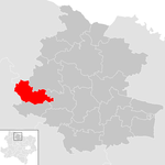
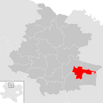
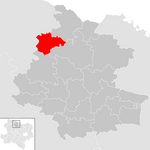
The Horn district covers 783.72 km² and is divided into 20 municipalities , including four towns and ten market communities.
- Regions are small regions in Lower Austria
| local community | location | Ew | km² | Ew / km² | Judicial district | region | Type | Metadata |
|---|---|---|---|---|---|---|---|---|
Altenburg
|

|
817 | 28.1 | 29 | horn | Kamp-Taffatal | local community |
According to code: 31101 |
Brunn an der Wild
|

|
838 | 32.01 | 26th | horn | Taffa Thaya game | local community |
According to code: 31102 |
Burgschleinitz-Kühnring
|

|
1,338 | 41.85 | 32 | horn | Manhartsberg | market community |
According to code: 31103 |
Drosendorf-Zissersdorf
|

|
1,210 | 53.36 | 23 | horn | Taffa Thaya game | urban community |
According to code: 31104 |
Eggenburg
|

|
3,503 | 23.55 | 149 | horn | Manhartsberg | urban community |
According to code: 31105 |
Gars am Kamp
|

|
3,476 | 50.42 | 69 | horn | Kamp-Taffatal | market community |
According to code: 31106 |
Geras
|

|
1,271 | 67.63 | 19th | horn | Taffa Thaya game | urban community |
According to code: 31107 |
horn
|

|
6,428 | 39.27 | 164 | horn | Kamp-Taffatal | urban community |
According to code: 31109 |
Irnfritz knives
|

|
1,441 | 55.98 | 26th | horn | Taffa Thaya game | market community |
According to code: 31110 |
Japons
|

|
717 | 29.38 | 24 | horn | Taffa Thaya game | market community |
According to code: 31111 |
Langau
|

|
676 | 22.2 | 30th | horn | Taffa Thaya game | market community |
According to code: 31113 |
Meiseldorf
|

|
876 | 35.44 | 25th | horn | Manhartsberg | local community |
According to code: 31114 |
Pernegg
|

|
702 | 36.6 | 19th | horn | Taffa Thaya game | market community |
According to code: 31117 |
Röhrenbach
|

|
522 | 25.12 | 21st | horn | Kamp-Taffatal | local community |
According to code: 31119 |
Röschitz
|

|
1,056 | 21.17 | 50 | horn | Manhartsberg | market community |
According to code: 31120 |
Rosenburg mold
|

|
850 | 30.67 | 28 | horn | Kamp-Taffatal | local community |
According to code: 31121 |
Sigmundsherberg
|

|
1,642 | 47.96 | 34 | horn | Manhartsberg | market community |
According to code: 31124 |
St. Bernhard-Frauenhofen
|

|
1,288 | 29.45 | 44 | horn | Taffa Thaya game | local community |
According to code: 31123 |
Straning-Grafenberg
|

|
727 | 26.45 | 27 | horn | Manhartsberg | market community |
According to code: 31130 |
Weitersfeld
|

|
1,558 | 87.12 | 18th | horn | Taffa Thaya game | market community |
According to code: 31129 |
Population development

In 1939 the population reached its maximum of 42,241 people. As in other districts on the northern border, the population of the Horn district has also decreased since 1939. Up until 1951 there was a large increase in population in many cities and municipalities, but the opposite was the case in the Horn district. In 1951 the population curve, which had been stagnating since 1910, finally fell downwards and dropped to 40,913 people, only to drop to 38,288 in 1961 - this value roughly corresponds to that of the 1910 census.
Since then, the population has stabilized again and, according to the 2001 census, is 32,400. Looking at these figures, it becomes clear that the figures fell by around 200 people annually in the exact years of the Iron Curtain - which put the district and its neighbors in an uncomfortable peripheral location. Before and after that, the population either grew or stagnated , as is currently the case.
See also
Web links
Individual evidence
- ↑ Reichsgesetzblatt No. 44/1868
Coordinates: 48 ° 40 ′ N , 15 ° 39 ′ E


