Mistelbach district
| location | |
|---|---|
| Basic data | |
| state | Lower Austria |
| NUTS III region | AT-125/126 |
| Administrative headquarters | Mistelbach |
| surface | 1293 km² |
| Residents | 75,625 (January 1, 2020) |
| Population density | 58 inhabitants / km² |
| License Plate | MI |
| District Commission | |
| District chief | Gerlinde Draxler |
| website |
www.noel.gv.at/Bezirke/ BH-Mistelbach |
| map | |
The Mistelbach district is an administrative district of the State of Lower Austria .
geography
With 1,292.53 km², it is the second largest district in the state in terms of area after the Zwettl district. It is located in the heart of the Weinviertel and is also assigned to the main Weinviertel region in spatial planning .
Adjacent local authorities
Neighboring districts are the Gänserndorf district in the southeast, the Korneuburg district in the southwest and the Hollabrunn district in the northwest. In the north it borders on the Czech Republic .
| Hollabrunn district | Znojmo District ( CZ ) | Lundenburg District (CZ) |
| Korneuburg district |

|
Gänserndorf district |
| Korneuburg district | District Gänserndorf , District Korneuburg | Gänserndorf district |
Administrative division
The Mistelbach district is divided into 36 communities , including 4 towns and 20 market communities.
- Regions in the table are small regions in Lower Austria
| local community | location | Ew | km² | Ew / km² | Judicial district | region | Type | Metadata |
|---|---|---|---|---|---|---|---|---|
Altlichtenwarth
|

|
766 | 20.43 | 37 | Mistelbach | Weinviertel tri-border region | local community |
According to code: 31601 |
Asparn on the Zaya
|

|
1,881 | 40.48 | 46 | Mistelbach | Quieter mountains | market community |
According to code: 31603 |
Bernhardsthal
|

|
1,582 | 52.01 | 30th | Mistelbach | Weinviertel tri-border region | market community |
According to code: 31604 |
Bockfließ
|

|
1,331 | 23.03 | 58 | Mistelbach | Region around Wolkersdorf | market community |
According to code: 31605 |
Drasenhofen
|
|
1.107 | 35.2 | 31 | Mistelbach | Weinviertel tri-border region | local community |
According to code: 31606 |
Falkenstein
|

|
480 | 19.19 | 25th | Mistelbach |
Land around Laa Weinviertel tri-border region |
market community |
According to code: 31608 |
Fallbach
|

|
819 | 30.42 | 27 | Mistelbach | Land around Laa | local community |
According to code: 31609 |
Gaubitsch
|

|
880 | 22.48 | 39 | Mistelbach | Land around Laa | local community |
Acc. To code: 31611 |
Gaweinstal
|
|
4.011 | 51.71 | 78 | Mistelbach | Southern Weinviertel | market community |
According to code: 31612 |
Grace Village
|

|
1,147 | 48.32 | 24 | Mistelbach | Land around Laa | local community |
According to code: 31613 |
Grossengersdorf
|

|
1,497 | 15.57 | 96 | Mistelbach | Region around Wolkersdorf | market community |
Acc. To code: 31615 |
Großebersdorf
|
|
2,218 | 18th | 123 | Mistelbach | Region around Wolkersdorf | market community |
According to code: 31614 |
Great harras
|

|
1,112 | 42.69 | 26th | Mistelbach | Land around Laa | market community |
According to code: 31616 |
Great Krut
|

|
1,619 | 38.46 | 42 | Mistelbach | Weinviertel tri-border region | market community |
According to code: 31617 |
Hausbrunn
|
|
865 | 16.18 | 53 | Mistelbach | - | market community |
According to code: 31620 |
Herrnbaumgarten
|
|
948 | 16.52 | 57 | Mistelbach | Weinviertel tri-border region | market community |
According to code: 31621 |
Hochleithen
|
|
1,144 | 19.91 | 57 | Mistelbach | Region around Wolkersdorf | local community |
According to code: 31622 |
Kreuttal
|

|
1,470 | 21.53 | 68 | Mistelbach | Region around Wolkersdorf | local community |
Acc. To code: 31627 |
Kreuzstetten
|

|
1,535 | 24.34 | 63 | Mistelbach | Region around Wolkersdorf | market community |
According to code: 31628 |
Laa an der Thaya
|

|
6.241 | 72.89 | 86 | Mistelbach | Land around Laa | urban community |
According to code: 31629 |
Shop village
|

|
2,304 | 50.12 | 46 | Mistelbach | Quieter mountains | market community |
According to code: 31630 |
Mistelbach
|

|
11,583 | 131.56 | 88 | Mistelbach | - | urban community |
According to code: 31633 |
Neudorf in the Weinviertel
|

|
1,397 | 40.14 | 35 | Mistelbach | Land around Laa | market community |
According to code: 31634 |
Niederleis
|

|
891 | 19.52 | 46 | Mistelbach | Quieter mountains | local community |
According to code: 31636 |
Ottenthal
|

|
533 | 15.4 | 35 | Mistelbach | Weinviertel tri-border region | local community |
Acc. To code: 31658 |
Pillichsdorf
|

|
1.166 | 14.34 | 81 | Mistelbach | Region around Wolkersdorf | market community |
According to code: 31642 |
Poysdorf
|

|
5,483 | 97.28 | 56 | Mistelbach | Weinviertel tri-border region | urban community |
Acc. To code: 31644 |
Rabensburg
|

|
1,096 | 20.14 | 54 | Mistelbach |
March-Thaya-Auen Weinviertel tri-border region |
market community |
According to code: 31645 |
Schrattenberg
|
|
821 | 19.15 | 43 | Mistelbach | Weinviertel tri-border region | local community |
Acc. To code: 31646 |
Staatz
|
|
1.911 | 42.65 | 45 | Mistelbach | Land around Laa | market community |
Acc. To code: 31649 |
Stronsdorf
|

|
1,618 | 48.17 | 34 | Mistelbach | Land around Laa | market community |
Acc. To code: 31650 |
Ulrichskirchen-Schleinbach
|

|
2,621 | 26.51 | 99 | Mistelbach | Region around Wolkersdorf | market community |
According to code: 31651 |
Unterstinkenbrunn
|

|
558 | 9.43 | 59 | Mistelbach | Land around Laa | local community |
According to code: 31652 |
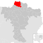
Wildendürnbach
|
|
1,568 | 53.65 | 29 | Mistelbach | Land around Laa | local community |
According to code: 31653 |
Wilfersdorf
|

|
2.123 | 30.5 | 70 | Mistelbach | Weinviertel tri-border region | market community |
Acc. To code: 31654 |
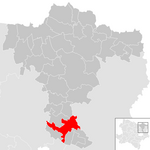
Wolkersdorf in the Weinviertel
|
|
7,299 | 44.6 | 164 | Mistelbach | Region around Wolkersdorf | urban community |
According to code: 31655 |
Population development

See also
Web links
Commons : District Mistelbach - Collection of images, videos and audio files
- Exhibition - The Mistelbach District: Old Views and Books (2005) - (PDF; 5.12 MB).
Coordinates: 48 ° 34 ' N , 16 ° 34' E


