
Korneuburg district
| location | |
|---|---|
  |
|
| Basic data | |
| state | Lower Austria |
| NUTS III region | AT-126 |
| Administrative headquarters | Korneuburg |
| surface | 662 km² |
| Residents | 91,254 (January 1, 2020) |
| Population density | 138 inhabitants / km² |
| License Plate | KO |
| District Commission | |
| District chief | Waltraud Müllner-Toifl |
| website |
www.noel.gv.at/ Bezirke / BH-Korneuburg |
| map | |
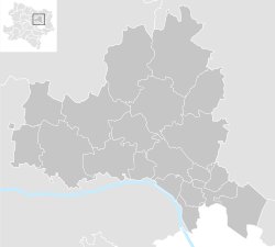  |
|
The Korneuburg district is an administrative district of the Province of Lower Austria .
history
On September 24, 2015, the Lower Austrian state parliament decided that the Vienna-Umgebung district would be dissolved on January 1, 2017. The state government then reallocated the municipalities to the neighboring districts: the city of Gerasdorf became part of the Korneuburg district.
geography
The district is located northwest of Vienna . The determining landscape units are the Danube and its meadow landscape, the Waschbergzone with the Michelberg , the Bisamberg as part of the Wiener Pforte .
It forms the south-western part of the Weinviertel and is also assigned to the main Weinviertel region in spatial planning .
Neighboring districts
| Hollabrunn district | Mistelbach district | Mistelbach district |
| Tulln district |
.svg)
|
Mistelbach district |
| Tulln district | Floridsdorf (Vienna) | Gänserndorf district , Donaustadt district (Vienna) |
Administrative division
The Korneuburg district covers 662.06 km² and is divided into:
- 20 parishes including are
- 3 cities and
- 14 market towns.

- Regions in the table are small regions in Lower Austria . The population figures are from January 1st, 2020.
| local community | location | Ew | km² | Ew / km² | Judicial district | region | Type | Metadata |
|---|---|---|---|---|---|---|---|---|
Bisamberg
|

|
4,795 | 10.77 | 445 | Korneuburg | 10 before Vienna | market community |
According to code: 31201 |
Enzersfeld in the Weinviertel
|

|
1,748 | 9.85 | 177 | Korneuburg | 10 before Vienna | market community |
According to code: 31202 |
Ernstbrunn
|

|
3,264 | 80.72 | 40 | Korneuburg | Quiet Mountains – Mistelbach | market community |
According to code: 31203 |
Gerasdorf near Vienna
|

|
11,401 | 35.24 | 324 | Klosterneuburg | - | urban community |
Acc. To code: 31235 |
Großmugl
|

|
1,607 | 64.47 | 25th | Korneuburg | - | market community |
According to code: 31204 |
Grossrußbach
|

|
2,221 | 32.76 | 68 | Korneuburg | 10 before Vienna | market community |
According to code: 31205 |
Hagenbrunn
|

|
2,291 | 13.5 | 170 | Korneuburg | 10 before Vienna | market community |
According to code: 31206 |
Harmannsdorf
|

|
4.032 | 55.58 | 73 | Korneuburg | 10 before Vienna | market community |
According to code: 31207 |
Hausleiten
|

|
3,800 | 61.14 | 62 | Korneuburg | - | market community |
According to code: 31208 |
Korneuburg
|

|
13,331 | 9.71 | 1373 | Korneuburg | 10 before Vienna | urban community |
According to code: 31213 |
Langenzersdorf
|

|
8,027 | 10.67 | 752 | Korneuburg | 10 before Vienna | market community |
According to code: 31214 |
Leitzersdorf
|

|
1,190 | 27.89 | 43 | Korneuburg | - | local community |
According to code: 31215 |
Leobendorf
|

|
4,890 | 30th | 163 | Korneuburg | 10 before Vienna | market community |
According to code: 31216 |
Niederhollabrunn
|

|
1,547 | 50.36 | 31 | Korneuburg | - | market community |
According to code: 31234 |
Russbach
|

|
1,409 | 30.7 | 46 | Korneuburg | - | local community |
According to code: 31224 |
Sierndorf
|

|
3,971 | 55.09 | 72 | Korneuburg | - | market community |
According to code: 31226 |
Spillers
|

|
2,428 | 12.7 | 191 | Korneuburg | 10 before Vienna | market community |
According to code: 31227 |
Stetteldorf am Wagram
|

|
1,057 | 25.73 | 41 | Korneuburg | Wagram region | market community |
According to code: 31228 |
Stetten
|

|
1,370 | 7.74 | 177 | Korneuburg | 10 before Vienna | local community |
According to code: 31229 |
Stockerau
|

|
16,875 | 37.44 | 451 | Korneuburg | 10 before Vienna | urban community |
According to code: 31230 |
Population development (according to area status 2016)

The most populous city is Stockerau with 16,875 inhabitants (as of January 1, 2020).
See also
Web links
- District authority Korneuburg in the web presence of the state of Lower Austria
Individual evidence
- ↑ Lower Austrian Parliament: Resolution Ltg.-729 / A-1 / 50-2015
- ^ Lower Austrian press service: Extraordinary meeting of the Lower Austrian provincial government - reallocation of the municipalities after the dissolution of the administrative district Vienna-Umgebung Article dated September 24, 2015, accessed on September 27, 2015
- ↑ Statistics Austria - Population at the beginning of 2002–2020 by municipalities (area status 01/01/2020)
Statutory cities: Krems an der Donau | St. Pölten | Waidhofen an der Ybbs | Wiener Neustadt
Administrative districts: Amstetten | Bathing | Bruck an der Leitha | Gänserndorf | Gmünd | Hollabrunn | Horn | Korneuburg | Krems | Lily field | Melk | Mistelbach | Mödling | Neunkirchen | St. Pölten | Scheibbs | Tulln | Waidhofen an der Thaya | Wiener Neustadt | Zwettl
Former districts: Floridsdorf area | Groß-Enzersdorf | Hernals | Hietzing | Hietzing area | Pöggstall | Six house | Währing | Vienna Area
Former branch: Pöggstall
Coordinates: 48 ° 23 ' N , 16 ° 12' E