Michelberg (Haselbach)
| Michelberg | ||
|---|---|---|
|
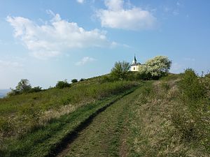
Michelberg, hilltop with chapel |
||
| height | 409 m above sea level A. | |
| location | Lower Austria | |
| Dominance | 10.1 km → Hadersfeld | |
| Notch height | 127 m ↓ southeast. Simonsfeld | |
| Coordinates | 48 ° 25 '48 " N , 16 ° 17' 20" E | |
|
|
||
| rock | Waschbergzone (limestone) | |
| particularities | There is a chapel on the hilltop | |
The Michelberg is a mountain in Lower Austria in the Korneuburg district near the village of Haselbach ( Niederhollabrunn municipality ). With a height of 409 m above sea level. A. it is the highest point in the Rohrwald forest and a popular vantage point in the Korneuburg and Stockerau areas .
geography
The Michelberg belongs geologically to the Waschberg zone . Old and new quarries show limestone, in which the remains of so-called prehistoric coin animals can be found, which is why this limestone is also called nummulite limestone .
The heights of Michelberg and Waschberg have smaller forests, most of them covered by a grass cover. Vineyards and fields stretch out on the slopes.
When visibility is good, you can overlook the Alpine arc from Schneeberg to Traunstein and see far into the Tullnerfeld , the Weinviertel and the Danube valley to Vienna . There is a panorama pane on a large stone, which makes orientation easier.
A bit below the summit with its chapel is a snack station (inn).
history

The Michelberg also has a long history as a place of worship. The Michaelskirche , which was a popular pilgrimage destination for a long time, is documented as early as the 9th century . In 1745 it was rebuilt and expanded to include a Michael chapel. During the Josephine reforms in 1783 , the church was demolished and a new church was built with its material by the Klosterneuburg canons in Haselbach and furnished with the furnishings of the former mountain church. Today's chapel dates from 1867 and was built by the Haselbach community.
The exposed location and the treeless knoll was used as an observation station as early as the Stone Age . During the Second World War , a radio measuring station was set up on the Michelberg and the area around it was declared a restricted military area.
The Michelberg is located on the Jakobsweg Weinviertel, which has been signposted since 2010 .
Archaeological finds
In 2010, the remains of a church and around 100 graves were uncovered during excavations. In the following year, another 50 graves were found, so that it is assumed that this is an early cemetery.
literature
- Ernst Lauermann: The Michelberg: An archaeological hotspot in the southern Weinviertel , Edition Winkler-Hermaden, Vienna 2019, 1st edition ISBN 978-3-9504-6256-2
- Fritz Peterka: Wien - Wienerwald , Bergverlag Rudolf Rother , Munich 2012, 7th edition ISBN 978-3-7633-4188-7
Individual evidence
- ↑ Archaeologists found Kirche am Michelsberg on ORF from July 31, 2011, accessed on July 31, 2011


