
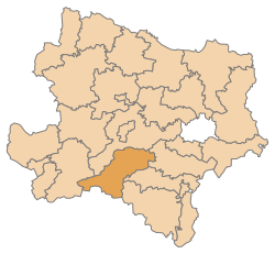
Lilienfeld district
| location | |
|---|---|
  |
|
| Basic data | |
| state | Lower Austria |
| NUTS III region | AT-122 |
| Administrative headquarters | Lily field |
| surface | 932 km² |
| Residents | 25,655 (January 1, 2020) |
| Population density | 28 inhabitants / km² |
| License Plate | LF |
| District Commission | |
| District Captain | Franz Kemetmüller |
| website |
www.noel.gv.at/Bezirke/ BH-Lilienfeld |
| map | |
  |
|
The Lilienfeld district is an administrative district of the Province of Lower Austria .
history
The political district of Lilienfeld was formed in 1868 from the judicial districts of Lilienfeld and Hainfeld. From January 1, 1890 to September 30, 1897, the district was closed, the parishes belonged to the St. Pölten district at that time. In 1897 the municipalities of the two judicial districts of Lilienfeld and Hainfeld were again separated from St. Pölten and the district of Lilienfeld was restored to its old extent.
The district was abandoned again on July 1, 1933, the restoration to the current extent did not take place until 1953.
geography
For the spatial planning of the state it belongs to the main region of Lower Lower Austria . The landscape is in the Mostviertel and includes parts of the Lower Austrian-Styrian Limestone Alps , the Gutenstein Alps and the Vienna Woods in the north-eastern part of the district.
The Lilienfeld district is the most forested district in Austria and consists of two main valleys, the
- Traisental , and the
- Gölsental
The highest point is the Ötscher ( 1893 m above sea level ), followed by the Göller ( 1766 m above sea level ).
Neighboring districts
| St. Pölten-Land district | Baden district | |
| Scheibbs district |
.svg)
|
District Wiener Neustadt-Land , District Neunkirchen |
| District Bruck-Mürzzuschlag (Styria) |
Administrative division
Today the Lilienfeld district comprises 14 communities , including two cities and six market communities.

- Regions are small regions in Lower Austria
| local community | location | Ew | km² | Ew / km² | Judicial district | region | Type | Metadata |
|---|---|---|---|---|---|---|---|---|
Annaberg
|

|
516 | 63.52 | 8.1 | Lily field | Traisen-Gölsental horse country pre-Alps |
local community |
According to code: 31401 |
Eschenau
|

|
1,293 | 24.6 | 53 | Lily field | Traisen-Gölsental | local community |
According to code: 31402 |
Hainfeld.gif)
|

|
3,801 | 44.7 | 85 | Lily field | - | urban community |
According to code: 31403 |
Hohenberg
|

|
1,502 | 56.71 | 26th | Lily field | Traisen-Gölsental horse country pre-Alps |
market community |
According to code: 31404 |
Kaumberg
|

|
1,057 | 43.04 | 25th | Lily field | Triestingtal | market community |
According to code: 31405 |
Small cell
|

|
879 | 93.08 | 9.4 | Lily field | - | local community |
According to code: 31406 |
Lily field
|

|
2,664 | 54.06 | 49 | Lily field | Traisen-Gölsental | urban community |
According to code: 31407 |
Mitterbach am Erlaufsee
|

|
481 | 67.32 | 7.1 | Lily field | Traisen-Gölsental horse country pre-Alps |
local community |
Acc. To code: 31408 |
Ramsau
|

|
830 | 54.71 | 15th | Lily field | Traisen-Gölsental | local community |
According to code: 31409 |
Rohrbach an der Gölsen
|

|
1,549 | 14.8 | 105 | Lily field | Traisen-Gölsental | local community |
According to code: 31410 |
St. Aegyd am Neuwalde
|

|
1,862 | 184.6 | 10 | Lily field | Traisen-Gölsental horse country pre-Alps |
market community |
According to code: 31411 |
St. Veit an der Gölsen
|

|
3,906 | 78.19 | 50 | Lily field | - | market community |
According to code: 31412 |
Traisen
|

|
3,402 | 6.8 | 500 | Lily field | - | market community |
According to code: 31413 |
Türnitz
|

|
1.913 | 146.02 | 13 | Lily field | Traisen-Gölsental | market community |
According to code: 31414 |
Population development

See also
Web links
Individual evidence
- ↑ RGBL No. 160/1889
- ↑ RGBL No. 202/1897
- ↑ NÖLGB No. 138/1933
- ↑ Memory of the country - establishment of a district authority in Lilienfeld
Statutory cities: Krems an der Donau | St. Pölten | Waidhofen an der Ybbs | Wiener Neustadt
Administrative districts: Amstetten | Bathing | Bruck an der Leitha | Gänserndorf | Gmünd | Hollabrunn | Horn | Korneuburg | Krems | Lily field | Melk | Mistelbach | Mödling | Neunkirchen | St. Pölten | Scheibbs | Tulln | Waidhofen an der Thaya | Wiener Neustadt | Zwettl
Former districts: Floridsdorf area | Groß-Enzersdorf | Hernals | Hietzing | Hietzing area | Pöggstall | Six house | Währing | Vienna Area
Former branch: Pöggstall
Coordinates: 47 ° 55 ′ 0 ″ N , 15 ° 36 ′ 0 ″ E