Hohenberg (Lower Austria)
|
market community Hohenberg
|
||
|---|---|---|
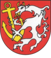
| coat of arms | Austria map | |
|
|
||
| Basic data | ||
| Country: | Austria | |
| State : | Lower Austria | |
| Political District : | Lily field | |
| License plate : | LF | |
| Surface: | 56.71 km² | |
| Coordinates : | 47 ° 55 ' N , 15 ° 37' E | |
| Height : | 488 m above sea level A. | |
| Residents : | 1,502 (January 1, 2020) | |
| Population density : | 26 inhabitants per km² | |
| Postal code : | 3192 | |
| Area code : | 02767 | |
| Community code : | 3 14 04 | |
| NUTS region | AT122 | |
| Address of the municipal administration: |
Market 1 3192 Hohenberg |
|
| Website: | ||
| politics | ||
| Mayor : | Heinrich Preus ( SPÖ ) | |
|
Municipal Council : ( 2020 ) (19 members) |
||
| Location of Hohenberg in the Lilienfeld district | ||
 Municipal Office |
||
| Source: Municipal data from Statistics Austria | ||
Hohenberg is a market town with 1502 inhabitants (as of January 1, 2020) in the Lilienfeld district in Lower Austria .
geography
Geographical location
Hohenberg is located in the valley of the Unrechttraisen at the foot of the Türnitzer Höger in the Mostviertel in Lower Austria. The area of the market town covers 56.62 square kilometers. 84.7 percent of the area is forested.
Community structure
The municipality includes the following five localities (population in brackets as of January 1, 2020):
- Andersbach (43) including Bachner and Bayerhof
- Furthof (259)
- Hofamt (238) including Mosbachtal, Seebachtal and Thorhof
- Hohenberg (849)
- Innerfahrafeld (113) including Großenbauer, Kälberhöfe, Kandlhof and Schusterwirt
The cadastral communities are Hohenberg (KG number 19311) and Innerfahrafeld (19309).
Neighboring communities
In the Wiener Neustadt-Land district :
history
In ancient times, the area was part of the Noricum province .
Population development
According to the results of the 2001 census , there were 1638 inhabitants. In 1991 the market town had 1715 inhabitants, in 1981 1771 and in 1971 2021 inhabitants.
Culture and sights
politics
Municipal council
The municipal council has 19 members.
- With the municipal council elections in Lower Austria in 1990, the municipal council had the following distribution: 13 SPÖ and 6 ÖVP.
- With the municipal council elections in Lower Austria in 1995, the municipal council had the following distribution: 12 SPÖ, 5 ÖVP and 2 FPÖ.
- With the municipal council elections in Lower Austria in 2000, the municipal council had the following distribution: 13 SPÖ, 4 ÖVP and 2 FPÖ.
- With the municipal council elections in Lower Austria in 2005 , the municipal council had the following distribution: 14 SPÖ and 5 ÖVP.
- With the municipal council elections in Lower Austria 2010 , the municipal council had the following distribution: 14 SPÖ and 5 ÖVP.
- With the municipal council elections in Lower Austria in 2015 , the municipal council had the following distribution: 13 SPÖ, 5 ÖVP and 1 FPÖ.
- With the municipal council elections in Lower Austria 2020 , the municipal council has the following distribution: 13 SPÖ and 6 ÖVP.
mayor
- since 2004 Heinrich Preus (SPÖ)
Economy and Infrastructure
In 2001 there were 81 non-agricultural workplaces, agricultural and forestry operations 46 according to the 1999 survey. According to the 2001 census, the number of people in employment at the place of residence was 659. In 2001, the activity rate was 41.26 percent.
traffic
Hohenberg had been accessible from 1893 on the Traisen – Kernhof railway line . Further stops in the municipality of Hohenberg were Innerfahrafeld and Furthof. After the cessation of passenger traffic, the line has now been converted into a connecting railway.
Personalities
- Sons and daughters of the church
- Aelred Pexa (1904–1974), Abbot of Rein Abbey (1954–1971)
Web links
- Marktgemeinde Hohenberg Homepage of the municipality
- 31404 - Hohenberg (Lower Austria). Community data, Statistics Austria .
Individual evidence
- ↑ Statistics Austria: Population on January 1st, 2020 by locality (area status on January 1st, 2020) , ( CSV )
- ^ Result of the local council election 1995 in Hohenberg. Office of the Lower Austrian State Government, March 30, 2000, accessed October 10, 2019 .
- ^ Election result of the municipal council election 2000 in Hohenberg. Office of the Lower Austrian State Government, February 4, 2005, accessed October 10, 2019 .
- ^ Election result of the local council election 2005 in Hohenberg. Office of the Lower Austrian State Government, March 4, 2005, accessed October 10, 2019 .
- ^ Election result of the local council election 2010 in Hohenberg. Office of the Lower Austrian State Government, October 8, 2010, accessed October 10, 2019 .
- ^ Election result of the 2015 municipal council election in Hohenberg. Office of the Lower Austrian State Government, December 1, 2015, accessed on October 10, 2019 .
- ^ Election results for the 2020 municipal council election in Hohenberg. Office of the Lower Austrian State Government, January 26, 2020, accessed on January 26, 2020 .


