
Türnitzer Höger
| Türnitzer Höger | ||
|---|---|---|
 Türnitzer Höger from east-southeast from above the Kalten Kuchl |
||
| height | 1372 m above sea level A. | |
| location | Lower Austria , Austria | |
| Mountains | Türnitz Alps | |
| Dominance | 8.9 km → Reisalpe | |
| Notch height | 469 m ↓ Traisenbergsattel | |
| Coordinates | 47 ° 55 '0 " N , 15 ° 33' 0" E | |
|
||
| rock | Main dolomite , Kössen formation | |
| Age of the rock | Upper Carnium - Rhaetium | |

The Türnitzer Höger is 1372 m above sea level. A. high mountain in the Türnitz Alps .
The densely wooded Höger rises almost 1000 m above the confluence of the Türnitzer Traisen from the southwest and the Unrecht-Traisen from the southeast to the Traisen . Valley locations are Türnitz in the west, Hohenberg in the east and St. Aegyd am Neuwalde in the south. From its highest point, an approximately 8 km long, panoramic ridge extends south. This leads over the Stadlberg ( 1226 m ), the Linsberg ( 1238 m ) and the Paulmauer ( 1248 m , with 100 m high west wall) to the Traisenbergsattel, which forms the transition to the Traisenberg ( Enzian , 1230 m ).
There are three managed huts on the Türnitzer Höger. In the immediate vicinity of the summit is the Türnitzer Hut ( 1372 m ), between Stadlberg and Linsberg the Gschwendthütte ( 1078 m ) and south of the Paulmauer the Zdarsky Hut ( 1082 m ). You can climb the Höger from all three valley locations on different routes; A continuous high path leads along the ridge.
Picture gallery

Summit area with summit cross

Grove of trees around 120 meters below the summit in autumn colors
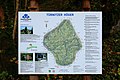
Information board (legible) about hiking trails and refuges


literature
- Franz Hauleitner: Ötscher. Mariazell - Türnitz - Traisentaler Berge , Bergverlag Rudolf Rother , Munich 2010, 4th edition. ISBN 978-3-7633-4026-2
Web links
- "A mountain like in the good old days" : Hiking tip from the daily Der Standard , August 6, 2012 (accessed December 11, 2012)