
Pipe in the mountains
|
Pipe in the mountains
|
||
|---|---|---|
| coat of arms | Austria map | |
 |
|
|
| Basic data | ||
| Country: | Austria | |
| State : | Lower Austria | |
| Political District : | Wiener Neustadt-Land | |
| License plate : | WB | |
| Surface: | 80.92 km² | |
| Coordinates : | 47 ° 54 ' N , 15 ° 44' E | |
| Height : | 683 m above sea level A. | |
| Residents : | 460 (January 1, 2020) | |
| Postal code : | 2663 | |
| Area code : | 02667 | |
| Community code : | 3 23 24 | |
| NUTS region | AT122 | |
| Address of the municipal administration: |
Rohr im Gebirge 24 2663 Rohr im Gebirge |
|
| Website: | ||
| politics | ||
| Mayor : | Christian Wagner ( ÖVP ) | |
|
Municipal Council : ( 2020 ) (13 members) |
||
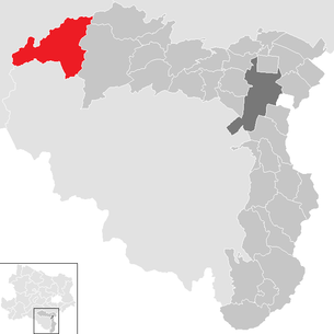
| Location of Rohr im Gebirge in the Wiener Neustadt-Land district | ||
  |
||
| Source: Municipal data from Statistics Austria | ||

Rohr im Gebirge is a municipality with 460 inhabitants (as of January 1, 2020) in the Wiener Neustadt-Land district in Lower Austria .
geography
Rohr im Gebirge is located in the uppermost Schwarzatal , which is counted as part of the industrial district of Lower Austria, on the creek . The area of the municipality covers 80.92 square kilometers, 89.95% of the area is forested.
Community structure
The only locality and cadastral community is Rohr im Gebirge , and there is only one counting district with the same name .
Geographically, the municipality is divided into:
- the main town of Rohr in the mountains
- the area out of the valley southwest of the village (and continuing to Schwarzau), with the side valley of the long side towards Kalte Kuchl and Krumbach am Krumbach
- Zellbach in the south-east of the valley to the Rohrer Sattel , with the Winsaberg in the southern side valleys there (Wagental)
- Klausbach up the Klausbach north-east, with Fuchsgraben and Rainbach in the local valleys
- and Hochreith in the far west in the headwaters of the Dürren Schwarza , with the hunting lodge
Up until the 1990s, Rohr im Gebirge , Steinapiesting (now just a Gutenstein district), Winsaberg and cellsbach were localities in the municipality.
The community belongs to the judicial district of Wiener Neustadt with its seat in Wiener Neustadt .
Neighboring communities
|
Hohenberg ( district Lilienfeld ) |
Kleinzell ( district Lilienfeld ) |
|
| St. Aegyd am Neuwalde ( District Lilienfeld ) |
.svg)
|
Gutenstein |
| Schwarzau in the mountains ( district Neunkirchen ) |
history

Before the birth of Christ, however, the area was part of the Celtic Kingdom of Noricum and belonged to the wider area of the Celtic hill settlement Burg on the Schwarzenbacher Burgberg , which was the main town for the entire northeastern kingdom. Later under the Romans , today's Rohr was then in the province of Pannonia .
Due to its inaccessible location, the area of Rohr was settled late. The Lords of Traisma are named as the first owners of the forest area around Rohr . In 1194 the area fell to the Duchy of Steyr . After the construction of Gutenstein Castle , which was first mentioned in 1220, Rohr came under the influence of the Gutenstein rule, which from then on was to remain the administrative center for the area until 1848 ( Gutenstein Regional Court ).
The name auf'm Roer was first mentioned in 1427. In 1470 the church of Rohr , which previously belonged to the parish of Schwarzau , was raised to its own parish. In the 16th century, the Reformation also had an impact in Rohr . Count Sigismund von Herberstein hired a Protestant preacher. But already in 1569 a Catholic priest was named again.
In 1595 the Barons von Hoyos became the new owners of the Gutenstein estate, and in 1622 the parish was officially rebuilt. In 1716 the Rohr church was enlarged and an onion dome was built in 1761.
In the second half of the 18th century, a school was founded in a farmhouse, which was given its own schoolhouse in 1782.
In 1848 the manorial authority over the residents of Rohr ended and a first mayor was freely elected. In 1877 a post office was opened and a stagecoach route to Gutenstein was established. Between 1884 and 1894, the roads to Gutenstein and over the Ochsattel into the Traisental were built, ending the previous isolation of the community. Another connection was established in 1910 via the Haselrast to Gutenstein.
In the years 1878/79, after the old church was demolished, a new church building was built, and a new schoolhouse was built from 1886 to 1888.
Population development

religion
According to the 2001 census data , 93.4% of the population were Roman Catholic and 1.0% Protestant . 0.2% were Muslim , 0.8% belonged to Orthodox churches and 0.4% were Israelite . 3.7% of the population had no religious denomination.
politics
The municipal council has 13 members.
- With the municipal council elections in Lower Austria in 1990, the municipal council had the following distribution: 8 ÖVP, 4 SPÖ, and 3 FPÖ. (15 members)
- With the municipal council elections in Lower Austria in 1995, the municipal council had the following distribution: 8 ÖVP, 3 SPÖ, 3 citizens list Rohr im Gebirge, and 1 FPÖ.
- With the municipal council elections in Lower Austria in 2000, the municipal council had the following distribution: 8 ÖVP, 4 SPÖ, 2 FPÖ, and 1 position youth.
- With the municipal council elections in Lower Austria in 2005 , the municipal council had the following distribution: 11 ÖVP and 4 SPÖ.
- With the municipal council elections in Lower Austria 2010 , the municipal council had the following distribution: 12 ÖVP, and 3 SPÖ. (15 members)
- With the municipal council elections in Lower Austria in 2015 , the municipal council had the following distribution: 9 ÖVP, 2 SPÖ, and 2 FPÖ. (13 members)
- With the municipal council elections in Lower Austria 2020 , the municipal council has the following distribution: 11 ÖVP, 1 SPÖ and 1 FPÖ. (13 members)
- mayor
- 1945 Josef Schneider
- 1946–1953 Anton Strohmayer
- 1953–1955 Rudolf Sallmannshofer
- 1955–1970 Franz Wagner
- 1970–1983 Wilhelm Schweiger
- 1983–? Heinrich Sallmannshofer
- since ? Christian Wagner (ÖVP)
Capital of the municipality
| Rohr im Gebirge ( village ) ( capital of the municipality ) | |
|---|---|
| Basic data | |
| Pole. District , state | Wiener Neustadt-Land , Lower Austria |
| Pole. local community | Rohr im Gebirge ( KG Rohr im Gebirge ) |
| Locality | Pipe in the mountains |
| Coordinates | 47 ° 53 ′ 43 " N , 15 ° 44 ′ 2" E |
| height | 683 m above sea level A. |
| Building status | 73 (addresses 2015 ) |
| Statistical identification | |
| Counting district / district | Pipe in the mountains (32 324 000) |
 Pipe, town center |
|
| Adr. Rohr im Gebirge , with Raintal / Schacherbauer ; former location until 1991: with area , long side , Krumbach Source: STAT : index of places ; BEV : GEONAM ; NÖGIS |
|
The main town of the municipality is the small village of Rohr in the mountains . It is located 40 km west of Wiener Neustadt , 35 km south of St. Pölten , around 15 km northwest of the Schneeberg. It is located on the cell stream at the confluence of the Klausbach , at around 680 m above sea level. A. Höhe, and extends from the mouth of the Rohrergraben to that of the Edlaberggraben.
The place comprises around 75 buildings, including the Garhof and Schacherbauer locations in the Raintal to the west above.
To the northwest rises the Jochart ( 1266 m above sea level ), south of the Edlaberg ( 1096 m above sea level ), east of the Wasserstein ( 964 m above sea level ), various lower mountains of the Gutenstein Alps , which already belong to the opposite the eastern alpine fringe alps that lead to the Vienna Woods.
Gutensteiner Straße B 21 runs through the village, which leads from Theresienfeld via Gutenstein and Rohrer Sattel to St. Aegyd and Mariazell in Styria, an important east-west connection in the area.
The place as a Kirchweiler was probably not created until the 15th century (1427 auf'm Roer still as a field name, 1470 parish seat). In 1569, the farmsteads Edlach, Feichten, Grub, Haraseben, Kogl, Linden, Mühl, Nest, Pasenhof, Stein, Walchhof, including the current districts of the area , Langseite and Krumbach, belonged to the former village of Rohr im Gebirge . In the entire 19th century that was only around 30 houses. The village was last recorded in 1981 with 96 buildings and around 254 inhabitants, since 1991 only one village has been counted for the entire municipality.
Economy and Infrastructure
There were 24 non-agricultural workplaces in 2001 and 42 agricultural and forestry holdings according to the 1999 survey. The number of people in employment at the place of residence was 239 according to the 2001 census. The 2001 activity rate was 46.8 percent.
Culture and sights
In 2006 the two themed trails were opened:
- Forest and Water Workshop - This themed trail leads through the forests around the village and is repeatedly accompanied by the streams.
- Legendary Tümpfelweg - the stations along the way tell of legends and local stories and tales, such as the origin story of Rohr, "The Sunken City".
literature
- Hiltraud Ast : Pipe in the mountains - home of the charcoal burners. Society of Friends of Gutenstein, published by the Rohr im Gebirge community, 2000.
Web links
- 32324 - Pipe in the mountains. Community data, Statistics Austria .
- Entry on Rohr im Gebirge in the Austria Forum (in the AEIOU Austria Lexicon )
- Community website
- Folklore videos from Rohr im Gebirge in the online archive of the Austrian Media Library (Corpus Christi sticks and charcoal production)
Individual evidence
-
↑ a b c Kurt Klein (edit.): Historical local dictionary . Statistical documentation on population and settlement history. Ed .: Vienna Institute of Demography [VID] d. Austrian Academy of Sciences . Lower Austria part 4, Rohr im Gebirge
, p.
46 ( online document , explanations . Suppl . ; both PDF - oD [updated]). Special references: 1569: Weigl Heinrich: Historical book of place names of Lower Austria . • 1951 and later: Austrian Central Statistical Office / Statistics Austria (ed.): Directory of places . (Results of the population censuses; from 2011 register censuses see above).
- ^ Result of the local council election 1995 in Rohr im Gebirge. Office of the Lower Austrian State Government, March 30, 2000, accessed on September 27, 2019 .
- ^ Election result of the municipal council election 2000 in Rohr im Gebirge. Office of the Lower Austrian State Government, February 4, 2005, accessed on September 27, 2019 .
- ↑ Results of the 2005 municipal council elections in Rohr im Gebirge. Office of the Lower Austrian State Government, March 4, 2005, accessed on September 27, 2019 .
- ^ Election result of the municipal council election 2010 in Rohr im Gebirge. Office of the Lower Austrian State Government, October 8, 2010, accessed on September 27, 2019 .
- ^ Election results for the 2015 municipal council election in Rohr im Gebirge. Office of the Lower Austrian State Government, December 1, 2015, accessed on September 27, 2019 .
- ↑ Results of the municipal council election 2020 in Rohr im Gebirge. Office of the Lower Austrian state government, January 26, 2020, accessed on February 9, 2020 .
- ↑ Anna Hektor: pipe in the bushes. In: The Lower Austrian districts Wiener Neustadt and its communities. Wiener Neustadt 1996, p. 187 .

Bad Erlach | Bad Fischau-Brunn | Bad Schönau | Bromberg | Ebenfurth | Eggendorf | Felixdorf | Gutenstein | Hochneukirchen-Gschaidt | Hochwolkersdorf | High wall | Hollenthon | Katzelsdorf | Kirchschlag in the Bucklige Welt | Krumbach | Lanzenkirchen | Lichtenegg | Lichtenwörth | Market Piesting | Matzendorf-Hölles | Miesenbach | Muggendorf | Pernitz | Pipe in the mountains | Schwarzenbach | Sollenau | Theresienfeld | Waidmannsfeld | Waldegg | Walpersbach | Weikersdorf am Steinfelde | Wiesmath | Winzendorf-Muthmannsdorf | Wöllersdorf-Steinabrückl | Zillingdorf

Cadastral municipality, locality and census district: pipe in the mountains
Village: Rohr im Gebirge | Hamlet: Hochreith | Scattered houses: Fuchsgraben • area • Klausbach • Krumbach • long side • Rainbach • Winsaberg • cell stream | Other locations: Hochreith Hunting Lodge • Naglreith • Tiefental • Werasöd