
Hochneukirchen-Gschaidt
|
market community Hochneukirchen-Gschaidt
|
||
|---|---|---|
| coat of arms | Austria map | |
 |
|
|
| Basic data | ||
| Country: | Austria | |
| State : | Lower Austria | |
| Political District : | Wiener Neustadt-Land | |
| License plate : | WB | |
| Main town : | Hochneukirchen | |
| Surface: | 35.25 km² | |
| Coordinates : | 47 ° 27 ' N , 16 ° 12' E | |
| Height : | 769 m above sea level A. | |
| Residents : | 1,642 (January 1, 2020) | |
| Population density : | 47 inhabitants per km² | |
| Postal code : | 2852 | |
| Area code : | 02648 | |
| Community code : | 3 23 09 | |
| NUTS region | AT122 | |
| Address of the municipal administration: |
Hauptstrasse 26 2852 Hochneukirchen-Gschaidt |
|
| Website: | ||
| politics | ||
| Mayor : | Thomas Heissenberger ( ÖVP ) | |
|
Municipal Council : ( 2020 ) (19 members) |
||
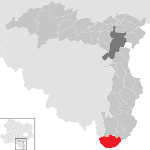
| Location of Hochneukirchen-Gschaidt in the Wiener Neustadt-Land district | ||
  |
||
| Source: Municipal data from Statistics Austria | ||

Hochneukirchen-Gschaidt is a market town with 1,642 inhabitants (1 January 2020) in Vienna's Neustadt-Land in the industrial area in Lower Austria .
geography

The market town of Hochneukirchen-Gschaidt is located in the triangle of Lower Austria / Burgenland / Styria and is the southernmost municipality in the Bucklige Welt .
Community structure
The municipality includes the following 12 localities (population in brackets as of January 1, 2020):
- Burgerschlag (34)
- Gramet Strike (92)
- Gschaidt (110)
- Harmannsdorf (102)
- Hattmannsdorf (187)
- Hochneukirchen (453)
- Kirchschlagl (164)
- Loipersdorf (46)
- Malting (124)
- Offenegg (156)
- Ulrichsdorf (64)
- Zuggen (110)
The community consists of the cadastral communities Gschaidt and Hochneukirchen.
Neighboring communities
Place names
Hochneukirchen: The high-altitude new church, at that time a special feature in a wide area, gave the place its name. Documented: 1295 "Hochniuchkirche"
Gschaidt: The first mention indicates the location on a watershed, a border or a transition. Documented: 1316 "Gscheid"
history
Before the birth of Christ, the area was part of the Celtic Kingdom of Noricum and belonged to the surroundings of the Celtic hill settlement Burg on the Schwarzenbacher Burgberg .
Later under the Romans, today's places Gschaidt and Hochneukirchen were then in the province of Pannonia .
Hochneukirchen is mentioned as the first place of the settlements in the south of the Bucklige Welt, which were established after the clearing of the Waldmark, in a document issued in Bernstein on January 27, 1295 in which Count Yban von Güssing undertook to part of the rule Kirchschlag to be returned to Leuthold von Kuenring , the owner of the Kirchschlager rule, against payment of 90 gold ducats. The other 11 villages in the municipality were only mentioned in a document at a later date.
The fortified church of Hochneukirchen was a very important building at the time. After all, the church was the villagers' last refuge when the enemy invaded the country. During the Turkish era around 1500, the church was given an upper storey that was equipped with loopholes and spy holes. The threat from the Turks , however, was harmless compared to the incursion of the Kuruzen , who were Hungarian insurgents who spread terror and fear at the beginning of the 18th century.
Until the independent communities were founded, the “Amt Hochneukirchen” belonged to the rule Krumbach and the “Amt Gschaidt” to the rule Ziegersberg . These two cadastral communities were constituted as their own independent communities in 1854 : Hochneukirchen with 998 inhabitants in 122 houses and Gschaidt with 395 inhabitants and 51 houses. In 1895 the volunteer fire brigades Hochneukirchen and Gschaidt were founded, a facility that had proven to be urgently needed in view of the numerous fires. The first school house was built after the introduction of compulsory schooling in 1774. In 1882 the first observation tower was built on the Hutwisch ; there is now the third observation point there. Hochneukirchen and Gschaidt were only gradually opened up to modern economic life through road construction, as it was a purely agricultural community that led a completely self-contained life. In 1856 the road connection from the sawmill (Krumbach) to Hochneukirchen was established.
After the Second World War , a constant upward development began in the community, which affected all areas of life of the community residents. Much has changed, especially through the creation and expansion of various public facilities. Beginning in the 1960s, the rapid expansion of infrastructural facilities such as freight routes, elementary and secondary schools, water supply, sewage disposal, official buildings, building yards, sports facilities, to name just the most important, began. On January 1, 1971, the formerly independent communities of Hochneukirchen and Gschaidt were merged to form the community of Hochneukirchen-Gschaidt.
On April 12, 1995, on the occasion of the 700th anniversary celebrations, the state parliament of Lower Austria raised it to the status of a market town and gave it the market coat of arms.
religion
According to the 2001 census data , 97.5% of the population are Roman Catholic and 1.0% Protestant . 1.1% of the population have no religious denomination.
politics
The municipal council has 19 members.
- With the municipal council elections in Lower Austria in 1990, the municipal council had the following distribution: 15 ÖVP, and 4 SPÖ.
- With the municipal council elections in Lower Austria in 1995, the municipal council had the following distribution: 15 ÖVP, 3 SPÖ, and 1 FPÖ.
- With the municipal elections in Lower Austria in 2000, the municipal council had the following distribution: 15 ÖVP, 3 SPÖ, and 1 FPÖ.
- With the municipal council elections in Lower Austria in 2005 , the municipal council had the following distribution: 15 ÖVP, 3 SPÖ, and 1 FPÖ.
- With the municipal council elections in Lower Austria 2010 , the municipal council had the following distribution: 16 ÖVP, 2 FPÖ, and 1 SPÖ.
- With the municipal council elections in Lower Austria in 2015 , the municipal council had the following distribution: 15 ÖVP, 2 FPÖ, and 2 SPÖ.
- With the municipal council elections in Lower Austria 2020 , the municipal council has the following distribution: 16 ÖVP, 2 SPÖ and 1 FPÖ.
- mayor
- 1945–1965 Franz Henmüller
- 1965–1975 Johann Kager
- 1975–1990 Alfred Beiglböck
- 1990–2008 Friedrich Beiglböck from Maltern (ÖVP)
- since 2008 Thomas Heissenberger from Hochneukirchen (ÖVP)
Culture and sights


.JPG)
- Catholic parish church Hochneukirchen hl. Bartholomäus: A former fortified church with a core substance around 1300. At the end of the 15th century, the fortified church was expanded. In 1787 the church was rebuilt and the east tower removed. The modern extension in the south was built in 1982/83 according to plans by Hans Petermair .
- Catholic parish church Gschaidt hl. Magdalena
- Catholic Filialkirche Maltern: A sacred building from the middle of the 18th century.
- Hutwisch observation tower: At 896 m, the Hutwisch is the highest point in the Bucklige Welt. The observation tower offers a wonderful panoramic view.
- Dreiländerstein: The Dreiländerstein marks the intersection of the federal states of Lower Austria, Styria and Burgenland. This stone is also the southernmost point of Lower Austria and the district of Wiener Neustadt.
- Willersdorfer Schlucht : natural monument. The Willersdorfer Gorge is an enchanting meadow landscape .
music
- Musikverein Hochneukirchen
- Gschaidt Music Association
- Association for the promotion of down-to-earth folk music "HUATWISCHTEIFLN"
societies
- Education and Heimatwerk
- Village renewal association Hochneukirchen
- Village renewal association Gschaidt
- Village renewal association Grametschlag
- Comradeship Association
- Rural youth
- Motorsport Club
- Senior Citizens' Association Hochneukirchen
- Seniors' Association Gschaidt
- Gymnastics and sports union
Sports
- Football field
- 3 tennis courts
- Beach volleyball court
- gym
- extensive network of bike and hiking trails
- 12 km cross-country ski run (Mühlenloipe)
Regular events
- New Year's Concert by the Hochneukirchen Musikverein (every year on January 1st)
- Village festival of the Hochneukirchen Musikverein (annually on the first Sunday in July)
- Motocross and enduro races in Harmannsdorf
- Dreiländermesse at Dreiländerstein ( Willersdorfer Schlucht )
- Tent festivals and balls of the clubs
Public facilities
- Catholic churches
- Community library
- General Practitioner
- vet
- Local office of the Red Cross
Fire brigades:
- Hochneukirchen volunteer fire department
- Maltern volunteer fire department
- Gschaidt volunteer fire department
education
- Hochneukirchen elementary school
- Hochneukirchen secondary school
- Music School Association Bucklige Welt - South
- Lower Austria state kindergarten Hochneukirchen
- Lower Austria state kindergarten Gschaidt
Personalities
- Sons and daughters of the church
- Wilhelm Beiglböck (1905–1963), internist, was convicted in the Nuremberg doctors ' trial
- Honorary citizen of the community
- Konsistorialrat Alois Glatzl, pastor
- Former Mayor Friedrich Beiglböck
- Local historian Markus Wieser
Web links
- 32309 - Hochneukirchen-Gschaidt. Community data, Statistics Austria .
- Website of the market town of Hochneukirchen-Gschaidt
Individual evidence
- ↑ Statistics Austria: Population on January 1st, 2020 by locality (area status on January 1st, 2020) , ( CSV )
- ↑ a b Community changes from 1945 (associations, divisions, name and status changes). Statistics Austria, pp. 54, 171 , accessed on February 7, 2019 .
- ^ Result of the municipal council election 1995 in Hochneukirchen-Gschaidt. Office of the Lower Austrian State Government, March 30, 2000, accessed on September 27, 2019 .
- ^ Election result of the municipal council election 2000 in Hochneukirchen-Gschaidt. Office of the Lower Austrian State Government, February 4, 2005, accessed on September 27, 2019 .
- ^ Election result of the municipal council election 2005 in Hochneukirchen-Gschaidt. Office of the Lower Austrian State Government, March 4, 2005, accessed on September 27, 2019 .
- ^ Election result of the municipal council election 2010 in Hochneukirchen-Gschaidt. Office of the Lower Austrian State Government, October 8, 2010, accessed on September 27, 2019 .
- ^ Election result of the 2015 municipal council election in Hochneukirchen-Gschaidt. Office of the Lower Austrian State Government, December 1, 2015, accessed on September 27, 2019 .
- ↑ Results of the municipal council election 2020 in Hochneukirchen-Gschaidt. Office of the Lower Austrian state government, January 26, 2020, accessed on February 9, 2020 .
- ↑ Franz Schabauer: Hochneukirchen-Gschaidt . In: The Lower Austrian district of Wiener Neustadt and its communities . 2nd Edition. Lower Austria. Verlag GesmbH, Wiener Neustadt 1996, p. 63 .
- ^ Dehio manual. The art monuments of Austria: Lower Austria south of the Danube. Part 1. A to L. Bundesdenkmalamt (editor), Verlag Berger, Horn / Vienna 2003, ISBN 3-85028-364-X , page 822f.
- ↑ Honorary citizenship celebration for Pastor Konsistorialrat Alois Glatzl , Marktgemeinde Hochneukirchen-Gschaidt, June 3, 2015, accessed on September 28, 2015

Bad Erlach | Bad Fischau-Brunn | Bad Schönau | Bromberg | Ebenfurth | Eggendorf | Felixdorf | Gutenstein | Hochneukirchen-Gschaidt | Hochwolkersdorf | High wall | Hollenthon | Katzelsdorf | Kirchschlag in the Bucklige Welt | Krumbach | Lanzenkirchen | Lichtenegg | Lichtenwörth | Market Piesting | Matzendorf-Hölles | Miesenbach | Muggendorf | Pernitz | Pipe in the mountains | Schwarzenbach | Sollenau | Theresienfeld | Waidmannsfeld | Waldegg | Walpersbach | Weikersdorf am Steinfelde | Wiesmath | Winzendorf-Muthmannsdorf | Wöllersdorf-Steinabrückl | Zillingdorf
Cadastral communities: Gschaidt | Hochneukirchen
Locations: Burgerschlag | Gramet strike | Gschaidt | Harmannsdorf | Hattmannsdorf | Hochneukirchen | Kirchschlagl | Loipersdorf | Maltern | Offenegg | Ulrichsdorf | Trains
Market place: Hochneukirchen Villages: Burgerschlag | Gramet strike | Gschaidt | Harmannsdorf | Hattmannsdorf | Maltern | Offenegg settlement: Geserriegel hamlet: Buchuck-Burgstall | Field lip | Haunes | Höhwirt | Wreath Mill | Schoberbauer Rotten: Ulrichsdorf | Züggen Scattered Houses: Hattmannsdorf-Scattered Houses | Kirchschlagl | Loipersdorf | Rotleiten | Züggenhöh
Counting district: Hochneukirchen | Gschaidt