Gutensteiner Strasse
| State road B21 in Austria | |||||||||||||||||||||||||||||||||||||||||||||||||||||||||||||||||||||||||||||||||||||||||||||||||||||||||||||||||||

|
|||||||||||||||||||||||||||||||||||||||||||||||||||||||||||||||||||||||||||||||||||||||||||||||||||||||||||||||||||
| map | |||||||||||||||||||||||||||||||||||||||||||||||||||||||||||||||||||||||||||||||||||||||||||||||||||||||||||||||||||
| Basic data | |||||||||||||||||||||||||||||||||||||||||||||||||||||||||||||||||||||||||||||||||||||||||||||||||||||||||||||||||||
| Overall length: | 102.0 km | ||||||||||||||||||||||||||||||||||||||||||||||||||||||||||||||||||||||||||||||||||||||||||||||||||||||||||||||||||
|
State : |
|||||||||||||||||||||||||||||||||||||||||||||||||||||||||||||||||||||||||||||||||||||||||||||||||||||||||||||||||||
|
Course of the road
|
|||||||||||||||||||||||||||||||||||||||||||||||||||||||||||||||||||||||||||||||||||||||||||||||||||||||||||||||||||
| State road B21a in Austria | |

|
|
| Basic data | |
| Overall length: | 5.5 km |
|
State : |
|
| State road B21b in Austria | |

|
|
| map | |
| Basic data | |
| Overall length: | 2.9 km |
|
State : |
|
|
Course of the road
|
|
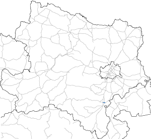
The Good Steiner Street B 21 is a former federal highway , mainly through Lower Austria runs. It leads over a length of about 100 km from Wiener Neustadt ( Theresienfeld ) to Mariazell .
course
The B 21 originally began in Wiener Neustadt. With the opening of the Nordspange Wiener Neustadt ( Wöllersdorf - Theresienfeld), the B 21 was diverted north to the border with Theresienfeld. The B 21b extends from Wiener Neustädter Strasse (B 17) in Wiener Neustadt to Leitha Strasse B 60. There is also the B 21a, a clasp from Wöllersdorf to L151 and to Felixdorf , which starts at the municipal border with Theresienfeld as a municipal street (Badener Strasse) continues.
From Wöllersdorf the B 21 continues through the Piestingtal , past the villages of Markt Piesting (connection to Berndorf via the Hart ), Oed- Waldegg , Reichental (connection to Puchberg via the Ascher ), through the narrow point of the Quarb to Pernitz (connection to Pottenstein over the neck ) and the eponymous Gutenstein , over the Rohrer Sattel (864 m) to Rohr im Gebirge and on to Kalte Kuchl .
From here to Walkemühle, where Hohenberger Straße B 214 meets B 21, the B 21 is poorly developed. From there, Gutensteiner Straße then continues via St. Aegyd am Neuwalde to Mariazell.
history
1808–1809 a “commercial road” was built through the Piestingtal, which branched off from Triester Straße in Sollenau and led to Gutenstein. In 1834 Guttensteiner Straße had three toll stations in Wöllersdorf, Pernitz and Gutenstein, which brought in around 5,000 guilders for the state treasury. Because of its minor supraregional importance, this road was handed over to the state of Lower Austria in 1869 and has since been used as a state road.
In 1894 the section between Schwarzau and Sankt Aegyd was opened and called the "most beautiful road in Lower Austria".
By a resolution of the Styrian Landtag on January 23, 1895, the Styrian section between Mariazell and Terz was upgraded to a first class district road. Since April 1, 1938, the district roads of the 1st order in Styria have been run as state roads.
The Gutensteiner street belongs since 1 January 1950 for the network of federal roads in Austria .
Gutensteiner Strasse began in Wiener Neustadt on January 1, 1972, and the historic route between Felixdorf and Wöllersdorf was renamed Felixdorfer Strasse and referred to as B 21a.
On December 11, 1990, the new bypass road from Oberpiesting to Waldegg was opened to traffic.
Web links
Individual evidence
- ↑ http://www.oevp-waldegg.at/chronik.htm
- ↑ Austrian Tourist Newspaper, No. 5/1895, p. 54.
- ^ Announcement by the Imperial and Royal Governor of Styria from April 1, 1895. LGBl. No. 48/1895.
- ^ Law on public roads with the exception of federal roads (State Road Administration Act). LGBl. No. 20/1938, Section 59 Paragraph 2 (b).
- ↑ Federal Roads Act of February 18, 1948, Directory C.
- ^ Announcement by the Federal Minister for Buildings and Technology of June 10, 1976 in accordance with Section 33 (4) of the Federal Roads Act 1971 with regard to the State of Lower Austria, Federal Law Gazette No. 337/1976.
- ↑ Chronicle. oevp-waldegg.at
| B21 | Like the other former federal highways, Gutensteiner Strasse was part of the federal administration. Since April 1, 2002, it has been under state administration and continues to have the B in the number, but not the name Bundesstraße. |

