Floridsdorfer Strasse
| State road B226 in Austria | |||||||||||||||||||||||||
| 226 | |||||||||||||||||||||||||
| map | |||||||||||||||||||||||||
| Basic data | |||||||||||||||||||||||||
| Overall length: | 4.4 km | ||||||||||||||||||||||||
|
State : |
|||||||||||||||||||||||||
|
Course of the road
|
|||||||||||||||||||||||||
The Floridsdorfer road B226 is a main road B and former federal road in Vienna . It connects the districts of Brigittenau and Floridsdorf over the Floridsdorfer bridge . In addition to the route over the north bridge , it provides the second connection between the Wiener Gürtel (B221) and Brünner Straße (B7). Since the north bridge has been subject to a vignette or toll since 2002, it is often used as an alternative route.
course
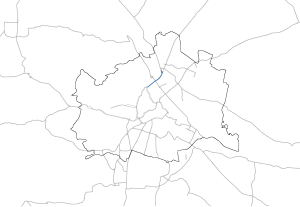
The B226 begins at the Gürtelbrücke as a direct extension of Wiener Gürtel Straße (B221) and follows Adalbert-Stifter-Straße to Friedrich-Engels-Platz . It then crosses the Danube in the course of the Floridsdorfer Bridge and follows the Floridsdorfer Hauptstraße to Am Spitz , the center of Floridsdorf. The last section leads along Prager Straße to the intersection with Katsushikastraße, where the street name changes to B3 .
history
The Floridsdorfer road was by the Federal Law of 14 June 1978 in the network of federal roads in Austria added.
B226 at Friedrich-Engels-Platz
B226 on the Floridsdorfer bridge
Individual evidence
- ↑ Federal Act of June 14, 1978, with which the Federal Roads Act 1971 is changed. Federal Law Gazette No. 294/1978.
| B226 | Like the other former federal highways, Floridsdorfer Straße was part of the federal administration. Since April 1, 2002, it has been under state administration and continues to have the B in the number, but not the name Bundesstraße. |


