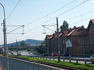
Wiener Neustädter Strasse
| State road B17 in Austria | |||||||||||||||||||||||||||||||||||||||||||||||||||||||||||||||||||||||||||||||||||||||||||||||||||||||||||||||||||||||||||||||||||||||||||||||||||||||||||||||||||||||||||||||||||||||||||||||||||||||||||||||||||||||||||||||||||||||||||||||||||||||||||||||||||||||||||||||||||||

|
|||||||||||||||||||||||||||||||||||||||||||||||||||||||||||||||||||||||||||||||||||||||||||||||||||||||||||||||||||||||||||||||||||||||||||||||||||||||||||||||||||||||||||||||||||||||||||||||||||||||||||||||||||||||||||||||||||||||||||||||||||||||||||||||||||||||||||||||||||||
| map | |||||||||||||||||||||||||||||||||||||||||||||||||||||||||||||||||||||||||||||||||||||||||||||||||||||||||||||||||||||||||||||||||||||||||||||||||||||||||||||||||||||||||||||||||||||||||||||||||||||||||||||||||||||||||||||||||||||||||||||||||||||||||||||||||||||||||||||||||||||
| Basic data | |||||||||||||||||||||||||||||||||||||||||||||||||||||||||||||||||||||||||||||||||||||||||||||||||||||||||||||||||||||||||||||||||||||||||||||||||||||||||||||||||||||||||||||||||||||||||||||||||||||||||||||||||||||||||||||||||||||||||||||||||||||||||||||||||||||||||||||||||||||
| Overall length: | 74.65 km incl. 1.9 km shared route with B 21b | ||||||||||||||||||||||||||||||||||||||||||||||||||||||||||||||||||||||||||||||||||||||||||||||||||||||||||||||||||||||||||||||||||||||||||||||||||||||||||||||||||||||||||||||||||||||||||||||||||||||||||||||||||||||||||||||||||||||||||||||||||||||||||||||||||||||||||||||||||||
|
State : |
|||||||||||||||||||||||||||||||||||||||||||||||||||||||||||||||||||||||||||||||||||||||||||||||||||||||||||||||||||||||||||||||||||||||||||||||||||||||||||||||||||||||||||||||||||||||||||||||||||||||||||||||||||||||||||||||||||||||||||||||||||||||||||||||||||||||||||||||||||||
| The B17 at the Shopping City Süd | |||||||||||||||||||||||||||||||||||||||||||||||||||||||||||||||||||||||||||||||||||||||||||||||||||||||||||||||||||||||||||||||||||||||||||||||||||||||||||||||||||||||||||||||||||||||||||||||||||||||||||||||||||||||||||||||||||||||||||||||||||||||||||||||||||||||||||||||||||||
|
Course of the road
|
|||||||||||||||||||||||||||||||||||||||||||||||||||||||||||||||||||||||||||||||||||||||||||||||||||||||||||||||||||||||||||||||||||||||||||||||||||||||||||||||||||||||||||||||||||||||||||||||||||||||||||||||||||||||||||||||||||||||||||||||||||||||||||||||||||||||||||||||||||||
The Wiener Neustadt Street B 17 is the main road B in Vienna , national road B in Lower Austria and former federal highway . It runs from Matzleinsdorfer Platz in Vienna via Wiener Neustadt to Gloggnitz .
Until the 1970s , it continued as Triester Strasse B 17 via Semmering , Leoben , Perchauer Sattel and Villach to the Italian border. This long-distance connection function was then taken over by the south autobahn A 2 and the Semmering expressway S 6.
Today, Wiener Neustädter Strasse is the most important connection from Vienna to the south alongside the Süd Autobahn . Shopping City Süd , Austria's largest shopping center, is located in Vösendorf between A 2 and B 17 .
history
Wiener Neustädter Strasse emerged from the Triester Reichsstrasse , which was built at the time of the Austrian Empire to connect Vienna with the most important Austrian port city of Trieste . Even today, local street names in the places the street passes are called Triester Straße - also in the federal capital Vienna.
In the area between Wiener Neustadt and Neunkirchen , where it leads through the pine forests of the Steinfeld , Wiener Neustädter Straße is also called Neunkirchner Allee . In this section, which runs straight through the Steinfeld as the Wiener Neustädter baseline , Joseph Liesganig began the first geodetic baseline measurement of Austria-Hungary in 1762/70 , whereby the two endpoints of the baseline are marked by monuments. On April 24, 1937, the 28-year-old Paraguayan diplomat's daughter Ingrid Wiengreen was the victim of a robbery on Neunkirchner Allee that dominated the headlines for days. The two perpetrators were arrested a little later, sentenced to death and executed . Today the Neunkirchner Allee has been expanded to four lanes. In order to break the monotony that is dangerous for motor vehicle drivers on a good roadway, a traffic light crossing was replaced by a roundabout around 2000/05.
The Triesterstraße is one of the main roads that have been set by the Federal Law of July 8, 1921st Until 1938 this route between Vienna and Villach was designated as the B 10, after the connection with Austria it was run as part of Reichsstraße 116 until 1945 . From 1949 to 1971, Triester Straße was designated as B 17 along its entire length .
In the emerging bathing tourism on the upper Adriatic and due to the increasing mobility of the population, the B 17 stood as a symbol of individual freedom in the 1950s and 1960s . Unused hotels and petrol stations bear witness to this time.
According to the Federal Roads Act of 1971, the Semmering expressway S 6 was to replace Triester Straße. From then on, the B 17 ended in Gloggnitz, while the southern section of Triester Straße was referred to as Kärntner Straße B 83.
In 2008 work began on the Sollenau - Felixdorf - Theresienfeld bypass . The planning was difficult because the required area runs in a Natura 2000 area, where the protected bird species Triel lives, which is rarely found in Central Europe. The bypass was completed in January 2013.
Conveyor traffic on the Triester Poststrasse at the Spinnerin am Kreuz 1855
literature
- Beppo Beyerl: The street with seven names. From Vienna to Trieste . Löcker, Vienna 2013, ISBN 978-3-85409-650-4 .
- Beppo Beyerl: The Triester Straße. A history of the traffic route from Vienna to Trieste in pictures . Edition Winkler-Hermaden, Schleinbach 2015, ISBN 978-3-9503739-9-8 .
Individual evidence
- ^ The course of the federal highways in Vienna on ris.bka.gv.at
- ^ Wiener Neustädter baseline
- ↑ Landesstraße B 17 bypass Wiener Neustadt and Sollenau-Theresienfeld (PDF; 4.19 MB) accessed on December 27, 2012
Web links
| B17 | Like the other former federal highways, Wiener Neustädter Straße was part of the federal administration. Since April 1, 2002, it has been under state administration and continues to have the B in the number, but not the name Bundesstraße. |


