Brünner Strasse
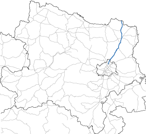
The Brünnerstraße B7 is a main road B in Vienna or country road B in Lower Austria , former federal highway and part of the European route E461 . It leads from Vienna- Floridsdorf (21st district; with the same starting point as Prager Straße ) north through the Weinviertel to the state border with the Czech Republic near Drasenhofen . The continuation on the Czech side is called Silnice I / 52 and continues to Brno .
history
The Brünner Straße runs for long stretches along the route of a famous predecessor. The legendary Amber Road, the oldest trade route in Central Europe, also led through the Weinviertel on its long route from the amber coasts of the Baltic Sea to the Mediterranean.
After the storms of the Migration Period, trade between north and south began again in the Middle Ages . Nikolsburg and Brno developed into important business centers in the Moravian margravate . The old trade route no longer led to Carnuntum , but crossed the Danube near Vienna . As "Schlesische Straße" it connected Vienna with Moravia and the Polish cities.
In 1722, Emperor Karl VI. the construction of five streets to connect all parts of the huge monarchy with the center of Vienna. The postal routes used up to now no longer meet the needs of the emerging state for a long time. In place of the existing paths, fortified routes have now been laid for the first time, which often run straight through the landscape. The imperial court mathematician Johann Jakob Marinoni was responsible for the planning . North of Wolkersdorf, Brünner Strasse, then called Nikolsburger Strasse , leads through the notorious Hochleithenwald , which allegedly served as a hiding place for the robber Johann Georg Grasel . To protect travelers, a guardhouse was built on the Kasernenberg in 1723, in which a 16 to 20-man cavalry unit was stationed. The barracks or the guard house stood at the highest point of the "Kasernberg". Today only the well is preserved. The "Kasanwirt" stood at the foot of the Kasernberg, but its centuries-old building was demolished in 2009. This building was part of the barracks on the hill. A rest station with a fast food restaurant and a gas station was built on the area of the "Kasanwirtes" .
At the end of the monarchy, "Kaiserstraße" was renamed Brünner Straße. The Brünnerstraße one of the imperial roads that have been adopted by the Federal Law of July 8, 1921 as national roads. In the course of job creation measures, Brünner Straße was expanded into a modern car road in the 1930s. In 1936 the steep section on Johannesberg near Wilfersdorf was removed, in 1937 the Kasernberg near Wolkersdorf and in 1938 the "White Mountain" in Poysdorf . Until 1938 Brünner Straße was designated as B 5, after the connection with Austria , Brünner Straße was part of Reichsstraße 116 until 1945 .
Bypass roads
The increasing traffic after the Second World War hit the towns along Brünner Straße severely. In addition, the Schricker Berg is located between Gaweinstal and Schrick , which represented a considerable obstacle for travelers. The B7 was moved in this area in the 1960s and since then has bypassed the mountain and the town of Schrick in the west. In 1974 a bypass road was built east of the towns of Hobersdorf and Wilfersdorf .
The Wolkersdorf bypass was originally intended to bypass Eibesbrunn to the west. However, the potato sellers there feared severe losses in sales and prevented Eibesbrunn from bypassing. So only the section located on Wolkersdorf municipality could be built. This was finally opened in November 2000. Since the north autobahn, which was opened in 2010 , follows the route of the Wolkersdorf bypass in this area, the B7 has been running through the city center of Wolkersdorf again since then.
Replacement as the main traffic artery by the A5
The B7 was relieved by the northern A5 motorway, which was opened to traffic on January 31, 2010 , and replaced as the main traffic artery to the border. Since the A5 runs partly on the route of the existing Brünner Straße, a new, narrower road was built parallel to the motorway for the B7 in these areas.
Miscellaneous

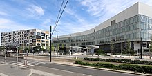
Where the Nordwestbahn crosses Brünner Straße, the S-Bahn station Wien Brünner Straße is on the S3 S-Bahn line towards Stockerau and Hollabrunn . On the eastern side of the street ( 21. , Brünner Straße 68-70) is the North Hospital ; it was structurally completed at the end of 2018 and was put into operation in 2019; since 2020 it has been called Klinik Floridsdorf. In order to facilitate access to the hospital, the S-Bahn station was relocated by 200 meters by the end of 2016 and completely rebuilt. The S3 intervals have been reduced to 15 minutes since the 2018 timetable.
The Brünnerstrasse also became known as a regional term for the surrounding vineyards and their types of wine ( Brünnerstrassler ).
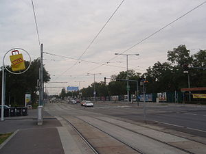
In Vienna, the B7 is closely connected to the tram line 31, which has been running for over a century from the Schottenring from Floridsdorf along the Brünner Straße to Stammersdorf .
literature
- Christian Jostmann, Lukáš Fasora, Ulrich Winkler-Hermaden (pictures): The Brünner Straße . A history of the traffic route from Vienna to Brno in pictures, Edition Winkler-Hermaden, Schleinbach, 2009, ISBN 978-3-9502688-6-7 .
Web links
Individual evidence
- ↑ See also Prager Strasse (Vienna) .
- ^ Historical data from Wolkersdorf accessed on September 9, 2010
- ↑ Archive link ( Memento of the original from October 7, 2007 in the Internet Archive ) Info: The archive link was inserted automatically and has not yet been checked. Please check the original and archive link according to the instructions and then remove this notice.
- ^ The Reichspost of May 14, 1937, p. 5.
- ↑ http://www.ots.at/presseaussendung/OTS_20100129_OTS0192
- ↑ With the S-Bahn to the hospital , in: wien.at , information sheet of the City of Vienna , issue 10/2014, p. 7
| B7 | Like the other former federal highways, Brünner Strasse was part of the federal administration. Since April 1, 2002, it has been under state administration and continues to have the B in the number, but not the name Bundesstraße. |


