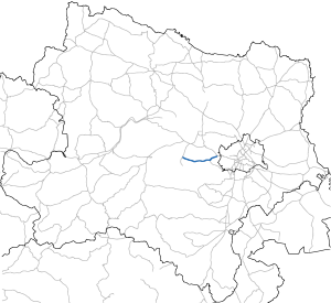
Neulengbacher Strasse
| State road B44 in Austria | |||||||||||||||||||||||||||||||||||||||||||||||||||||||

|
|||||||||||||||||||||||||||||||||||||||||||||||||||||||
| map | |||||||||||||||||||||||||||||||||||||||||||||||||||||||
| Basic data | |||||||||||||||||||||||||||||||||||||||||||||||||||||||
| Overall length: | 23.4 km | ||||||||||||||||||||||||||||||||||||||||||||||||||||||
|
State : |
|||||||||||||||||||||||||||||||||||||||||||||||||||||||
|
Course of the road
|
|||||||||||||||||||||||||||||||||||||||||||||||||||||||
The Neulengbach Street B 44 is a main road in Austria . It runs for a length of 23.4 km through the Vienna Woods . The road begins in Purkersdorf on the outskirts of Vienna and runs parallel to the Westbahn and West Autobahn A 1 via Pressbaum to Neulengbach .
history
The Commercialstrasse leading from St. Pölten to Neulengbach was opened to traffic on January 1st, 1845. The stretch leading from Purkersdorf to Rekawinkel was a Reichsstraße in 1861 , and only a district road in 1879.
The Purkersdorf-St. Pöltner Straße has been part of the network of federal highways in Austria since April 1st, 1959 . Its western section between St. Pölten and Neulengbach was graduated to a state road in 1971.
swell
- ^ Circulars. In: Wiener Zeitung , Official Gazette, November 12, 1844, p. 766 (online at ANNO ).
- ↑ Statistical overview of the Archduchy of Austria under the Enns . kk Hof- und Staatsdruckerei, Vienna 1861, IV. Means of transport for traffic; C. Reichs- (Aerarial-) Streets, p. 41 ff . ( Online in Google Book Search [accessed February 28, 2015]).
- ↑ Graf Gatterburg: Report of the Lower Austrian Provincial Committee, with which the tabular evidence of the result of the road survey carried out is presented . XIX- [1879] der Beilagen […] In: Supplements to the stenographic minutes of the Lower Austrian Landtag. II. Session. V. Election term. From I to CXVII. Vienna 1880, p. 811 (PDF) ff . ( Online in Google Book Search USA [accessed on March 1, 2015] Table 2, No. 150).
- ↑ Federal Act of March 18, 1959, with which the Federal Roads Act is again amended, Directory H.
- ^ Announcement by the Federal Minister for Buildings and Technology of June 10, 1976 in accordance with Section 33 (4) of the Federal Roads Act 1971 with regard to the State of Lower Austria, Federal Law Gazette No. 337/1976.
| B44 | Like the other former federal highways, Neulengbacher Strasse was part of the federal administration. Since April 1, 2002, it has been under state administration and continues to have the B in the number, but not the name Bundesstraße. |
