
Purkersdorf
|
Borough Purkersdorf
|
||
|---|---|---|
| coat of arms | Austria map | |
 |
|
|
| Basic data | ||
| Country: | Austria | |
| State : | Lower Austria | |
| Political District : | Sankt Pölten-Land | |
| License plate : | PL (since 2017; old: WU) | |
| Surface: | 30.26 km² | |
| Coordinates : | 48 ° 12 ' N , 16 ° 11' E | |
| Height : | 248 m above sea level A. | |
| Residents : | 9,818 (Jan 1, 2020) | |
| Population density : | 324 inhabitants per km² | |
| Postcodes : | 1140, 3002, 3011, 3012 | |
| Area code : | 02231 | |
| Community code : | 3 19 52 | |
| NUTS region | AT126 | |
| Address of the municipal administration: |
Hauptplatz 1 3002 Purkersdorf |
|
| Website: | ||
| politics | ||
| Mayor : | Stefan Steinbichler ( SPÖ ) | |
|
Municipal Council : ( 2020 ) (33 members) |
||
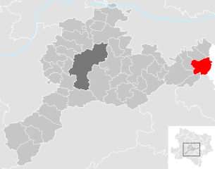
| Location of Purkersdorf in the Sankt Pölten-Land district | ||
  |
||
 View to the parish church |
||
| Source: Municipal data from Statistics Austria | ||

The municipality of Purkersdorf with 9,818 inhabitants (as of January 1, 2020) is located in the Vienna Woods region of the St. Pölten district , directly on the city limits of Vienna at 248 m above sea level. A.
geography
Purkersdorf lies at the confluence of the Gablitzbach in the Wien River . The settlement area extends along the two bodies of water to the city limits, where it merges into the neighboring communities of Vienna, Tullnerbach and Gablitz .
The highest elevations in the community lie south of the Wien River: Laabersteigberg ( 530 m above sea level ), Feuersteinberg ( 507 m above sea level ), Rudolfshöhe ( 475 m above sea level , with Rudolfswarte). The summit of the north, at 542 m above sea level. A. slightly higher Troppberg is already in the municipality of Gablitz . Between the Rudolfshöhe and the city center are the historically significant pre- peaks Schöffelstein ( 425 m above sea level ) and Georgenberg ( 433 m above sea level ).
Community structure
Purkersdorf consists of one village. Districts are An der Stadlhütte, Baunzen, Deutschwald, Glasgraben, Irenental, Neu-Purkersdorf, Postsiedlung, Rechenfeld, Richter-Minder-Siedlung, Sagbergsiedlung, Süssfeld and some individual locations.
Neighboring communities
| Gablitz | Mauerbach | |
| Tullnerbach , Pressbaum |
.svg)
|
Vienna |
| Wolf pit | Laab im Walde ( Mödling district ) |
history
Early history and the Middle Ages
The Purkersdorf area (especially the Georgenberg) has been continuously populated since the 8th century BC, by Illyrians from the Hallstatt period and then by Celts from the Latène period . There are also finds from Roman times . Purkersdorf was founded as a forest settlement around the year 1000. The name Purchartesdorf was evidently mentioned when its owner Albero de Purchartesdorf appears as a witness and donor in various writings of the Klosterneuburg monastery in 1133 . The castle was probably built during this time. The Babenbergers declared the largest part of the Vienna Woods, with Purkersdorf in the middle, a Bannwald , reserved for hunting only for the selected. The castle ( castrum Purchartsdorf ), then a massive moated castle , has been demonstrable since the middle of the 12th century . The place and castle changed hands several times until Reinprecht von Wallsee sold them to the Habsburgs in 1333 . Duke Albrecht the Wise resided in Purchartzdorf in 1348/49 because it was completely spared the plague .
Habsburg era


The princely forest area was administered from 1500 to 1848/49 by the imperial forest office, which ruled the place as a representative of the landlord. The forest office was located in Purkersdorf Castle until 1788. It was not only a technical administrative body, but also the sovereign sovereign supervisory authority, which had jurisdiction over. In 1284 the Teutonic Order acquired extensive forest holdings here (district Deutschwald ). It was not until 1766 that these Burckersdorff forests were sold to the forest authority. In 1452 the Hungarians moved through the town. In the course of the sieges of Vienna in 1529 and 1683 by the Turks , Purkersdorf was devastated like the entire area around Vienna.
The determining factor for the place was its location on Reichsstrasse , which followed the historic Römerweg over the Riederberg . The Burkherdorff post station is documented from 1558, but it is certainly much older. It was the first (seen from Vienna) and therefore very profitable rest stop on the Vienna – Linz route . In 1796/97 the post office was rebuilt in the early classicist style. The facade decorated in relief can still be seen today. At the time of the Reformation , the Roman Catholic parish was closed and only re-established in 1570 by Emperor Maximilian II . In 1713 the place was ravaged by the plague brought in from Vienna. Almost half of the 250 residents fell victim to it. In 1805 Napoleon imprisoned, allegedly 3,000 men, in the local church, who burned the entire inventory because of the cold.
In a hiking guide from the Biedermeier period , the work of Vienna's surroundings for twenty hours in the vicinity of Adolf Schmidl from 1835, it is reported about the then so-called Burkersdorf :
“The village is very suitable to announce the proximity of the residence to the traveler. The local post office is a pretty building with the headline: "Welcome!" The carpenter's house deserves a special mention, the first on the left when you reach the village. It has a small park in which the bust of Sr. Majesty of Emperor Francis I is placed. "
In August 1842 the "great fire" broke out due to drought and strong winds from the post office building to the church, castle and school and cremated another 13 houses.
In the fight against Viennese revolutionaries , Croatian associations loyal to the government of the Bans Joseph Jellacic occupied the place in October 1848.
In 1849 Purkersdorf became an independent local community due to the new municipal law of Emperor Franz Joseph I. From 1856 to 1858 part of the imperial and royal privileged Kaiserin-Elisabeth-Bahn , today's Westbahn , was built here and Purkersdorf was thus connected to the modern transport network. The Landgravine Fürstenberg had, however, implemented a changed route - with a train station one kilometer from the town center.
The Purkersdorf Volunteer Fire Brigade was founded in 1873 . In 1905, the Purkersdorf sanatorium was opened as a spa and hydrotherapy facility based on plans by Josef Hoffmann .
Republic of Austria
In the inter-war period, the place was raised to a market town in 1929 . A short time later, after the "annexation" of Austria to the German Reich , the place was on 15 October 1938 as part of the newly created 14th district, Penzing , according to Greater Vienna incorporated.
On April 5, 1945, the Red Army marched in from Lake Wienerwald without major combat operations . More than sixty residents, including many staunch National Socialists , committed suicide. On April 12, 1945, the Soviet occupying power established a municipal administration. In 1946, Vienna and Lower Austria agreed to return Purkersdorf to Lower Austria like many other places assigned to Greater Vienna in 1938. The Soviet Union, on the other hand, as the occupying power, vetoed it and only lifted it in 1954. The occupation in the village was withdrawn in 1947, the local command in 1949. Purkersdorf became independent again on September 1, 1954 when it separated from Vienna. In 1966 (enactment of law, official celebration in 1967) the market town was finally elevated to a town council.
In 1973 the town partnership was entered into with Bad Säckingen am Hochrhein . Further twin cities from 2002 onwards are Sanary-sur-Mer in France and Göstling an der Ybbs in Lower Austria. There were always major floods when the Vienna came out of its banks, most recently in 1940, 1997 and 2002. In 2002 the Austrian Federal Forests moved into their new headquarters in a multi-storey wooden building in the palace gardens.
From 1954 until its dissolution on December 31, 2016, Purkersdorf was part of the Lower Austrian district of Vienna-Umgebung . Since then it has belonged to the St. Pölten district .
Population development
For the year 1572 120 and for the year 1830 already 961 inhabitants are mentioned in the chronicles for Purkersdorf.

Culture and sights

- Purkersdorf Sanatorium ; a major work of Art Nouveau by Josef Hoffmann
- Parish church of St. Jakob ; Medieval origin, with miraculous image of the breastfeeding Madonna ( Madonna lactans ) and peace cross
- Purkersdorf Sandstone Viennese Forest Nature Park
- Purkersdorf City Museum (in the courtyard of the palace )
- See also: List of listed objects in Purkersdorf
Economy and Infrastructure
traffic

Purkersdorf is located on the Westbahn and has four stops there (Purkersdorf-Sanatorium, Unter Purkersdorf, Purkersdorf-Zentrum and Unter-Tullnerbach ). Purkersdorf is connected to Vienna's Westbahnhof via the S50 S-Bahn line . In addition, REX stops at the Purkersdorf Zentrum station every half hour to hourly in the direction of Wien Westbahnhof or St. Pölten Hauptbahnhof and Amstetten.
The A1 western motorway begins near Purkersdorf . It crosses the municipality without a junction in the area of the districts of Baunzen and Glasgraben.
health care
There are several general practitioners, specialists and two pharmacies in Purkersdorf. The nearest hospitals are in St. Pölten , Tulln and Vienna . In the village there is an office of the Red Cross and the Arbeiter-Samariter-Bund , which are manned around the clock and jointly operate an ambulance base . The Red Cross emergency vehicles are dispatched from the regional and national control center 144 Emergency Call Lower Austria .
politics
Mayor of the municipality is Stefan Steinbichler. He was elected to succeed Karl Schlögl in an extraordinary council meeting on November 6, 2018 . Schlögl made the office available on October 31, 2018, having held it since 1989. There was only one interruption between 1997 and 2000, when Karl Schlögl was Minister of the Interior in the Federal Climate Government . After the end of the SPÖ / ÖVP coalition, Schlögl returned to the mayor's chair and won reliable majorities for his party in the municipal elections in 2005, 2010 and 2015.
Claudia Winkler-Widauer is the head of the office.
Municipal council
Since the municipal council election on January 26, 2020, there is a total of 33 seats in the municipal council as follows:
- List SPÖ 15
- List of ÖVP 8
- List tree and greenery + Purkersdorfer list 6
- List NEOS and Citizens' Forum Purkersdorf 3
- FPÖ 1
Mayor since 1849
|
Monarchy:
|
First Republic:
|
Second Republic:
|
Town twinning
-
 Bad Säckingen , Germany (1973)
 -
 Sanary-sur-Mer , France (2002)
 -
 Göstling an der Ybbs , Austria (2002)
Personalities
Connected with Purkersdorf
- Johann Baptist Anton Schmitt (1775–1840), forest scientist
- Karl Graf Welsperg-Raitenau (1779–1873), politician
- Leopold Grabner (1802–1864), forest scientist
- Josef von Bauer (1817–1886), lawyer and politician
- Manfred Bauer (1957–2012), journalist and writer
- Franz von Gernerth (1821–1900), lawyer, composer and music writer
- Ignaz von Schurda (1822–1879), civil servant and politician
- Konrad Adolf Hallenstein (1835–1892), actor
- Emil Steinbach (1846–1907), lawyer, politician and finance minister
- Karl Maria Schuster (1871–1953), painter
- Arnold Hartig (1878–1972), sculptor and medalist
- Richard Plattensteiner (1878–1956), local writer
- Camillo Fritz Discher (1884–1976), architect
- Julius von Pia (1887–1943), geologist and paleontologist
- Hermann Michel (mineralogist) (1888–1965), mineralogist and gemstone specialist
- Georg Kotek (1889–1977), folk song researcher
- Karl Dewanger (1897–1944), politician
- Friedrich Winkelmüller (1898–1979), local writer
- Georg Traar (1899–1980), Evangelical Lutheran theologian
- Gottfried Haberler (1900–1995), economist
- Hans Hadamowsky (1906–1986), oboist, university professor and composer
- Else Rambausek (1907–1994), actress and singer
- Hans Altenhuber (* 1924), adult educator
- Heinz Reincke (1925–2011), actor and voice actor
- Horst Aschermann (1932–2005), sculptor
- Andreas Prochaska (* 1964), screenwriter and director
- Herbert Kickl (* 1968), politician
Honorary citizen
- Emil Ritter von Hardt , kk section chief , his former honor was in 1910 Katharinengasse in Hardt-Stremayr Alley renamed
- Michael Häupl , Mayor of Vienna until 2018
- Erwin Pröll , governor of Lower Austria until 2017
- Kurt Schlintner, former Vice Mayor
- Josef Schöffel , “savior” of the Vienna Woods
- Heinz Mau, Vice Mayor of the City of Bad Säckingen a. D.
- Günther Nufer, Mayor of Bad Säckingen a. D.
- Karl Schlögl, former Minister of the Interior and Mayor
Web links
- Homepage of the municipality of Purkersdorf
- Purkersdorf Online - Open communication platform
- 31952 - Purkersdorf. Community data, Statistics Austria .
- Entry for Purkersdorf in the database of the state's memory for the history of the state of Lower Austria ( Museum Niederösterreich )
Individual evidence
- ↑ Burkhard Weigl: Stone Age finds . In: noen.at , July 10, 2014, accessed on May 6, 2020.
- ↑ For historical section: Kurt Schlintner: Keyword Purkersdorf. The Vienna Woods City from AZ. Municipality of Purkersdorf 2003, passim .
- ^ Adolf Schmidl: Vienna's surroundings for twenty hours in a circle. Described by Adolf Schmidl after his own hikes. Printed and published by Carl Gerold, Vienna 1835, p. 307.
- ↑ Purkersdorf: Steinbichler follows Schlögl on ORF Lower Austria from November 7, 2018, accessed on November 8, 2018.
- ↑ Schlögl withdraws from politics on ORF Lower Austria from August 30, 2018, accessed on August 30, 2018
- ↑ New guided tour for Purkersdorf NÖN from November 23, 2018, accessed on January 3, 2019.
- ↑ Results of the municipal council election 2020 in Purkersdorf. Office of the Lower Austrian State Government, January 26, 2020, accessed on February 3, 2020 .
- ↑ Heinz Mau now an honorary citizen in Purkersdorf. Badische Zeitung, October 29, 2009
- ↑ Karl Schlögl is an "honorary citizen". meinviertel.at, May 26, 2019

Altlengbach | Asperhofen | Böheimkirchen | Brand-Laaben | Eichgraben | Frankenfels | Gablitz | Gerersdorf | Hafnerbach | Haunoldstein | Herzogenburg | Hofstetten-Grünau | Inzersdorf-Getzersdorf | Kapelln | Karlstetten | Box near Böheimkirchen | Kirchberg an der Pielach | Kirchstetten | Loich | Maria-Anzbach | Markersdorf-Haindorf | Mauerbach | Michelbach | Envious | Neulengbach | Neustift-Innermanzing | Nussdorf ob der Traisen | Ober-Grafendorf | Obritzberg-Rust | Perschling | Press tree | Prinzersdorf | Purkersdorf | Pyhra | Rabenstein an der Pielach | Schwarzenbach an der Pielach | St. Margarethen an der Sierning | Statzendorf | Stössing | Traismauer | Tullnerbach | Weinburg | Wilhelmsburg | Wölbling | Wolf pit
Cadastral municipality and locality: Purkersdorf
City: Purkersdorf | Villages: German Forest • Neu-Purkersdorf | Hamlet: Glasgraben | Rotten: Baunzen • Irenental | Settlements: On the Stadlhütte • Postsiedlung • Calculation field • Richter-Minder-settlement • Sagbergsiedlung • Süßfeld
Counting district: Purkersdorf center | Purkersdorf-North | Purkersdorf-Ost | Purkersdorf-South | Purkersdorf-West