St. Pölten-Land district
| location | |
|---|---|
| Basic data | |
| state | Lower Austria |
| NUTS III region | AT-123/126 |
| Administrative headquarters | St. Polten |
| surface | 1288 km² |
| Residents | 131,729 (January 1, 2020) |
| Population density | 102 inhabitants / km² |
| License Plate | PL |
| District Commission | |
| District Captain | Josef Kronister |
| website |
www.noel.gv.at/ Bezirke / BH-St-Poelten |
The district of St. Pölten , or in its older form St. Pölten-Land, is an administrative district of the Province of Lower Austria .
geography
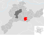
It includes the area surrounding the state capital St. Pölten and the Vienna Woods communities immediately west of Vienna . Branch offices of the St. Pölten-Land district authority exist in Kirchberg an der Pielach , Neulengbach and Purkersdorf . It has an area of 1,287.89 km².
In terms of landscape, most of the district belongs to the Mostviertel except for the Wienerwald communities that were added in 2017 and are part of the industrial district . It belongs to the main region of regional planning in Lower Lower Austria .
Neighboring districts
Administrative division
The St. Pölten district has been divided into 45 municipalities since 2017 , including 6 cities and 25 market communities.
On September 24, 2015, the Lower Austrian state parliament decided that the Vienna-Umgebung district would be dissolved on December 31, 2016. The state government then reallocated the communities to the neighboring districts: The communities Gablitz , Mauerbach , Pressbaum , Purkersdorf , Tullnerbach and Wolfsgraben became part of the St. Pölten district.
- Regions in the table are small regions in Lower Austria
| local community | location | Ew | km² | Ew / km² | Judicial district | region | Type | Metadata |
|---|---|---|---|---|---|---|---|---|
Altlengbach
|

|
3,025 | 35.54 | 85 | Neulengbach | Wienerwald initiative region | market community |
According to code: 31901 |
Asperhofen
|

|
2,236 | 28.92 | 77 | Neulengbach | Wienerwald initiative region | market community |
According to code: 31902 |
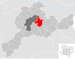
Boheimkirchen
|
|
5,096 | 45.49 | 112 | Neulengbach | - | market community |
According to code: 31903 |
Brand-Laaben
|

|
1,236 | 34.53 | 36 | Neulengbach | Wienerwald initiative region | local community |
According to code: 31904 |
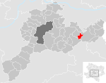
Eichgraben
|
|
4,652 | 8.88 | 524 | Neulengbach | Wienerwald initiative region | market community |
According to code: 31905 |
Frankenfels
|

|
1.941 | 56.16 | 35 | St. Polten | Pielachtal small region | market community |
According to code: 31906 |
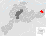
Gablitz
|
|
5,025 | 18.15 | 277 | Purkersdorf | Small region of Troppberg | market community |
According to code: 31949 |
Gerersdorf
|

|
985 | 13.67 | 72 | St. Polten | - | local community |
According to code: 31907 |
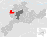
Hafnerbach
|
|
1,663 | 29.31 | 57 | St. Polten | ARGE Dunkelsteinerwald | market community |
According to code: 31910 |
Haunoldstein
|

|
1,226 | 9.91 | 124 | St. Polten | ARGE Dunkelsteinerwald | local community |
According to code: 31911 |
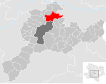
Herzogenburg
|
|
7,844 | 46.16 | 170 | St. Polten | Lower Traisental | urban community |
According to code: 31912 |
Hofstetten-Grünau
|

|
2,684 | 36 | 75 | St. Polten | Pielachtal small region | market community |
According to code: 31909 |
Inzersdorf-Getzersdorf
|

|
1,617 | 13.57 | 119 | St. Polten | Lower Traisental | local community |
According to code: 31913 |
Chapels
|

|
1,390 | 20.18 | 69 | Neulengbach | Lower Traisental | market community |
According to code: 31915 |
Karlstetten
|

|
2.175 | 28.46 | 76 | St. Polten | - | market community |
According to code: 31916 |
Box near Böheimkirchen
|

|
1,410 | 20.54 | 69 | Neulengbach | - | local community |
According to code: 31917 |
Kirchberg an der Pielach
|

|
3,207 | 63.41 | 51 | St. Polten | Pielachtal small region | market community |
According to code: 31918 |
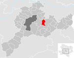
Kirchstetten
|
|
2.210 | 17.77 | 124 | Neulengbach | Wienerwald initiative region | market community |
According to code: 31919 |
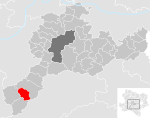
Loich
|
|
594 | 24.58 | 24 | St. Polten | Pielachtal small region | local community |
According to code: 31920 |
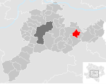
Maria-Anzbach
|
|
3,064 | 18.19 | 168 | Neulengbach | - | market community |
According to code: 31921 |
Markersdorf-Haindorf
|
|
2,090 | 16.67 | 125 | St. Polten | - | market community |
According to code: 31922 |
Mauerbach
|

|
3,642 | 20.35 | 179 | Purkersdorf | - | market community |
According to code: 31950 |
Michelbach
|

|
893 | 25.06 | 36 | Neulengbach | - | market community |
Acc. To code: 31923 |
Envious
|

|
1,472 | 18.69 | 79 | St. Polten | ARGE Dunkelsteinerwald | market community |
According to code: 31925 |
Neulengbach
|

|
8,304 | 51.66 | 161 | Neulengbach | Wienerwald initiative region | urban community |
Acc. To code: 31926 |
Neustift-Innermanzing
|

|
1,588 | 14.84 | 107 | Neulengbach | Wienerwald initiative region | local community |
According to code: 31927 |
Nussdorf ob der Traisen
|
|
1,786 | 15.52 | 115 | St. Polten | Lower Traisental | market community |
According to code: 31928 |
Ober-Grafendorf
|
|
4,593 | 24.6 | 187 | St. Polten | Pielachtal small region | market community |
According to code: 31929 |
Obritzberg-Rust
|

|
2,321 | 41.55 | 56 | St. Polten | - | market community |
According to code: 31930 |
Perschling
|

|
1,411 | 23.8 | 59 | Neulengbach | - | local community |
Acc. To code: 31946 |
Press tree
|

|
7,754 | 58.89 | 132 | Purkersdorf | Small region of Troppberg | urban community |
According to code: 31951 |
Prinzersdorf
|

|
1,592 | 4.05 | 393 | St. Polten | - | market community |
Acc. To code: 31932 |
Purkersdorf
|

|
9,818 | 30.26 | 324 | Purkersdorf | Small region of Troppberg | urban community |
According to code: 31952 |
Pyhra
|
|
3,566 | 66.94 | 53 | St. Polten | - | market community |
According to code: 31934 |
Rabenstein on the Pielach
|

|
2,537 | 36.22 | 70 | St. Polten | Pielachtal small region | market community |
Acc. To code: 31935 |
St. Margarethen on the Sierning
|

|
1.007 | 14.58 | 69 | St. Polten | - | local community |
Acc. To code: 31938 |
Schwarzenbach an der Pielach
|

|
380 | 45.37 | 8.4 | St. Polten | Pielachtal small region | local community |
According to code: 31939 |
Statzendorf
|

|
1,443 | 12.47 | 116 | St. Polten | - | local community |
According to code: 31940 |
Stössing
|
|
841 | 27.51 | 31 | Neulengbach | - | local community |
According to code: 31941 |
Traismauer
|

|
6.330 | 43.03 | 147 | St. Polten | - | urban community |
According to code: 31943 |
Tullnerbach
|

|
2,905 | 20.24 | 144 | Purkersdorf | Small region of Troppberg | market community |
According to code: 31953 |
Weinburg
|

|
1,395 | 10.4 | 134 | St. Polten | Pielachtal small region | local community |
Acc. To code: 31945 |
Wilhelmsburg
|

|
6,492 | 45.96 | 141 | St. Polten | Traisen-Gölsental | urban community |
According to code: 31947 |
Wölbling
|

|
2,553 | 32.37 | 79 | St. Polten | - | market community |
According to code: 31948 |
Wolf pit
|

|
1,736 | 17.44 | 100 | Purkersdorf | - | local community |
According to code: 31954 |
Population development
- according to area status 2016

See also
- Listed objects in the Sankt Pölten-Land district
- List of natural monuments in the Sankt Pölten-Land district
Web links
annotation
- ↑ This form is kept lemmatic because it is easier to distinguish it from the statutory city.
Individual evidence
- ↑ Lower Austrian Parliament: Resolution Ltg.-729 / A-1 / 50-2015
- ^ Lower Austrian press service: Extraordinary meeting of the Lower Austrian state government - reallocation of the municipalities after the dissolution of the administrative district Vienna-Umgebung , article from September 24, 2015, accessed on September 27, 2015
Coordinates: 48 ° 9 ' N , 15 ° 30' E


