
Neustift-Innermanzing
|
Neustift-Innermanzing
|
||
|---|---|---|
| coat of arms | Austria map | |
 |
|
|
| Basic data | ||
| Country: | Austria | |
| State : | Lower Austria | |
| Political District : | Sankt Pölten-Land | |
| License plate : | PL | |
| Main town : | Neustift | |
| Surface: | 14.84 km² | |
| Coordinates : | 48 ° 8 ' N , 15 ° 55' E | |
| Height : | 298 m above sea level A. | |
| Residents : | 1,588 (January 1, 2020) | |
| Population density : | 107 inhabitants per km² | |
| Postal code : | 3052 | |
| Area code : | 02774 | |
| Community code : | 3 19 27 | |
| NUTS region | AT123 | |
| Address of the municipal administration: |
Dänekeplatz 3 3052 Neustift-Innermanzing |
|
| Website: | ||
| politics | ||
| Mayoress : | Irmgard Schibich ( ÖVP ) | |
|
Municipal Council : ( 2020 ) (19 members) |
||
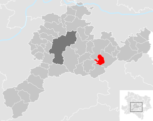
| Location of Neustift-Innermanzing in the Sankt Pölten-Land district | ||
  |
||
| Source: Municipal data from Statistics Austria | ||

Neustift-Innermanzing is a municipality with 1,588 inhabitants (as of January 1, 2020) in the district of Sankt Pölten-Land in Lower Austria .
geography
Neustift-Innermanzing is located in the Mostviertel in Lower Austria on the western edge of the Vienna Woods . The area of the municipality covers 14.9 square kilometers. 47.47 percent of the area is forested.
Community structure
The municipality includes the following 12 localities (population in brackets as of January 1, 2020):
- Almerberg (75)
- Aschberg (42)
- Outermanzing (67)
- Barbara Wood (40)
- Corner (46)
- Giesshübl (7)
- Gumpersberg (8)
- Innermanzing (750)
- Mannersdorf (61)
- Neustift (419) including Kohlhof
- Oberkuhberg (44)
- Unterkuhberg (29)
The community consists of the cadastral community of Neustift-Innermanzing.
history
In ancient times, the area was part of the Noricum province .
The place was probably created in the course of the reclamation of the Vienna Woods. Around 1519 he is mentioned as Manzing on the Neustift. The name was changed to Neustift in 1555 and to "Neustift bei Altlengbach" in 1893. The community, which was established around 1850, has only had its current name Neustift-Innermanzing since 1910. In 1955, the foundation stone was laid for its own church in Innermanzing, which was completed in 1967.
Population development
According to the results of the 2001 census, there were 1281 inhabitants. In 1991 the municipality had 1,086 inhabitants, in 1981 976 and in 1971 696 inhabitants.
parish

Until the end of 1935 the entire municipality belonged to the Roman Catholic. Parish St. Christophen and was then added to the Parish Altlengbach .
The branch church in Innermanzing was built on the initiative of August Khary and according to plans by Walter Prutscher . The foundation stone was laid on May 15, 1955. The tower cross of the 40 m high tower and four bells were consecrated in autumn 1956 and the church itself was consecrated in 1967. In 1989, a community cemetery was laid out on the southwest side of the church by the village renewal committee under architect H. Erhart .
politics
Mayor of the municipality is Irmgard Schibich, head of office Andreas Grübl. After the 2020 municipal council elections, there will be the following distribution of mandates with a total of 19 seats in the municipal council :
ÖVP 12, SPÖ 5, GRÜNE 2, others no seats.
Culture and sights
See: List of listed objects in Neustift-Innermanzing
Economy and Infrastructure
In 2001 there were 57 non-agricultural workplaces, and according to the 1999 survey there were 40 in agriculture and forestry. According to the 2001 census, the number of people in employment at the place of residence was 624. In 2001, the employment rate was 50.5 percent. Neustift-Innermanzing is a member of the Wienerwald Initiative Region .
Web links
- 31927 - Neustift-Innermanzing. Community data, Statistics Austria .
Individual evidence
- ↑ Statistics Austria: Population on January 1st, 2020 by locality (area status on January 1st, 2020) , ( CSV )
- ↑ a b Neustift-Innermanzing parish : parish | Church ; accessed on Sep. 13 2016

Altlengbach | Asperhofen | Böheimkirchen | Brand-Laaben | Eichgraben | Frankenfels | Gablitz | Gerersdorf | Hafnerbach | Haunoldstein | Herzogenburg | Hofstetten-Grünau | Inzersdorf-Getzersdorf | Kapelln | Karlstetten | Box near Böheimkirchen | Kirchberg an der Pielach | Kirchstetten | Loich | Maria-Anzbach | Markersdorf-Haindorf | Mauerbach | Michelbach | Envious | Neulengbach | Neustift-Innermanzing | Nussdorf ob der Traisen | Ober-Grafendorf | Obritzberg-Rust | Perschling | Press tree | Prinzersdorf | Purkersdorf | Pyhra | Rabenstein an der Pielach | Schwarzenbach an der Pielach | St. Margarethen an der Sierning | Statzendorf | Stössing | Traismauer | Tullnerbach | Weinburg | Wilhelmsburg | Wölbling | Wolf pit
Cadastral communities: Neustift-Innermanzing
Locations: Almerberg | Aschberg | Außenermanzing | Barbara wood | Corner | Giesshübl | Gumpersberg | Innermanzing | Mannersdorf | Neustift | Oberkühberg | Unterkühberg
Villages: Innermanzing • Mannersdorf • Neustift Weiler: Gumpersberg • Kohlhof Rotten: Almerberg • Aschberg • Ausermanzing • Barbaraholz • Eck • Gießhübl • Oberkühberg • Unterkühberg
Counting district: Neustift-Innermanzing