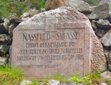
Nassfeld Street
| State road B90 in Austria | |||||||||||||||||||||||||

|
|||||||||||||||||||||||||
| Basic data | |||||||||||||||||||||||||
| Overall length: | 12.8 km | ||||||||||||||||||||||||
|
State : |
|||||||||||||||||||||||||
|
Course of the road
|
|||||||||||||||||||||||||
The Nassfeld road (B 90) is a country road in Austria . It has a length of 12.8 km and leads from Gailtal to Nassfeld on the border with Italy .
history
Naßfeld Straße was built by the military in 1915 during World War I as a pass road from Austrian Tröpolach in Gailtal to Pontafel in the Canal Valley , which was also Austrian at the time . It was an inner Austrian road near the border. After the First World War, the Canal Valley and with it the road from the top of the pass to Pontafel - now Pontebba - fell to Italy.
On 1 January 1949, the Austrian part was included in the network of the Carinthian roads and to 1972 as a national road no. 22 out. From October 1, 1972 to 2002, it was part of the network of federal highways in Austria ; then it became the state road B90 .
swell
- ^ Law of January 21, 1949, regarding the adoption of new state roads. LGBl. No. 7/1949.
- ↑ Law of October 25, 1972 amending the 1971 Roads Act. LGBl. No. 15/1972.
- ^ Announcement by the Federal Minister for Buildings and Technology of December 14, 1972 in accordance with Section 33, Paragraph 4 of the Federal Roads Act 1971 with regard to the State of Carinthia, Federal Law Gazette No. 17/1973.
| B90 | Like the other former federal highways, Nassfeld Strasse was part of the federal administration. Since April 1, 2002, it has been under state administration and continues to have the B in the number, but not the name Bundesstraße. |
