Thayatal street
| State road B30 in Austria | |

|
|
| map | |
| Basic data | |
| Overall length: | 113.4 km |
|
State : |
|
|
Course of the road
|
|
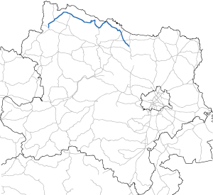
The Thayatal Straße (B 30) is a state road in Austria . It runs for a length of 113.4 km in Lower Austria along the state border to the Czech Republic . The road begins in Guntersdorf in the Weinviertel and leads via Retz to the Thayatal National Park , which gives it its name . From here it leads to Drosendorf , where it reaches the Thaya . It follows this and from Raabs an der Thaya its source river Deutsche Thaya to Dobersberg . It also leads via Heidenreichstein to Schrems , where it ends in the Waldviertel .
history
The Guntersdorf-Retzer road and the Horn WOHNEN in DROSENDORF road among the roads in Lower Austria, which have been declared by the Federal Law of 2 June 1954 federal roads. In the federal budget of 1954, 15,000,000 schillings were made available for the expansion of these roads.
The Thayatal street belongs since 1 April 1959, the network of federal roads in Austria and led originally by Drosendorf to Schrems.
The Geras-Retzer road is also part of April 1, 1959, the network of federal roads in Austria .
Individual evidence
- ↑ Federal Act of June 2, 1954, Directory E.
- ↑ Federal Act of March 18, 1959, with which the Federal Roads Act is again amended, Directory H.
- ↑ Federal Act of March 18, 1959, with which the Federal Roads Act is again amended, Directory H.
Web links
| B30 | Like the other former federal highways, Thayatal Straße was part of the federal administration. Since April 1, 2002, it has been under state administration and continues to have the B in the number, but not the name Bundesstraße. |
