Puchenstubner Strasse
| State road B28 in Austria | ||||||||||||||||||||||||||||

|
||||||||||||||||||||||||||||
| map | ||||||||||||||||||||||||||||
| Basic data | ||||||||||||||||||||||||||||
| Overall length: | 27.0 km | |||||||||||||||||||||||||||
|
State : |
||||||||||||||||||||||||||||
|
Course of the road
|
||||||||||||||||||||||||||||
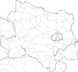
The Puchenstubner road B 28 is a 27-km long former federal highway and nunmehrige country road B in Lower Austria . It leads from Neubruck bei Scheibbs at the intersection with Erlauftal Straße B 25 via Puchenstuben to Reith (community Annaberg) and joins Mariazeller Straße B 20.
history
The Neubruck Viennese Bruckerstraße one of the streets in Lower Austria, which have been declared by the Federal Law of 2 June 1954 federal roads. In the federal budget of 1954, 15,000,000 schillings were made available for the expansion of these roads.
swell
- ↑ Signs on the top of the pass (as seen on Nov. 4, 2014)
- ↑ Federal Act of June 2, 1954, Directory E.
| B28 | Like the other former federal highways, Puchenstubner Strasse was part of the federal administration. Since April 1, 2002, it has been under state administration and continues to have the B in the number, but not the name Bundesstraße. |
